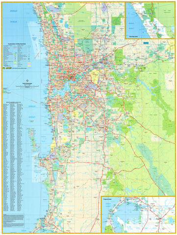
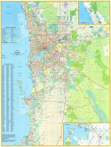
Metropolitan Perth — Historic Wall Map (1952)
Streets in crisp mid-century grids, the sweep of the Swan River, and a coastline poised for decades of change—this 1952 Department of Lands & Surveys classic captures Metropolitan Perth at a formative moment. Prepared in the Chief Draftsman’s Branch under J.M. Ryan (Chief Cartographer) and P. Stanley (Chief Draughtsman), it balances official precision with lived geography. Part chart, part city memory, it lets you see what has changed—and what has quietly endured—while bringing Perth’s post-war confidence to your wall.
Why it captivates
-
🧭 Mid-century Perth, meticulously drawn — a clear metropolitan portrait prepared by the state’s official mapping office in 1952.
-
🌆 Neighbourhoods in context — the river, foreshore and suburban fabric set in elegant period lettering for instant orientation.
-
🗺️ Authoritative provenance — compiled and drawn by the Department of Lands and Surveys, Chief Draftsman’s Branch.
-
🏛️ Scholarly & beautiful — disciplined linework, neatlines and balanced typography that read cleanly from across the room.
What you’ll see
-
Comprehensive metropolitan coverage (1952) of Perth and environs with legible suburb and feature naming.
-
Clear river, coastline and reserves rendered with confident mid-century drafting.
-
Period finish preserved — titlework, neatline, and a disciplined hierarchy for streets, districts and landmarks.
-
A composition that rewards lingering—each look reveals another bend, boundary, or familiar place name.
A richer historical frame
The early 1950s found Perth expanding with post-war energy—new suburbs, planned reserves, and a metropolitan footprint coming into focus. Maps from the Chief Draftsman’s Branch distilled that momentum into documents both exact and approachable. This 1952 edition stands in that tradition: faithful to evidence, composed for clarity, and quietly alive to the stories a city grid can hold.
Choose your finish
Heavyweight Paper (160 gsm matte)
Best for: Framing under glass in studies and living spaces
Look & feel: Non-glare matte that preserves fine linework and small labels
Laminated (true encapsulation)
Best for: Classrooms, offices, libraries, shared spaces
Build: Sealed edge-to-edge between two 80-micron gloss sheets
Benefit: Wipe-clean, durable, moisture-resistant
Laminated + Timber Hang Rails (Ready to hang)
What you get: Encapsulated print plus natural lacquered timber rails top & bottom with a discreet hanging cord
Where it shines: Foyers, offices, schools, libraries—polished look with everyday toughness
Install: Arrives ready to hang (just add a wall hook)
Lead time: Please allow up to 10 working days for professional rail mounting
Archival Canvas (395 gsm HP Professional Matte)
Best for: Premium interiors, boardrooms, galleries
Print system: Pigment-based, fade-resistant inks for long display life
Presence: Textured surface adds warmth and museum-style depth
Canvas + Timber Hang Rails (Gallery-ready)
What you get: Canvas fitted with natural timber rails top & bottom, matching cord
Where it shines: Statement walls, curated displays, heritage spaces
Install: Ready to hang; single-hook friendly
Lead time: Please allow up to 10 working days for rail mounting
Sizes (W × H)
-
990 × 750 mm — balanced landscape format with generous metropolitan detail
At-a-glance materials
| Option | Best for | Key benefits |
|---|---|---|
| Paper (160 gsm) | Framing under glass | Matte clarity; crisp period detail |
| Laminated (encapsulated) | Busy/shared spaces | Wipeable; tough; edge-to-edge protection |
| Laminated + Rails | Ready-to-hang public display | Professional mount; easy install; durable |
| Canvas (395 gsm) | Premium display | Archival inks; textured depth; gallery appeal |
| Canvas + Rails | Gallery-ready feature | Period-true presentation; simple hanging |
Styling ideas
-
Civic or office foyer: choose Laminated + Rails for a robust, polished display that invites close reading.
-
Home study or library: frame the paper edition and pair with a small plaque noting family streets or milestones.
-
Design studio wall: canvas with rails as a reference point for discussions about urban form and heritage.
-
Local history corner: cluster with period photographs or ephemera to show change over time.
Specifications
| Detail | Description |
|---|---|
| Title | Metropolitan Perth — Historic Wall Map |
| Edition | 1952 |
| Compiler/Publisher | Department of Lands & Surveys (WA), Chief Draftsman’s Branch — J.M. Ryan (Chief Cartographer); P. Stanley (Chief Draughtsman) |
| Region | Metropolitan Perth, Western Australia |
| Type | Metropolitan plan |
| Finishes | Paper; Laminated (encapsulated); Laminated + Timber Rails; Canvas; Canvas + Timber Rails |
| Lead Time (Rails) | Up to 10 working days (laminated or canvas with rails) |
| Orientation | Landscape |
| Size | 990 × 750 mm (W × H) |
| Production | Made in Australia |
Who it’s for
-
Perth locals, families and collectors tracing neighbourhood stories
-
Councils, libraries & museums curating metropolitan heritage
-
Planners, architects & designers seeking an authoritative mid-century reference
-
Interiors seeking authentic Western Australian cartography with quiet character
Let the city come into focus—bend by bend along the river, street by street across the grid—through a faithful, beautifully produced 1952 classic. Choose Paper for frame-under-glass clarity, Laminated + Timber Rails for a ready-to-hang public display, or Archival Canvas + Timber Rails for warm, gallery-style presence. Printed in Australia with premium stocks and pigment-based, fade-resistant inks, it’s made to live with—and to keep Perth’s mid-century story close, day after day.


