- Australia ▾
- Topographic
▾
- Australia AUSTopo 250k (2025)
- Australia 50k Geoscience maps
- Australia 100k Geoscience maps
- Australia 250k Geoscience maps
- Australia 1:1m Geoscience maps
- New Zealand 50k maps
- New Zealand 250k maps
- New South Wales 25k maps
- New South Wales 50k maps
- New South Wales 100k maps
- Queensland 10k maps
- Queensland 25k maps
- Queensland 50k maps
- Queensland 100k maps
- Western Australia 25k maps
- Western Australia 50k maps
- Western Australia 100k maps
- Compasses
- Software
- GPS Systems
- International ▾
- Wall Maps
▾
- World
- Australia & New Zealand
- Countries, Continents & Regions
- Historical
- Vintage National Geographic
- Australian Capital Territory
- New South Wales
- Northern Territory
- Queensland
- South Australia
- Tasmania
- Victoria
- Western Australia
- Celestial
- Children's
- Mining & Resources
- Wine Maps
- Healthcare
- Postcode Maps
- Electoral Maps
- Nautical ▾
- Flags
▾
- Australian Flag Sets & Banners
- Flag Bunting
- Handwavers
- Australian National Flags
- Aboriginal Flags
- Torres Strait Islander Flags
- International Flags
- Flagpoles & Accessories
- Australian Capital Territory Flags
- New South Wales Flags
- Northern Territory Flags
- Queensland Flags
- South Australia Flags
- Tasmania Flags
- Victoria Flags
- Western Australia Flags
- Gifts ▾
- Globes ▾
Dear valued customer. Please note that our checkout is not supported by old browsers. Please use a recent browser to access all checkout capabilities


New South Wales - Maps, Guides, Road Atlases,Digital Mapping & Street Directories
New South Wales wall maps, road atlases, folded maps, and street directories offer a complete solution for navigating the state—whether you're planning from the wall, navigating on the road, or finding your way street by street. From Sydney’s busy urban network to coastal drives, regional centres, and outback highways, these resources provide accurate, up-to-date detail across all terrain.
Our collection includes large-format wall maps ideal for planning and display, compact folded maps for travellers, durable road atlases for vehicles, and comprehensive street directories for in-depth local navigation. Perfect for homes, offices, classrooms, vehicles, and logistics operations, these maps are essential tools for anyone who needs to move through New South Wales with clarity and confidence.


About New South Wales Maps
NSW is Australia's most populous state and one of its most cartographically diverse — 800,000 square kilometres covering everything from the Sydney basin's tightly mapped suburbs to the wide-open outback of the Far West, the alpine snow country of Kosciuszko, the rainforest hinterland of the North Coast, and over 2,000 km of coastline. Whether you're planning a drive up the North Coast, hiking the Six Foot Track, sailing Sydney Harbour, mapping a sales territory across Greater Sydney, or 4WDing through the Snowy backcountry, getting the right NSW map matters.
Mapworld stocks NSW maps from every major Australian publisher — Hema, UBD-Gregory's, Spatial Vision (the topographic and adventure specialist), Boiling Billy (4WD treks), Cartographics, plus the official NSW Spatial Services topographic series and the Australian Hydrographic Service AUS-numbered nautical charts.
NSW Map Types Explained
Touring & Wall Maps
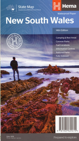
The Hema New South Wales State Map is the standard touring reference — folded for glove-box use or laminated as a wall map. The UBD 270 New South Wales State and Suburban Map provides combined state-wide and Greater Sydney coverage in a double-sided format. For Sydney metro specifically, the UBD 262 Sydney Suburban map is the standard street-level reference, available as folded, laminated wall map, and Supermap (large format) versions.
Regional NSW Wall Maps
For specific NSW regions, dedicated wall maps offer higher detail than state-wide versions:
- North Coast NSW (1000 × 1050mm laminated) — Byron, Coffs Harbour, Newcastle through to the Queensland border
- South Coast NSW (900 × 1165mm laminated) — Wollongong, Jervis Bay, Batemans Bay, Eden
- Outback New South Wales (Hema regional + laminated wall map versions) — Broken Hill, Bourke, the Darling River
- Newcastle, Central Coast and the Hunter Street Directory by UBD-Gregory's
- Sydney Postcode and NSW Postcode wall maps for territory and real estate work
Topographic Maps
NSW topographic sheets are published by NSW Spatial Services (formerly Land and Property Information / LPI) at 1:25k, 1:50k and 1:100k scales — the standard for bushwalking, orienteering, emergency services and surveying. Available in paper, waterproof Tyvek and laminated formats. The full NSW 1:25k series is essential for serious bushwalking — particularly in the Blue Mountains, the Snowy Mountains, and the Royal National Park area.
Bushwalking & Adventure Maps
Spatial Vision produces the definitive commercial bushwalking maps for NSW's premier walking destinations:
- Blue Mountains North and Blue Mountains South topographic and adventure maps
- Kosciuszko Alpine Area — for the high country and the Main Range
- Six Foot Track — Katoomba to Jenolan
- Cape to Cape map pack (NSW South Coast walks)
- Lord Howe Island dedicated topographic
4WD & Outback Maps
Boiling Billy publishes the comprehensive 4WD guide range for NSW:
- 4WD Treks Close to Sydney — 20 off-road adventures within easy reach of the city
- 4WD Treks of the High Country — Victorian and NSW alpine 4WD
For outback NSW, the Hema Outback NSW regional map is the standard reference, with a laminated wall map version for trip planning.
Postcode, Electoral & LGA Maps
The New South Wales Postcode Wall Map covers the full state at 1110 × 788mm laminated. The New South Wales Local Government Areas Wall Map is one of our most popular NSW maps — every council, shire and city boundary across the state. Combined Electoral and LGA maps for Metropolitan Sydney and the Newcastle area cover both political and council boundaries on a single reference.
Marine & Nautical Charts
NSW's coast is covered by official AUS-numbered Australian Hydrographic Service charts. AUS 200 Port Jackson is the essential chart for Sydney Harbour boating; AUS 209 Port Stephens covers the Hunter coast; additional charts cover Botany Bay, Jervis Bay, the Hawkesbury, and the entire NSW coastline.
Choosing the Right NSW Map by Region
| Region | Recommended map |
|---|---|
| Sydney metro / suburbs | UBD 262 Sydney Suburban map (folded or laminated wall) |
| Blue Mountains bushwalking | Spatial Vision Blue Mountains North or South topographic |
| North Coast NSW road trip | North Coast NSW laminated wall map + Hema NSW state map |
| South Coast NSW | South Coast NSW laminated wall map + Cape to Cape map pack |
| Snowy Mountains / Kosciuszko | Spatial Vision Kosciuszko Alpine Area + UBD 262 for road approaches |
| Hunter Valley wine region | UBD Newcastle Central Coast and the Hunter Street Directory |
| Outback NSW / Broken Hill | Hema Outback NSW regional + Hema Australia Road and 4WD Atlas |
| Lord Howe Island | Lord Howe Island topographic by NSW Spatial Services |
| Sydney boating | AUS 200 Port Jackson nautical chart |
| Real estate / sales / electoral planning | NSW Postcode wall map + NSW LGA wall map |
Why Buy NSW Maps from Mapworld
- Largest specialist NSW range — over 110 NSW products in stock
- Spatial Vision & NSW LPI depth — comprehensive coverage of the topographic and adventure specialists
- Current editions only — we rotate stock with each new release
- Free shipping over $75 Australia-wide, flat $7 below that
- Custom mapping service — postcode overlays, sales territories, healthcare catchments, mining tenement maps
- Knowledgeable support — call 1300 795 697 for trip planning or product recommendations
Frequently Asked Questions
What is the best map for the Blue Mountains?
For bushwalking, Spatial Vision's Blue Mountains North or Blue Mountains South topographic maps are the standard reference — they cover the major walking areas in detail. For driving and broader exploration, the NSW 1:25k topographic sheets (Katoomba, Jamison, Mount Wilson, etc.) provide the highest detail. The Six Foot Track map covers the historic Katoomba-to-Jenolan route specifically.
Are these the latest editions of NSW maps?
Yes. Mapworld stocks current editions only. Each product page lists the edition number and publication year. When publishers release new editions, we rotate stock to the new version.
Do you ship NSW maps interstate?
Yes. Mapworld ships Australia-wide from our Perth warehouse. Free shipping on orders over $75, flat $7 below that. Most metro deliveries arrive in 2 to 5 business days. Express options available at checkout.
What is the difference between Hema and NSW Spatial Services topographic maps?
Hema produces touring-scale maps from 1:550k to 1:2m with road, track and trip-planning data, ideal for road-tripping, 4WD and caravan travel. NSW Spatial Services (formerly LPI) topographic maps are detailed 1:25k, 1:50k and 1:100k sheets with contour, terrain and feature data, ideal for bushwalking, orienteering and emergency services. Most travelling NSW residents own both.
Can I get a custom NSW postcode or sales-territory map?
Yes. Mapworld runs a custom mapping service for businesses needing branded or modified NSW maps including postcode and electoral overlays, sales-territory colouring, healthcare service catchments, and fleet planning maps.
How quickly does Mapworld dispatch NSW orders?
Orders placed before 2 pm AWST on weekdays dispatch same-day from our Perth warehouse. Australia-wide delivery typically takes 2 to 7 business days via Australia Post.
© 2026 Mapworld. Website designed by Genie Media
X