- Australia ▾
- Topographic
▾
- Australia AUSTopo 250k (2025)
- Australia 50k Geoscience maps
- Australia 100k Geoscience maps
- Australia 250k Geoscience maps
- Australia 1:1m Geoscience maps
- New Zealand 50k maps
- New Zealand 250k maps
- New South Wales 25k maps
- New South Wales 50k maps
- New South Wales 100k maps
- Queensland 10k maps
- Queensland 25k maps
- Queensland 50k maps
- Queensland 100k maps
- Western Australia 25k maps
- Western Australia 50k maps
- Western Australia 100k maps
- Compasses
- Software
- GPS Systems
- International ▾
- Wall Maps
▾
- World
- Australia & New Zealand
- Countries, Continents & Regions
- Historical
- Vintage National Geographic
- Australian Capital Territory
- New South Wales
- Northern Territory
- Queensland
- South Australia
- Tasmania
- Victoria
- Western Australia
- Celestial
- Children's
- Mining & Resources
- Wine Maps
- Healthcare
- Postcode Maps
- Electoral Maps
- Nautical ▾
- Flags
▾
- Australian Flag Sets & Banners
- Flag Bunting
- Handwavers
- Australian National Flags
- Aboriginal Flags
- Torres Strait Islander Flags
- International Flags
- Flagpoles & Accessories
- Australian Capital Territory Flags
- New South Wales Flags
- Northern Territory Flags
- Queensland Flags
- South Australia Flags
- Tasmania Flags
- Victoria Flags
- Western Australia Flags
- Gifts ▾
- Globes ▾
Dear valued customer. Please note that our checkout is not supported by old browsers. Please use a recent browser to access all checkout capabilities


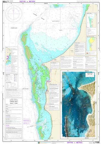
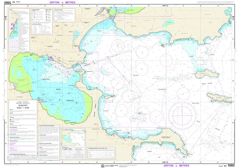
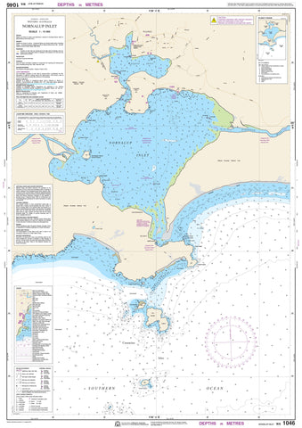
Recreational Inshore Charts for Western Australia
Our range of Western Australia Inshore DPI (Department of Primary Industries and Regional Development) charts provides essential, easy-to-use navigation for recreational fishers, boaters, and coastal explorers operating close to shore. Specifically designed for inshore waters, these charts cover popular fishing areas, boating routes, and marine infrastructure along the extensive WA coastline.
Produced in collaboration with local authorities and marine experts, DPI charts offer clear, accessible information including depth contours, boat ramp locations, navigation markers, restricted zones, and key fishing regulations—making them perfect for safe, informed inshore travel and sustainable fishing practices.
Available in durable paper and laminated formats, they’re ideal for onboard use, withstanding the elements and repeated handling. Whether you're launching out of Perth, heading up to Exmouth, or exploring the waters near Albany or Broome, these charts are a must-have for anyone navigating Western Australia's nearshore environments.
Note: For a full index of the charts, please click on Nautical Chart Index


© 2026 Mapworld. Website designed by Genie Media
X