- Australia ▾
- Topographic
▾
- Australia AUSTopo 250k (2025)
- Australia 50k Geoscience maps
- Australia 100k Geoscience maps
- Australia 250k Geoscience maps
- Australia 1:1m Geoscience maps
- New Zealand 50k maps
- New Zealand 250k maps
- New South Wales 25k maps
- New South Wales 50k maps
- New South Wales 100k maps
- Queensland 10k maps
- Queensland 25k maps
- Queensland 50k maps
- Queensland 100k maps
- Western Australia 25k maps
- Western Australia 50k maps
- Western Australia 100k maps
- Compasses
- Software
- GPS Systems
- International ▾
- Wall Maps
▾
- World
- Australia & New Zealand
- Countries, Continents & Regions
- Historical
- Vintage National Geographic
- Australian Capital Territory
- New South Wales
- Northern Territory
- Queensland
- South Australia
- Tasmania
- Victoria
- Western Australia
- Celestial
- Children's
- Mining & Resources
- Wine Maps
- Healthcare
- Postcode Maps
- Electoral Maps
- Nautical ▾
- Flags
▾
- Australian Flag Sets & Banners
- Flag Bunting
- Handwavers
- Australian National Flags
- Aboriginal Flags
- Torres Strait Islander Flags
- International Flags
- Flagpoles & Accessories
- Australian Capital Territory Flags
- New South Wales Flags
- Northern Territory Flags
- Queensland Flags
- South Australia Flags
- Tasmania Flags
- Victoria Flags
- Western Australia Flags
- Gifts ▾
- Globes ▾
Dear valued customer. Please note that our checkout is not supported by old browsers. Please use a recent browser to access all checkout capabilities


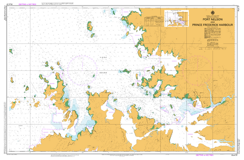
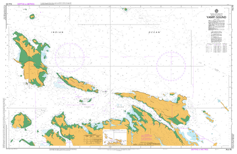
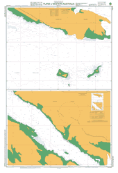
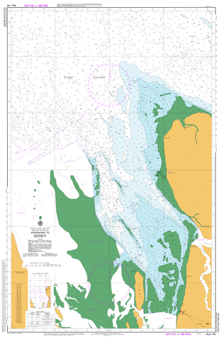
Western Australia AUS Charts
Our fully chart-corrected nautical charts of Western Australia provide essential, up-to-date navigation for one of the most expansive and diverse maritime regions in the country. Produced and maintained by the Australian Hydrographic Office, these official AUS charts are updated with the latest Notices to Mariners, ensuring precise information on depths, reefs, channels, hazards, tides, and navigation aids.
Covering key areas such as Perth and Fremantle, Albany, Exmouth Gulf, Broome, the Kimberley coast, and the remote stretches of the North West Shelf, these charts are vital for commercial shipping, offshore operations, recreational boating, and fishing throughout WA’s vast coastline.
Available in both paper and laminated formats, our charts cater to a range of needs. Paper charts are ideal for traditional navigation and planning, while laminated charts provide enhanced durability and water resistance—perfect for frequent onboard use in WA’s challenging and remote marine environments.
Download Australian Chart indexes 5000 and 5001
Note: Laminated charts have the main side matt laminated to facilitate plotting with a dry-erase or 2B pencil; the reverse is gloss laminate. Although sent rolled up in a tube, all charts have been folded down the middle for both paper maps and prior to laminating.


© 2026 Mapworld. Website designed by Genie Media
X