- Australia ▾
- Topographic
▾
- Australia AUSTopo 250k (2025)
- Australia 50k Geoscience maps
- Australia 100k Geoscience maps
- Australia 250k Geoscience maps
- Australia 1:1m Geoscience maps
- New Zealand 50k maps
- New Zealand 250k maps
- New South Wales 25k maps
- New South Wales 50k maps
- New South Wales 100k maps
- Queensland 10k maps
- Queensland 25k maps
- Queensland 50k maps
- Queensland 100k maps
- Compasses
- Software
- GPS Systems
- Orienteering
- International ▾
- Wall Maps
▾
- World
- Australia & New Zealand
- Countries, Continents & Regions
- Historical
- Vintage National Geographic
- Australian Capital Territory
- New South Wales
- Northern Territory
- Queensland
- South Australia
- Tasmania
- Victoria
- Western Australia
- Celestial
- Children's
- Mining & Resources
- Wine Maps
- Healthcare
- Postcode Maps
- Electoral Maps
- Nautical ▾
- Flags
▾
- Australian Flag Sets & Banners
- Flag Bunting
- Handwavers
- Australian National Flags
- Aboriginal Flags
- Torres Strait Islander Flags
- International Flags
- Flagpoles & Accessories
- Australian Capital Territory Flags
- New South Wales Flags
- Northern Territory Flags
- Queensland Flags
- South Australia Flags
- Tasmania Flags
- Victoria Flags
- Western Australia Flags
- Gifts ▾
- Globes ▾
Dear valued customer. Please note that our checkout is not supported by old browsers. Please use a recent browser to access all checkout capabilities


Marine Charts & Accessories
Australia's largest range of nautical charts and marine accessories — official Australian Hydrographic Service (AHS) AUS-numbered charts in paper and laminated, state DPI inshore charts, Imray international charts, cruising guides, compasses and navigation equipment. Every AUS chart is fully corrected to the latest Notices to Mariners. Ships from our Perth warehouse with free shipping on orders over $75.


Choosing the right nautical chart
The right chart depends on where you're navigating, what authority your operation requires, and how you'll use it on board.
- Official AHS AUS charts — produced by the Australian Hydrographic Service, fully corrected to the latest Notices to Mariners. Mandatory for SOLAS-class vessels and the standard reference for commercial operators, training institutions and serious recreational mariners.
- State DPI / inshore charts — recreational-boating charts from state fisheries agencies. Cover inshore waters, fishing grounds and harbours at higher detail than offshore AUS charts.
- Imray charts — the international standard for cruising the Mediterranean, Caribbean, Pacific and beyond.
- Paper vs laminated — paper for traditional plotting and chart-table use; laminated for cockpit, exposed helms, and repeated reference. Both editions are AHS-corrected.
Browse by Australian state
- NSW charts — Port Jackson, Broken Bay, Port Stephens, Jervis Bay and the full coast
- Queensland charts — Moreton Bay, Whitsundays, Great Barrier Reef, Hervey Bay
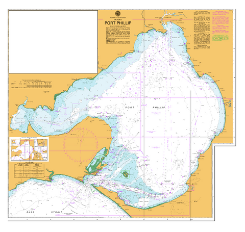
- Victoria charts — Port Phillip, The Rip, Westernport, Bass Strait
- South Australia charts — Spencer Gulf, St Vincent Gulf, Kangaroo Island
- WA AUS charts — Perth, Fremantle, Dampier, Geraldton, Albany
- WA Inshore (DPI) charts — recreational-boating charts for WA waters
- Tasmania charts — Hobart, D'Entrecasteaux, east and west coasts
- Northern Territory charts — Darwin, Arafura Sea, Gulf of Carpentaria
Browse by category
- Imray international charts — cruising the Med, Caribbean, Pacific
- Cruising guides — Lucas, Coral Coast and other Australian and international titles
- Digital charts & tide tables — C-Map, Navionics, AHS tide tables
- Historical charts — antique reproductions, decorative
- Compasses — handheld, dashboard, marine-grade
- Navigational equipment — dividers, parallel rules, plotters
- Clocks & barometers — brass, ship's-style, weather instruments
- Binoculars — marine and general-use
Why buy from Mapworld
- Official AHS-corrected stock — every AUS chart is fully chart-corrected at time of dispatch
- Australia's largest in-stock nautical range — full state coverage, plus international and historical
- Same-day dispatch from our Perth warehouse on orders before 2pm AWST
- Free shipping on orders over $75 Australia-wide; $7 standard postage on smaller orders
Frequently asked questions
What's the difference between AUS charts and DPI inshore charts?
AUS-numbered charts are produced by the Australian Hydrographic Service (the navy's hydrographic office) and are the official charts required for SOLAS-class vessels. They cover offshore navigation in detail. State DPI inshore charts are produced by state fisheries departments for recreational boaters — they cover inshore waters, fishing grounds and harbours at higher resolution but aren't valid for commercial offshore use.
Are these charts current — corrected to the latest Notices to Mariners?
Yes. Every AUS chart shipped from Mapworld is fully chart-corrected at time of dispatch, incorporating the latest AHS Notices to Mariners. If you're holding charts for ongoing voyaging, we recommend subscribing to the AHS Notices to Mariners service to keep them current between editions.
Should I buy paper or laminated?
Paper charts are the traditional standard — designed for chart-table plotting with pencil and dividers, and required for SOLAS compliance on many vessels. Laminated charts are wipe-clean and water-resistant — ideal for cockpit and exposed-helm use, repeated chart-table reference and training. Both editions carry the same AHS-corrected detail.
Do you stock digital charts and tide tables?
Yes. We stock C-Map and Navionics digital chart cards, AHS tide tables and digital chart subscriptions alongside our paper range. See our Digital Charts & Tide Tables collection.
Do you ship nautical charts Australia-wide?
Yes. Charts ship folded as standard from our Perth warehouse. Larger formats can ship rolled in a tube on request. Free shipping on orders over $75; $7 standard postage Australia-wide on smaller orders. Most metro deliveries arrive in 2–5 business days.
Can you supply charts for commercial vessels and training institutions?
Yes. Mapworld supplies marine training colleges, charter operators, government agencies and commercial vessels. Bulk orders, account terms and standing orders for chart updates available — contact us via our contact page.
For local-knowledge anchorage and passage planning detail, browse our Australian cruising guide range — Alan Lucas's Cruising the Coral Coast, NSW and Tasmania cruising guides, plus New Zealand and South Pacific references.
© 2026 Mapworld. Website designed by Genie Media
X