- Australia ▾
- Topographic
▾
- Australia AUSTopo 250k (2025)
- Australia 50k Geoscience maps
- Australia 100k Geoscience maps
- Australia 250k Geoscience maps
- Australia 1:1m Geoscience maps
- New Zealand 50k maps
- New Zealand 250k maps
- New South Wales 25k maps
- New South Wales 50k maps
- New South Wales 100k maps
- Queensland 10k maps
- Queensland 25k maps
- Queensland 50k maps
- Queensland 100k maps
- Western Australia 25k maps
- Western Australia 50k maps
- Western Australia 100k maps
- Compasses
- Software
- GPS Systems
- International ▾
- Wall Maps
▾
- World
- Australia & New Zealand
- Countries, Continents & Regions
- Historical
- Vintage National Geographic
- Australian Capital Territory
- New South Wales
- Northern Territory
- Queensland
- South Australia
- Tasmania
- Victoria
- Western Australia
- Celestial
- Children's
- Mining & Resources
- Wine Maps
- Healthcare
- Postcode Maps
- Electoral Maps
- Nautical ▾
- Flags
▾
- Australian Flag Sets & Banners
- Flag Bunting
- Handwavers
- Australian National Flags
- Aboriginal Flags
- Torres Strait Islander Flags
- International Flags
- Flagpoles & Accessories
- Australian Capital Territory Flags
- New South Wales Flags
- Northern Territory Flags
- Queensland Flags
- South Australia Flags
- Tasmania Flags
- Victoria Flags
- Western Australia Flags
- Gifts ▾
- Globes ▾
Dear valued customer. Please note that our checkout is not supported by old browsers. Please use a recent browser to access all checkout capabilities


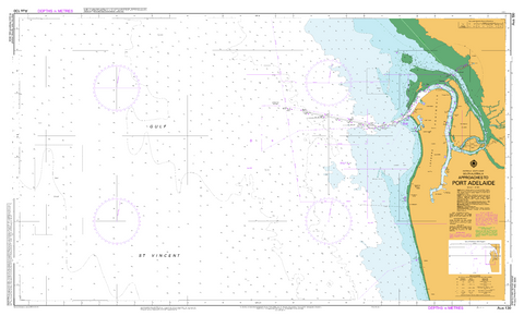
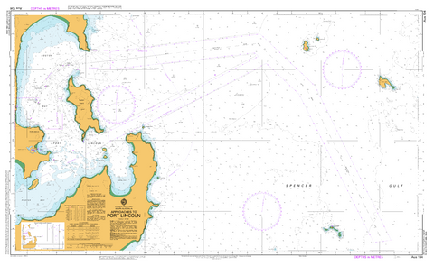
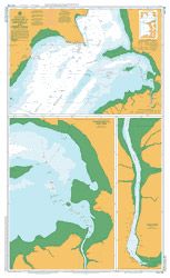
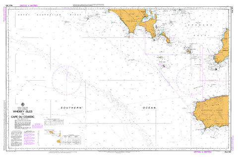
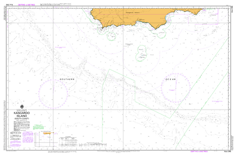
South Australia AUS Charts
Our fully chart-corrected nautical charts of South Australia provide precise and dependable navigation for the state's diverse coastal waters—from the rugged cliffs of the Great Australian Bight to the sheltered inlets of the Spencer and St Vincent Gulfs. Produced and maintained by the Australian Hydrographic Office, these official AUS charts are continually updated with the latest Notices to Mariners, ensuring current and accurate information on depths, channels, navigation aids, hazards, and maritime boundaries.
Key areas covered include Port Adelaide, Kangaroo Island, Whyalla, Ceduna, and the Eyre Peninsula, making these charts essential for commercial shipping, fishing operations, recreational boaters, and maritime training institutions across South Australia.
Available in both paper and laminated formats, our charts suit a variety of maritime environments. Paper charts are ideal for voyage planning and traditional navigation, while laminated charts offer added durability and moisture resistance—perfect for regular use aboard vessels in dynamic marine conditions.
Download Australian Chart indexes 5000 and 5001
Note: Laminated charts have the main side matt laminated to facilitate plotting with a dry erase or 2B pencil, the reverse is gloss laminate. All charts although sent rolled up in a tube, have been folded down the middle for both paper maps and prior to laminating.


© 2026 Mapworld. Website designed by Genie Media
X