- Australia ▾
- Topographic
▾
- Australia AUSTopo 250k (2025)
- Australia 50k Geoscience maps
- Australia 100k Geoscience maps
- Australia 250k Geoscience maps
- Australia 1:1m Geoscience maps
- New Zealand 50k maps
- New Zealand 250k maps
- New South Wales 25k maps
- New South Wales 50k maps
- New South Wales 100k maps
- Queensland 10k maps
- Queensland 25k maps
- Queensland 50k maps
- Queensland 100k maps
- Western Australia 25k maps
- Western Australia 50k maps
- Western Australia 100k maps
- Compasses
- Software
- GPS Systems
- International ▾
- Wall Maps
▾
- World
- Australia & New Zealand
- Countries, Continents & Regions
- Historical
- Vintage National Geographic
- Australian Capital Territory
- New South Wales
- Northern Territory
- Queensland
- South Australia
- Tasmania
- Victoria
- Western Australia
- Celestial
- Children's
- Mining & Resources
- Wine Maps
- Healthcare
- Postcode Maps
- Electoral Maps
- Nautical ▾
- Flags
▾
- Australian Flag Sets & Banners
- Flag Bunting
- Handwavers
- Australian National Flags
- Aboriginal Flags
- Torres Strait Islander Flags
- International Flags
- Flagpoles & Accessories
- Australian Capital Territory Flags
- New South Wales Flags
- Northern Territory Flags
- Queensland Flags
- South Australia Flags
- Tasmania Flags
- Victoria Flags
- Western Australia Flags
- Gifts ▾
- Globes ▾
Dear valued customer. Please note that our checkout is not supported by old browsers. Please use a recent browser to access all checkout capabilities


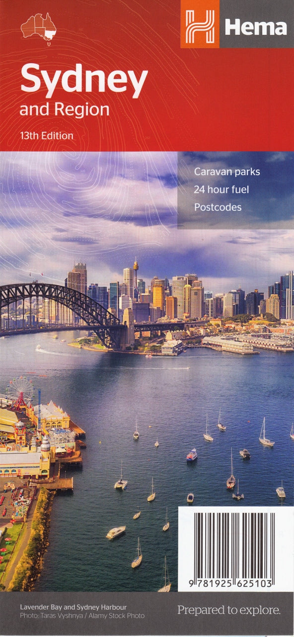
Sydney & Region Map – Hema Maps (13th Edition)
$11.95
Afterpay is only available for orders between $50.00 and $1000.00 More info
The essential navigation and planning resource for Australia’s most iconic city and its diverse surroundings.
Whether you’re a visitor discovering Sydney for the first time, a local needing a detailed reference for suburban navigation, or a professional planning routes or logistics, the Sydney & Region Map by Hema delivers clear, concise, and beautifully designed cartography tailored to Greater Sydney and its surrounds. Now in its 13th edition, this map combines Hema’s trusted detail with practical features for both urban navigation and regional exploration.
Covering from Newcastle in the north to Wollongong in the south, and inland to Lithgow, this double-sided map provides an ideal combination of street-level detail and broader trip-planning overview.
🗺️ What’s Included – Double-Sided Layout
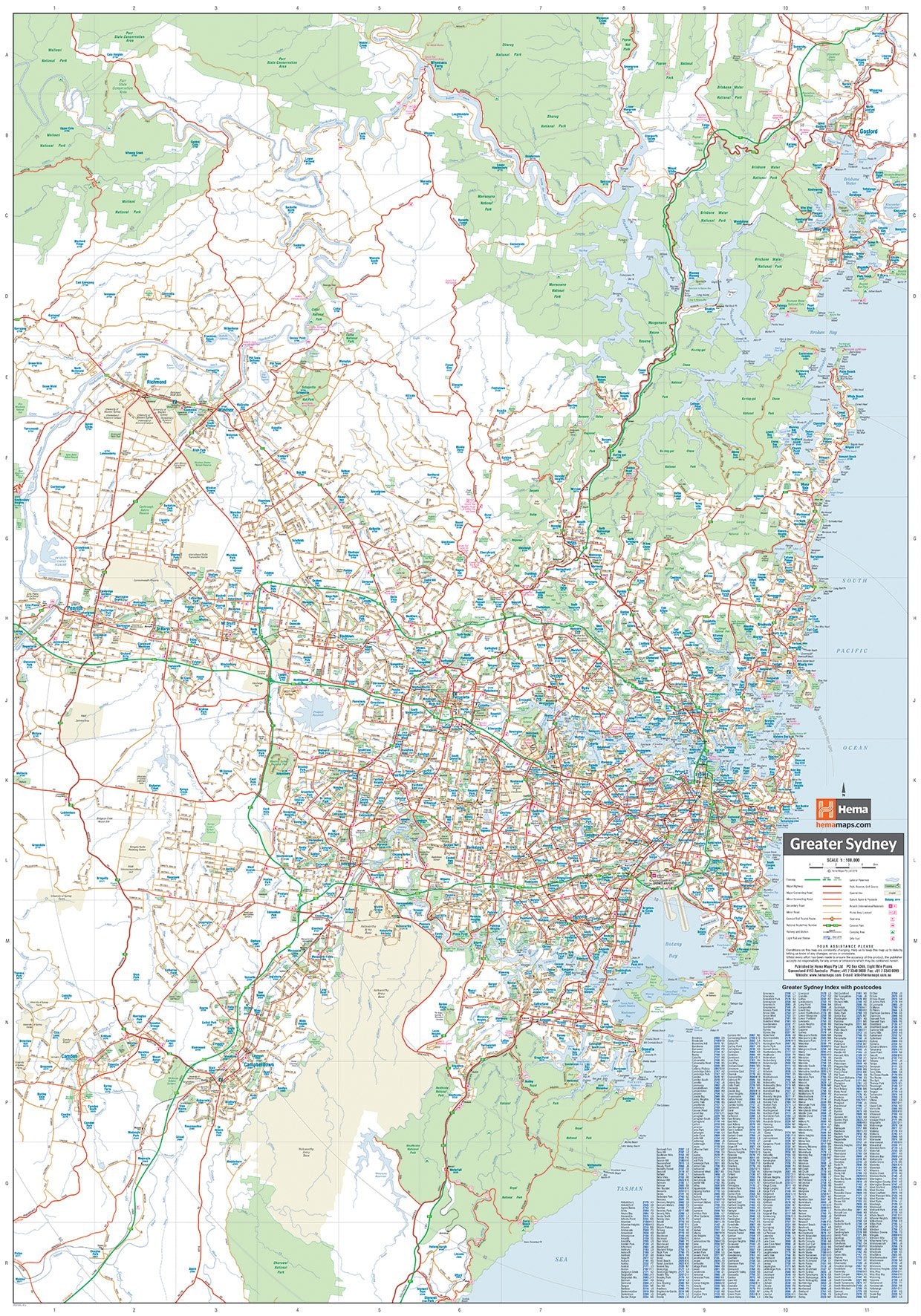
🔹 Side A – Greater Sydney
Scale: 1:100,000
-
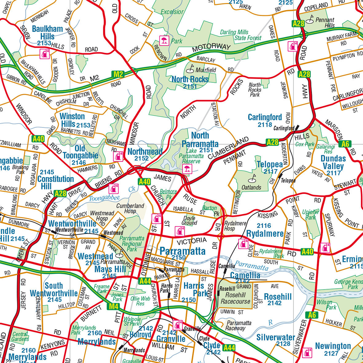
Detailed road network from Cronulla and Campbelltown in the south to Liverpool and Penrith in the west, Hornsby in the north, and Sydney’s Eastern Suburbs.
-
Suburbs clearly marked with boundaries and names.
-
Main roads, highways, and transport routes identified with clarity.
-
Sydney CBD inset with street-level detail, showing tourist attractions, major intersections, key landmarks, accommodation zones, and pedestrian-friendly areas.
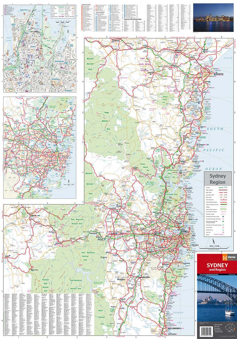
🔹 Side B – Regional Overview
Scale: 1:350,000
-
Expands the map coverage to include Wollongong, Newcastle, Blue Mountains, and Southern Highlands.
-
Ideal for day trips, road trip planning, and visualising how Greater Sydney connects to surrounding regional centres.
-
Features scenic drives, regional highways, national parks, and towns.
🚍 Transport & Services
-
Includes CityRail (Sydney Trains) network diagram for easy public transport reference.
-
Sydney Ferries routes and major wharf locations indicated.
-
Key transport hubs, such as Central Station and Sydney Airport, clearly labelled.
-
24-hour fuel outlets, caravan parks, and rest areas marked for convenience.
📌 Practical Additions
-
Postcode boundaries and suburb listings
-
Tourist information centres, hospitals, and major shopping centres
-
Highlighted national parks, nature reserves, and green spaces
-
Colour-coded road types for easy navigation (freeways, arterial roads, local roads)
📐 Map Specifications
-
Edition: 13th
-
Published: September 2018
-
Flat Size: 1000 mm (W) × 700 mm (H)
-
Folded Size: 118 mm × 250 mm × 3 mm
-
Weight: ~70 grams
-
Publisher: Hema Maps
-
Material: High-quality paper (laminated version also available)
🛒 Purchase Options
🎯 Who Is This Map For?
-
Tourists & Visitors: A comprehensive guide to Sydney’s layout and attractions, with useful transport integration.
-
Residents: A practical tool for navigating suburbs, planning travel routes, or keeping track of postcode zones.
-
Professionals: Useful for delivery planning, logistics, and service coverage.
-
Educators: Supports geography studies, local history lessons, and regional planning discussions.
-
Students & Researchers: Offers a geographic and civic overview of Australia’s largest metropolitan area.
🧭 Why Choose Hema’s Sydney & Region Map?
-
Produced by Australia’s most trusted mapping brand
-
Carefully field-checked for accuracy
-
Combines street detail with regional perspective
-
Designed for clarity, usability, and everyday practicality
-
Suitable for wall display, glove boxes, field kits, and travel bags
From the bustle of the Harbour Bridge to the tranquility of the Blue Mountains, the Sydney & Region Hema Map brings it all into focus.
Whether you’re mapping a morning commute or planning a weekend escape, this map is your perfect visual companion to Sydney and beyond.
Frequently Asked Questions
Where can I buy the Sydney & Region Map – Hema Maps (13th Edition)?
The Sydney & Region Map – Hema Maps (13th Edition) is available to buy online from Mapworld, Australia's largest map and geographic product retailer, with fast shipping Australia-wide.
Is the Sydney & Region Map – Hema Maps (13th Edition) in stock at Mapworld?
Mapworld maintains extensive stock across its map range and aims for fast dispatch. Orders placed before 2pm AEST on business days are typically dispatched the same day, with standard and express Australia-wide delivery options available.
What is Mapworld's returns policy?
Mapworld accepts returns on undamaged items in original condition. Contact Mapworld within 90 days of purchase to arrange a return or exchange.
Does Mapworld ship the Sydney & Region Map – Hema Maps (13th Edition) across Australia?
Yes, Mapworld ships Australia-wide. Standard shipping is a flat $7 rate, with free standard shipping on orders over $75. Express options are available at checkout. Most orders placed before 2pm AEST on weekdays are dispatched same day.
Related Items


© 2026 Mapworld. Website designed by Genie Media
X