- Australia ▾
- Topographic
▾
- Australia AUSTopo 250k (2024)
- Australia 50k Geoscience maps
- Australia 100k Geoscience maps
- Australia 250k Geoscience maps
- Australia 1.1m Geoscience maps
- New Zealand 50k maps
- New Zealand 250k maps
- New South Wales 25k maps
- New South Wales 50k maps
- New South Wales 100k maps
- Queensland 10k maps
- Queensland 25k maps
- Queensland 50k maps
- Queensland 100k maps
- Compasses
- Software
- GPS Systems
- Orienteering
- International ▾
- Wall Maps
▾
- World
- Australia & New Zealand
- Countries, Continents & Regions
- Historical
- Vintage National Geographic
- Australian Capital Territory
- New South Wales
- Northern Territory
- Queensland
- South Australia
- Tasmania
- Victoria
- Western Australia
- Celestial
- Children's
- Mining & Resources
- Wine Maps
- Healthcare
- Postcode Maps
- Electoral Maps
- Nautical ▾
- Flags
▾
- Australian Flag Sets & Banners
- Flag Bunting
- Handwavers
- Australian National Flags
- Aboriginal Flags
- Torres Strait Islander Flags
- International Flags
- Flagpoles & Accessories
- Australian Capital Territory Flags
- New South Wales Flags
- Northern Territory Flags
- Queensland Flags
- South Australia Flags
- Tasmania Flags
- Victoria Flags
- Western Australia Flags
- Gifts ▾
- Globes ▾
Dear valued customer. Please note that our checkout is not supported by old browsers. Please use a recent browser to access all checkout capabilities
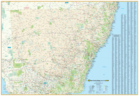
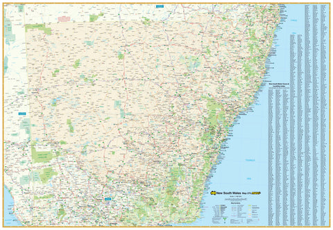
New South Wales Hema 1000 x 700mm Laminated Wall Map
$99.95
or make 4 interest-free payments of
$24.99 AUD
fortnightly with
![]() More info
More info
A versatile, durable, and exceptionally detailed map of New South Wales — ideal for trip planning, logistics, education, and display
The Hema New South Wales State Map is one of the most comprehensive and easy-to-read wall maps available for Australia’s most populous state. Designed by Hema Maps, Australia’s leading publisher of reliable mapping and navigation tools, this large-format wall map is a superb resource for anyone needing a clear, up-to-date, and visually appealing overview of the entire state.
Whether you’re a traveller planning your next road trip, a business tracking regional operations, a logistics coordinator, or simply someone who enjoys visualising geography, this map offers both the clarity of design and depth of information to meet your needs.
🗺️ Map Features
-
Comprehensive Road Network:
All major highways, secondary roads, sealed/unsealed routes, and access roads are clearly shown, along with distance markings and route numbers. -
Urban and Regional Centres:
Features a full array of towns and cities from Sydney and Newcastle to Broken Hill and Byron Bay — clearly labelled for quick reference. -
Natural Features:
Major rivers, lakes, and mountain ranges are highlighted, along with shaded relief and elevation tinting to show terrain and topography. -
National Parks and Protected Areas:
Easily identify state forests, national parks, and reserves — ideal for eco-tourism, education, and land management applications. -
Railways and Infrastructure:
Includes train lines, key infrastructure corridors, and region borders — useful for freight, transport, and public sector planning. -
Latitude/Longitude Grid:
Assists with orientation, geospatial referencing, and cross-matching with GPS systems.
📌 Laminated for Durability and Interactivity
This map is fully encapsulated in high-quality gloss laminate, turning it into a long-lasting tool that is:
-
Tear-resistant and waterproof — perfect for high-use environments
-
Compatible with whiteboard markers — write, wipe, plan, and re-use
-
Suitable for Mark-It-Dots — track locations of interest or activity
-
Resilient to fingerprints, spills, and general wear and tear
Ideal for classrooms, offices, tourist centres, or any environment where information is regularly updated or discussed.
📐 Specifications
-
Scale: 1:1,500,000 – a great balance between state-wide context and navigational detail
-
Size: 1000 mm (W) x 700 mm (H) – large enough to make an impact without overwhelming your wall
-
Edition: Latest available
-
Material: Printed on quality stock, encapsulated between two 80-micron gloss laminate sheets
-
Orientation: Landscape
🛍️ Purchase Options
-
Flat Laminated Map – $99.00 AUD
-
Supplied professionally laminated and flat (not folded)
-
Perfect for framing, wall mounting, or pin-board display
-
🧭 Who This Map Is For
-
Travellers and road trippers wanting to plan or track their journeys
-
Businesses and logistics teams managing deliveries, field staff, or service zones
-
Teachers and students studying geography, civics, or environmental science
-
Government departments and councils requiring spatial awareness of jurisdictions
-
Cartography lovers and décor seekers looking for an attractive, informative wall piece
-
Real estate offices, schools, and community groups needing regional awareness tools
🎁 Why Choose This Map
-
Designed and published by Hema Maps, trusted by adventurers, planners, and educators
-
Combines functionality with aesthetic clarity, offering both form and purpose
-
Makes a thoughtful gift for travellers, students, or new residents of New South Wales
-
A reliable backup to digital tools, useful in remote or offline environments
Visualise the state. Plan your journey. Understand the land.
Whether you're mapping out a delivery network or marking every corner you've travelled, the Hema New South Wales Wall Map gives you the full picture — clearly, accurately, and beautifully.
Explore, educate, and display with confidence — with Hema.


