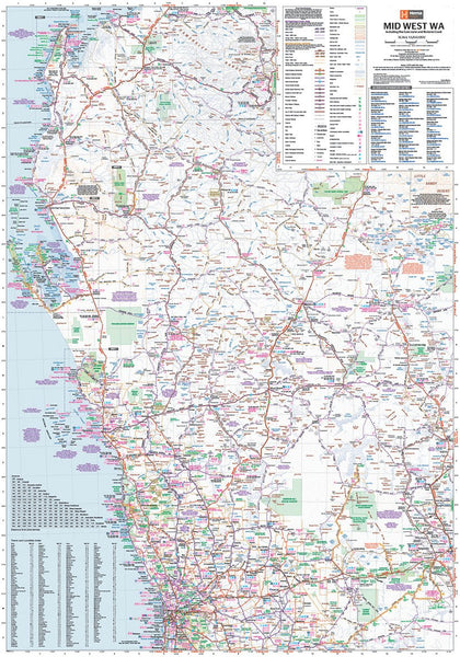
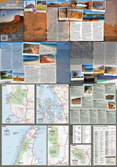
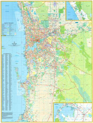
700 mm (W) × 1000 mm (H) | Double-Sided | Laminated for Durability
Explore the Heart of WA’s Vast Interior with Confidence
The Mid West Western Australia Laminated Wall Map by Hema is an essential tool for travellers, adventurers, and planners exploring this vast and richly diverse region. Covering an expansive stretch of the state—from Perth to Kalgoorlie, the North West Cape to Meekatharra, and westward to Collier Range National Park—this map is part of Hema’s acclaimed regional map series, renowned for its clarity, accuracy, and field-checked detail.
More than just a navigation aid, this map is your gateway to discovering the rugged charm, historic trails, and natural wonders of inland Western Australia. Whether you're chasing desert sunsets, exploring 4WD tracks, or tracing the steps of pioneers, this map is your trusted companion.
🧭 Map Coverage & Detail
| Map Features | Details |
|---|---|
| Coverage | Perth, Kalgoorlie, North West Cape, Meekatharra, Collier Range NP |
| Scale | 1:1,250,000 |
| Orientation | Double-sided regional mapping |
| Inset Maps | Includes additional regional detail panels |
| GPS Accuracy | Roads and tracks field-checked with Hema’s GPS Mapping System |
🛣️ Road & Track Classification
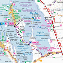
This map includes 8 distinct road and track classifications, clearly distinguishing:
-
Major highways
-
Secondary roads
-
4WD tracks
-
Unsealed and minor access routes
-
National and designated tourist routes
Highlighted tourist routes include:
-
Golden Quest Discovery Trail
-
Kingsford Smith Mail Run
-
Miners Pathway
-
Pioneers Pathway
-
Wool Wagon Pathway
What’s Inside
-
✔️ Top 10 4WD Tracks – For off-road adventurers
-
✔️ National Parks & Nature Reserves – Including camping and permit details
-
✔️ Camping Areas & Fuel Stops – Critical for trip planning in remote areas
-
✔️ Tourist Attractions & Lookouts – Find out what to see and do along the way
-
✔️ Inset Detail Maps – For better orientation in key areas
-
✔️ International Symbols – For fast, easy identification of facilities and services
Laminated Finish
This map comes fully laminated using high-quality 80-micron gloss laminate. That means:
-
✔️ You can write on it with whiteboard markers and wipe it clean
-
✔️ Map dots can be applied without damage
-
✔️ It's protected against tears, dirt, spills, and fading
-
✔️ Ideal for both trip planning and long-term display
📝 Please note: This laminated map is made from a folded sheet, professionally flattened and encapsulated. As a result, some light fold lines may still be visible.
📐 Specifications
| Format | Laminated Wall Map (Double-Sided) |
|---|---|
| Scale | 1:1,250,000 |
| Size | 700 mm (W) × 1000 mm (H) |
| Publisher | Hema Maps |
| Edition | Regional Series |
| Material | Encapsulated in 80-micron gloss laminate |
🎯 Who Is This Map For?
-
🧭 4WD Enthusiasts planning outback tracks
-
⛺ Camping and RV Travellers exploring WA’s remote heart
-
🗺️ Teachers and Schools seeking detailed regional geography
-
🛠️ Project Planners and Government working in the Mid West
-
🌿 Nature and National Park Visitors mapping out hiking and camping routes
Whether you’re on the road, planning from home, or outfitting your shed wall, the Mid West WA Laminated Map by Hema is a robust and reliable chart of one of Australia’s most fascinating regions.
Made in Australia | Hema Certified Accuracy | Adventure-Ready.


