- Australia ▾
- Topographic
▾
- Australia AUSTopo 250k (2025)
- Australia 50k Geoscience maps
- Australia 100k Geoscience maps
- Australia 250k Geoscience maps
- Australia 1:1m Geoscience maps
- New Zealand 50k maps
- New Zealand 250k maps
- New South Wales 25k maps
- New South Wales 50k maps
- New South Wales 100k maps
- Queensland 10k maps
- Queensland 25k maps
- Queensland 50k maps
- Queensland 100k maps
- Western Australia 25k maps
- Western Australia 50k maps
- Western Australia 100k maps
- Compasses
- Software
- GPS Systems
- International ▾
- Wall Maps
▾
- World
- Australia & New Zealand
- Countries, Continents & Regions
- Historical
- Vintage National Geographic
- Australian Capital Territory
- New South Wales
- Northern Territory
- Queensland
- South Australia
- Tasmania
- Victoria
- Western Australia
- Celestial
- Children's
- Mining & Resources
- Wine Maps
- Healthcare
- Postcode Maps
- Electoral Maps
- Nautical ▾
- Flags
▾
- Australian Flag Sets & Banners
- Flag Bunting
- Handwavers
- Australian National Flags
- Aboriginal Flags
- Torres Strait Islander Flags
- International Flags
- Flagpoles & Accessories
- Australian Capital Territory Flags
- New South Wales Flags
- Northern Territory Flags
- Queensland Flags
- South Australia Flags
- Tasmania Flags
- Victoria Flags
- Western Australia Flags
- Gifts ▾
- Globes ▾
Dear valued customer. Please note that our checkout is not supported by old browsers. Please use a recent browser to access all checkout capabilities


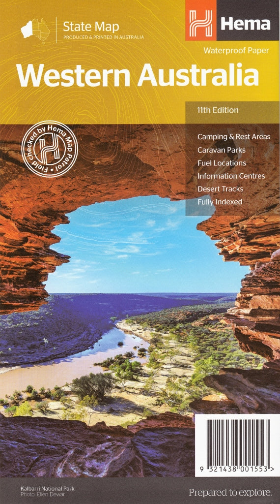
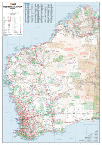
Western Australia Hema State Map
$14.95
Afterpay is only available for orders between $50.00 and $1000.00 More info
Your definitive guide to the roads, tracks, parks, and landscapes of Australia’s vast western frontier
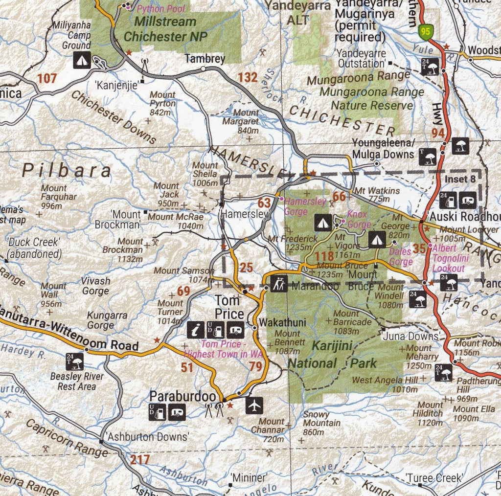
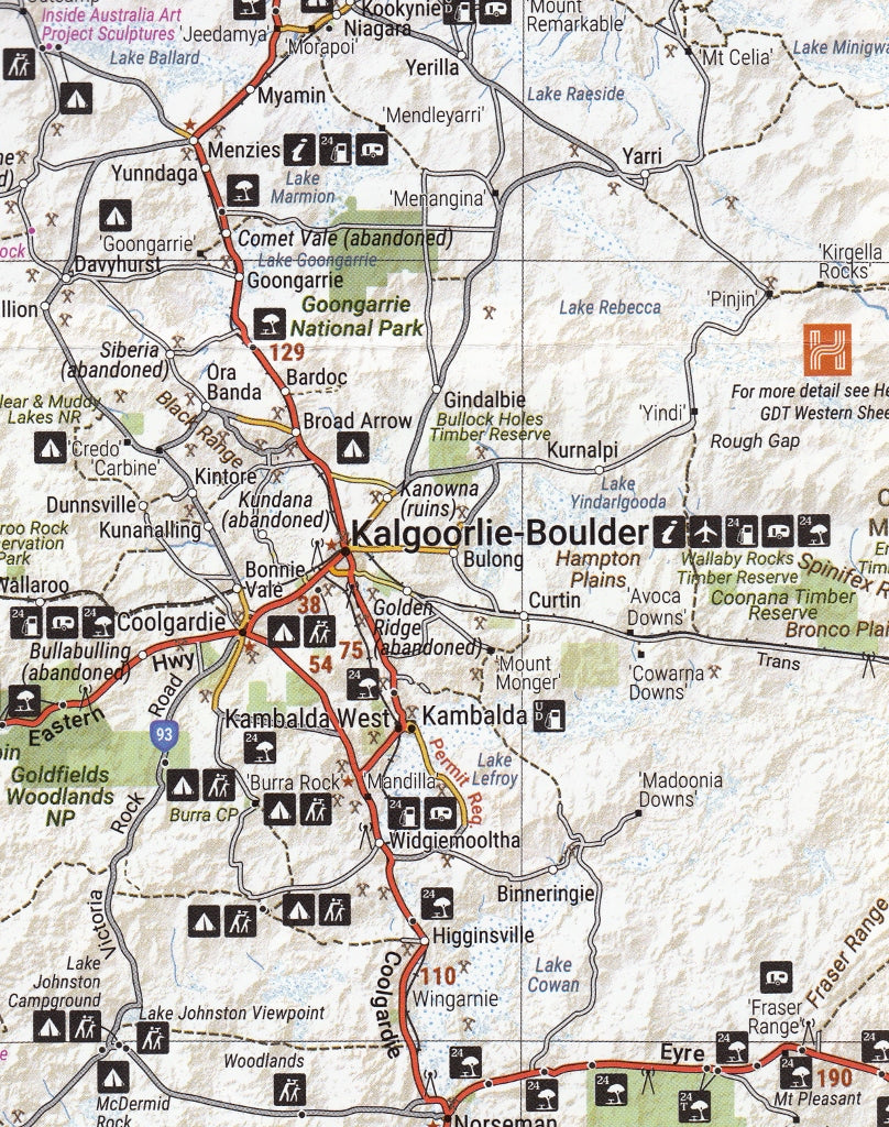
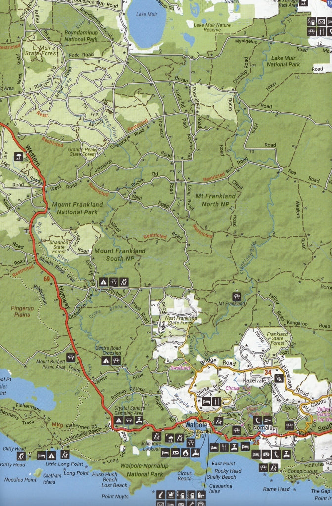
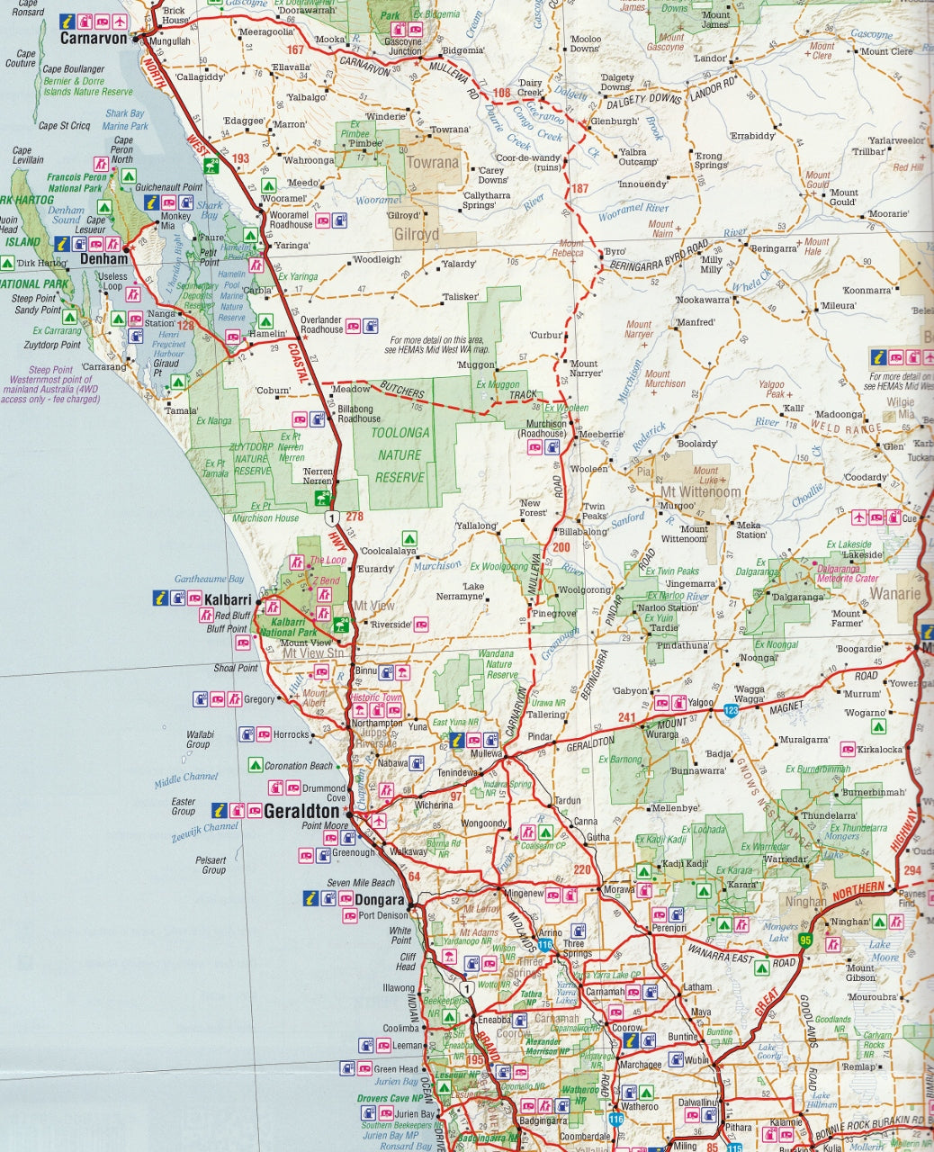
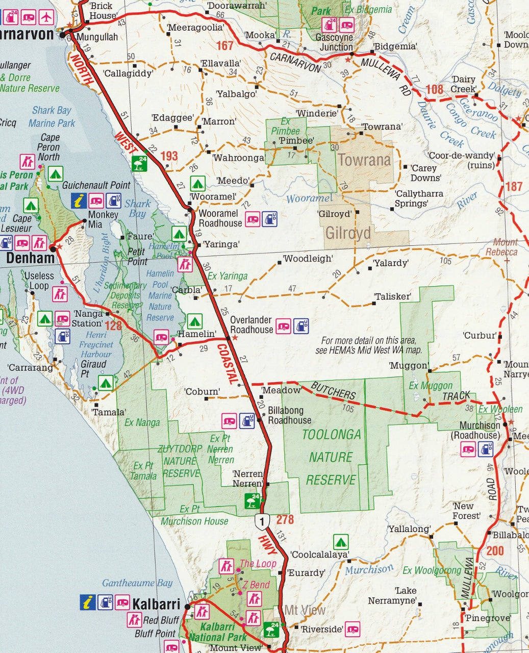
Covering nearly a third of the Australian continent, Western Australia is a land of immense contrasts — from the fertile wine valleys of the southwest to the epic, red-earthed outback of the Pilbara, and from the coral reefs of Ningaloo to the rugged ridgelines of the Kimberley. The Hema Western Australia State Map (11th Edition) is your trusted and detailed companion to navigating this incredible diversity.
Created and field-checked by Hema’s renowned Map Patrol, this full-colour touring map is a comprehensive tool for both practical navigation and inspiring exploration. Whether you’re setting off on a coastal road trip, venturing into national parks, or preparing for a remote 4WD expedition, this map provides the accuracy, clarity, and detail you need to travel with confidence.
🗺️ Map Specifications:
-
Scale: 1:2,500,000 (1 cm = 25 km) — ideal for long-distance planning across such a vast area
-
Unfolded Size: 1000 mm (W) x 700 mm (H)
-
Folded Size: 250 mm x 140 mm
-
Weight: Approx. 90 grams
-
Edition: 11th
-
Publication Date: 1 November 2019
-
Printed on: High-quality, durable paper (also available laminated or in wall map format)
-
Also available in: Supermap size (1000 mm x 1430 mm, scale 1:1,750,000) laminated with timber hang rails for wall display
-
Pre-Folded Laminated Map – $49.95
-
Laminated from a previously folded edition
-
Some minor crease lines may remain
-
Ideal for those seeking a durable and more affordable wall-ready map
-
🧭 Key Features:
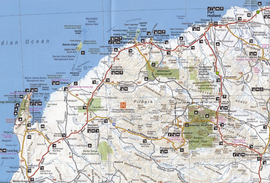
🛣️ Extensive Road & Track Coverage:
-
Clearly differentiated sealed and unsealed roads
-
Major highways, state routes, and remote desert tracks
-
Includes distances and route numbers
-
GPS-verified data ensures navigation reliability
-
Ideal for trip planning, including overland and 4WD touring
🏕️ Camping, Rest & Fuel Stops:
-
Over 1000 points of interest including:
-
Rest areas and picnic spots
-
Caravan parks and campgrounds
-
24-hour fuel stations
-
Information centres and key service towns
-
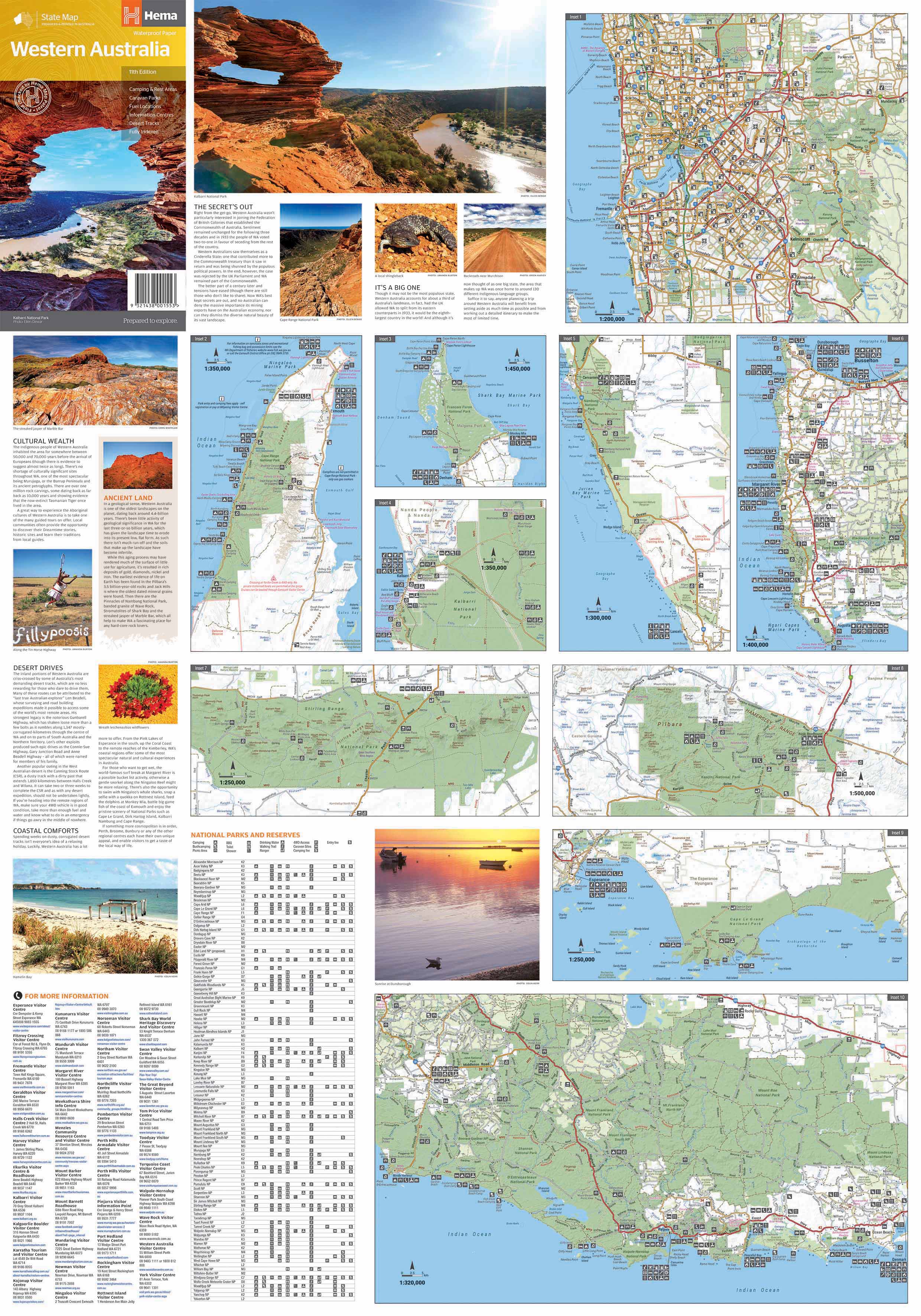
🗺️ Inset & Regional Maps Include:
-
Greater Perth & Suburbs – street-level navigation and key transport routes
-
Leeuwin-Naturaliste National Park – including Margaret River and coastal walks
-
Karijini National Park – showcasing one of WA’s most dramatic gorges and trails
-
Cape Range & Ningaloo Reef – ideal for marine and eco-tourism planning
-
Purnululu (Bungle Bungles) – access routes and attractions
-
Francois Peron, Walpole-Nornalup, Nambung (Pinnacles) – park facilities and tracks
🌿 Natural & Cultural Landmarks:
-
National parks, conservation areas, marine parks, and reserves clearly marked
-
Aboriginal lands, restricted access zones, and heritage regions
-
Lakes, rivers, mountain ranges, and coastal features
-
Named gorges, cliffs, dunes, and escarpments for explorers and photographers
📚 Touring Information:
-
Index of over 2000 towns and localities
-
Handy travel planning grid and distance chart
-
Highlights regional attractions including beaches, lookouts, waterfalls, and bushwalks
-
Coastal tourism routes, wine trails, and scenic byways identified
📦 Available Formats:
-
Standard Folded Map – great for glovebox use
-
Laminated Flat Map – durable for field use or wall mounting
-
Laminated Supermap with Hang Rails – ideal for offices, schools, or planning rooms
-
Suitable for marking with dry-erase markers or Hema’s Mark-It Dots
🌍 Who Is This Map For?:
-
4WD enthusiasts seeking adventure across the Gibb River Road, Great Central Road, or Canning Stock Route
-
Self-drive tourists and grey nomads heading from Esperance to Exmouth
-
Educators and students needing a reliable state-wide overview
-
Business and freight logistics planners needing accurate road infrastructure
-
Outdoor lovers exploring parks, coastlines, or outback oases
Whether you’re chasing wildflowers through the Wheatbelt, camping beneath the stars in Karijini, or planning a long-haul coastal drive along the Coral Coast, the Hema Western Australia State Map is the essential companion for a journey into one of Australia’s most spectacular regions.
Traverse the far reaches. Find your way. Discover Western Australia — with Hema.
Frequently Asked Questions
Where can I buy the Western Australia Hema State Map?
The Western Australia Hema State Map is available to buy online from Mapworld, Australia's largest map and geographic product retailer, with fast shipping Australia-wide.
Is the Western Australia Hema State Map in stock at Mapworld?
Mapworld maintains extensive stock across its map range and aims for fast dispatch. Orders placed before 2pm AEST on business days are typically dispatched the same day, with standard and express Australia-wide delivery options available.
What is Mapworld's returns policy?
Mapworld accepts returns on undamaged items in original condition. Contact Mapworld within 90 days of purchase to arrange a return or exchange.
Does Mapworld ship the Western Australia Hema State Map across Australia?
Yes, Mapworld ships Australia-wide. Standard shipping is a flat $7 rate, with free standard shipping on orders over $75. Express options are available at checkout. Most orders placed before 2pm AEST on weekdays are dispatched same day.
Related Items


© 2026 Mapworld. Website designed by Genie Media
X