- Australia ▾
- Topographic
▾
- Australia AUSTopo 250k (2024)
- Australia 50k Geoscience maps
- Australia 100k Geoscience maps
- Australia 250k Geoscience maps
- Australia 1.1m Geoscience maps
- New Zealand 50k maps
- New Zealand 250k maps
- New South Wales 25k maps
- New South Wales 50k maps
- New South Wales 100k maps
- Queensland 10k maps
- Queensland 25k maps
- Queensland 50k maps
- Queensland 100k maps
- Compasses
- Software
- GPS Systems
- Orienteering
- International ▾
- Wall Maps
▾
- World
- Australia & New Zealand
- Countries, Continents & Regions
- Historical
- Vintage National Geographic
- Australian Capital Territory
- New South Wales
- Northern Territory
- Queensland
- South Australia
- Tasmania
- Victoria
- Western Australia
- Celestial
- Children's
- Mining & Resources
- Wine Maps
- Healthcare
- Postcode Maps
- Electoral Maps
- Nautical ▾
- Flags
▾
- Australian Flag Sets & Banners
- Flag Bunting
- Handwavers
- Australian National Flags
- Aboriginal Flags
- Torres Strait Islander Flags
- International Flags
- Flagpoles & Accessories
- Australian Capital Territory Flags
- New South Wales Flags
- Northern Territory Flags
- Queensland Flags
- South Australia Flags
- Tasmania Flags
- Victoria Flags
- Western Australia Flags
- Gifts ▾
- Globes ▾
Dear valued customer. Please note that our checkout is not supported by old browsers. Please use a recent browser to access all checkout capabilities


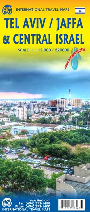
Tel Aviv, Jaffa & Central Israel ITMB Travel Map
Sold Out
Afterpay is only available for orders between $50.00 and $1000.00 More info
Double-Sided Folded Travel Map | Cultural, Historical & Road Detail
Includes Tel Aviv, Jaffa, Jerusalem, Dead Sea, Gaza, West Bank, Nazareth & More
Size: 685 mm x 990 mm (27" x 39")
🇮🇱 Explore Israel’s Urban Coast and Sacred Heartlands
Navigate the fascinating crossroads of history, culture, and religion with ITMB’s Tel Aviv, Jaffa & Central Israel Map. This double-sided folded map brings together the modern vibrancy of Tel Aviv, the ancient charm of Jaffa, and the full scope of central Israel’s sacred and strategic landmarks—from the Mediterranean coast to the Dead Sea.
Designed for travellers, pilgrims, and curious explorers alike, this map offers clear cartography, political and cultural context, and practical navigation tools for one of the world’s most complex and captivating regions.
🧭 Dual-Sided Regional Coverage
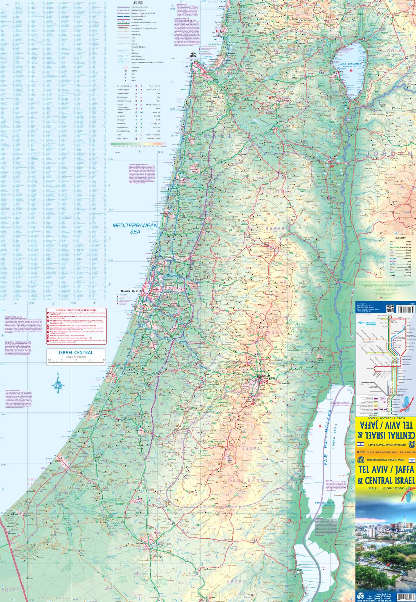
🗺 Side 1 – Tel Aviv & Jaffa
-
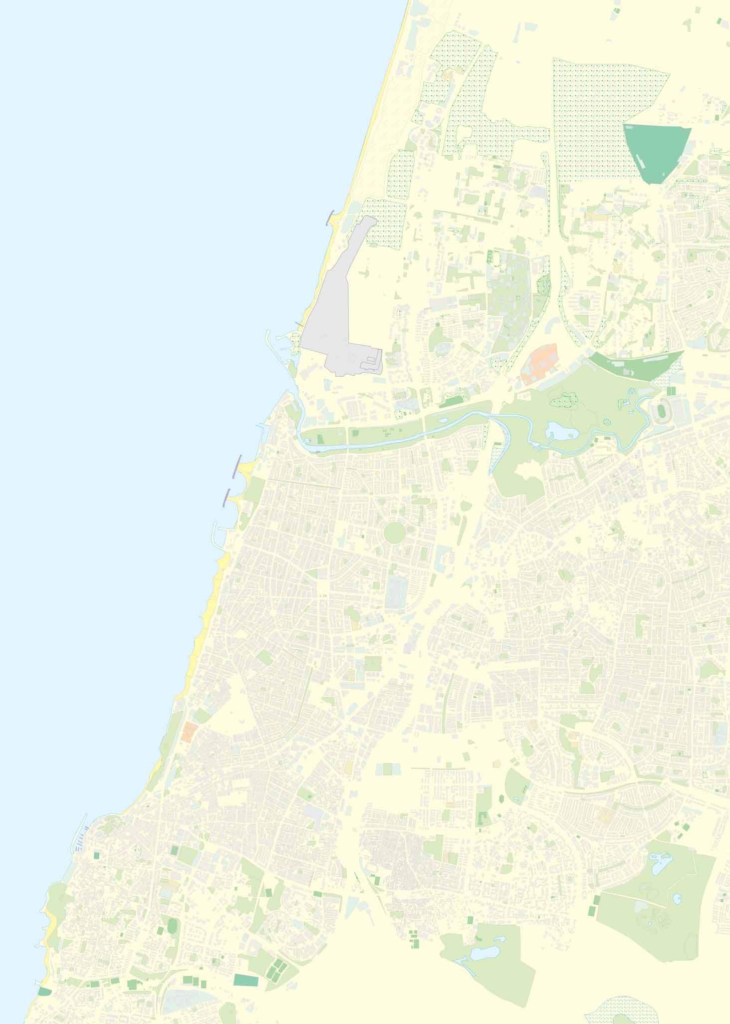
Detailed street map of Tel Aviv, Israel’s cultural and economic hub
-
Includes key infrastructure: beaches, major roads, transit routes, parks, hotels, and museums
-
Historic Jaffa (Yafo) inset with its old city streets, port area, markets, and architectural highlights
-
Tourist-friendly English-language map—ideal for international visitors
🗺 Side 2 – Central Israel Regional Map
-
Covers Haifa to the Dead Sea, and Beersheba to the Sea of Galilee
-
Includes:
-
🕍 Jerusalem, Bethlehem, Nazareth, Akko (Acre), and Tiberias
-
✡️ Major religious sites: the Western Wall, Church of the Nativity, Dome of the Rock, Mount of Olives, and more
-
🗺️ Politically sensitive regions such as the West Bank and Gaza Strip are clearly indicated for awareness and navigation
-
-
Great for road trips, pilgrimage routes, and historical exploration
🔍 Key Features
✅ City-Level Detail & Tourist Sites
-
Streets, neighbourhoods, public transport, historic areas, parks, and markets
-
Highlights major landmarks, walking zones, cultural sites, and accommodation zones
✅ Regional Overview with Road Network
-
Full road system with distances, border zones, checkpoints, and main travel routes
-
Perfect for self-driving, guided tours, and planning multi-day itineraries
✅ Clear, International-Friendly Cartography
-
English-language labels throughout
-
Designed for accessibility to non-Hebrew speakers
✅ Cultural & Religious Interest
-
Includes important Jewish, Christian, and Muslim heritage sites
-
Ideal for religious travellers, academics, and students of Middle Eastern history
📌 Map Specifications
| Feature | Details |
|---|---|
| Map Type | Double-sided folded travel map |
| Publisher | ITMB (International Travel Maps) |
| Size | 685 mm x 990 mm (27" x 39") |
| City Map Scale | Approx. 1:10,000 (Tel Aviv & Jaffa) |
| Regional Map Scale | Approx. 1:330,000 – 1:500,000 (Central Israel) |
| Language | English (place names and map legend) |
| Format | Folded paper map |
👥 Who Is This Map For?
-
🧳 Travellers and tourists visiting Tel Aviv, Jaffa, or Jerusalem for the first time
-
📸 Cultural explorers and history buffs tracing ancient trade routes and empires
-
🕊️ Pilgrims following paths to key religious sites across Israel and Palestine
-
🚗 Road trippers and independent explorers touring Israel by car or van
-
📚 Researchers and educators seeking a compact yet detailed regional reference
-
🗺️ Map collectors and Middle East enthusiasts looking for practical cartography
🛒 Add the ITMB Tel Aviv & Central Israel Map to Your Cart Today
Plan your journey through ancient streets and modern skylines with one durable, informative, and beautifully designed map. Whether you're headed to the beach, the bazaar, or the birthplace of civilizations—this is your essential guide to Israel’s heartland.


