- Australia ▾
- Topographic
▾
- Australia AUSTopo 250k (2025)
- Australia 50k Geoscience maps
- Australia 100k Geoscience maps
- Australia 250k Geoscience maps
- Australia 1:1m Geoscience maps
- New Zealand 50k maps
- New Zealand 250k maps
- New South Wales 25k maps
- New South Wales 50k maps
- New South Wales 100k maps
- Queensland 10k maps
- Queensland 25k maps
- Queensland 50k maps
- Queensland 100k maps
- Western Australia 25k maps
- Western Australia 50k maps
- Western Australia 100k maps
- Compasses
- Software
- GPS Systems
- International ▾
- Wall Maps
▾
- World
- Australia & New Zealand
- Countries, Continents & Regions
- Historical
- Vintage National Geographic
- Australian Capital Territory
- New South Wales
- Northern Territory
- Queensland
- South Australia
- Tasmania
- Victoria
- Western Australia
- Celestial
- Children's
- Mining & Resources
- Wine Maps
- Healthcare
- Postcode Maps
- Electoral Maps
- Nautical ▾
- Flags
▾
- Australian Flag Sets & Banners
- Flag Bunting
- Handwavers
- Australian National Flags
- Aboriginal Flags
- Torres Strait Islander Flags
- International Flags
- Flagpoles & Accessories
- Australian Capital Territory Flags
- New South Wales Flags
- Northern Territory Flags
- Queensland Flags
- South Australia Flags
- Tasmania Flags
- Victoria Flags
- Western Australia Flags
- Gifts ▾
- Globes ▾
Dear valued customer. Please note that our checkout is not supported by old browsers. Please use a recent browser to access all checkout capabilities


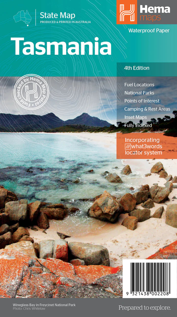
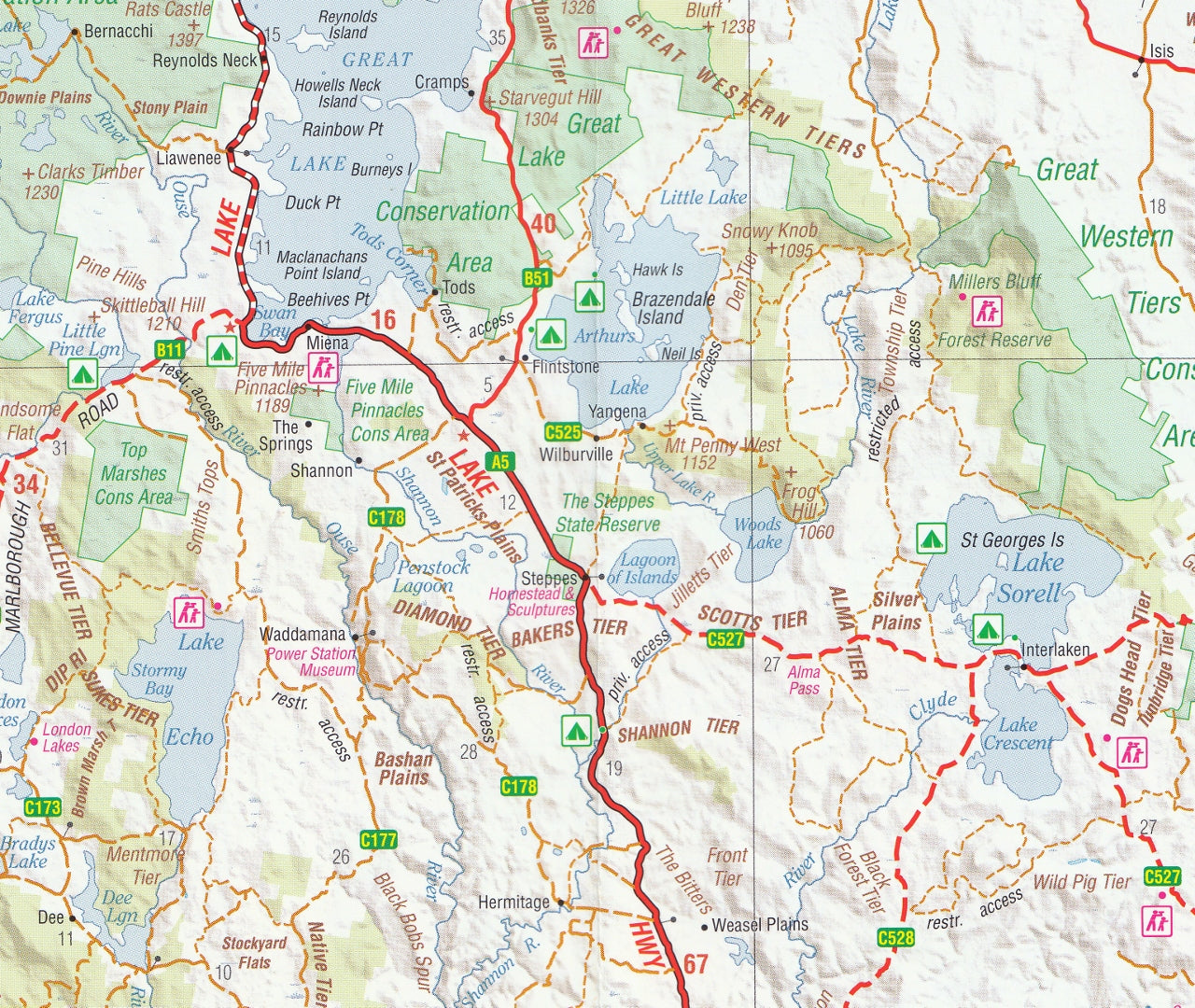
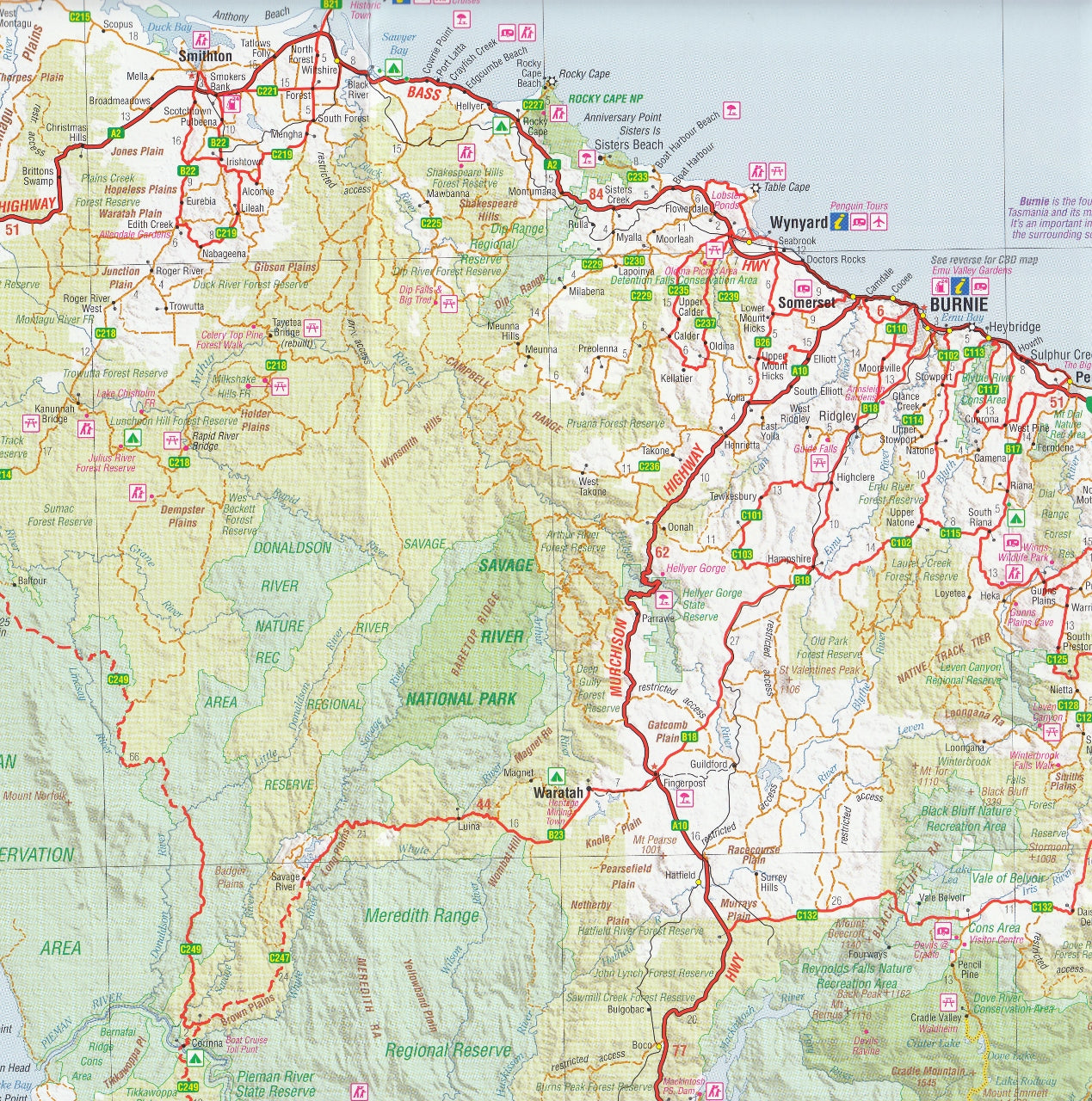
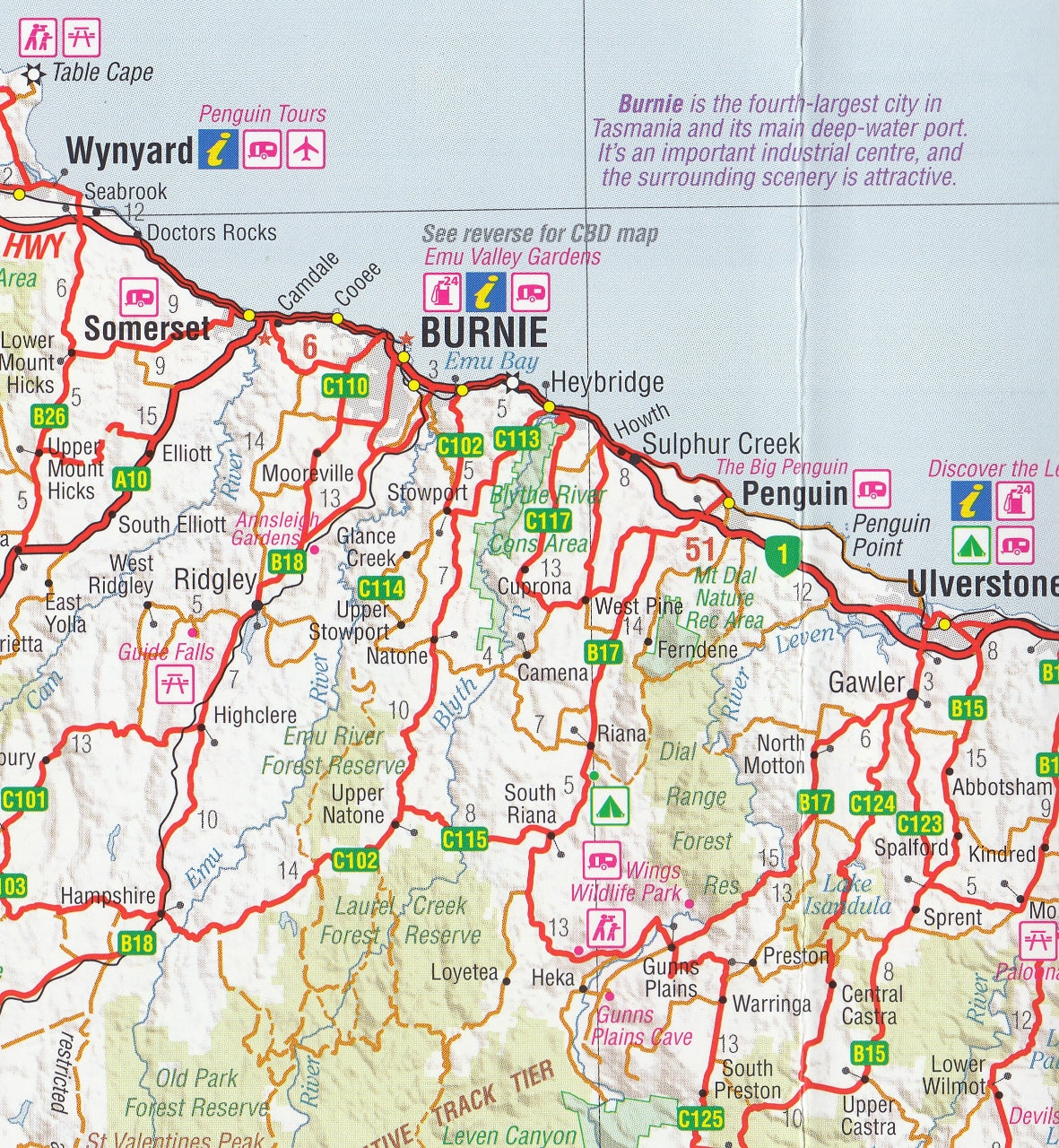
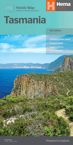
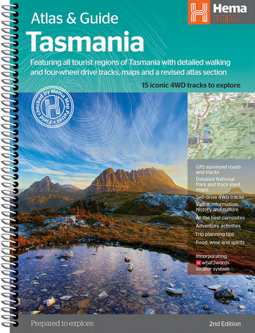
Tasmania Hema State Map New 4th Edition
$14.95
Afterpay is only available for orders between $50.00 and $1000.00 More info
A beautifully detailed and field-checked road and touring map of Tasmania – perfect for travellers, campers, adventurers, and anyone seeking to explore the Apple Isle
The Hema Tasmania State Map 4th Edition is your comprehensive guide to one of Australia's most stunning and diverse destinations. Whether you're winding through the ancient forests of the West Coast, heading east to the white sands of Freycinet, or exploring historic Hobart, this map offers everything you need to plan and execute your Tasmanian adventure with confidence.
Meticulously updated and field-checked by Hema’s renowned Map Patrol, this edition features clear cartography, rich tourist information, and multiple inset maps of key regions and national parks. It’s the go-to choice for self-drive holidaymakers, campers, hikers, and anyone wanting an accurate, physical reference for Tasmania.
🗺️ Key Features:
-
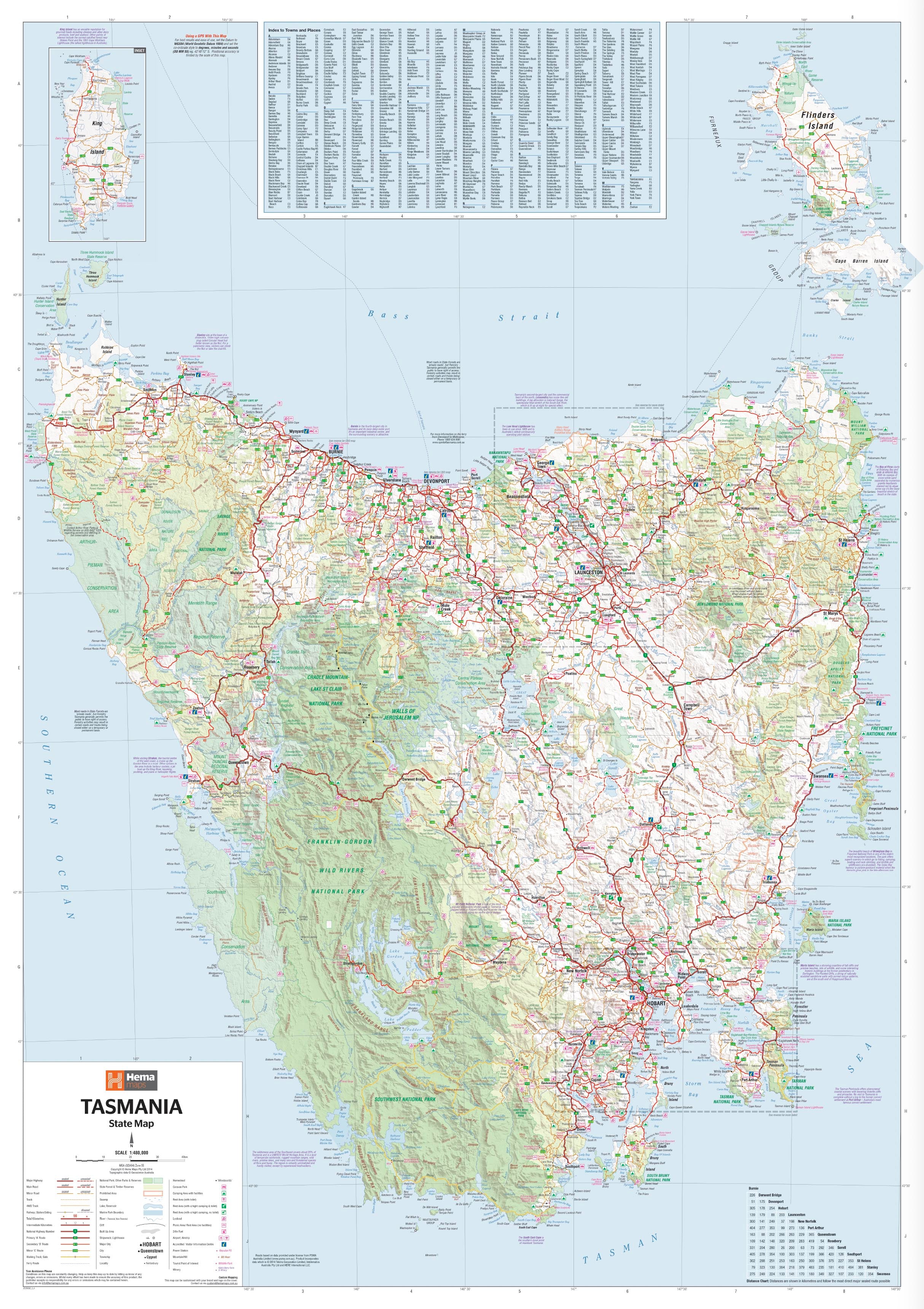
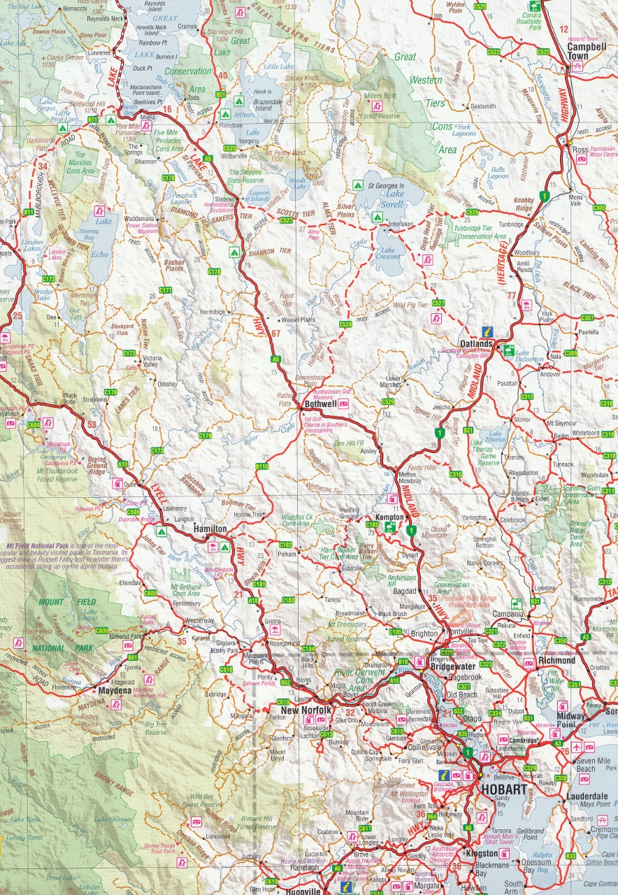
Main Map Scale: 1:500,000 — 1 cm = 5 km
A touring-friendly scale offering excellent coverage and readability for navigating both major highways and backroads -
Unfolded Size: 1000 mm x 700 mm
-
Folded Size: 250 mm x 140 mm x 3 mm
-
Weight: Approximately 90 grams — lightweight and portable
Pre-Folded Laminated Folded Map – $49.95
-
Flattened and laminated from a folded original
-
Slight crease lines may be visible but retains full functionality
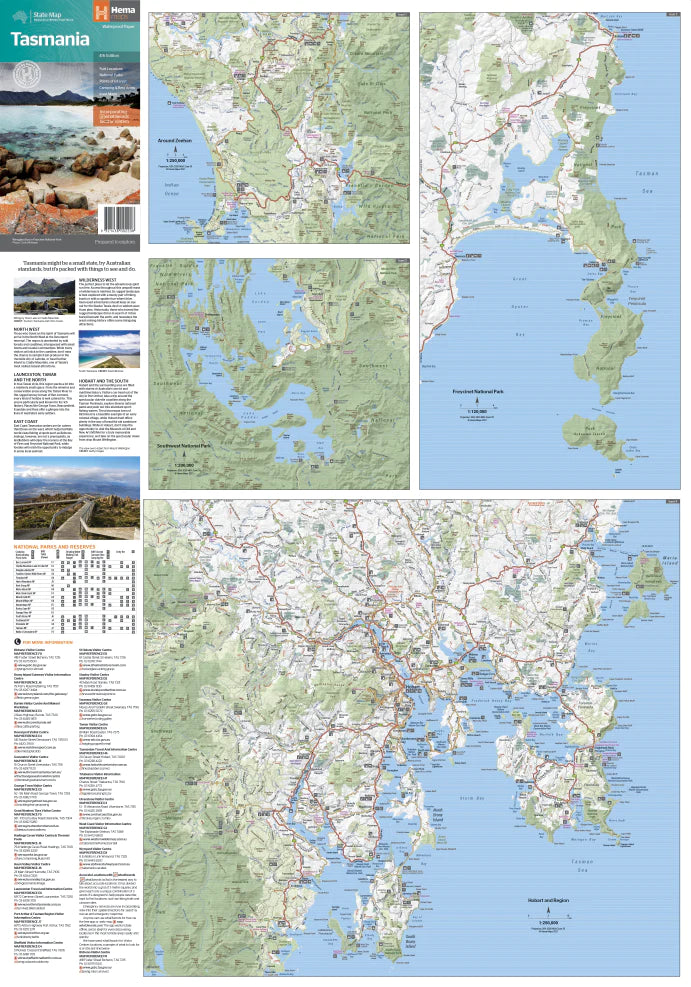
🌄 Inset Maps for Deeper Exploration:
-
Zeehan & Queenstown Region – 1:250,000
-
Southwest National Park – 1:200,000
-
Freycinet National Park – 1:125,000
-
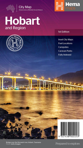
Hobart & Region – 1:250,000
These detailed insets provide enhanced coverage for Tasmania’s most popular outdoor and wilderness destinations, with greater topographic detail, park access, walking tracks, and local features.
🧭 Additional Highlights:
-
Camping & Caravan Icons – Locations for free and paid campsites, caravan parks, and overnight rest stops
-
Fuel Locations – Marked across the island, helpful for trip planning in remote areas
-
Tourist Icons – Point out popular attractions such as wineries, waterfalls, lookout points, heritage sites, and wildlife reserves
-
Facilities Table – A handy reference listing national parks and reserves, with available amenities like toilets, BBQs, showers, and accessible features
-
Visitor Information Centres – Clearly marked so you can get local help and advice on the road
-
Road Distances & Driving Times – Useful for planning efficient travel routes between towns and regions
-
National Parks & World Heritage Areas – Highlighted for outdoor enthusiasts, bushwalkers, and nature lovers
-
Topographic Relief Shading – Provides a visual sense of Tasmania’s mountainous terrain and remote regions
🚗 Perfect For:
-
Touring Tasmania by car, motorhome, or campervan
-
Bushwalkers and hikers accessing national parks and remote reserves
-
Road trip planners mapping scenic drives and regional loops
-
Grey nomads, families, and adventure travellers seeking off-the-beaten-path campsites and hidden gems
-
Teachers, students, and geography enthusiasts wanting a large-format reference to Tasmania’s landscape and infrastructure
-
Map collectors and travel gift-givers looking for a practical yet beautiful addition to their library
Whether you're tracing Tasmania’s wild west coast, discovering colonial heritage in Launceston, or ferrying across to Bruny Island, the Hema Tasmania State Map 4th Edition is your trusted companion. Its thoughtful design, accurate data, and traveller-focused detail make it far more than just a map — it’s a guide, a planner, and a record of your journey across one of Australia’s most remarkable destinations.
Unfold the best of Tasmania. Travel smart. Discover more — with Hema.
Published March 2023
NEXT DAY SHIPPING
Frequently Asked Questions
Where can I buy the Tasmania Hema State Map New 4th Edition?
The Tasmania Hema State Map New 4th Edition is available to buy online from Mapworld, Australia's largest map and geographic product retailer, with fast shipping Australia-wide.
Is the Tasmania Hema State Map New 4th Edition in stock at Mapworld?
Mapworld maintains extensive stock across its map range and aims for fast dispatch. Orders placed before 2pm AEST on business days are typically dispatched the same day, with standard and express Australia-wide delivery options available.
What is Mapworld's returns policy?
Mapworld accepts returns on undamaged items in original condition. Contact Mapworld within 90 days of purchase to arrange a return or exchange.
Does Mapworld ship the Tasmania Hema State Map New 4th Edition across Australia?
Yes, Mapworld ships Australia-wide. Standard shipping is a flat $7 rate, with free standard shipping on orders over $75. Express options are available at checkout. Most orders placed before 2pm AEST on weekdays are dispatched same day.
Related Items
© 2026 Mapworld. Website designed by Genie Media
X