- Australia ▾
- Topographic
▾
- Australia AUSTopo 250k (2025)
- Australia 50k Geoscience maps
- Australia 100k Geoscience maps
- Australia 250k Geoscience maps
- Australia 1.1m Geoscience maps
- New Zealand 50k maps
- New Zealand 250k maps
- New South Wales 25k maps
- New South Wales 50k maps
- New South Wales 100k maps
- Queensland 10k maps
- Queensland 25k maps
- Queensland 50k maps
- Queensland 100k maps
- Compasses
- Software
- GPS Systems
- Orienteering
- International ▾
- Wall Maps
▾
- World
- Australia & New Zealand
- Countries, Continents & Regions
- Historical
- Vintage National Geographic
- Australian Capital Territory
- New South Wales
- Northern Territory
- Queensland
- South Australia
- Tasmania
- Victoria
- Western Australia
- Celestial
- Children's
- Mining & Resources
- Wine Maps
- Healthcare
- Postcode Maps
- Electoral Maps
- Nautical ▾
- Flags
▾
- Australian Flag Sets & Banners
- Flag Bunting
- Handwavers
- Australian National Flags
- Aboriginal Flags
- Torres Strait Islander Flags
- International Flags
- Flagpoles & Accessories
- Australian Capital Territory Flags
- New South Wales Flags
- Northern Territory Flags
- Queensland Flags
- South Australia Flags
- Tasmania Flags
- Victoria Flags
- Western Australia Flags
- Gifts ▾
- Globes ▾
Dear valued customer. Please note that our checkout is not supported by old browsers. Please use a recent browser to access all checkout capabilities
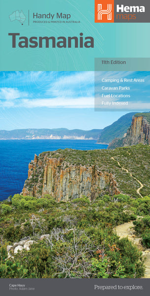
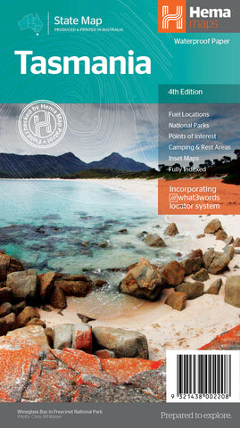
Tasmania Hema Handy Map 11th Edition
$11.95
Afterpay is only available for orders between $50.00 and $1000.00 More info
Compact Touring Map Featuring Camping, Fuel Stops, National Parks & Attractions
Folded Paper Map | Size Open: 500 mm x 750 mm | ISBN: 9321438002246
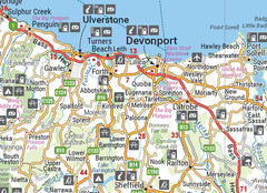
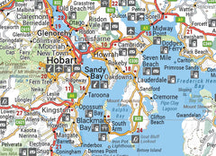
Discover the natural wonders, rugged beauty, and rich history of Tasmania with the Tasmania Handy Map by Hema, now in its 11th Edition. Designed for travellers, campers, and road trippers, this conveniently sized fold-out touring map offers a wealth of detail across the island state — from Cradle Mountain to Hobart, the Tarkine to Freycinet.
Whether you're planning a self-drive adventure, exploring national parks, or navigating remote townships, this map delivers clarity, up-to-date information, and ease of use — all in a highly portable format.
✅ Key Features
| 🔍 Feature | 💡 Details |
|---|---|
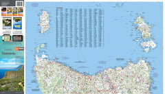
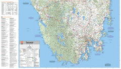
| 🛣️ Touring Road Map | Clear, easy-to-read touring layout showing all major roads and secondary routes |
| ⛽ Fuel Locations | Includes 24-hour fuel stops and remote outback fuel access points |
| ⛺ Camping Information | Identifies camping areas, rest stops, and caravan parks |
| 🏕️ National Parks | Highlights Tasmania’s stunning parks including Cradle Mountain, Freycinet, and Southwest National Park |
| 📍 Points of Interest | Icons marking scenic lookouts, natural attractions, historic towns, and visitor centres |
| 📏 Distance Grid | Easy-to-use chart for measuring driving distances across the island |
| 🗂️ Index of Towns & Localities | Quickly locate any town, locality, or regional centre with a full alphabetical index |
🧳 Who's It For?
-
Caravanners and campers looking for fuel stops, campgrounds, and remote park access
-
Self-drive holidaymakers exploring scenic drives and Tasmania’s natural landmarks
-
Tour planners, sales reps or consultants needing accurate road data and distance planning
-
Students and educators studying Tasmania’s geography in an easy-to-read format
-
Everyday travellers who want a lightweight, quick-reference map in the glovebox
📐 Product Details
| Specification | Description |
|---|---|
| Publisher | Hema Maps |
| Edition | 11th Edition |
| Format | Folded Handy Map |
| Material | Durable, high-quality map stock |
| Map Coverage | Entire island of Tasmania |
| Size When Open | 500 mm (H) x 750 mm (W) |
| Scale | Touring-scale for practical use |
| ISBN | 9321438002246 |
🌿 Why Choose the Hema Handy Map of Tasmania?
✔️ Compact and portable — fits easily in glove boxes, backpacks, or caravan drawers
✔️ Up-to-date — includes the latest touring infrastructure, including fuel and rest areas
✔️ Designed for travel — focuses on practical detail for exploring off the beaten path
✔️ Eco-conscious — printed on FSC-certified paper using sustainable practices
This is not just a map — it’s your companion for one of Australia’s most breathtaking destinations. Whether you're camping beside alpine lakes, trekking the Overland Track, or chasing gourmet trails through the Huon Valley, the Tasmania Hema Handy Map will keep you oriented, informed, and inspired.
Plan with confidence. Travel with clarity. Explore Tasmania the Hema way


