- Australia ▾
- Topographic
▾
- Australia AUSTopo 250k (2025)
- Australia 50k Geoscience maps
- Australia 100k Geoscience maps
- Australia 250k Geoscience maps
- Australia 1:1m Geoscience maps
- New Zealand 50k maps
- New Zealand 250k maps
- New South Wales 25k maps
- New South Wales 50k maps
- New South Wales 100k maps
- Queensland 10k maps
- Queensland 25k maps
- Queensland 50k maps
- Queensland 100k maps
- Western Australia 25k maps
- Western Australia 50k maps
- Western Australia 100k maps
- Compasses
- Software
- GPS Systems
- International ▾
- Wall Maps
▾
- World
- Australia & New Zealand
- Countries, Continents & Regions
- Historical
- Vintage National Geographic
- Australian Capital Territory
- New South Wales
- Northern Territory
- Queensland
- South Australia
- Tasmania
- Victoria
- Western Australia
- Celestial
- Children's
- Mining & Resources
- Wine Maps
- Healthcare
- Postcode Maps
- Electoral Maps
- Nautical ▾
- Flags
▾
- Australian Flag Sets & Banners
- Flag Bunting
- Handwavers
- Australian National Flags
- Aboriginal Flags
- Torres Strait Islander Flags
- International Flags
- Flagpoles & Accessories
- Australian Capital Territory Flags
- New South Wales Flags
- Northern Territory Flags
- Queensland Flags
- South Australia Flags
- Tasmania Flags
- Victoria Flags
- Western Australia Flags
- Gifts ▾
- Globes ▾
Dear valued customer. Please note that our checkout is not supported by old browsers. Please use a recent browser to access all checkout capabilities


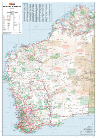
South West Corner Western Australia Regional Map by QPA
$12.95
Afterpay is only available for orders between $50.00 and $1000.00 More info
Double-Sided Touring Map | Scale 1:170,000 | Available in Paper or Laminated Finish
Journey through the lush forests, coastal havens, and wine-rich valleys of Western Australia’s stunning South West Corner with this double-sided, up-to-date map by QPA (Quality Publishing Australia). From Yanchep in the north to the dramatic coastlines of D’Entrecasteaux National Park in the south, this map is the ideal planning and navigation tool for road trippers, campers, hikers, and outdoor explorers.
Whether you’re sipping wine in Margaret River, surfing in Yallingup, or wandering the ancient forests of Pemberton, this map delivers the accuracy and regional insight you need for a seamless journey.
🧭 Key Features
-
📍 Double-Sided Coverage
-
Side 1: Northern region from Yanchep to Busselton, including Perth and Geographe Bay
-
Side 2: Southern region through Margaret River, Pemberton, Nannup, and into D’Entrecasteaux NP
-
-
🛣️ Road & Track Network
-
Major highways, scenic drives, minor roads, and off-road tracks for 4WD use
-
-
🏕️ Camping & Rest Areas
-
Clearly marked roadhouses, caravan parks, national park campgrounds, picnic areas, and public rest stops
-
-
🌲 Natural Highlights & Attractions
-
National and conservation parks, lookouts, beaches, caves, waterfalls, and heritage landmarks
-
📐 Product Specifications
| Attribute | Details |
|---|---|
| Title | South West Corner Western Australia Map |
| Publisher | QPA (Quality Publishing Australia) |
| Format | Double-sided |
| Scale | 1:170,000 |
| Map Size | 1010 mm (W) × 700 mm (H) |
| Coverage | Yanchep to D’Entrecasteaux National Park |
| Finish Options | ▪️ Paper – folded, lightweight, ideal for travel ▪️ Laminated – encapsulated in 80-micron gloss laminate |
| Made in | Australia |
💎 Why Choose the Laminated Version?
-
✏️ Writeable Surface – Use whiteboard markers to plot routes or highlight campsites
-
💧 Water-Resistant & Tear-Proof – Ideal for use in the field or on the road
-
📍 Compatible with Map Dots – Mark key destinations without permanent marks
-
🧳 Perfect for Touring Vehicles – Keep in the caravan, glovebox, or trip folder
🎯 Ideal For:
-
🚙 Road trippers exploring WA’s southwest wine and forest regions
-
🏕️ Campers and caravan travellers seeking reliable campsite and fuel stop information
-
🧭 4WD enthusiasts and outdoor adventurers hitting backroads and bush tracks
-
🗺️ Tourism operators and educators using regional references in classrooms or visitor centres
🌿 Discover WA’s South West – Naturally Diverse, Endlessly Inspiring
From the vineyard-laced valleys of Margaret River to the ancient woodlands and wild beaches of D’Entrecasteaux, this map connects you to the rich natural beauty and regional culture of Western Australia’s South West Corner.
📦 Order now in your preferred finish—paper for portability or laminated for durability—and take the road less travelled with confidence.
Frequently Asked Questions
Where can I buy the South West Corner Western Australia Regional Map by QPA?
The South West Corner Western Australia Regional Map by QPA is available to buy online from Mapworld, Australia's largest map and geographic product retailer, with fast shipping Australia-wide.
Is the South West Corner Western Australia Regional Map by QPA in stock at Mapworld?
Mapworld maintains extensive stock across its map range and aims for fast dispatch. Orders placed before 2pm AEST on business days are typically dispatched the same day, with standard and express Australia-wide delivery options available.
What is Mapworld's returns policy?
Mapworld accepts returns on undamaged items in original condition. Contact Mapworld within 90 days of purchase to arrange a return or exchange.
Does Mapworld ship the South West Corner Western Australia Regional Map by QPA across Australia?
Yes, Mapworld ships Australia-wide. Standard shipping is a flat $7 rate, with free standard shipping on orders over $75. Express options are available at checkout. Most orders placed before 2pm AEST on weekdays are dispatched same day.
Related Items


© 2026 Mapworld. Website designed by Genie Media
X