- Australia ▾
- Topographic
▾
- Australia AUSTopo 250k (2024)
- Australia 50k Geoscience maps
- Australia 100k Geoscience maps
- Australia 250k Geoscience maps
- Australia 1.1m Geoscience maps
- New Zealand 50k maps
- New Zealand 250k maps
- New South Wales 25k maps
- New South Wales 50k maps
- New South Wales 100k maps
- Queensland 10k maps
- Queensland 25k maps
- Queensland 50k maps
- Queensland 100k maps
- Compasses
- Software
- GPS Systems
- Orienteering
- International ▾
- Wall Maps
▾
- World
- Australia & New Zealand
- Countries, Continents & Regions
- Historical
- Vintage National Geographic
- Australian Capital Territory
- New South Wales
- Northern Territory
- Queensland
- South Australia
- Tasmania
- Victoria
- Western Australia
- Celestial
- Children's
- Mining & Resources
- Wine Maps
- Healthcare
- Postcode Maps
- Electoral Maps
- Nautical ▾
- Flags
▾
- Australian Flag Sets & Banners
- Flag Bunting
- Handwavers
- Australian National Flags
- Aboriginal Flags
- Torres Strait Islander Flags
- International Flags
- Flagpoles & Accessories
- Australian Capital Territory Flags
- New South Wales Flags
- Northern Territory Flags
- Queensland Flags
- South Australia Flags
- Tasmania Flags
- Victoria Flags
- Western Australia Flags
- Gifts ▾
- Globes ▾
Dear valued customer. Please note that our checkout is not supported by old browsers. Please use a recent browser to access all checkout capabilities


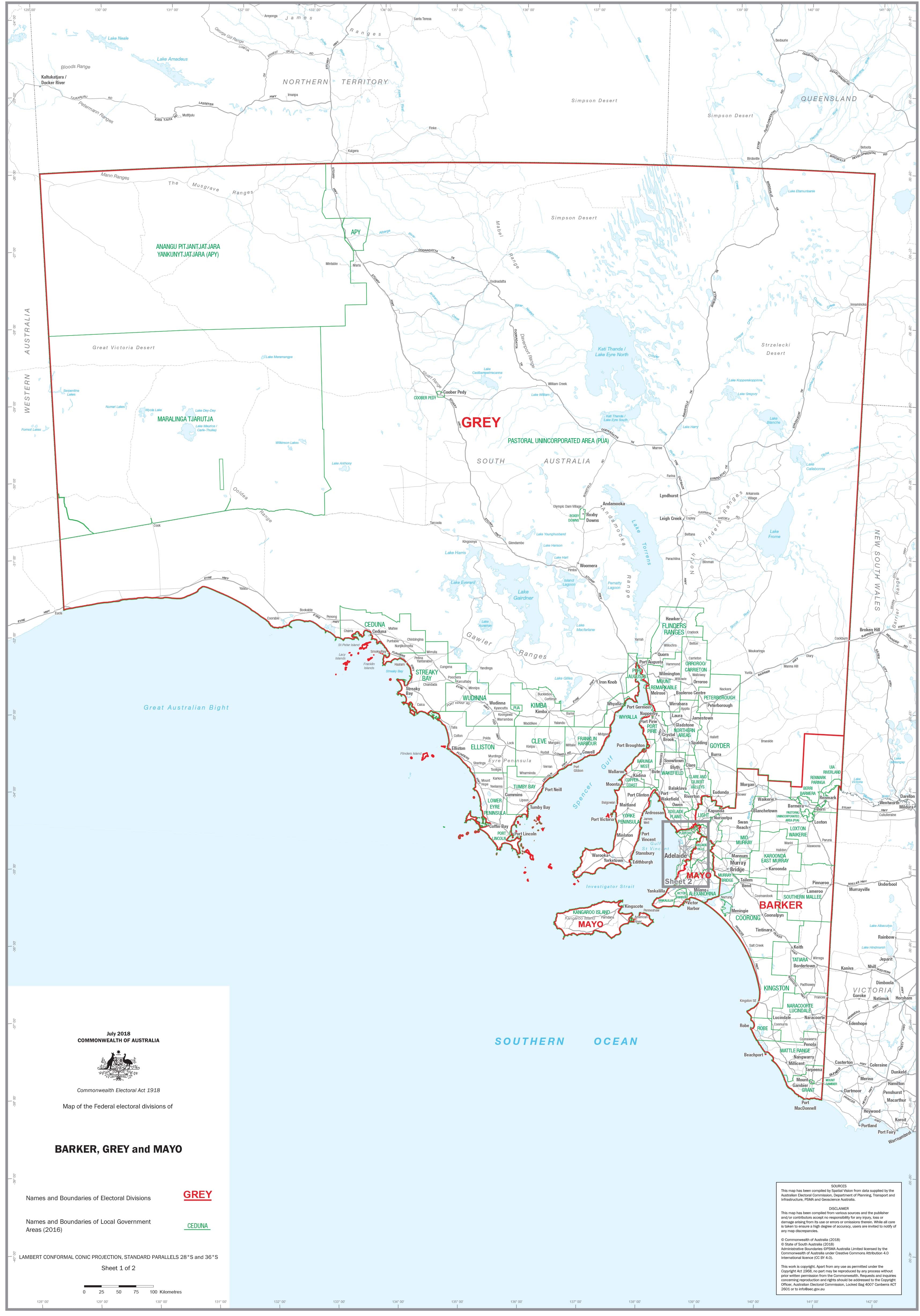
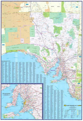
South Australia Federal Electoral Divisions and Local Government Areas Map - Adelaide & Region
$59.95
or make 4 interest-free payments of
$14.99 AUD
fortnightly with
![]() More info
More info
The Complete Reference for Electoral and Local Government Boundaries
Gain a clear, authoritative overview of South Australia’s electoral landscape with this detailed map, covering the federal electoral divisions of Barker, Grey, and Mayo, as well as all local government areas (LGAs) in the Adelaide region and surrounding areas. Perfect for professionals, researchers, planners, and educators, this map combines exceptional clarity with durable, premium materials.
🗺️ Detailed & Easy-to-Read
At a glance, this map provides:
-
Clearly marked federal electoral boundaries: Shows the divisions of Barker, Grey, and Mayo in fine detail.
-
Local government area names and boundaries: Allows you to identify and distinguish each LGA with ease—ideal for planning, analysis, and understanding local governance.
-
Fine cartographic design: Clean fonts, distinct colours, and precise lines ensure the map is practical and visually appealing, whether displayed in a boardroom, classroom, or community centre.
🌟 Perfect For
-
Political consultants & campaign managers: Understand voter distribution, target outreach, and analyse trends across divisions.
-
Government departments & agencies: A practical reference tool for policy, planning, and resource allocation.
-
Businesses & logistics professionals: Optimise delivery routes, plan service coverage, or assess market opportunities by division or council area.
-
Educators & researchers: Use as a teaching aid in classrooms, research settings, or community workshops.
-
Community organisations & advocacy groups: Support local initiatives, highlight boundaries, and coordinate campaigns effectively.
✅ Premium Materials & Flexible Options
Choose from:
-
Heavyweight 160 gsm FSC matte-coated paper: Perfect for framing under glass or archiving.
-
Laminated with 80-micron gloss laminate: Durable, wipe-clean surface ideal for use with whiteboard markers or map dots—great for high-use spaces like offices or classrooms.
🖼️ Additional Customisation Available
We can also produce individual detailed maps of each electoral division—perfect for those focusing on Barker, Grey, or Mayo specifically. Contact us to discuss custom orders, bulk requests, or special requirements.
📐 Specifications
| Attribute | Details |
|---|---|
| Title | South Australia Federal Electoral Divisions and Local Government Areas Map - Adelaide & Region |
| Coverage | Barker, Grey, Mayo divisions + Adelaide region LGAs |
| Size | 1000 mm (W) x 700 mm (H) |
| Material options | Paper (160 gsm FSC matte coated) or laminated (80-micron gloss laminate) |
| Delivery | Made to order—please allow 7-10 working days |
| Origin | Made in Australia |
🎯 Why Choose This Map?
| Feature | Benefit |
|---|---|
| Clear division & LGA boundaries | Instantly understand the political and administrative landscape |
| Premium materials | Built to last and maintain clarity over time |
| Easy to annotate | Perfect for planning meetings, analysis sessions, and presentations |
| Flexible format options | Choose the finish that suits your needs best |
| Locally made | Supporting Australian craftsmanship and production |
Invest in clarity and precision—equip your workspace, office, or classroom with this detailed map of South Australia’s electoral and local government boundaries today.