- Australia ▾
- Topographic
▾
- Australia AUSTopo 250k (2025)
- Australia 50k Geoscience maps
- Australia 100k Geoscience maps
- Australia 250k Geoscience maps
- Australia 1:1m Geoscience maps
- New Zealand 50k maps
- New Zealand 250k maps
- New South Wales 25k maps
- New South Wales 50k maps
- New South Wales 100k maps
- Queensland 10k maps
- Queensland 25k maps
- Queensland 50k maps
- Queensland 100k maps
- Western Australia 25k maps
- Western Australia 50k maps
- Western Australia 100k maps
- Compasses
- Software
- GPS Systems
- International ▾
- Wall Maps
▾
- World
- Australia & New Zealand
- Countries, Continents & Regions
- Historical
- Vintage National Geographic
- Australian Capital Territory
- New South Wales
- Northern Territory
- Queensland
- South Australia
- Tasmania
- Victoria
- Western Australia
- Celestial
- Children's
- Mining & Resources
- Wine Maps
- Healthcare
- Postcode Maps
- Electoral Maps
- Nautical ▾
- Flags
▾
- Australian Flag Sets & Banners
- Flag Bunting
- Handwavers
- Australian National Flags
- Aboriginal Flags
- Torres Strait Islander Flags
- International Flags
- Flagpoles & Accessories
- Australian Capital Territory Flags
- New South Wales Flags
- Northern Territory Flags
- Queensland Flags
- South Australia Flags
- Tasmania Flags
- Victoria Flags
- Western Australia Flags
- Gifts ▾
- Globes ▾
Dear valued customer. Please note that our checkout is not supported by old browsers. Please use a recent browser to access all checkout capabilities


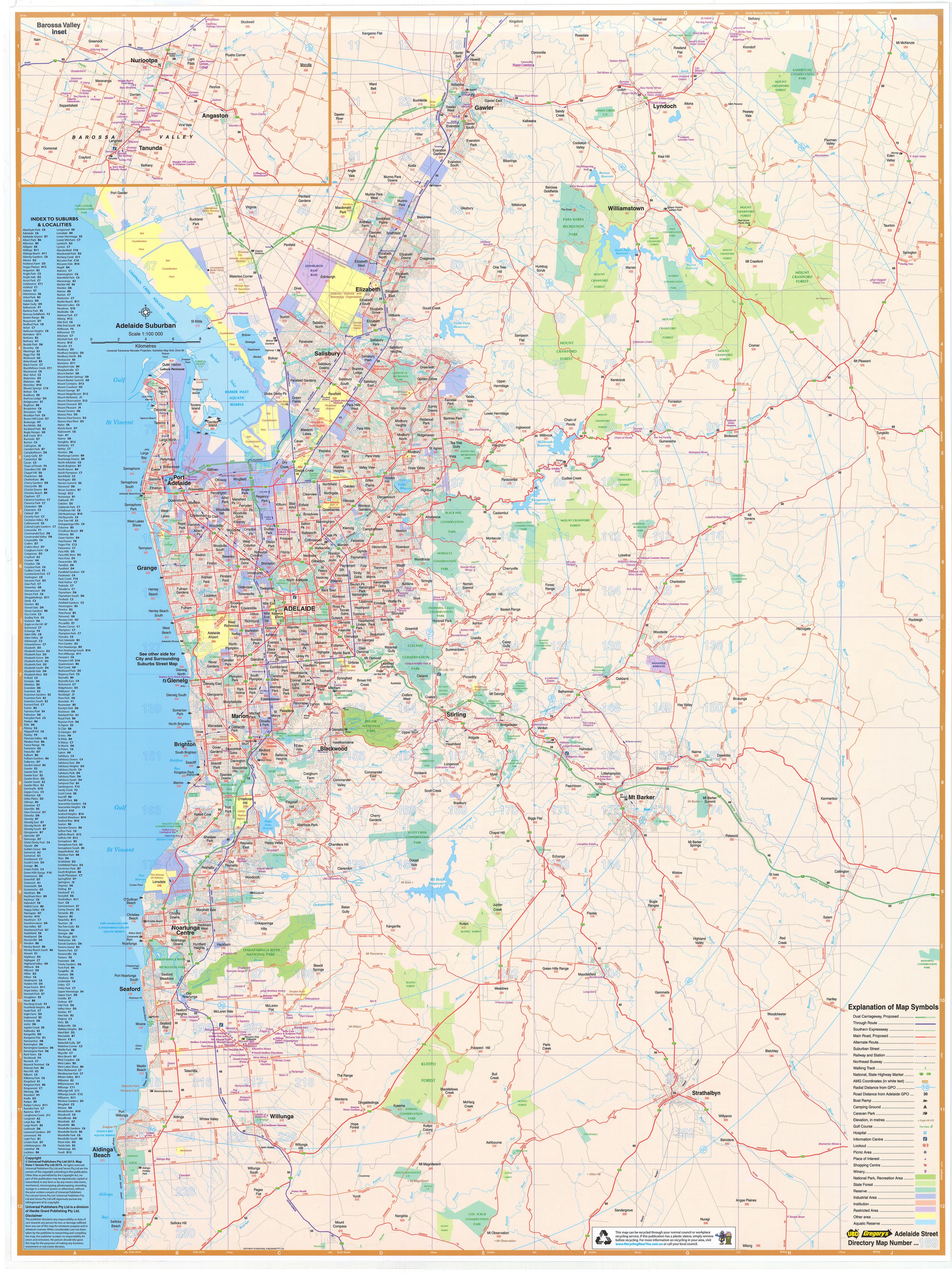
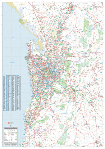
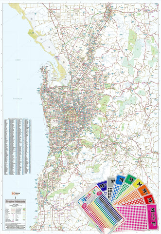
Adelaide UBD 562 Map 1020 x 1480mm Laminated Wall Map
$365.00
or make 4 interest-free payments of
$91.25 AUD
fortnightly with
![]() More info
More info
An Incredibly Detailed, Office-Ready Map of Metropolitan Adelaide and Surrounds
Format: Laminated Wall Map
Size: 1020 mm (W) × 1480 mm (H)
Publisher: UBD Gregory’s
Map Code: 562
📌 Overview
The Adelaide UBD 562 Wall Map is one of the most detailed metropolitan maps available, making it ideal for businesses, planners, educational institutions, and logistics professionals operating in South Australia.
Covering a 75 km radius of Adelaide’s suburbs, this large-format laminated map extends from Gawler in the north to Aldinga Beach in the south, and includes a detailed inset of the Barossa Valley—South Australia’s iconic wine region.
🧭 Key Features
-
Full Suburban Coverage: Clearly shows general suburban built-up areas across the Adelaide metropolitan region, with each suburb name marked and indexed.
-
Postcode Boundaries: All suburbs are shown with their corresponding postcodes—ideal for logistics, delivery planning, or service area management.
-
Road Network Detail: Includes arterial routes, main roads, and transport infrastructure for easy navigation and business planning.
-
Barossa Valley Inset: Bonus detail of one of Australia’s most significant regional areas.
-
Natural & Industrial Zones: National parks, green spaces, and key industrial areas are clearly marked.
-
Complete Index: Every suburb listed alphabetically with easy map reference.
🛡️ Premium Lamination
This map is printed on durable 120 gsm stock and encapsulated in 80-micron gloss laminate, offering:
-
Write-on/Wipe-off Surface: Perfect for whiteboard markers—great for temporary notes or route planning.
-
Durability: Resists tears, stains, and moisture—ideal for high-use environments like offices and dispatch rooms.
-
UV Resistance: Gloss laminate protects against fading, even in brightly lit areas.
📐 Specifications
| Feature | Description |
|---|---|
| Map Title | Adelaide UBD 562 |
| Coverage Area | Gawler to Aldinga Beach, Barossa Valley |
| Postcode Display | Suburbs with postcodes indexed |
| Material | Laminated (80-micron gloss) |
| Dimensions | 1020 mm (W) × 1480 mm (H) |
| Publisher | UBD Gregory’s |
🏢 Ideal For
-
Business Offices & Sales Teams
-
Logistics & Courier Companies
-
Government & Council Planning
-
Property Managers & Real Estate Agents
-
Schools, Libraries & Community Spaces
Get a clear, practical, and visually informative view of metropolitan Adelaide with this UBD 562 laminated wall map—a smart and durable solution for any professional or planning space.
Frequently Asked Questions
What are the dimensions of the Adelaide UBD 562 Map 1020 x 1480mm Laminated Wall Map?
Mapworld wall maps range from standard 700×1000mm to large-format 1000×1430mm Supermaps. The exact dimensions for this map are shown in the product title. Where multiple sizes are available, select your preferred size when adding to cart.
Is this wall map available laminated?
Many Mapworld wall maps are available in paper, laminated, or framed finishes. Check the product options when adding to cart. Laminated maps are wipe-clean and more durable.
Is this the latest edition?
Mapworld stocks the most current editions available from all publishers. Edition year is shown in the product title where applicable. Mapworld updates its catalogue as new editions are released.
Can I write on or pin this wall map?
Laminated wall maps can be written on with whiteboard markers and wiped clean. Paper maps can be pinned on a corkboard. Choose a laminated option for a writeable surface.
Does Mapworld ship the Adelaide UBD 562 Map 1020 x 1480mm Laminated Wall Map across Australia?
Yes, Mapworld ships Australia-wide. Standard shipping is a flat $7 rate, with free standard shipping on orders over $75. Express options are available at checkout. Most orders placed before 2pm AEST on weekdays are dispatched same day.
Related Items
© 2026 Mapworld. Website designed by Genie Media
X