- Australia ▾
- Topographic
▾
- Australia AUSTopo 250k (2025)
- Australia 50k Geoscience maps
- Australia 100k Geoscience maps
- Australia 250k Geoscience maps
- Australia 1:1m Geoscience maps
- New Zealand 50k maps
- New Zealand 250k maps
- New South Wales 25k maps
- New South Wales 50k maps
- New South Wales 100k maps
- Queensland 10k maps
- Queensland 25k maps
- Queensland 50k maps
- Queensland 100k maps
- Compasses
- Software
- GPS Systems
- Orienteering
- International ▾
- Wall Maps
▾
- World
- Australia & New Zealand
- Countries, Continents & Regions
- Historical
- Vintage National Geographic
- Australian Capital Territory
- New South Wales
- Northern Territory
- Queensland
- South Australia
- Tasmania
- Victoria
- Western Australia
- Celestial
- Children's
- Mining & Resources
- Wine Maps
- Healthcare
- Postcode Maps
- Electoral Maps
- Nautical ▾
- Flags
▾
- Australian Flag Sets & Banners
- Flag Bunting
- Handwavers
- Australian National Flags
- Aboriginal Flags
- Torres Strait Islander Flags
- International Flags
- Flagpoles & Accessories
- Australian Capital Territory Flags
- New South Wales Flags
- Northern Territory Flags
- Queensland Flags
- South Australia Flags
- Tasmania Flags
- Victoria Flags
- Western Australia Flags
- Gifts ▾
- Globes ▾
Dear valued customer. Please note that our checkout is not supported by old browsers. Please use a recent browser to access all checkout capabilities


Adelaide & Region by Hema Maps 1400 x 2000mm Megamap Paper Wall Map
$299.95
or make 4 interest-free payments of
$74.99 AUD
fortnightly with
![]() More info
More info
Adelaide & Region — Hema Megamap (Paper Wall Map)
Size: 1400 mm (W) × 2000 mm (H)
Format: Megamap • Paper
Printed in Australia
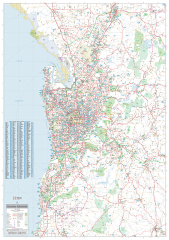
The Adelaide & Region Hema Megamap delivers South Australia’s capital at true wall scale, presenting the city and its surrounding regions in one clear, authoritative view. Printed at an impressive 1400 × 2000 mm, this Megamap makes Adelaide’s metropolitan structure, transport corridors, and regional connections easy to read from across the room.
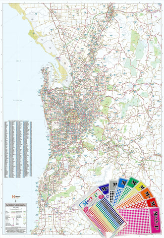
Covering Greater Adelaide and surrounding areas, the map clearly shows major and secondary roads, state and national highways, suburbs, and key regional centres. It’s ideal for offices, planning rooms, classrooms, operations spaces, and homes, where a big-picture understanding of Adelaide’s layout, growth corridors, and connections to regional South Australia is essential.
Built on trusted Hema cartography, this Megamap balances clarity and detail, turning Adelaide’s urban footprint into a practical, wall-ready reference.
🗝️ Key Features
-
Comprehensive Adelaide & regional coverage — Metropolitan Adelaide and surrounding districts
-
Clear road hierarchy — Major & secondary roads shown with strong visual clarity
-
State & national highways — Easily trace regional and interstate routes
-
Urban structure at scale — Suburbs, corridors, and connections visible at a glance
-
Megamap scale impact — Large-format design readable across shared spaces
-
Trusted Hema cartography — Renowned for accuracy, consistency, and clean design
🎨 Materials & Finish
-
Premium paper stock — Printed on 120 gsm matte-coated FSC-certified paper, ideal for large-format wall display
-
Low-glare surface — Matte finish reduces reflections in bright offices and classrooms
-
Archival print quality — Produced using Hewlett-Packard archival, fade-resistant pigment inks for crisp detail and long-term colour stability
-
Frame-ready — Perfect for framing under glass
📐 Size & Orientation
-
1400 mm × 2000 mm (Megamap)
-
Orientation: Portrait
📊 Specifications
| Attribute | Details |
|---|---|
| Title | Adelaide & Region — Hema Megamap |
| Coverage | Greater Adelaide & surrounding regions |
| Features | Major & secondary roads, state & national highways, suburbs and regional centres |
| Print Size | 1400 mm × 2000 mm |
| Paper | 120 gsm matte-coated FSC-certified |
| Inks | Hewlett-Packard archival, fade-resistant pigment inks |
| Format | Paper |
| Origin | Printed in Australia |
🎯 Who it’s for
-
🏢 Businesses & offices — Metropolitan planning and regional overview
-
🚛 Transport & service operators — Understanding routes and service areas
-
🎓 Education & community spaces — Teaching Adelaide geography and urban growth
-
🏠 Homes & studios — A bold, informative Adelaide reference
-
🧭 Planning & operations rooms — Big-picture coordination and discussion
🤝 Our Commitment
Every Hema Megamap is printed locally in Australia using FSC-certified paper and Hewlett-Packard archival pigment inks. Each map is carefully checked and packed to ensure it arrives ready to deliver clarity, accuracy, and long-term usability.
🛒 Order your Adelaide & Region Hema Megamap today — a wall-filling, authoritative view of Greater Adelaide designed for planning, learning, and seeing the city as a whole.