- Australia ▾
- Topographic
▾
- Australia AUSTopo 250k (2024)
- Australia 50k Geoscience maps
- Australia 100k Geoscience maps
- Australia 250k Geoscience maps
- Australia 1.1m Geoscience maps
- New Zealand 50k maps
- New Zealand 250k maps
- New South Wales 25k maps
- New South Wales 50k maps
- New South Wales 100k maps
- Queensland 10k maps
- Queensland 25k maps
- Queensland 50k maps
- Queensland 100k maps
- Compasses
- Software
- GPS Systems
- Orienteering
- International ▾
- Wall Maps
▾
- World
- Australia & New Zealand
- Countries, Continents & Regions
- Historical
- Vintage National Geographic
- Australian Capital Territory
- New South Wales
- Northern Territory
- Queensland
- South Australia
- Tasmania
- Victoria
- Western Australia
- Celestial
- Children's
- Mining & Resources
- Wine Maps
- Healthcare
- Postcode Maps
- Electoral Maps
- Nautical ▾
- Flags
▾
- Australian Flag Sets & Banners
- Flag Bunting
- Handwavers
- Australian National Flags
- Aboriginal Flags
- Torres Strait Islander Flags
- International Flags
- Flagpoles & Accessories
- Australian Capital Territory Flags
- New South Wales Flags
- Northern Territory Flags
- Queensland Flags
- South Australia Flags
- Tasmania Flags
- Victoria Flags
- Western Australia Flags
- Gifts ▾
- Globes ▾
Dear valued customer. Please note that our checkout is not supported by old browsers. Please use a recent browser to access all checkout capabilities


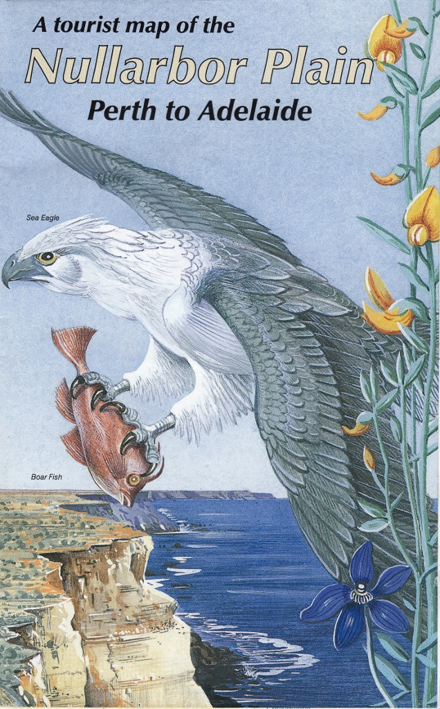
Nullarbor Plain (Perth to Adelaide) Cartographics Map
$11.95
Afterpay is only available for orders between $50.00 and $1000.00 More info
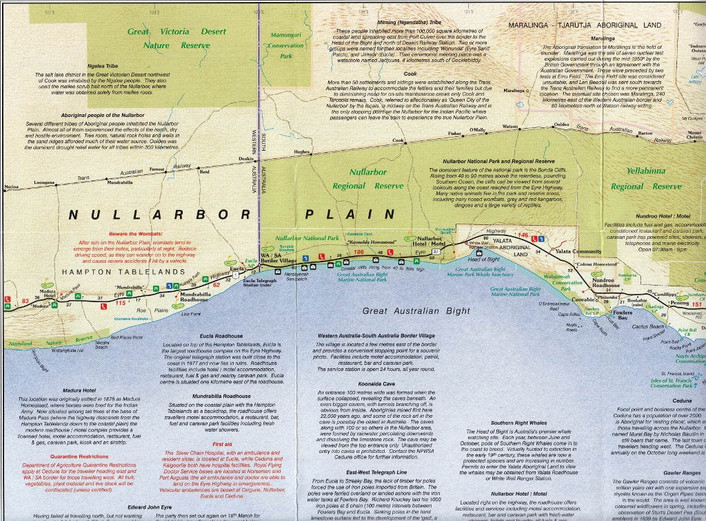
Carto Graphics | Scale 1:2,250,000 | Size: Approx. 1000 × 700mm
Explore Australia’s Most Iconic Road Trip in Detail
Now Featuring: The World’s Longest Golf Course!
Traverse the vast and dramatic expanse of southern Australia with the Nullarbor Plain Touring Map by Carto Graphics—your essential travel companion for the epic journey between Perth and Adelaide. This map is more than a navigational aid; it’s your personal guide to fuel stops, quirky roadside attractions, historical sites, and outback survival.
Whether you’re driving solo across the desert, towing a caravan into the sunrise, or teeing off at the world’s longest golf course, this map ensures you won’t miss a thing on the Nullarbor Highway.
🗺️ Map Highlights & Key Features
| ✅ Feature | 📍 Description |
|---|---|
| 🛣️ Full Route Overview | Detailed road mapping from Perth, WA to Adelaide, SA, including Eyre Highway and connecting outback routes |
| 🛑 Roadside Services Marked | Fuel stations, roadhouses, toilets, overnight stops, motels, caravan parks, and designated rest areas clearly identified |
| 🏛️ Cultural & Historic Points | Includes sites such as Eucla Telegraph Station, Head of Bight Lookout, Nullarbor Roadhouse, Murrawijinie Caves, and whale-watching spots |
| 🏌️ Nullarbor Links Golf Course | All 18 holes of the world’s longest golf course, spanning 1,365 km from Kalgoorlie to Ceduna, are pinpointed on the map—with roadhouse tees and local landmarks |
| 🐋 Natural Attractions | Bunda Cliffs, Great Australian Bight, Nullarbor Caves, and whale migration viewing points are clearly marked |
| 📏 Distance Grid & Travel Guidance | Helps calculate travel times and distances between remote locations—vital for long-haul planning |
| 🧭 Topographic Relief | Subtle elevation shading shows terrain and helps visualise Australia’s famously flat desert expanse |
| 🛠️ Tourist Tips | Includes hints on road safety, water, emergency supplies, and outback etiquette |
🧳 Who Is This Map For?
This is a must-have for:
-
🚐 Caravan and campervan adventurers crossing the Nullarbor
-
🧭 Self-drive tourists planning a bucket-list road trip
-
🏌️♂️ Golf enthusiasts playing the full Nullarbor Links course
-
🏫 Teachers and students studying Australia’s geography and remote infrastructure
-
🌾 Rural travellers and logistics drivers operating across SA and WA
-
📸 Photographers and naturalists tracking wildlife and dramatic coastlines
-
🥾 Explorers seeking the unique quiet beauty of Australia’s desert and coastline
📐 Specifications
| Specification | Detail |
|---|---|
| Title | Nullarbor Plain Touring Map – Perth to Adelaide |
| Publisher | Carto Graphics |
| Main Scale | 1:2,250,000 |
| Map Dimensions | Approx. 1000 mm (W) × 700 mm (H) |
| Format | Folded paper map |
| Material | High-quality full-colour paper |
| Coverage | Perth WA to Adelaide SA, including Eyre Peninsula, Nullarbor Plain, and Great Australian Bight |
| Printed in | Australia |
🔒 Laminated Version – Optional Upgrade
Prefer something more rugged for the glovebox or camp kitchen?
Upgrade to our laminated version, ideal for rough conditions:
-
🧴 Encapsulated in 80-micron gloss laminate – waterproof and tear-resistant
-
✍️ Reusable surface – mark stops or draw routes using whiteboard markers
-
💼 Perfect for field use in vehicles, information centres, or remote depots
🔔 Note: We laminate a flattened version of the folded map. Light fold lines may still be visible.
🛒 Add to Cart – Navigate the Outback With Confidence
The Nullarbor Plain Touring Map is the ultimate tool for navigating one of Australia’s great road journeys—1,200 km of raw, wide-open desert beauty between two capital cities. From curious roadside sculptures and ancient seabeds to breathtaking cliffs and golf fairways laid across a continent, the Nullarbor isn’t just a drive—it’s a rite of passage.
📦 Choose between folded paper or laminated versions before checkout.
Looking for related maps? Pair with:
-
Western Australia Handy Map
-
South Australia Touring Map
-
Australia Road Atlas


