- Australia ▾
- Topographic
▾
- Australia AUSTopo 250k (2024)
- Australia 50k Geoscience maps
- Australia 100k Geoscience maps
- Australia 250k Geoscience maps
- Australia 1.1m Geoscience maps
- New Zealand 50k maps
- New Zealand 250k maps
- New South Wales 25k maps
- New South Wales 50k maps
- New South Wales 100k maps
- Queensland 10k maps
- Queensland 25k maps
- Queensland 50k maps
- Queensland 100k maps
- Compasses
- Software
- GPS Systems
- Orienteering
- International ▾
- Wall Maps
▾
- World
- Australia & New Zealand
- Countries, Continents & Regions
- Historical
- Vintage National Geographic
- Australian Capital Territory
- New South Wales
- Northern Territory
- Queensland
- South Australia
- Tasmania
- Victoria
- Western Australia
- Celestial
- Children's
- Mining & Resources
- Wine Maps
- Healthcare
- Postcode Maps
- Electoral Maps
- Nautical ▾
- Flags
▾
- Australian Flag Sets & Banners
- Flag Bunting
- Handwavers
- Australian National Flags
- Aboriginal Flags
- Torres Strait Islander Flags
- International Flags
- Flagpoles & Accessories
- Australian Capital Territory Flags
- New South Wales Flags
- Northern Territory Flags
- Queensland Flags
- South Australia Flags
- Tasmania Flags
- Victoria Flags
- Western Australia Flags
- Gifts ▾
- Globes ▾
Dear valued customer. Please note that our checkout is not supported by old browsers. Please use a recent browser to access all checkout capabilities


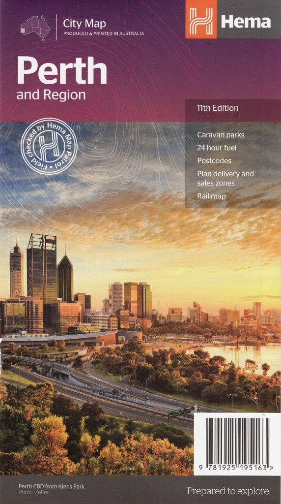
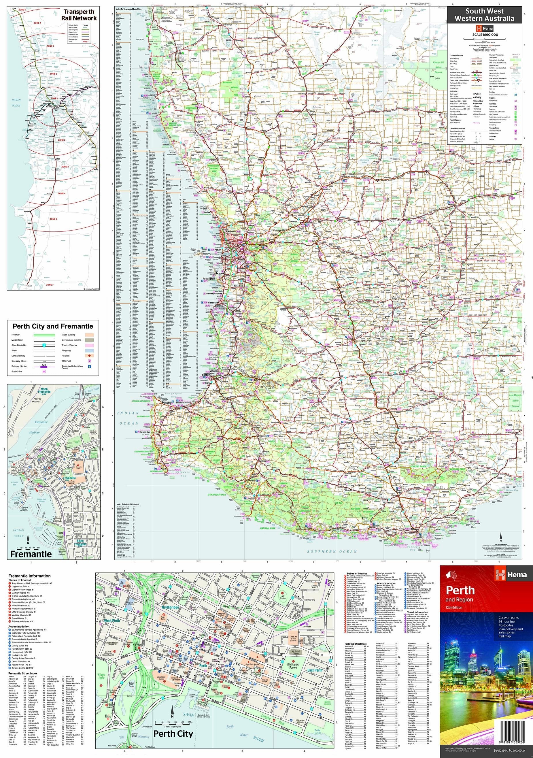
Perth & Region Map Hema 11th Edition
$11.95
Afterpay is only available for orders between $50.00 and $1000.00 More info
An essential, up-to-date street and touring map of Perth and its surrounding regions—perfect for local navigation, road trips, and weekend getaways.
The Perth & Region Map by Hema Maps, now in its 11th Edition, is one of the most trusted and widely used maps for navigating Western Australia’s capital city and its greater surrounds. Whether you're a Perth resident, an interstate visitor, or an adventurous road tripper exploring the west coast, this map combines urban detail with regional scope in a practical, easy-to-use format.
With clear cartography, updated road information, and valuable tourist features, it’s the ideal companion for everything from daily navigation to multi-day excursions through Western Australia's unique landscapes.
🌆 Detailed City & Suburban Mapping
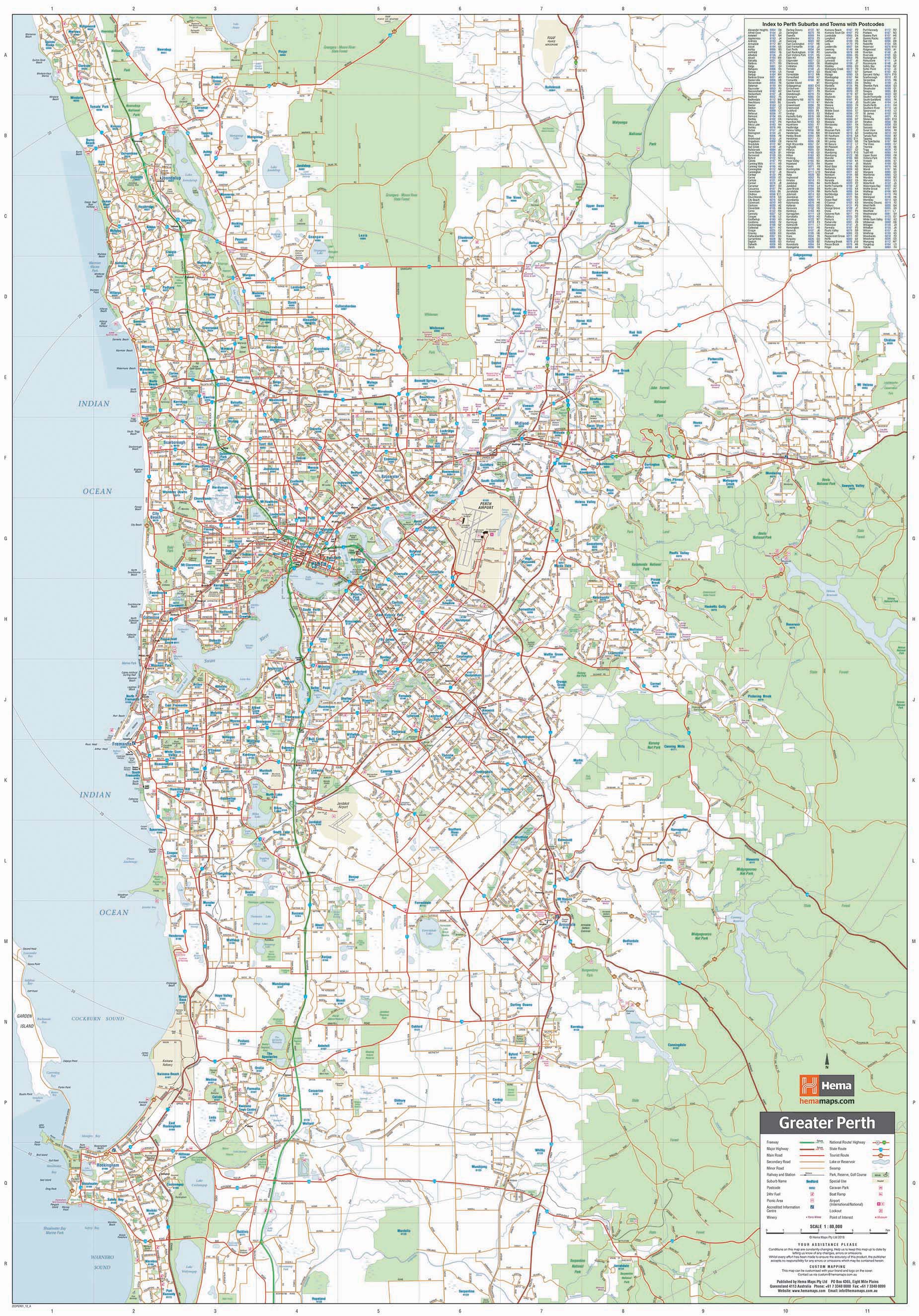
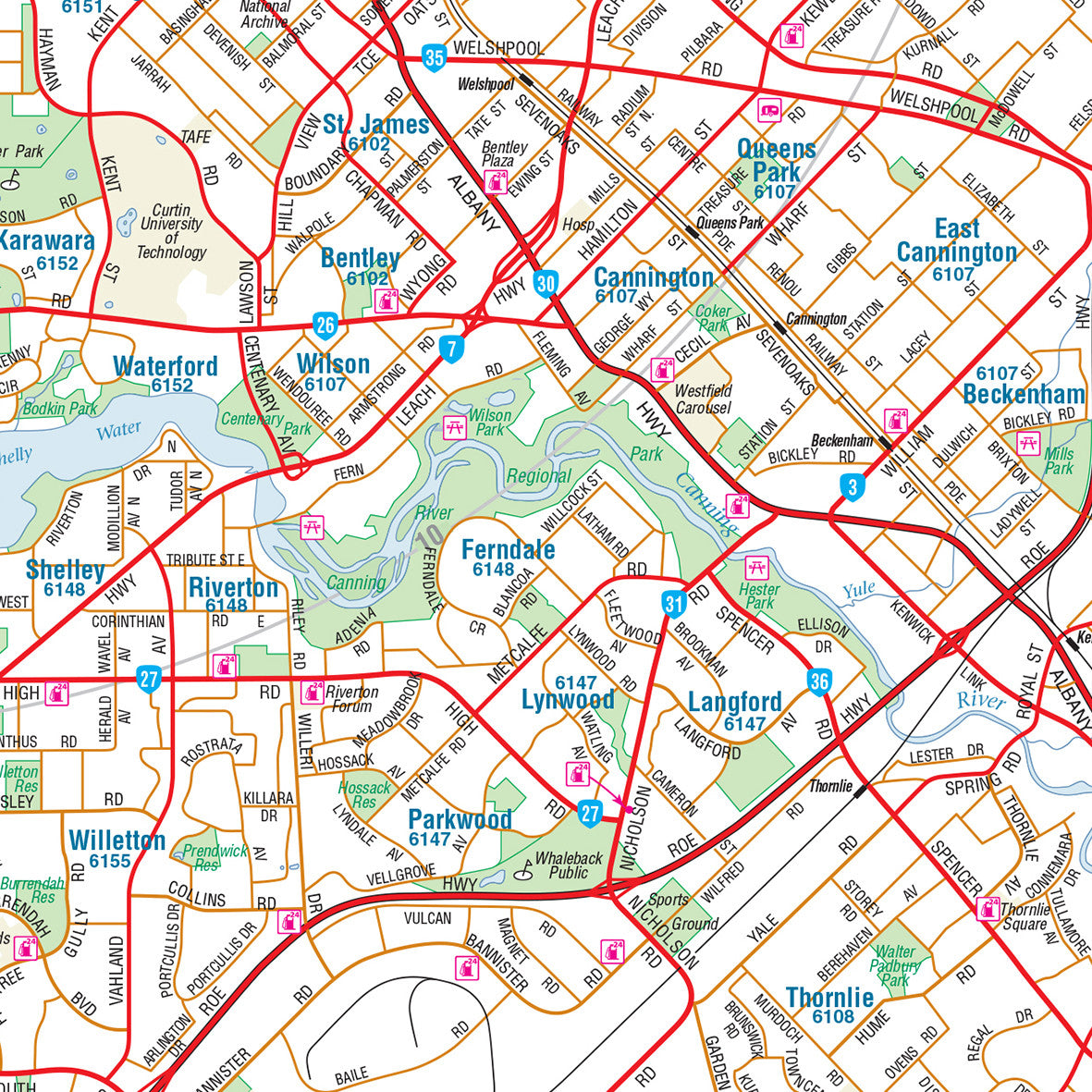
The front side of the map offers a highly detailed view of Perth’s metropolitan area, covering the CBD and surrounding suburbs with precision. Streets are clearly labelled, arterial routes are easily identifiable, and key landmarks are highlighted for quick reference.
Included in this section:
-
Central Perth and Northbridge
-
Fremantle and portside suburbs
-
Inner suburbs such as Subiaco, Mount Lawley, Victoria Park, and South Perth
-
Key city infrastructure: hospitals, universities, ferry terminals, and train stations
-
Parks, reserves, recreational spaces, and coastal walks
Designed with everyday users in mind, the map supports local navigation, commuter planning, and urban exploration, offering unparalleled readability and up-to-date accuracy.
🌄 Broader Regional Coverage
Flip the map over and you’ll find a regional overview of greater Perth and surrounding areas, ideal for weekend getaways, scenic drives, or regional planning.
Coverage extends north, south, and east to include:
-
Yanchep and Two Rocks
-
Guilderton and Lancelin
-
Toodyay and the Avon Valley
-
The Swan Valley wine region
-
Mundaring and the Perth Hills
-
Rockingham, Mandurah, and coastal south
-
Pinjarra and inland highways
This side of the map offers a broader-scale view with:
-
Major roads and highways marked with clear route numbers
-
Distances between towns for trip planning
-
National parks, forest reserves, and nature attractions
-
Coastal highlights, beach access points, and tourist icons
This combination of detail and scope makes the map perfect for travellers, tourism operators, and anyone exploring the outer reaches of the Perth region.
📌 Features at a Glance
-
Double-sided layout with metro detail on one side and regional overview on the reverse
-
Fully updated road networks, suburbs, and landmarks as of the 11th Edition
-
Clear and modern cartography with colour-coded roads and easy-to-read labels
-
Suburb and street index for quick and efficient lookup
-
Tourist symbols marking attractions, lookouts, beaches, and heritage sites
-
Distance grid and travel routes to assist with planning trips and estimating time
-
Ideal for folding and storing in vehicles, travel kits, or map drawers
✏️ Practical Uses
The Perth & Region Map is highly versatile, making it a valuable tool across a wide range of applications:
-
Local residents seeking a reliable street map for navigating the metro area
-
Visitors to Perth looking to orient themselves in the city and explore key attractions
-
Grey nomads and road trippers planning routes across Western Australia
-
School and university geography departments using it as a learning resource
-
Business owners and tradespeople operating in or around the Perth region
-
Tour operators and hospitality venues offering local area guidance to guests
It’s equally at home in a glovebox, map pocket, travel centre, or office wall.
📐 Specifications
| Feature | Description |
|---|---|
| Publisher | Hema Maps |
| Edition | 11th Edition |
| Type | Fold-out, double-sided paper map |
| Front Scale | Detailed Perth metropolitan area – approx. 1:30,000 |
| Reverse Scale | Greater Perth regional map – approx. 1:250,000 |
| Size | Approx. 700 mm × 1000 mm (unfolded) |
| Format | Paper map (laminated version may be available separately) |
| Content | Street index, suburb index, road distances, POIs |
✅ Why Choose the Hema Perth & Region Map?
-
Reliable and accurate—trusted by locals, travellers, and professionals
-
Covers both city and country in one convenient package
-
Produced by Hema Maps, Australia’s leader in travel cartography
-
Perfect for planning, navigation, or display
-
Updated 11th Edition reflects the most current data available
🧳 A Map Designed for Real Travel
Western Australia is vast, and navigating it effectively requires tools that are designed for distance, clarity, and reliability. The Hema Perth & Region Map – 11th Edition meets that challenge with precision, combining urban insight with regional reach.
Whether you're navigating Perth’s inner-city laneways or planning a coastal drive toward Mandurah or Lancelin, this map will guide you with confidence, clarity, and convenience.


