- Australia ▾
- Topographic
▾
- Australia AUSTopo 250k (2024)
- Australia 50k Geoscience maps
- Australia 100k Geoscience maps
- Australia 250k Geoscience maps
- Australia 1.1m Geoscience maps
- New Zealand 50k maps
- New Zealand 250k maps
- New South Wales 25k maps
- New South Wales 50k maps
- New South Wales 100k maps
- Queensland 10k maps
- Queensland 25k maps
- Queensland 50k maps
- Queensland 100k maps
- Compasses
- Software
- GPS Systems
- Orienteering
- International ▾
- Wall Maps
▾
- World
- Australia & New Zealand
- Countries, Continents & Regions
- Historical
- Vintage National Geographic
- Australian Capital Territory
- New South Wales
- Northern Territory
- Queensland
- South Australia
- Tasmania
- Victoria
- Western Australia
- Celestial
- Children's
- Mining & Resources
- Wine Maps
- Healthcare
- Postcode Maps
- Electoral Maps
- Nautical ▾
- Flags
▾
- Australian Flag Sets & Banners
- Flag Bunting
- Handwavers
- Australian National Flags
- Aboriginal Flags
- Torres Strait Islander Flags
- International Flags
- Flagpoles & Accessories
- Australian Capital Territory Flags
- New South Wales Flags
- Northern Territory Flags
- Queensland Flags
- South Australia Flags
- Tasmania Flags
- Victoria Flags
- Western Australia Flags
- Gifts ▾
- Globes ▾
Dear valued customer. Please note that our checkout is not supported by old browsers. Please use a recent browser to access all checkout capabilities
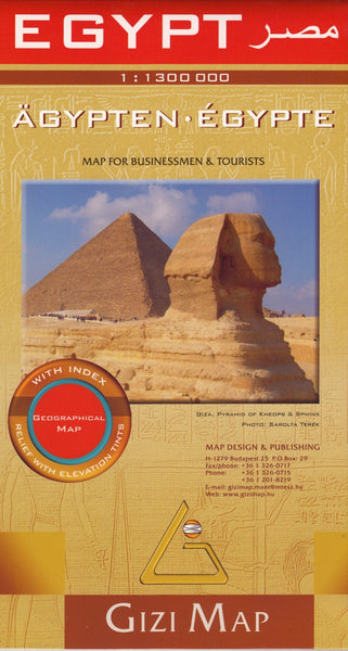
Egypt Map Gizi Maps Folded
$24.95
Afterpay is only available for orders between $50.00 and $1000.00 More info
🇪🇬 Egypt Folded Travel Map – Gizi Maps
Single-Sided | Terrain Shading | Place Name Index
Scale: 1:1,300,000
Flat Size: 1000 mm x 930 mm (39.4" x 36.6")
Format: Folded Map
Edition: Latest Available
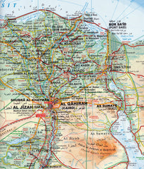
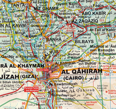
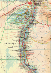
Discover the geographic diversity and ancient heritage of Egypt with this beautifully designed folded map by Gizi Maps. At a practical scale of 1:1,300,000, this single-sided map is perfect for trip planning, navigation, or educational use—offering a fine balance of clarity, topographic insight, and travel-focused detail.
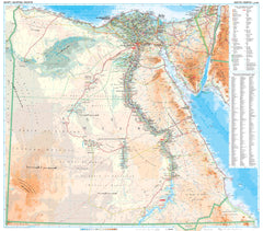
Ideal for both first-time visitors and experienced travellers, this map provides a clear view of Egypt’s roads, cities, and landmarks, enhanced by terrain shading that brings deserts, mountains, valleys, and river systems vividly to life.
🗺️ Key Features
-
🧭 Single-sided map of Egypt, from Alexandria to Abu Simbel
-
🛣️ Clear road network with route classifications and major connections
-
🏞️ Terrain shading & colour relief to illustrate elevation and landforms
-
🌿 Vegetation zones indicated with subtle colouring
-
📍 Comprehensive place name index for fast, easy reference
-
🏛️ Major archaeological sites and points of interest marked
-
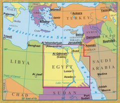
🌍 Includes borders with Libya, Sudan, Israel, and the Gaza Strip for regional context
🧾 Map Specifications
| Feature | Details |
|---|---|
| Publisher | Gizi Maps |
| Map Type | Folded, single-sided |
| Material | Paper (durable and high-resolution print) |
| Scale | 1:1,300,000 |
| Size (Flat) | 1000 mm x 930 mm (39.4" x 36.6") |
| Language | Multilingual (English included) |
| Index | Full index of towns, cities, and regions |
🧳 Who Is This Map For?
Perfect for:
-
✈️ Travellers and tourists planning an Egyptian road or river journey
-
🏛️ Archaeology and history enthusiasts visiting iconic sites like Luxor, Karnak, Giza, and Abu Simbel
-
🧭 Overland and adventure travellers navigating through Egypt by vehicle
-
🗺️ Teachers and students needing a reliable wall or desk map for reference
-
🧑💼 Travel agents and tour guides looking for a practical planning tool
🐪 Why Choose Gizi Maps?
Gizi Maps are known for their cartographic clarity, attractive design, and practical usability. This edition brings Egypt’s landscape and infrastructure into focus with artistic terrain shading and crisp labelling—making it suitable for both real-world travel and armchair exploration.
Whether you’re heading for the Red Sea coast, exploring the Nile Valley, or charting a route through Cairo’s bustling streets, this Gizi map offers the visual accuracy and clarity you need.


