- Australia ▾
- Topographic
▾
- Australia AUSTopo 250k (2024)
- Australia 50k Geoscience maps
- Australia 100k Geoscience maps
- Australia 250k Geoscience maps
- Australia 1.1m Geoscience maps
- New Zealand 50k maps
- New Zealand 250k maps
- New South Wales 25k maps
- New South Wales 50k maps
- New South Wales 100k maps
- Queensland 10k maps
- Queensland 25k maps
- Queensland 50k maps
- Queensland 100k maps
- Compasses
- Software
- GPS Systems
- Orienteering
- International ▾
- Wall Maps
▾
- World
- Australia & New Zealand
- Countries, Continents & Regions
- Historical
- Vintage National Geographic
- Australian Capital Territory
- New South Wales
- Northern Territory
- Queensland
- South Australia
- Tasmania
- Victoria
- Western Australia
- Celestial
- Children's
- Mining & Resources
- Wine Maps
- Healthcare
- Postcode Maps
- Electoral Maps
- Nautical ▾
- Flags
▾
- Australian Flag Sets & Banners
- Flag Bunting
- Handwavers
- Australian National Flags
- Aboriginal Flags
- Torres Strait Islander Flags
- International Flags
- Flagpoles & Accessories
- Australian Capital Territory Flags
- New South Wales Flags
- Northern Territory Flags
- Queensland Flags
- South Australia Flags
- Tasmania Flags
- Victoria Flags
- Western Australia Flags
- Gifts ▾
- Globes ▾
Dear valued customer. Please note that our checkout is not supported by old browsers. Please use a recent browser to access all checkout capabilities
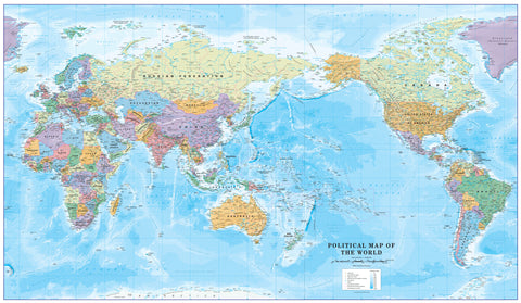
World Political National Geographic 1852 x 1219mm (Pacific Centred) Super Laminated Wall Map with Hang Rails
$499.95
or make 4 interest-free payments of
$124.99 AUD
fortnightly with
![]() More info
More info
By National Geographic | Super Format: 1852 mm (W) × 1219 mm (H) | Laminated with Timber Hang Rails | Made in Australia
A World View from the Pacific – Detailed, Durable, and Ready to Hang
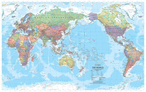
Discover the world from a refreshing new perspective with this striking Pacific-Centred Political Wall Map by National Geographic. Crafted with scientific precision and presented with National Geographic’s iconic aesthetic, this super-sized laminated map features up-to-date political boundaries, geographic detail, and oceanic depth contours—all wrapped in a timeless design that complements any room.
Whether you're mapping global travel plans, enhancing a workspace, or enriching a learning environment, this map is both an elegant decorative piece and an essential geographic reference.
Why Choose a Pacific-Centred Map?
This orientation re-centres the map around the Pacific Ocean, placing Australia, New Zealand, Southeast Asia, and the Pacific Rim at the forefront. It provides a geographically balanced alternative to the traditional Africa- or Euro-centred perspectives and is especially relevant for users in Oceania, Asia-Pacific, and the Americas.
A Pacific-centred map is ideal for:
-
🧳️ Trans-Pacific travel planning
-
🌏 Teaching or learning geography from a regional perspective
-
🌐 Visualising global trade and migration across the Pacific Rim
Map Highlights
| Feature | Description |
|---|---|
| Projection | Winkel Tripel – reduces distortion of land masses, especially near the poles |
| Orientation | Pacific-centred – puts Oceania and the Pacific at the heart of the world map |
| Political Boundaries | Countries outlined with bold die lines and labelled with capitals and major cities |
| Topography | Mountain ranges and elevation shown using shaded relief |
| Oceanography | Ocean currents, sea depth contours, and bathymetric details add depth and realism |
| Inset Maps | Includes thematic mini-maps showing population density, vegetation zones, and land use patterns |
| Design Style | Classic National Geographic blue tones with clean, modern typography |
🎨 Premium Build & Finish
This map is printed on heavyweight 120 gsm matte-coated FSC-certified paper, encapsulated in two layers of 80-micron gloss laminate for long-lasting protection. The laminated finish is writable and wipeable, allowing you to:
-
Use whiteboard markers to mark routes or annotate data
-
Apply and remove map dots for interactive use
-
Protect against spills, fingerprints, and UV light
Hang-Ready with Timber Rails
For easy installation and classic presentation, this version comes pre-fitted with natural timber hang rails:
-
Top and bottom wooden battens, lacquered in a clear finish
-
A discreet hanging cord attached to the top rail
-
Requires only a single hook or nail to hang securely
Note: Hang-railed maps are custom-mounted and take up to 10 business days for professional assembly and dispatch.
📊 Specifications
| Attribute | Value |
| Title | World Political Wall Map – Pacific-Centred |
| Publisher | National Geographic Society |
| Published | 2021 Edition |
| Projection | Winkel Tripel |
| Scale | 1:22,445,000 |
| Size | 1852 mm (W) × 1219 mm (H) |
| Material | Laminated 120 gsm matte paper |
| Hanging Method | Timber rails with hanging cord |
| Printed In | Australia |
🌟 Who Is This Map For?
| User | Why It’s Ideal |
| Teachers & Students | Excellent for geography, environmental science, and global studies |
| Travellers | Use map dots and markers to plan or track journeys |
| Professionals | Adds visual impact to boardrooms, offices, and reception spaces |
| Families | A practical conversation piece for living rooms and home studies |
| Gift Buyers | A meaningful and unique gift for map lovers and knowledge seekers |
🚞️ Shipping & Delivery
-
📦 Rolled and protected in reinforced mailing tubes
-
🔧 Hang-railed versions take up to 10 working days for custom framing
-
🇦🇺 Printed, laminated, and finished in Australia to the highest standards
🌍 Elevate Your Wall with a Global Perspective
The National Geographic World Political Pacific-Centred Wall Map is more than a reference—it’s an invitation to explore, a tool to educate, and a work of cartographic art. Perfect for those who appreciate both form and function, it offers a fresh and modern view of our interconnected world.


