- Australia ▾
- Topographic
▾
- Australia AUSTopo 250k (2024)
- Australia 50k Geoscience maps
- Australia 100k Geoscience maps
- Australia 250k Geoscience maps
- Australia 1.1m Geoscience maps
- New Zealand 50k maps
- New Zealand 250k maps
- New South Wales 25k maps
- New South Wales 50k maps
- New South Wales 100k maps
- Queensland 10k maps
- Queensland 25k maps
- Queensland 50k maps
- Queensland 100k maps
- Compasses
- Software
- GPS Systems
- Orienteering
- International ▾
- Wall Maps
▾
- World
- Australia & New Zealand
- Countries, Continents & Regions
- Historical
- Vintage National Geographic
- Australian Capital Territory
- New South Wales
- Northern Territory
- Queensland
- South Australia
- Tasmania
- Victoria
- Western Australia
- Celestial
- Children's
- Mining & Resources
- Wine Maps
- Healthcare
- Postcode Maps
- Electoral Maps
- Nautical ▾
- Flags
▾
- Australian Flag Sets & Banners
- Flag Bunting
- Handwavers
- Australian National Flags
- Aboriginal Flags
- Torres Strait Islander Flags
- International Flags
- Flagpoles & Accessories
- Australian Capital Territory Flags
- New South Wales Flags
- Northern Territory Flags
- Queensland Flags
- South Australia Flags
- Tasmania Flags
- Victoria Flags
- Western Australia Flags
- Gifts ▾
- Globes ▾
Dear valued customer. Please note that our checkout is not supported by old browsers. Please use a recent browser to access all checkout capabilities
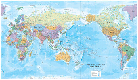
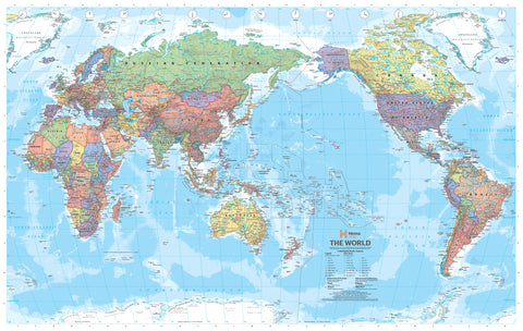
World Executive Antique Style National Geographic 1852 x 1219mm (Pacific Centred) Super Wall Map
$179.95
or make 4 interest-free payments of
$44.99 AUD
fortnightly with
![]() More info
More info
By National Geographic
Antique Style | Pacific Perspective | Grand Format: 1852 x 1219 mm
🗺️ A World Reimagined in Antique Elegance
Shift your global perspective with this majestic World Executive Political Map by National Geographic, re-centred to highlight the Pacific Ocean and the Asia-Pacific region. With timeless antique styling and meticulously updated geopolitical detail, this stunning map serves as both an elegant décor feature and an invaluable educational resource.
Whether you're in a classroom, boardroom, library, or living room, this map invites conversation, discovery, and inspiration.
🌐 Why Pacific-Centred?
Traditional world maps often focus on Europe or Africa—but this map offers a fresh lens. Centred on the Pacific Ocean, it places Australia, New Zealand, Southeast Asia, and the Americas in more intuitive proximity, providing:
-
A regionally relevant view for Southern Hemisphere users
-
Better visualization of oceanic geography and trade routes
-
A unique layout that subtly redefines how we see global relationships
🎨 Timeless Style Meets Modern Cartography
-
Elegant Antique Palette – Warm tones of parchment cream, earth browns, sage greens, and muted blues evoke the golden age of exploration while blending beautifully with modern or traditional interiors.
-
Current Political Detail – Country borders, capitals, major cities, rivers, mountain ranges, island groups, and more—up to date and carefully rendered.
-
Winkel Tripel Projection – National Geographic’s preferred projection minimizes distortion and presents the world in balanced proportion.
-
Inset Thematic Maps:
-
Global Population Density
-
Vegetation Patterns
-
Land Use Classification
-
Ocean Floor Relief with subtle shaded bathymetry
-
📄 Format & Finish Options
Choose the finish that best suits your purpose and space:
📜 Paper – 160 gsm Premium Matte Stock
-
Ideal for framing under glass
-
Crisp colour definition and smooth finish
-
FSC-certified and eco-friendly
💧 Laminated – Gloss Encapsulated (2 x 80 Micron)
-
True encapsulation for maximum durability
-
Wipeable surface—great for classrooms and collaborative settings
-
Compatible with whiteboard markers and removable map dots
-
✅ Optional Timber Hang Rails Available
🖼️ Canvas – 395 gsm HP Professional Matte
-
Archival-quality pigment-based inks for vibrant, fade-resistant colour
-
Rich canvas texture—ideal for executive, library, or gallery display
-
✅ Optional Timber Hang Rails Available
🪵 Optional Timber Hang Rails
Add an elegant finishing touch with natural timber battens, available for both canvas and laminated versions:
-
Lacquered wooden rails attached top and bottom
-
Discreet hanging cord on the top rail
-
Easy to install—hang from a single hook or nail
-
No framing required
🕒 Please allow up to 10 business days for hand-assembly of hang-railed maps.
📐 Specifications
| Feature | Detail |
|---|---|
| Map Size | 1852 mm (width) x 1219 mm (height) |
| Scale | 1:22,445,000 |
| Projection | Winkel Tripel |
| Orientation | Pacific-Centred |
| Published | 2016 |
| Printed In | Australia |
| Language | English |
🎯 Perfect For
| Audience | Description |
|---|---|
| 🎓 Educators | A dynamic tool for schools, universities, and homeschool settings |
| 🗺️ Travellers | Ideal for planning routes, marking destinations, and travel inspiration |
| 🏛️ Professionals | Adds intellectual elegance to boardrooms and offices |
| 🏡 Home Decorators | A centrepiece map for hallways, lounges, and studies |
| 📚 Collectors | A refined addition to any cartography or history collection |
📦 Shipping & Delivery
-
Paper and laminated versions are rolled and packed in protective mailing tubes
-
Canvas and laminated hang-railed versions may be shipped flat or in reinforced tubes
-
Printed and shipped in Australia
📅 Please allow up to 10 business days for hang-railed formats due to custom framing.
🌍 Let the World Inspire Your Walls
From classrooms to boardrooms, this Pacific-Centred World Executive Map by National Geographic is more than a map—it's a perspective shift. With its rich antique styling and unmatched attention to detail, it brings both global understanding and timeless sophistication to any space.
Order yours today—and let your walls tell the story of the world.


