- Australia ▾
- Topographic
▾
- Australia AUSTopo 250k (2025)
- Australia 50k Geoscience maps
- Australia 100k Geoscience maps
- Australia 250k Geoscience maps
- Australia 1:1m Geoscience maps
- New Zealand 50k maps
- New Zealand 250k maps
- New South Wales 25k maps
- New South Wales 50k maps
- New South Wales 100k maps
- Queensland 10k maps
- Queensland 25k maps
- Queensland 50k maps
- Queensland 100k maps
- Compasses
- Software
- GPS Systems
- Orienteering
- International ▾
- Wall Maps
▾
- World
- Australia & New Zealand
- Countries, Continents & Regions
- Historical
- Vintage National Geographic
- Australian Capital Territory
- New South Wales
- Northern Territory
- Queensland
- South Australia
- Tasmania
- Victoria
- Western Australia
- Celestial
- Children's
- Mining & Resources
- Wine Maps
- Healthcare
- Postcode Maps
- Electoral Maps
- Nautical ▾
- Flags
▾
- Australian Flag Sets & Banners
- Flag Bunting
- Handwavers
- Australian National Flags
- Aboriginal Flags
- Torres Strait Islander Flags
- International Flags
- Flagpoles & Accessories
- Australian Capital Territory Flags
- New South Wales Flags
- Northern Territory Flags
- Queensland Flags
- South Australia Flags
- Tasmania Flags
- Victoria Flags
- Western Australia Flags
- Gifts ▾
- Globes ▾
Dear valued customer. Please note that our checkout is not supported by old browsers. Please use a recent browser to access all checkout capabilities


South Australia - Maps, Guides, Road Atlases, Digital Mapping & Street Directories
South Australia wall maps, road atlases, folded maps, and street directories provide a detailed and dependable way to navigate this diverse and expansive state. From the orderly grid of Adelaide to the vast outback, wine regions, coastal routes, and remote towns, these resources offer comprehensive coverage for planning, travel, and logistics.
Our collection features wall maps ideal for office, classroom, or home display; rugged road atlases perfect for touring and 4WD travel; folded maps for easy on-the-go reference; and detailed street directories for navigating Adelaide and surrounding areas. Whether you're exploring the Flinders Ranges, driving through the Eyre Peninsula, or coordinating services across the state, South Australia maps deliver clarity, accuracy, and practical insight at every turn.


About South Australia Maps
South Australia covers nearly one million square kilometres — from Adelaide's Mediterranean coast to the red-dirt outback, from the Coorong's wetlands to the Flinders' alpine ridges. It's also home to some of Australia's most iconic 4WD destinations (the Birdsville Track, the Oodnadatta, the Strzelecki) and the country's most concentrated wine regions (Barossa, Clare Valley, McLaren Vale, Coonawarra). That diversity demands a deep map range.
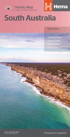
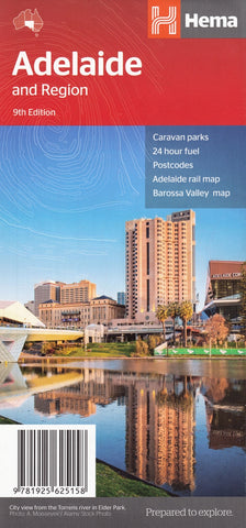
Mapworld stocks South Australia maps from every major Australian publisher — Hema, UBD-Gregory's, Cartographics (the SA-based regional specialist), Westprint and the Department of Environment and Water topographic series. Cartographics in particular produces the definitive SA regional maps for the Yorke and Eyre Peninsulas, the Limestone Coast, and the Adelaide Hills.
South Australia Map Types Explained
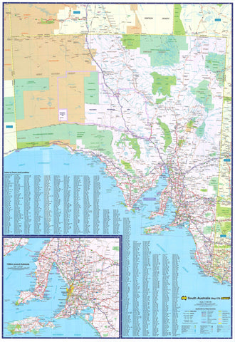
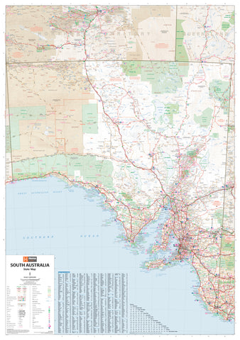
Touring & Wall Maps
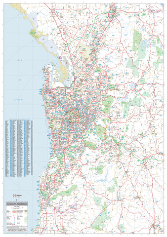
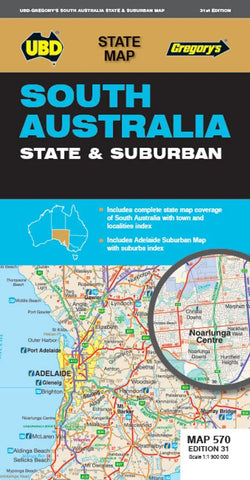
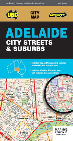
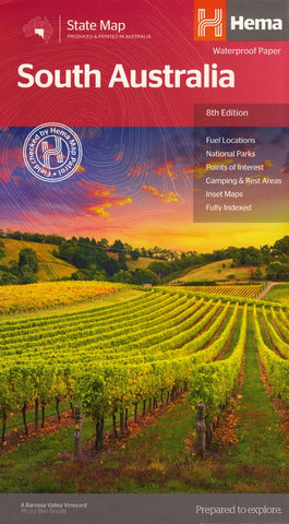
The Hema South Australia State Map is the standard touring reference — folded for glove-box use or laminated as a wall map for office and classroom display. For Adelaide and metro areas, the UBD 562 Adelaide map is the standard street-level reference, also available in folded and laminated wall map formats.
4WD & Outback Maps
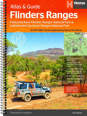
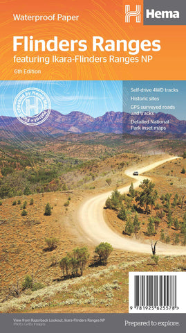
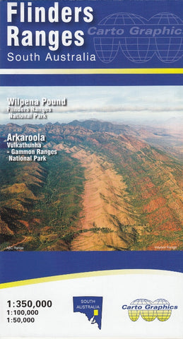
South Australia is home to three of Australia's most iconic 4WD tracks. Westprint specialises in this category with dedicated maps for the Oodnadatta Track, the Birdsville Track, and the Strzelecki Track. The Hema Great Desert Tracks Eastern Sheet covers the broader outback SA region. For the Flinders Ranges, the dedicated Hema Flinders Ranges map and atlas are essential — available in standard and Supermap (1430 × 1000mm) wall map formats.
Regional Maps — Cartographics & Beyond
For specific SA regions, Cartographics produces the definitive specialist range:
- Yorke Peninsula & Copper Coast — including the wine and seaside towns of the Copper Triangle
- Eyre Peninsula — covering Whyalla, Port Lincoln and the western coastline
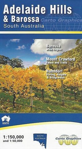
- Adelaide Hills — for Hahndorf, the Barossa fringe and McLaren Vale
- Limestone Coast — Coonawarra wine country, the Coorong, Mount Gambier
Topographic Maps
SA topographic sheets are published by the Department of Environment and Water at 1:50k and 1:100k scales — ideal for bushwalking, orienteering, emergency services and fieldwork. The Geoscience Australia 1:250k AUSTopo series provides broader topographic coverage of the entire state.
Postcode, Electoral & LGA Maps
Mapworld's South Australia Federal Electoral Divisions and Local Government Areas Map (Adelaide Metro) is one of our most popular SA wall maps — combining both boundary systems in a single reference, ideal for political analysis, government affairs and journalism. State-wide SA postcode and LGA maps are available for real estate, sales, healthcare and council planning.
Marine & Nautical Charts
SA's coastline is covered by official AUS-numbered Australian Hydrographic Service charts plus state Department of Primary Industries and Regions inshore boating charts. Spencer Gulf, Gulf St Vincent, and Kangaroo Island are well-served by dedicated chart sheets.
Choosing the Right South Australia Map by Region
| Region | Recommended map |
|---|---|
| Adelaide metro / suburbs | UBD 562 Adelaide Suburban map (folded or laminated wall) |
| Barossa Valley / Clare wine country | Hema South Australia State Map + Adelaide Hills regional |
| Yorke Peninsula | Cartographics Yorke Peninsula & Copper Coast map |
| Eyre Peninsula / Port Lincoln | Cartographics Eyre Peninsula map |
| Flinders Ranges | Hema Flinders Ranges map + Pastoral Stations 1948 historical (for context) |
| Outback SA — Birdsville, Strzelecki, Oodnadatta | Westprint dedicated track maps + Hema Great Desert Tracks Eastern Sheet |
| Limestone Coast / Coonawarra | Cartographics Limestone Coast map |
| Real estate / sales / electoral planning | SA Postcode wall map + SA Federal Electoral & LGA Adelaide Metro map |
| Bushwalking / national parks | DEW topographic sheets at 1:50k for the relevant region |
Why Buy SA Maps from Mapworld
- Largest specialist SA range — over 80 South Australia products in stock
- Cartographics depth — comprehensive coverage of the SA regional specialist publisher
- Current editions only — we rotate stock with each new release
- Free shipping over $75 Australia-wide, flat $7 below that
- Custom mapping service — postcode overlays, sales territories, healthcare catchments, mining tenement maps
- Knowledgeable support — call 1300 795 697 for trip planning or product recommendations
Frequently Asked Questions
What is the best map for the Birdsville Track?
Westprint's dedicated Birdsville Track map is the field-checked specialist reference. Pair it with the Hema Great Desert Tracks Eastern Sheet for broader regional context, and the Hema Australia Road and 4WD Atlas for connecting routes.
Are these the latest editions of SA maps?
Yes. Mapworld stocks current editions only. Each product page lists the edition number and publication year. When publishers release new editions, we rotate stock to the new version.
Do you ship South Australia maps interstate?
Yes. Mapworld ships Australia-wide from our Perth warehouse. Free shipping on orders over $75, flat $7 below that. Most metro deliveries arrive in 2 to 5 business days. Express options available at checkout.
What is the difference between Cartographics and Hema for South Australia?
Hema produces broad-scale touring and 4WD maps covering the whole state. Cartographics specialises in detailed SA regional maps — Yorke and Eyre Peninsulas, Adelaide Hills, Limestone Coast — at higher resolution than Hema's regional coverage. Many SA travellers and locals own both: Hema for the trip-level view, Cartographics for the destination.
Can I get a custom SA postcode or sales-territory map?
Yes. Mapworld runs a custom mapping service for businesses needing branded or modified SA maps — postcode and electoral overlays, sales-territory colouring, healthcare service catchments, mining tenement maps and fleet planning maps.
How quickly does Mapworld dispatch SA orders?
Orders placed before 2 pm AWST on weekdays dispatch same-day from our Perth warehouse. Australia-wide delivery typically takes 2 to 7 business days via Australia Post.
© 2026 Mapworld. Website designed by Genie Media
X