- Australia ▾
- Topographic
▾
- Australia AUSTopo 250k (2024)
- Australia 50k Geoscience maps
- Australia 100k Geoscience maps
- Australia 250k Geoscience maps
- Australia 1.1m Geoscience maps
- New Zealand 50k maps
- New Zealand 250k maps
- New South Wales 25k maps
- New South Wales 50k maps
- New South Wales 100k maps
- Queensland 10k maps
- Queensland 25k maps
- Queensland 50k maps
- Queensland 100k maps
- Compasses
- Software
- GPS Systems
- Orienteering
- International ▾
- Wall Maps
▾
- World
- Australia & New Zealand
- Countries, Continents & Regions
- Historical
- Vintage National Geographic
- Australian Capital Territory
- New South Wales
- Northern Territory
- Queensland
- South Australia
- Tasmania
- Victoria
- Western Australia
- Celestial
- Children's
- Mining & Resources
- Wine Maps
- Healthcare
- Postcode Maps
- Electoral Maps
- Nautical ▾
- Flags
▾
- Australian Flag Sets & Banners
- Flag Bunting
- Handwavers
- Australian National Flags
- Aboriginal Flags
- Torres Strait Islander Flags
- International Flags
- Flagpoles & Accessories
- Australian Capital Territory Flags
- New South Wales Flags
- Northern Territory Flags
- Queensland Flags
- South Australia Flags
- Tasmania Flags
- Victoria Flags
- Western Australia Flags
- Gifts ▾
- Globes ▾
Dear valued customer. Please note that our checkout is not supported by old browsers. Please use a recent browser to access all checkout capabilities
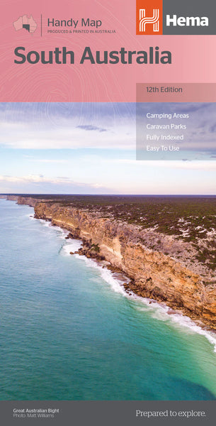
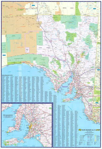
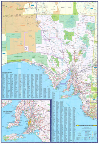
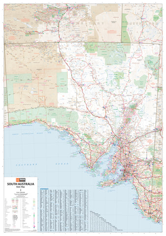
South Australia Hema Handy Map 12th Edition
$11.95
Afterpay is only available for orders between $50.00 and $1000.00 More info
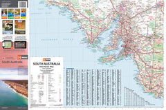
Compact Touring Map | Camping, Fuel Stops, Points of Interest & National Parks
Scale: 1:1,700,000 | Size Open: 500 × 750 mm | Folded: 125 × 250 mm
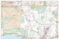
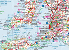
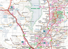
Navigate your way through the outback, coastline, wine regions, and heritage towns of South Australia with this practical, compact, and information-rich map by Hema Maps — Australia’s most trusted name in cartography for explorers and road trippers.
Perfect for glove boxes, backpacks, and planning tables, this 12th edition offers clear mapping with all the essential information for travellers, including camping areas, rest stops, fuel locations, and a full index of towns and localities.
🌟 Key Features
| 🧭 Feature | ✅ Description |
|---|---|
| 🏕️ Camping Areas | Locations of designated campgrounds across the state |
| 🛑 Rest Areas | Roadside rest stops for day use or overnight breaks |
| ⛽ Fuel Stops | Includes 24-hour service stations & remote outback refuels |
| 🚐 Caravan Parks | Easily locate places to park and stay overnight |
| 🏞️ National Parks | Clearly marked boundaries and access points |
| 📍 Points of Interest | Landmarks, tourist attractions & key navigation markers |
| 📊 Distance Grid | Plan travel distances between towns using the grid reference system |
| 📇 Town & Locality Index | Quick reference to every place on the map |
🧳 Travel-Ready Convenience
-
📁 Folds down to 125 x 250 mm – compact enough for daypacks, car doors, or camp kits
-
🧾 Full-colour printing with clear road hierarchies and natural terrain
-
🛣️ Highlights major highways, regional roads, remote tracks and access routes
-
📘 Includes road classifications for easy route planning
-
🌿 Ideal for Grey Nomads, 4WDers, nature lovers, or first-time visitors to SA
📐 Product Specifications
| Specification | Detail |
|---|---|
| Title | South Australia Handy Map |
| Edition | 12th Edition |
| Publisher | Hema Maps |
| Scale | 1:1,700,000 |
| Open Size | 500 mm (W) × 750 mm (H) |
| Folded Size | 125 mm (W) × 250 mm (H) |
| Material | Folded paper or laminated options |
| Weight | Approx. 50 g |
| ISBN | 9781865008707 |
| Made In | Australia |
🛡️ Optional Laminated
Looking for a more durable or display-ready version of the map? Choose our premium laminated option:
🔒 Laminated Version:
-
💧 Encapsulated in 80-micron gloss laminate
-
🖊️ Wipe-clean surface — use with whiteboard markers
-
🧲 Ideal for caravans, schools, offices, or fieldwork
- This map will have started life as a folded map so there will be some slight crease lines once laminated.
🎯 Who’s It For?
-
🚐 Caravanners & touring families planning road trips across South Australia
-
🗺️ 4WD explorers & overlanders mapping out off-grid journeys
-
🏕️ Camping and outdoor lovers seeking the best rest stops and parks
-
📚 Geography teachers & homeschoolers looking for visual, practical resources
-
🏢 Travel centres, local councils, and accommodation providers
💬 Why Customers Love It
⭐ “Perfect size and scale for regional touring without the bulk of an atlas.”
⭐ “Easy to read and packed with useful info for campers and fuel stops.”
🛒 Add to Cart – Your Ultimate South Australian Travel Companion
Whether you’re heading to the Flinders Ranges, the Limestone Coast, or the Eyre Peninsula, the South Australia Handy Map by Hema will guide you there and back again — safely, easily, and enjoyably.
Choose your preferred format:
-
📁 Folded Paper (perfect for on-the-go)
-
🛡️ Laminated (durable & reusable)
Let the journey begin. Order your copy today!


