- Australia ▾
- Topographic
▾
- Australia AUSTopo 250k (2025)
- Australia 50k Geoscience maps
- Australia 100k Geoscience maps
- Australia 250k Geoscience maps
- Australia 1:1m Geoscience maps
- New Zealand 50k maps
- New Zealand 250k maps
- New South Wales 25k maps
- New South Wales 50k maps
- New South Wales 100k maps
- Queensland 10k maps
- Queensland 25k maps
- Queensland 50k maps
- Queensland 100k maps
- Western Australia 25k maps
- Western Australia 50k maps
- Western Australia 100k maps
- Compasses
- Software
- GPS Systems
- International ▾
- Wall Maps
▾
- World
- Australia & New Zealand
- Countries, Continents & Regions
- Historical
- Vintage National Geographic
- Australian Capital Territory
- New South Wales
- Northern Territory
- Queensland
- South Australia
- Tasmania
- Victoria
- Western Australia
- Celestial
- Children's
- Mining & Resources
- Wine Maps
- Healthcare
- Postcode Maps
- Electoral Maps
- Nautical ▾
- Flags
▾
- Australian Flag Sets & Banners
- Flag Bunting
- Handwavers
- Australian National Flags
- Aboriginal Flags
- Torres Strait Islander Flags
- International Flags
- Flagpoles & Accessories
- Australian Capital Territory Flags
- New South Wales Flags
- Northern Territory Flags
- Queensland Flags
- South Australia Flags
- Tasmania Flags
- Victoria Flags
- Western Australia Flags
- Gifts ▾
- Globes ▾
Dear valued customer. Please note that our checkout is not supported by old browsers. Please use a recent browser to access all checkout capabilities


Tuvalu Wall Map
$59.95
or make 4 interest-free payments of
$14.99 AUD
fortnightly with
![]() More info
More info
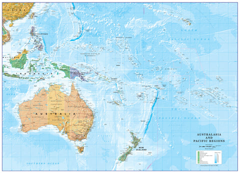
Tuvalu Wall Map — Pacific Atoll Nation
Remote, resilient, and remarkably beautiful, Tuvalu is one of the world’s smallest and least-visited nations — a scattering of narrow coral atolls set deep within the Pacific Ocean. This wall map captures the geography of a country where land and sea exist in delicate balance, offering a rare visual insight into one of Earth’s most isolated sovereign states.
Far removed from mass tourism, Tuvalu represents a way of life shaped by ocean currents, tides, and tradition. This map is both a geographic reference and a quiet tribute to a nation defined by simplicity, community, and connection to the natural world.
🌊 A Nation Shaped by the Ocean
-
Low-lying coral atolls and reef islands clearly shown, illustrating Tuvalu’s fragile geography
-
Funafuti Atoll, the political and cultural heart of the nation, prominently marked
-
Island chains and reef structures mapped across a vast expanse of ocean
-
A powerful visual reminder of sea-level vulnerability and the realities faced by small island nations
This map offers perspective — not just on where Tuvalu is, but on how it exists.
🏝️ Funafuti & Island Life
At the centre lies Funafuti, home to Tuvalu’s capital and main population. The surrounding Funafuti Conservation Area is one of the Pacific’s most pristine marine environments, renowned for its crystal-clear lagoons, healthy coral reefs, and vibrant marine life.
Beyond the reef, village communities maintain a strong connection to Polynesian traditions, local handicrafts, and communal celebrations. The uncluttered design of this map mirrors that rhythm — calm, open, and geographically honest.
🌏 Why Tuvalu Captivates
Tuvalu’s appeal lies not in scale, but in authenticity:
-
No large resorts
-
No crowds
-
No distractions from nature and culture
For travellers, educators, and Pacific scholars alike, Tuvalu represents a vanishing rarity — a nation where modern borders meet ancient ways of living.
🖼️ Premium Print & Display Options
Each map is printed in Australia using archival methods to preserve fine detail and long-term clarity.
📄 Heavyweight Paper (160 gsm)
-
Smooth matte finish with excellent line definition
-
Ideal for framing under glass
-
A classic choice for collectors, libraries, and heritage interiors
🔒 Laminated (True Encapsulation)
-
Sealed between 2 × 80-micron gloss laminate
-
Tear-resistant, wipe-clean, and highly durable
-
Perfect for offices, libraries, and educational settings
🔒 Laminated + Timber Hang Rails (Ready to Hang)
-
Laminated print fitted with natural timber hang rails (top & bottom)
-
Supplied with hanging cord — no framing required
-
Please allow up to 10 working days for professional attachment
🎨 Archival Canvas (395 gsm HP Professional Matte)
-
Printed on HP 395 gsm Professional Matte Canvas
-
Pigment-based, fade-resistant inks
-
Adds warmth and presence while preserving fine cartographic detail
🎨 Canvas + Timber Hang Rails (Gallery-Ready)
-
Canvas print finished with lacquered natural timber rails
-
Elegant, frame-free presentation suited to home or office
-
Please allow up to 10 working days for completion
🏫 Ideal For
-
Pacific studies and geography classrooms
-
Travel-inspired interiors
-
Libraries, offices, and cultural spaces
-
Collectors of island and Oceanic maps
-
Anyone drawn to the quiet edges of the world
📐 Specifications
| Feature | Details |
|---|---|
| Title | Tuvalu Wall Map |
| Region | Tuvalu, Central Pacific |
| Focus | Political geography & coral atolls |
| Capital | Funafuti |
| Print Size | 1000 mm (W) × 700 mm (H) |
| Orientation | Landscape |
| Finishes | Paper · Laminated · Canvas |
| Hang Rails | Optional (laminated or canvas) |
| Origin | Printed in Australia |
🇦🇺 Our Commitment
Every map is printed locally in Australia, carefully colour-managed, hand-checked, and packed with care — ensuring a premium result worthy of this extraordinary Pacific nation.
Bring one of the world’s most remote countries into focus.
Select your preferred finish and display option, and add the Tuvalu Wall Map to your collection today.
Frequently Asked Questions
What are the dimensions of the Tuvalu Wall Map?
Mapworld wall maps range from standard 700×1000mm to large-format 1000×1430mm Supermaps. The exact dimensions for this map are shown in the product title. Where multiple sizes are available, select your preferred size when adding to cart.
Is this wall map available laminated?
Many Mapworld wall maps are available in paper, laminated, or framed finishes. Check the product options when adding to cart. Laminated maps are wipe-clean and more durable.
Is this the latest edition?
Mapworld stocks the most current editions available from all publishers. Edition year is shown in the product title where applicable. Mapworld updates its catalogue as new editions are released.
Can I write on or pin this wall map?
Laminated wall maps can be written on with whiteboard markers and wiped clean. Paper maps can be pinned on a corkboard. Choose a laminated option for a writeable surface.
Does Mapworld ship the Tuvalu Wall Map across Australia?
Yes, Mapworld ships Australia-wide. Standard shipping is a flat $7 rate, with free standard shipping on orders over $75. Express options are available at checkout. Most orders placed before 2pm AEST on weekdays are dispatched same day.
Related Items


© 2026 Mapworld. Website designed by Genie Media
X