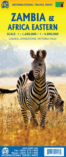
Double-Sided Map Featuring Detailed Zambia Coverage & a Regional Overview of Eastern Africa
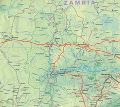
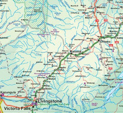
This double-sided map from ITMB offers a valuable combination of detailed country-specific mapping of Zambia on one side and a broad regional overview of Eastern Africa on the other—perfect for travellers, overlanders, and educators.
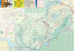
Side One: Zambia – The Heart of Southern Africa
The primary focus of this map is Zambia, a landlocked gem known for its wildlife, waterfalls, and warm-hearted people. This side includes:
-
Comprehensive road and town network
-
National parks, game reserves, and safari lodges clearly marked
-
Major rivers and lakes, including Lake Kariba and Lake Tanganyika
-
International border crossings noted, including:
-
To Zimbabwe via Victoria Falls and Kariba
-
To Botswana via Sesheke
-
To Tanzania and Malawi for regional exploration
-
Inset Maps Included:
-
Lusaka – Zambia’s capital, shown in fine urban detail
-
Livingstone – gateway to the falls and safari destinations
-
Victoria Falls – one of the world’s most iconic natural wonders (located on the border with Zimbabwe)
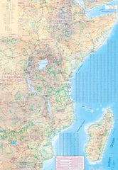
Side Two: Eastern Africa – Regional Context at a Glance
The reverse side presents a regional map that spans:
-
From Ethiopia and Eritrea in the north
-
To Eswatini (Swaziland) and southern Mozambique in the south
-
Including Madagascar, Comoro Islands, and coastal East Africa
This regional view is ideal for understanding transcontinental routes, cultural zones, and logistics across one of the most dynamic and diverse parts of the African continent.
Durable Laminated Option Available
We offer this map laminated in premium 80-micron gloss film, which makes it:
-
Writeable & wipeable with whiteboard markers
-
Compatible with map dots for marking places of interest
-
Tear-resistant and stain-resistant – ideal for travel, classroom, or office use
📌 Please note: This map is produced from a previously folded version. When laminated, slight fold lines may still be visible beneath the surface.
🗺️ Product Specifications
| Feature | Description |
|---|---|
| Publisher | ITMB (International Travel Maps) |
| Map Type | Double-sided, folded or laminated |
| Primary Focus | Zambia (detailed) + Eastern Africa (regional) |
| Scale | Zambia: 1:1,680,000 / Eastern Africa: 1:4,800,000 |
| Size | 690 mm (w) x 990 mm (h) |
| Language | English |
Why Choose This Map?
-
✅ Excellent for self-drive safaris and overland journeys
-
✅ Provides both micro and macro perspectives
-
✅ A must-have for travellers, educators, and logistics coordinators
-
✅ Highlights crossings and connections between countries
From safari planning to classroom instruction, the Zambia & Eastern Africa ITMB Map offers both local detail and regional perspective – beautifully presented and built to last.


