- Australia ▾
- Topographic
▾
- Australia AUSTopo 250k (2024)
- Australia 50k Geoscience maps
- Australia 100k Geoscience maps
- Australia 250k Geoscience maps
- Australia 1.1m Geoscience maps
- New Zealand 50k maps
- New Zealand 250k maps
- New South Wales 25k maps
- New South Wales 50k maps
- New South Wales 100k maps
- Queensland 10k maps
- Queensland 25k maps
- Queensland 50k maps
- Queensland 100k maps
- Compasses
- Software
- GPS Systems
- Orienteering
- International ▾
- Wall Maps
▾
- World
- Australia & New Zealand
- Countries, Continents & Regions
- Historical
- Vintage National Geographic
- Australian Capital Territory
- New South Wales
- Northern Territory
- Queensland
- South Australia
- Tasmania
- Victoria
- Western Australia
- Celestial
- Children's
- Mining & Resources
- Wine Maps
- Healthcare
- Postcode Maps
- Electoral Maps
- Nautical ▾
- Flags
▾
- Australian Flag Sets & Banners
- Flag Bunting
- Handwavers
- Australian National Flags
- Aboriginal Flags
- Torres Strait Islander Flags
- International Flags
- Flagpoles & Accessories
- Australian Capital Territory Flags
- New South Wales Flags
- Northern Territory Flags
- Queensland Flags
- South Australia Flags
- Tasmania Flags
- Victoria Flags
- Western Australia Flags
- Gifts ▾
- Globes ▾
Dear valued customer. Please note that our checkout is not supported by old browsers. Please use a recent browser to access all checkout capabilities
Africa ITMB Map
$24.95
Afterpay is only available for orders between $50.00 and $1000.00 More info
Scale: 1:5,000,000 | Size: 1350 mm x 1000 mm | Waterproof & Laminated Options Available
A Complete, Updated Overview of the African Continent and Surrounding Island Nations
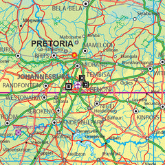
Covering all 54 countries and adjacent island territories, the Africa Map by International Travel Maps (ITMB) is one of the only full-continent maps created using a purpose-built digital cartographic database. This detailed and beautifully designed double-sided map provides an essential overview of a vast and geopolitically dynamic continent—offering up-to-date road networks, political boundaries, regional connections, and international perspectives.
Whether you’re a traveller, educator, planner, or simply map-curious, this is an invaluable reference map for understanding the layout and structure of modern Africa.
✅ Key Features & Benefits
🗺️ Complete Continental Coverage
From the Mediterranean coast to the Cape of Good Hope, and from Dakar to Djibouti, this map covers:
-
All 54 African countries
-
Major and secondary roads, including border connections
-
Island nations such as Madagascar, Cape Verde, Seychelles, São Tomé and others
🧭 Road Network Updates & Regional Improvements
This edition features numerous updates, including improved data for:
-
The southern tip of Morocco to Mauritania (Nouakchott)
-
Emerging road links across East, West, and North Africa
📌 Realistic Political Context
While some regional tensions (e.g. Algeria–Morocco border closure, Libyan instability) remain unresolved, this map offers a stable and neutral cartographic view, supporting practical navigation and geopolitical understanding.
🧳 Perfect for Travel Planning & Education
An excellent tool for:
-
Planning multi-country travel itineraries
-
Studying African geography and post-colonial state boundaries
-
Understanding the relationship between roads, terrain, and political borders
💧 Durable Format with Laminated Option
📜 Printed on Waterproof ITM Synthetic Paper
Durable and field-ready, this synthetic map resists tears, stains, and moisture, making it ideal for extended use in classrooms, fieldwork, or travel settings.
🖊️ Upgrade to Laminated for Write-On/Wipe-Off Use
Encapsulated in 80-micron high-quality gloss laminate, the laminated version allows:
-
Use with whiteboard markers
-
Application of map dots or sticky notes
-
Easy cleaning and long-term reusability
🔁 Note: Laminated editions are created from previously folded maps, carefully flattened and sealed. Slight fold lines may remain, but they do not affect readability or performance.
📦 Product Specifications
| Feature | Description |
|---|---|
| Publisher | International Travel Maps (ITMB) |
| Map Title | Africa – Continental Map |
| Scale | 1:5,000,000 |
| Size (Unfolded) | 1350 mm x 1000 mm |
| Format | Two-sided |
| Material (Standard) | Waterproof ITM synthetic paper |
| Laminated Option | Available – Writeable & wipeable surface |
| Regions Covered | All 54 African countries + island territories |
| Updates Include | Roads, cross-border connections, regional revisions |
| Language | English-language key and country labelling |
🌏 Perfect For:
✔️ Travellers & Overlanders – Plan cross-continental journeys and routes
✔️ Teachers & Academic Institutions – Visualise African geography at scale
✔️ Embassies & NGOs – Understand regional relationships and boundaries
✔️ Map Collectors & World Builders – A foundational reference for any map collection
✔️ Office or Wall Display – An impressive and informative feature for home or workspaces
Africa is a continent of incredible diversity, complexity, and resilience. With this updated ITMB map, you gain a detailed, thoughtfully designed overview that’s both geographically accurate and practically useful. It’s one of the few truly continent-wide maps that balances cartographic clarity with modern geopolitical awareness.
🛒 Select your preferred format—Waterproof Paper or Laminated—and add this essential map of Africa to your collection today.


