- Australia ▾
- Topographic
▾
- Australia AUSTopo 250k (2024)
- Australia 50k Geoscience maps
- Australia 100k Geoscience maps
- Australia 250k Geoscience maps
- Australia 1.1m Geoscience maps
- New Zealand 50k maps
- New Zealand 250k maps
- New South Wales 25k maps
- New South Wales 50k maps
- New South Wales 100k maps
- Queensland 10k maps
- Queensland 25k maps
- Queensland 50k maps
- Queensland 100k maps
- Compasses
- Software
- GPS Systems
- Orienteering
- International ▾
- Wall Maps
▾
- World
- Australia & New Zealand
- Countries, Continents & Regions
- Historical
- Vintage National Geographic
- Australian Capital Territory
- New South Wales
- Northern Territory
- Queensland
- South Australia
- Tasmania
- Victoria
- Western Australia
- Celestial
- Children's
- Mining & Resources
- Wine Maps
- Healthcare
- Postcode Maps
- Electoral Maps
- Nautical ▾
- Flags
▾
- Australian Flag Sets & Banners
- Flag Bunting
- Handwavers
- Australian National Flags
- Aboriginal Flags
- Torres Strait Islander Flags
- International Flags
- Flagpoles & Accessories
- Australian Capital Territory Flags
- New South Wales Flags
- Northern Territory Flags
- Queensland Flags
- South Australia Flags
- Tasmania Flags
- Victoria Flags
- Western Australia Flags
- Gifts ▾
- Globes ▾
Dear valued customer. Please note that our checkout is not supported by old browsers. Please use a recent browser to access all checkout capabilities
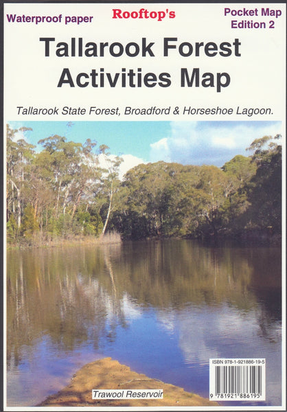
Tallarook Forest Activities Map Rooftop
$11.95 $13.95
Afterpay is only available for orders between $50.00 and $1000.00 More info
Topographic Adventure Map for Walkers, Campers & 4WD Explorers
Scale: 1:30,000
Opened Size: 700 mm (W) x 340 mm (H)
Optional Lamination Available
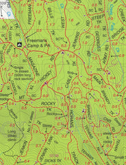
Get off the beaten path and into the heart of Victoria’s rugged bushland with the Tallarook Forest Activities Map by Rooftop Maps—a trusted name in adventure mapping. This highly detailed topographic map is tailored for bushwalkers, campers, four-wheel drivers, and anyone seeking to explore the region’s vast network of trails, reserves, and hidden natural features.
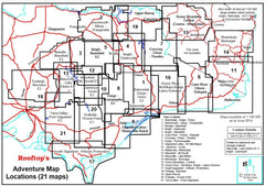
🗺️ Map Coverage Includes:
-
🌲 Tallarook State Forest
-
🏔️ Mount Hickey & Warragul Rocks
-
💧 Falls Creek Reservoir & Horseshoe Lagoon (Goulburn River)
-
🏕️ Freemans Camp and surrounding bushland tracks
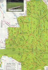
Every national park, reserve, and state forest is clearly marked, and the map includes over 1,000 km of roads and tracks, all meticulously plotted using GPS field mapping technology for exceptional accuracy.
Key Features:
-
Topographic detail with contour lines, elevation shading, and watercourses
-
Up-to-date track conditions and accessibility notes
-
Fire warnings and safety information
-
Suggested scenic lookouts, camping zones, and recreational access points
-
Opening hours and seasonal access information for key facilities
-
Perfect for 4WD and trail exploration, showing everything from graded dirt roads to remote bush tracks
-
Great for bushwalking, with clearly marked walking trails and landmarks
Whether you're planning a day trip, overnight hike, or 4WD journey, this map is a practical and informative companion.
Optional Laminated Version Available
Upgrade to the laminated edition for field-ready durability and versatility:
-
✅ Encapsulated in high-quality 80-micron gloss laminate
-
✅ Waterproof and tear-resistant – ideal for use in rugged or wet conditions
-
✅ Use whiteboard markers to mark trails or campsite plans and simply wipe clean
-
✅ Compatible with map dots to track points of interest or completed routes
Note: Laminated versions are produced from previously folded maps and flattened for lamination—some light fold lines may remain visible.
📐 Specifications
| Feature | Detail |
|---|---|
| Map Title | Tallarook Forest Activities Map |
| Publisher | Rooftop Maps (Australia) |
| Region Covered | Tallarook State Forest & surrounds |
| Scale | 1:30,000 |
| Opened Size | 700 mm (W) x 340 mm (H) |
| Roads & Tracks | Over 1,000 km of routes mapped via GPS |
| Format | Folded paper map (optional laminated) |
| Lamination | Optional 80-micron gloss laminate |
| Ideal Uses | 4WD, bushwalking, camping, outdoor recreation |
Perfect For:
-
🚙 4WD and off-road adventurers navigating remote bush tracks
-
🥾 Hikers and campers exploring the scenic Victorian ranges
-
🏕️ Weekend explorers and caravaners seeking new spots off the highway
-
🔥 Emergency planning and bushfire preparedness
-
🎒 Schools, outdoor ed programs, and scout groups in the region
The Tallarook Forest Activities Map by Rooftop is more than just a topographic reference—it's an invitation to explore one of Victoria’s hidden outdoor gems. With accurate trail data, local knowledge, and smart design, this is the go-to map for anyone ready to embrace the tracks less travelled.
Adventure confidently. Explore responsibly. Discover Tallarook.


