- Australia ▾
- Topographic
▾
- Australia AUSTopo 250k (2024)
- Australia 50k Geoscience maps
- Australia 100k Geoscience maps
- Australia 250k Geoscience maps
- Australia 1.1m Geoscience maps
- New Zealand 50k maps
- New Zealand 250k maps
- New South Wales 25k maps
- New South Wales 50k maps
- New South Wales 100k maps
- Queensland 10k maps
- Queensland 25k maps
- Queensland 50k maps
- Queensland 100k maps
- Compasses
- Software
- GPS Systems
- Orienteering
- International ▾
- Wall Maps
▾
- World
- Australia & New Zealand
- Countries, Continents & Regions
- Historical
- Vintage National Geographic
- Australian Capital Territory
- New South Wales
- Northern Territory
- Queensland
- South Australia
- Tasmania
- Victoria
- Western Australia
- Celestial
- Children's
- Mining & Resources
- Wine Maps
- Healthcare
- Postcode Maps
- Electoral Maps
- Nautical ▾
- Flags
▾
- Australian Flag Sets & Banners
- Flag Bunting
- Handwavers
- Australian National Flags
- Aboriginal Flags
- Torres Strait Islander Flags
- International Flags
- Flagpoles & Accessories
- Australian Capital Territory Flags
- New South Wales Flags
- Northern Territory Flags
- Queensland Flags
- South Australia Flags
- Tasmania Flags
- Victoria Flags
- Western Australia Flags
- Gifts ▾
- Globes ▾
Dear valued customer. Please note that our checkout is not supported by old browsers. Please use a recent browser to access all checkout capabilities


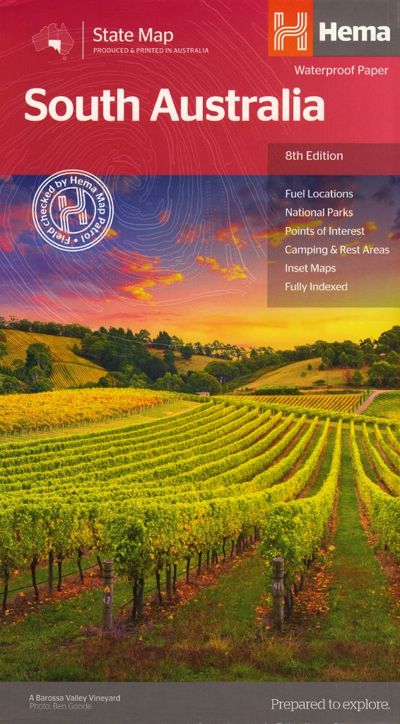
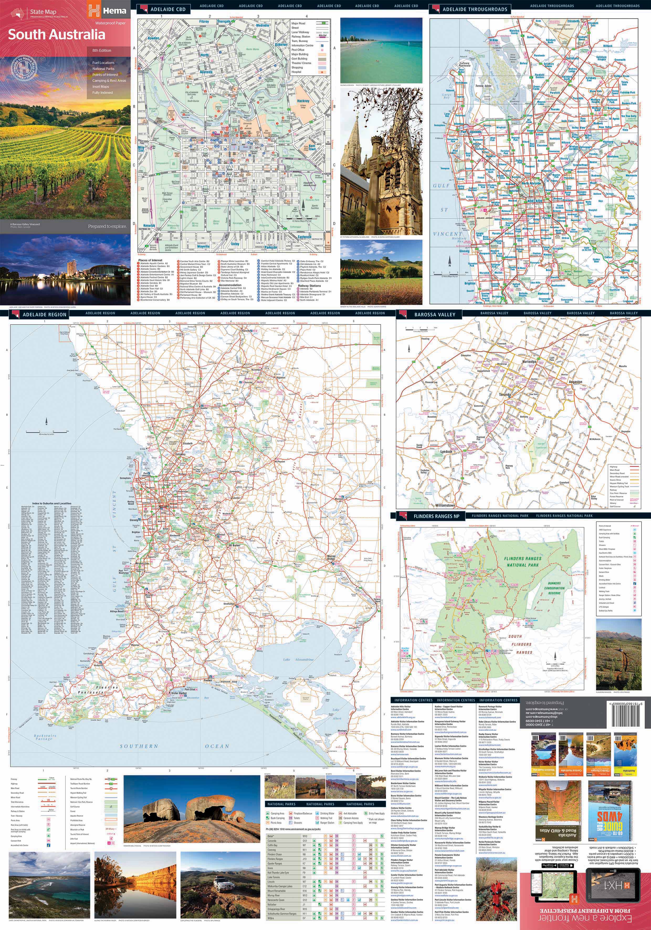
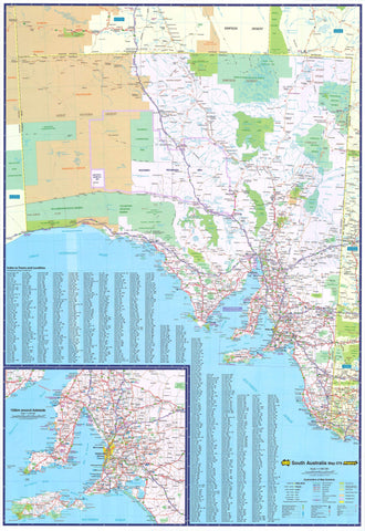
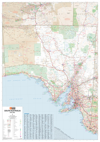
South Australia Hema State Map
$14.95
Afterpay is only available for orders between $50.00 and $1000.00 More info
Your comprehensive companion for exploring South Australia’s rugged landscapes, coastal charm, and historic heartlands
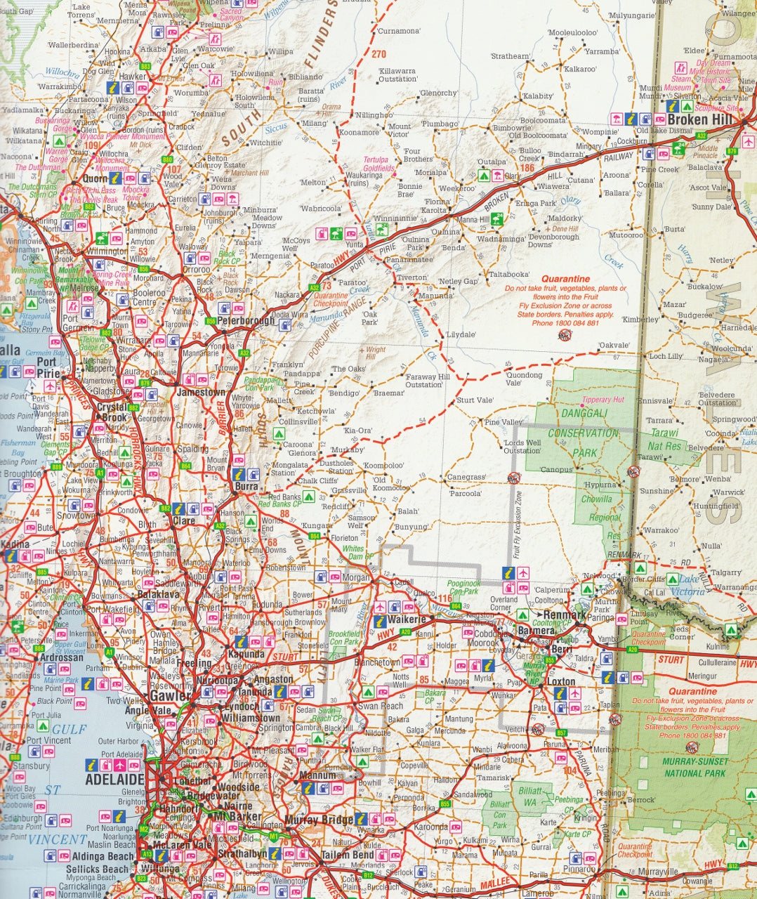
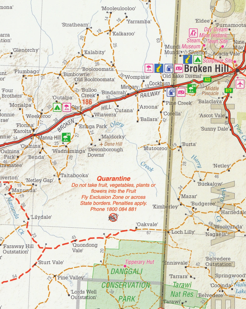
From the wild expanse of the Nullarbor Plain to the fertile valleys of the Barossa and the dramatic peaks of the Flinders Ranges, South Australia offers some of the most varied and spectacular terrain in Australia. The Hema South Australia State Map (8th Edition) is a purpose-built touring map crafted to guide travellers, explorers, and road-trippers through this diverse state with clarity, detail, and reliability.
Produced and field-checked by Hema’s Map Patrol, this map brings trusted accuracy and up-to-date information to your glovebox, backpack, or travel plan — ensuring that every journey is both informed and inspiring.
🗺️ Map Specifications:
-
Scale: 1:1,800,000 (1 cm = 18 km)
Provides an excellent balance between regional overview and travel planning detail -
Unfolded Size: 1000 mm (W) x 700 mm (H)
-
Folded Size: 250 mm x 140 mm
-
Edition: 8th Edition
-
Publication Date: 20 October 2014
-
Weight: Approx. 90 grams
-
Printed on: Premium map-grade paper designed for durability and clear legibility
🌟 Key Features:
🚗 Road Network & Travel Routes:
-
Clearly marked sealed and unsealed roads
-
Identification of highways, tourist drives, and state routes
-
Road distances for easy trip planning
-
Minor outback tracks and regional connectors included
🏕️ Camping & Traveller Services:
-
Locations of campgrounds and caravan parks
-
24-hour fuel stations, free rest stops, and roadhouses
-
Symbols for public facilities including toilets, picnic areas, and lookouts
🗺️ Inset Maps Include:
-
Adelaide CBD and Metropolitan Area – ideal for navigating the state capital
-
Barossa Valley – showcasing one of Australia’s premier wine regions
-
Flinders Ranges National Park – highlighting key attractions and access roads
🌿 Natural Features & National Parks:
-
Detailed depiction of national parks, state forests, conservation areas, and protected zones
-
Rivers, lakes, and coastline features clearly marked
-
Park facilities matrix indicating amenities such as:
-
Toilets
-
Showers
-
Camping areas
-
BBQ facilities
-
Walking tracks
-
🧭 Tourist and Regional Info:
-
Regional breakdown of key attractions
-
Contact details for South Australian Visitor Information Centres
-
Historical and natural highlights marked across the state
📦 Why Choose This Map?:
-
Comprehensive, easy-to-read format perfect for all types of travellers
-
Created by Australia’s most trusted cartography team — Hema Maps
-
Ideal for:
-
Self-drive tours and road trips
-
Educational use in schools and field studies
-
Logistics and service delivery across rural regions
-
4WD, camper, and caravan travel
-
Whether you're venturing through the red desert heart, cruising down the Limestone Coast, or meandering through the wine trails and riverlands, the Hema South Australia State Map is your best travel companion.
Navigate with confidence, explore with ease — and discover the best of South Australia with Hema.