- Australia ▾
- Topographic
▾
- Australia AUSTopo 250k (2025)
- Australia 50k Geoscience maps
- Australia 100k Geoscience maps
- Australia 250k Geoscience maps
- Australia 1:1m Geoscience maps
- New Zealand 50k maps
- New Zealand 250k maps
- New South Wales 25k maps
- New South Wales 50k maps
- New South Wales 100k maps
- Queensland 10k maps
- Queensland 25k maps
- Queensland 50k maps
- Queensland 100k maps
- Compasses
- Software
- GPS Systems
- Orienteering
- International ▾
- Wall Maps
▾
- World
- Australia & New Zealand
- Countries, Continents & Regions
- Historical
- Vintage National Geographic
- Australian Capital Territory
- New South Wales
- Northern Territory
- Queensland
- South Australia
- Tasmania
- Victoria
- Western Australia
- Celestial
- Children's
- Mining & Resources
- Wine Maps
- Healthcare
- Postcode Maps
- Electoral Maps
- Nautical ▾
- Flags
▾
- Australian Flag Sets & Banners
- Flag Bunting
- Handwavers
- Australian National Flags
- Aboriginal Flags
- Torres Strait Islander Flags
- International Flags
- Flagpoles & Accessories
- Australian Capital Territory Flags
- New South Wales Flags
- Northern Territory Flags
- Queensland Flags
- South Australia Flags
- Tasmania Flags
- Victoria Flags
- Western Australia Flags
- Gifts ▾
- Globes ▾
Dear valued customer. Please note that our checkout is not supported by old browsers. Please use a recent browser to access all checkout capabilities


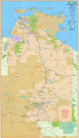
Northern Territory Wall Map by Robinson published 1908
$69.95
or make 4 interest-free payments of
$17.49 AUD
fortnightly with
![]() More info
More info
A Vintage Cartographic Masterpiece from the Lady Northcote Atlas of Australia
Step back in time with this beautifully reproduced Northern Territory Wall Map, originally published in 1908 as part of H.E.C. Robinson’s Lady Northcote Atlas of Australia. Carefully enlarged from the original plate, this historic map offers a captivating glimpse into the political and geographic understanding of Australia's vast northern frontier in the early 20th century.
This is more than a map—it’s a piece of Australian cartographic heritage.
Historical Significance
Commissioned during a period of rapid exploration and colonial expansion, this map illustrates the Northern Territory in the decades before it gained self-governance, when vast regions remained sparsely mapped. It reflects a fascinating blend of topography, pastoral leases, rail routes (proposed and existing), administrative boundaries, and early settlement markers.
Finishing Options
| Finish Type | Description |
|---|---|
| 160gsm Paper | Crisp and smooth—perfect for framing under glass |
| Laminated Version | Encapsulated in 80-micron gloss laminate, allowing use with whiteboard markers and map dots. Ideal for offices or educational settings |
| Canvas (395gsm) | Printed on premium HP Professional Matte Canvas using archival pigment inks—fade-resistant and built to last |
| Hang Rails (Optional) | Canvas or laminated maps can be finished with handcrafted wooden hang rails (top & bottom) and a hanging cord for easy display. The natural timber finish complements vintage styling beautifully |
⏳ Please allow up to 10 working days for delivery of hang-railed versions, as each is made to order by our professional framer.
📐 Product Details
| Feature | Standard Size | Large Size |
|---|---|---|
| Dimensions | 660 mm (W) x 900 mm (H) | 920 mm (W) x 1230 mm (H) |
| Scale | Historical reproduction (not to modern scale) | |
| Cartographer | H.E.C. Robinson, Sydney | |
| Published | 1908 | |
| Source | Lady Northcote Atlas of Australia | |
| Made In | Australia |
A Collector’s Statement Piece
Perfect for:
-
Vintage map collectors
-
History enthusiasts
-
Lovers of the Northern Territory
-
Heritage-style home or office decor
-
Educational institutions and libraries
This map is a talking piece, offering both visual appeal and a sense of historic grandeur. Whether you're celebrating your connection to the NT or honouring Australia's mapping legacy, this reproduction brings authenticity and elegance to any space.
Own a map that tells a story.
Bring the Northern Territory of 1908 into the present day—with beauty, detail, and timeless style.
Frequently Asked Questions
What are the dimensions of the Northern Territory Wall Map by Robinson published 1908?
Mapworld wall maps range from standard 700×1000mm to large-format 1000×1430mm Supermaps. The exact dimensions for this map are shown in the product title. Where multiple sizes are available, select your preferred size when adding to cart.
Is this wall map available laminated?
Many Mapworld wall maps are available in paper, laminated, or framed finishes. Check the product options when adding to cart. Laminated maps are wipe-clean and more durable.
Is this the latest edition?
Mapworld stocks the most current editions available from all publishers. Edition year is shown in the product title where applicable. Mapworld updates its catalogue as new editions are released.
Can I write on or pin this wall map?
Laminated wall maps can be written on with whiteboard markers and wiped clean. Paper maps can be pinned on a corkboard. Choose a laminated option for a writeable surface.
Does Mapworld ship the Northern Territory Wall Map by Robinson published 1908 across Australia?
Yes, Mapworld ships Australia-wide. Standard shipping is a flat $7 rate, with free standard shipping on orders over $75. Express options are available at checkout. Most orders placed before 2pm AEST on weekdays are dispatched same day.
Related Items


© 2026 Mapworld. Website designed by Genie Media
X