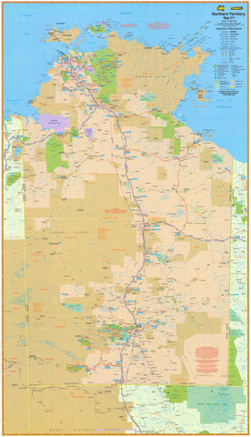
Northern Territory — Offshore & Onshore Petroleum Activity & Infrastructure Map (2026)
A definitive, large-format reference to the Northern Territory’s petroleum landscape—covering offshore and onshore operators, operating mines, and the critical infrastructure that connects them. Designed for clarity and accuracy, this map is ideal for energy companies, government agencies, investors, logistics teams, educators, and research institutions.
🗝️ Key Features
-
Operating Sites: Clearly marked operating mines across the NT.
-
Petroleum Operators: Onshore & offshore operators identified for rapid situational awareness.
-
Infrastructure Network:
-
Major roads and railways
-
Oil & gas pipelines and connections to hubs
-
-
Professional Readability: Clean symbology and legible labels for boardrooms, project rooms, and classrooms.
🎨 Materials & Finishes
Choose the finish that suits your space and usage:
📄 Paper (160 gsm Matte)
-
Archival, glare-free surface
-
Best for framing under glass in offices and meeting rooms
💧 Laminated (True Encapsulation)
-
Fully encapsulated in 2 × 80-micron gloss laminate
-
Waterproof, tear-resistant, wipe-clean surface (compatible with whiteboard markers & map dots)
-
Built for heavy-use environments
🪵 Laminated + Timber Hang Rails
-
Laminated map mounted with natural lacquered timber rails (top & bottom)
-
Top hanging cord for quick, tidy wall display
-
⚠️ Custom finish — please allow up to 10 working days for delivery
🎨 Canvas (395 gsm HP Professional Matte)
-
Museum-grade matte canvas with pigment-based, fade-resistant inks
-
Durable, refined presentation for boardrooms and reception areas
🪵 Canvas + Timber Hang Rails
-
Canvas map fitted with lacquered timber battens and top hanging cord
-
Gallery-quality ready-to-hang finish
-
⚠️ Custom finish — please allow up to 10 working days for delivery
📐 Sizes Available
-
Large: 700 mm (W) × 1000 mm (H)
-
Supermap: 1015 mm (W) × 1400 mm (H)
-
Orientation: Portrait
📊 Specifications
| Attribute | Details |
|---|---|
| Title | Northern Territory Offshore & Onshore Petroleum Activity & Infrastructure 2026 |
| Content | Operating mines; onshore & offshore operators; roads; railways; oil & gas pipelines |
| Sizes | Large — 700 × 1000 mm; Supermap — 1015 × 1400 mm |
| Format Options | Paper; Laminated; Laminated + Timber Hang Rails; Canvas; Canvas + Timber Hang Rails |
| Paper | 160 gsm archival matte |
| Laminate | 2 × 80-micron gloss (true encapsulation) |
| Canvas | 395 gsm HP Professional Matte |
| Inks | Pigment-based, fade-resistant |
| Delivery | Paper/Laminated: standard lead times; Hang-railed finishes: allow up to 10 working days |
| Made in | Australia |
🎯 Who It’s For
-
🛢️ Energy & resources companies — asset overviews and stakeholder briefings
-
🏛️ Government & regulators — policy, approvals, and regional planning
-
💼 Investors & advisors — due diligence and portfolio context
-
🚛 Logistics & services — routing and infrastructure awareness
-
🎓 Universities & schools — teaching energy geography and infrastructure
🤝 Our Commitment
Every map is printed and finished locally in Australia with archival materials and fade-resistant inks. Each copy is colour-managed, hand-checked, and professionally packed to arrive display-ready and built to last.
🛒 Order your NT Offshore & Onshore Petroleum Activity & Infrastructure Map (2026) today — a clear, durable, and authoritative view of the Territory’s energy landscape.