- Australia ▾
- Topographic
▾
- Australia AUSTopo 250k (2025)
- Australia 50k Geoscience maps
- Australia 100k Geoscience maps
- Australia 250k Geoscience maps
- Australia 1:1m Geoscience maps
- New Zealand 50k maps
- New Zealand 250k maps
- New South Wales 25k maps
- New South Wales 50k maps
- New South Wales 100k maps
- Queensland 10k maps
- Queensland 25k maps
- Queensland 50k maps
- Queensland 100k maps
- Western Australia 25k maps
- Western Australia 50k maps
- Western Australia 100k maps
- Compasses
- Software
- GPS Systems
- International ▾
- Wall Maps
▾
- World
- Australia & New Zealand
- Countries, Continents & Regions
- Historical
- Vintage National Geographic
- Australian Capital Territory
- New South Wales
- Northern Territory
- Queensland
- South Australia
- Tasmania
- Victoria
- Western Australia
- Celestial
- Children's
- Mining & Resources
- Wine Maps
- Healthcare
- Postcode Maps
- Electoral Maps
- Nautical ▾
- Flags
▾
- Australian Flag Sets & Banners
- Flag Bunting
- Handwavers
- Australian National Flags
- Aboriginal Flags
- Torres Strait Islander Flags
- International Flags
- Flagpoles & Accessories
- Australian Capital Territory Flags
- New South Wales Flags
- Northern Territory Flags
- Queensland Flags
- South Australia Flags
- Tasmania Flags
- Victoria Flags
- Western Australia Flags
- Gifts ▾
- Globes ▾
Dear valued customer. Please note that our checkout is not supported by old browsers. Please use a recent browser to access all checkout capabilities


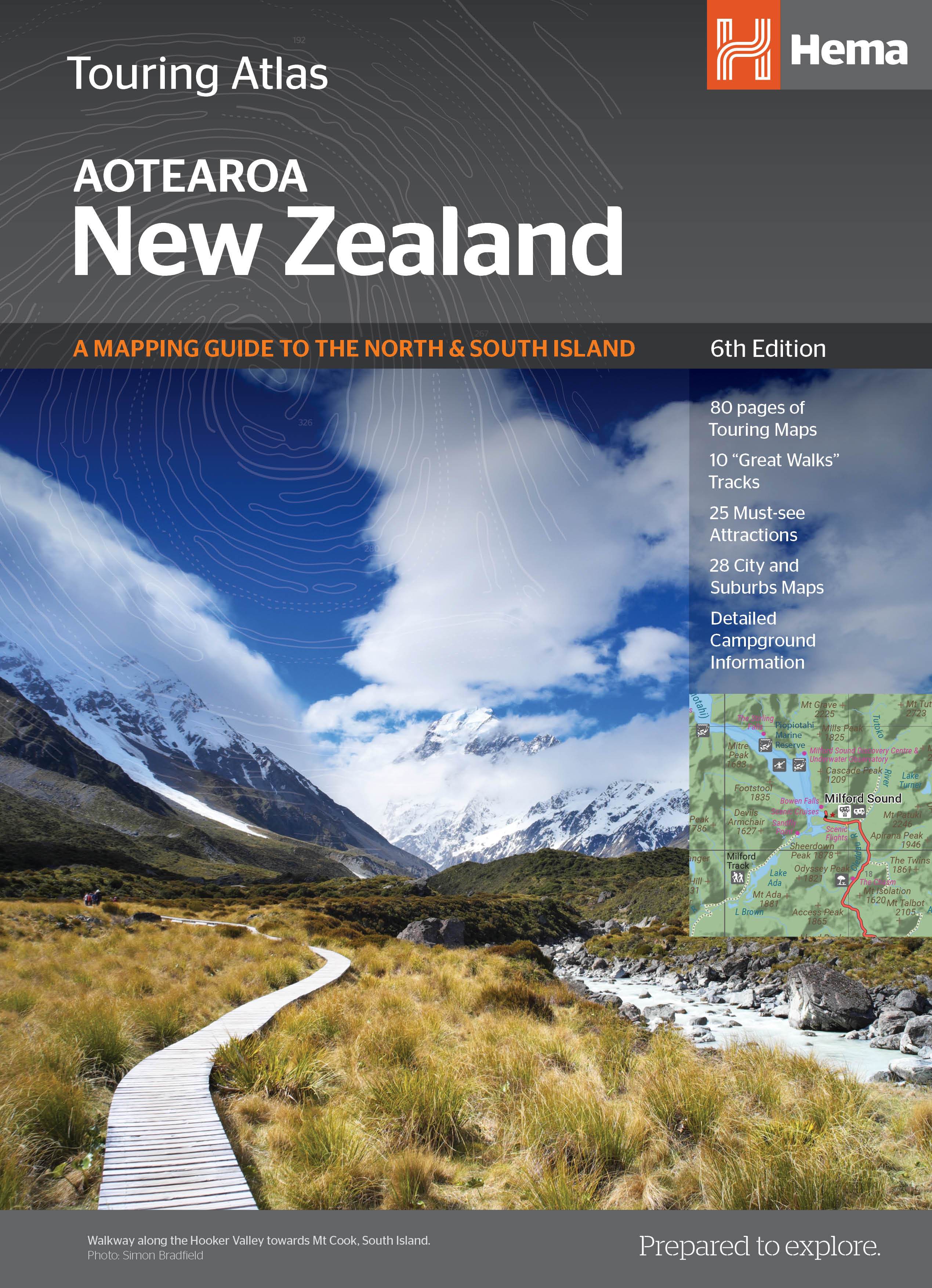
New Zealand Touring Atlas Spiral Hema
$44.95
Afterpay is only available for orders between $50.00 and $1000.00 More info
Your essential travel companion for exploring the North and South Islands of Aotearoa — packed with detailed maps, travel insights, and outdoor adventure guidance.
The New Zealand Touring Atlas by Hema Maps is the ultimate all-in-one reference for discovering the rugged mountains, sweeping coastlines, thermal valleys, and vibrant towns of New Zealand. Designed for road trippers, campers, hikers, and motorhome travellers, this comprehensive spiral-bound atlas combines detailed cartography with practical travel tools, ensuring your journey is well-informed, flexible, and unforgettable.
Whether you're navigating the winding roads of the Coromandel Peninsula, planning a trek through Fiordland, or discovering hidden gems along the West Coast, this atlas gives you everything you need to get the most out of your New Zealand adventure.
🗺️ Key Features & Highlights
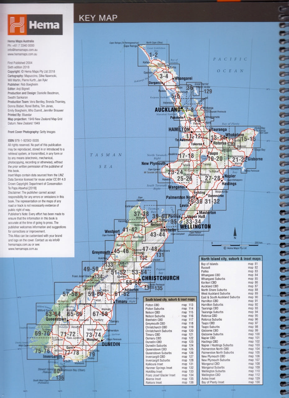
🌏 Touring Maps – North & South Island Coverage
-
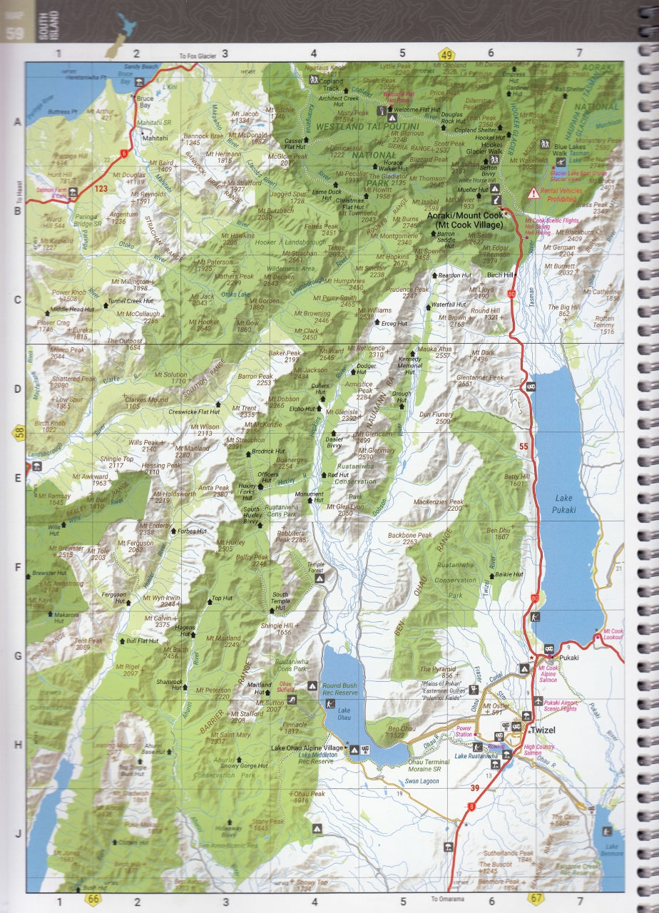
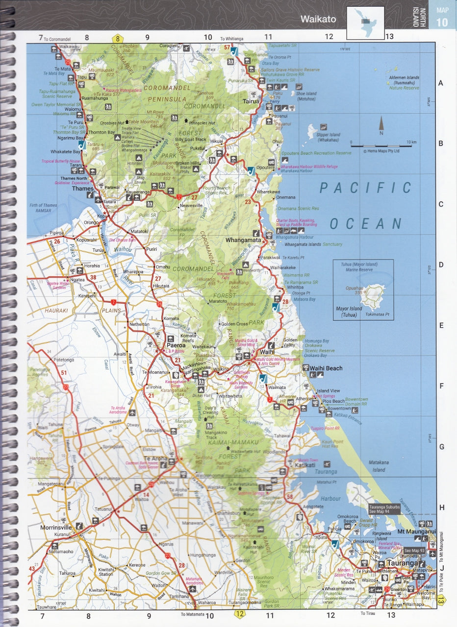
Contains 80 pages of detailed touring maps at an approximate scale of 1:345,000
-
Full coverage of both North Island and South Island, including:
-
National highways and regional roads
-
Scenic routes and tourist drives
-
Road surface types (sealed, unsealed)
-
Elevation contours and key topographic features
-
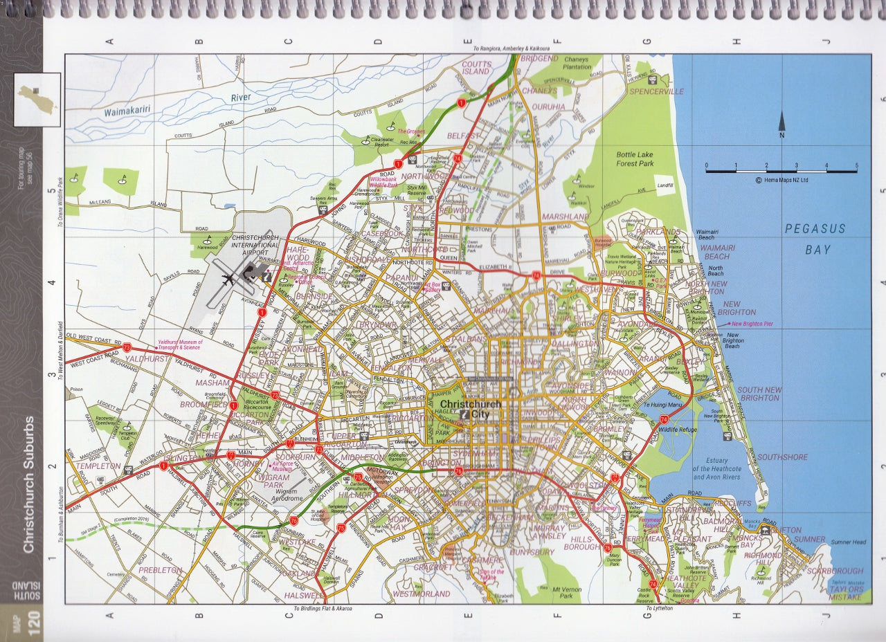
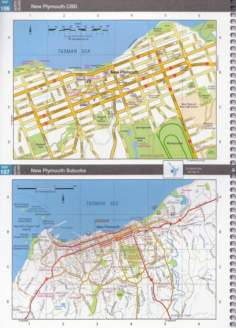
🏙️ City & Suburban Maps
-
Includes 28 detailed urban maps of major centres such as:
-
Auckland
-
Wellington
-
Christchurch
-
Queenstown
-
Dunedin and more
-
-
Ideal for navigating through metropolitan traffic, locating facilities, or planning short city stopovers
🏞️ National Parks & Great Walks
-
Showcases 8 of New Zealand’s National Parks, including:
-
Tongariro, Fiordland, Abel Tasman, Mount Cook/Aoraki, and more
-
-
Features information and overview maps of all 10 Great Walks, such as:
-
The Milford Track
-
Routeburn Track
-
Heaphy Track
-
Kepler and Abel Tasman Coast Tracks
-
-
Includes an overview of the Te Araroa Trail, a long-distance thru-hike spanning the entire country
🧭 Points of Interest & Travel Tools
-
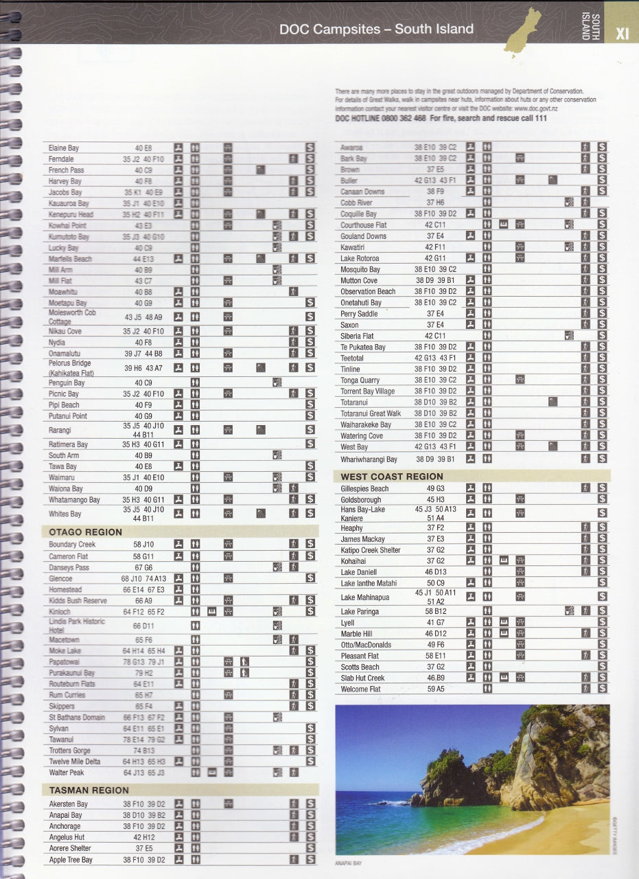
Over 1,500 listings including:
-
Campsites and holiday parks
-
Motorhome dump stations
-
Adventure activity sites, wineries, and tourist attractions
-
Information centres, fuel stations, and public facilities
-
-
Handy distance charts and travel time guides for efficient route planning
-
Icons and symbols clearly guide you to essential travel services
📖 User-Friendly Format
-
A4 spiral-bound layout: Lays flat for easy use in vehicles, caravans, or campervans
-
Heavy-duty cover for durability on the road
-
Designed for easy page flipping and reference while navigating
-
Suitable for both first-time visitors and seasoned explorers of New Zealand
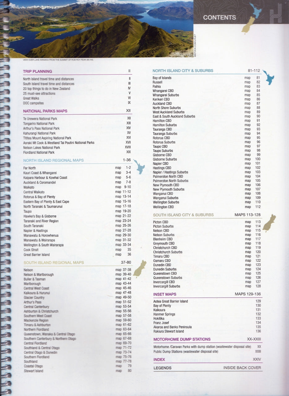
📐 Product Specifications
-
Edition: 6th Edition
-
Published: 14 November 2018
-
Format: Spiral-bound atlas
-
Pages: 144
-
Size: A4 (approx. 22.2 x 29.9 cm)
-
ISBN: 9781925625035
-
Language: English
-
Weight: Approx. 560 grams
-
Publisher: Hema Maps — Australia & New Zealand’s leading travel cartographers
🎯 Ideal For:
-
Road trippers and campervan explorers looking for scenic, accessible routes
-
Motorhome travellers needing dump point info and overnight park listings
-
Hikers and adventurers planning Great Walks or trail-based holidays
-
Families touring New Zealand wanting an all-in-one travel planning tool
-
Educators, guides, and travel agents offering resources for independent travellers
-
Locals rediscovering their backyard and exploring off-the-beaten-track destinations
✅ Why Choose the Hema New Zealand Touring Atlas?
-
Created by Hema Maps, Australasia’s most trusted name in road and adventure cartography
-
Combines up-to-date road mapping, travel logistics, and natural attraction guidance
-
Durable, functional, and designed for real-world use
-
Perfect for travellers who prefer paper-based navigation with the added reliability of curated local knowledge
From geothermal marvels to glacial fjords, lush forests to windswept beaches — New Zealand is meant to be explored.
The Hema New Zealand Touring Atlas makes sure you won’t miss a thing.
Detailed. Durable. Adventure-ready.
Take the scenic route — and never lose your way.
Frequently Asked Questions
What does the New Zealand Touring Atlas Spiral Hema cover?
This atlas covers the geographic region indicated in the product title, including roads, towns, distances, and key travel information. Mapworld stocks atlases for Australian states and territories, 4WD regions, and international destinations.
Is this the latest edition?
Yes, this is the latest edition. Mapworld stocks the most current editions available from publishers.
Is this atlas or guide spiral bound?
Spiral binding is indicated in the product title where applicable. Spiral-bound atlases and guides lay flat when open, making them ideal for use in vehicles or on a table without needing to hold pages open.
Is the New Zealand Touring Atlas Spiral Hema in stock at Mapworld?
Mapworld maintains extensive stock across its map range and aims for fast dispatch. Orders placed before 2pm AEST on business days are typically dispatched the same day, with standard and express Australia-wide delivery options available.
Does Mapworld ship the New Zealand Touring Atlas Spiral Hema across Australia?
Yes, Mapworld ships Australia-wide. Standard shipping is a flat $7 rate, with free standard shipping on orders over $75. Express options are available at checkout. Most orders placed before 2pm AEST on weekdays are dispatched same day.
Related Items

© 2026 Mapworld. Website designed by Genie Media
X