- Australia ▾
- Topographic
▾
- Australia AUSTopo 250k (2025)
- Australia 50k Geoscience maps
- Australia 100k Geoscience maps
- Australia 250k Geoscience maps
- Australia 1:1m Geoscience maps
- New Zealand 50k maps
- New Zealand 250k maps
- New South Wales 25k maps
- New South Wales 50k maps
- New South Wales 100k maps
- Queensland 10k maps
- Queensland 25k maps
- Queensland 50k maps
- Queensland 100k maps
- Western Australia 25k maps
- Western Australia 50k maps
- Western Australia 100k maps
- Compasses
- Software
- GPS Systems
- International ▾
- Wall Maps
▾
- World
- Australia & New Zealand
- Countries, Continents & Regions
- Historical
- Vintage National Geographic
- Australian Capital Territory
- New South Wales
- Northern Territory
- Queensland
- South Australia
- Tasmania
- Victoria
- Western Australia
- Celestial
- Children's
- Mining & Resources
- Wine Maps
- Healthcare
- Postcode Maps
- Electoral Maps
- Nautical ▾
- Flags
▾
- Australian Flag Sets & Banners
- Flag Bunting
- Handwavers
- Australian National Flags
- Aboriginal Flags
- Torres Strait Islander Flags
- International Flags
- Flagpoles & Accessories
- Australian Capital Territory Flags
- New South Wales Flags
- Northern Territory Flags
- Queensland Flags
- South Australia Flags
- Tasmania Flags
- Victoria Flags
- Western Australia Flags
- Gifts ▾
- Globes ▾
Dear valued customer. Please note that our checkout is not supported by old browsers. Please use a recent browser to access all checkout capabilities


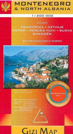
Montenegro & Albania North Gizi Maps Folded
$29.95
Afterpay is only available for orders between $50.00 and $1000.00 More info
Scale: 1:1,000,000
Format: Folded, single-sided road and terrain map
Unfolded Size: 1000 mm × 930 mm
Folded Size: 243 mm × 110 mm (approx.)
Publisher: Gizi Map
Printed in: Hungary
Delivery: Ordered in on demand – please allow up to 10 working days for dispatch
🌍 Navigate the Balkans with Clarity and Precision
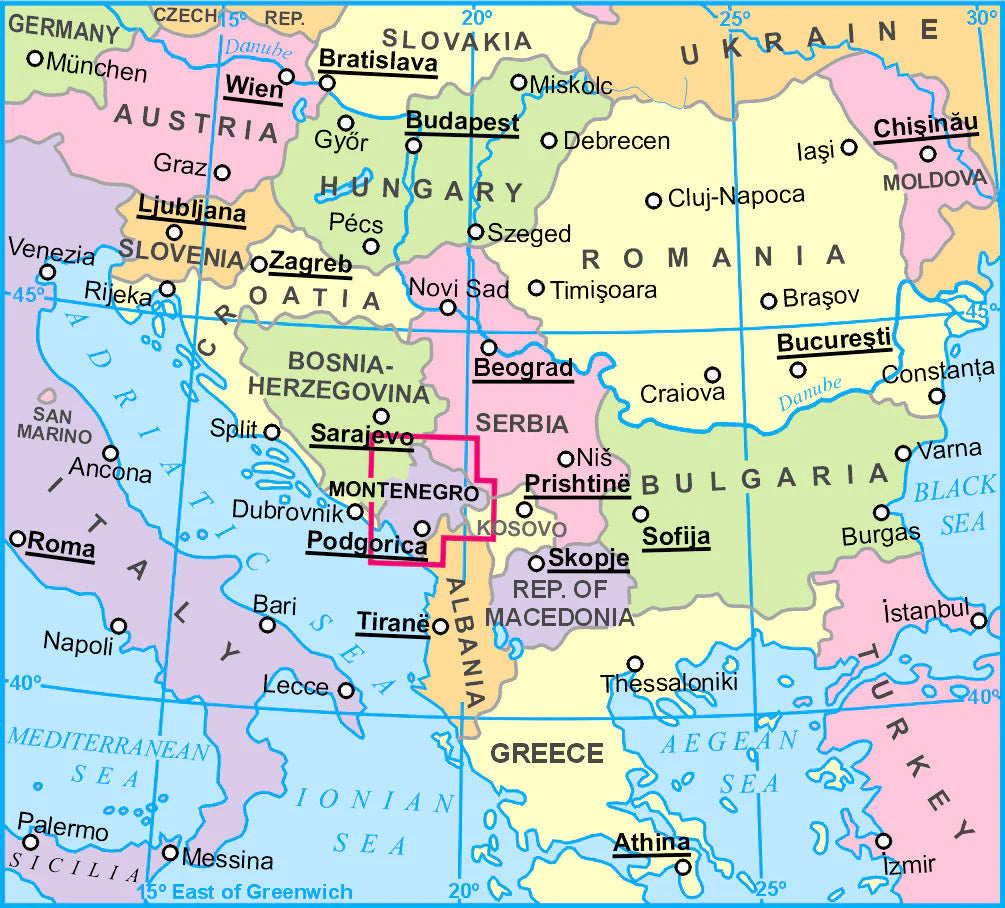
This beautifully rendered folded map from Gizi Maps is the essential travel companion for anyone exploring Montenegro and northern Albania—two of the most captivating yet lesser-explored destinations in the Balkans.
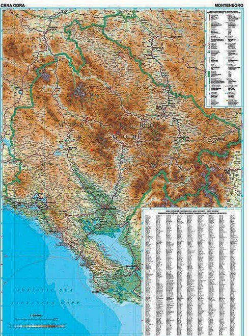
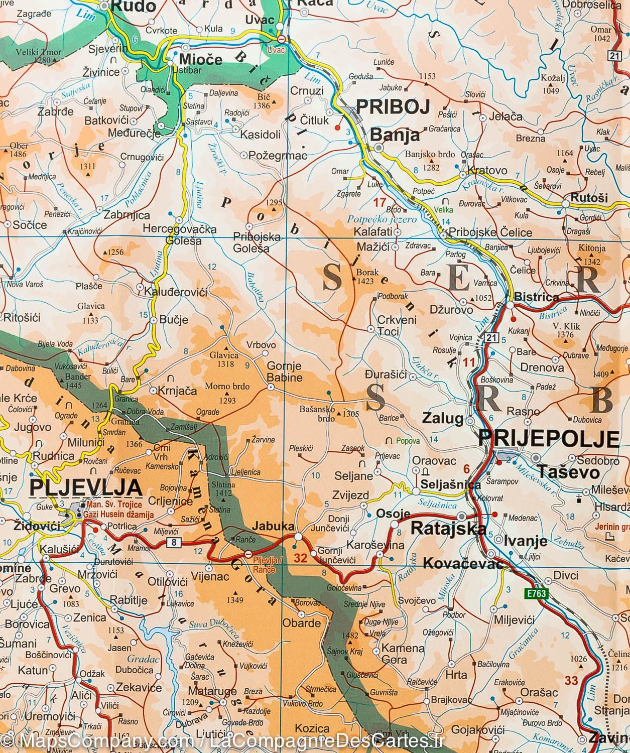
With detailed terrain shading, a finely scaled road network, and the inclusion of tourist points of interest, this 1:1,000,000 scale map offers a rare combination of accuracy, clarity, and aesthetic appeal. Whether you're planning a coastal road trip along the Bay of Kotor or venturing into the Albanian Alps, this map provides both practical information and geographical insight.
🧭 Key Features
✔ Detailed Topographic Shading – Altitude zones are clearly rendered with color gradations and contour-based elevation visuals
✔ Complete Road Network – From major highways to minor local roads, all key connections are shown with distances
✔ Tourist Highlights – Symbols mark out historical sites, beaches, scenic routes, ferry crossings, viewpoints, and nature parks
✔ Inset Town Plans – Includes important urban insets such as:
-
Podgorica
-
Budva
-
Cetinje
-
Kotor
-
Herceg Novi
-
Shkodër
✔ National Parks and Natural Areas – Including Durmitor, Biogradska Gora, Theth, and Lake Skadar
✔ Multilingual Place Name Index – Fully indexed with names in local and international spellings
✔ Distance Markers – Useful for itinerary planning and travel time estimation
✔ Latitude/Longitude Grid – GPS compatible for digital navigation backup
🧳 Why Choose This Map?
This Gizi map is not just a navigational tool—it’s a window into a region of timeless charm, dramatic scenery, and rich cultural depth.
Ideal for:
-
🚐 Self-drive explorers and overlanders
-
🥾 Hikers and walkers tackling cross-border treks
-
🏕️ Campers looking to discover off-the-beaten-path destinations
-
📸 Photographers and travel writers seeking hidden gems
-
📚 Students or map collectors interested in Balkan geography
📦 Product Specifications
| Feature | Details |
|---|---|
| Map Type | Folded, single-sided |
| Scale | 1:1,000,000 |
| Size (Unfolded) | 1000 mm × 930 mm |
| Size (Folded) | ~243 mm × 110 mm |
| Tourist Sites Shown | Yes – with special symbols |
| Topography | Colour shaded relief & spot heights |
| Indexed | Yes, multilingual index included |
| Inset Town Maps | Podgorica, Budva, Kotor, etc. |
| Road Detail | Major & minor roads with distances |
| Printed | In Hungary by Gizi Map |
| Delivery | Order-on-demand (10 working days) |
📬 Important Delivery Note
This is an order-on-demand item. To ensure the freshest possible print run, please allow up to 10 working days for delivery.
🏞️ Start Your Journey
Whether you're tracing Ottoman caravan routes, exploring UNESCO-listed towns, or navigating the Adriatic coastline, this Montenegro & Northern Albania Map by Gizi Maps is an indispensable guide to your Balkan adventure.
👉 Add to cart now and plan your trip with confidence, clarity, and the timeless pleasure of unfolding a real, detailed map.
Frequently Asked Questions
Where can I buy the Montenegro & Albania North Gizi Maps Folded?
The Montenegro & Albania North Gizi Maps Folded is available to buy online from Mapworld, Australia's largest map and geographic product retailer, with fast shipping Australia-wide.
Is the Montenegro & Albania North Gizi Maps Folded in stock at Mapworld?
Mapworld maintains extensive stock across its map range and aims for fast dispatch. Orders placed before 2pm AEST on business days are typically dispatched the same day, with standard and express Australia-wide delivery options available.
What is Mapworld's returns policy?
Mapworld accepts returns on undamaged items in original condition. Contact Mapworld within 90 days of purchase to arrange a return or exchange.
Does Mapworld ship the Montenegro & Albania North Gizi Maps Folded across Australia?
Yes, Mapworld ships Australia-wide. Standard shipping is a flat $7 rate, with free standard shipping on orders over $75. Express options are available at checkout. Most orders placed before 2pm AEST on weekdays are dispatched same day.
Related Items


© 2026 Mapworld. Website designed by Genie Media
X