

With Regional Health Boundaries | Optional Lamination
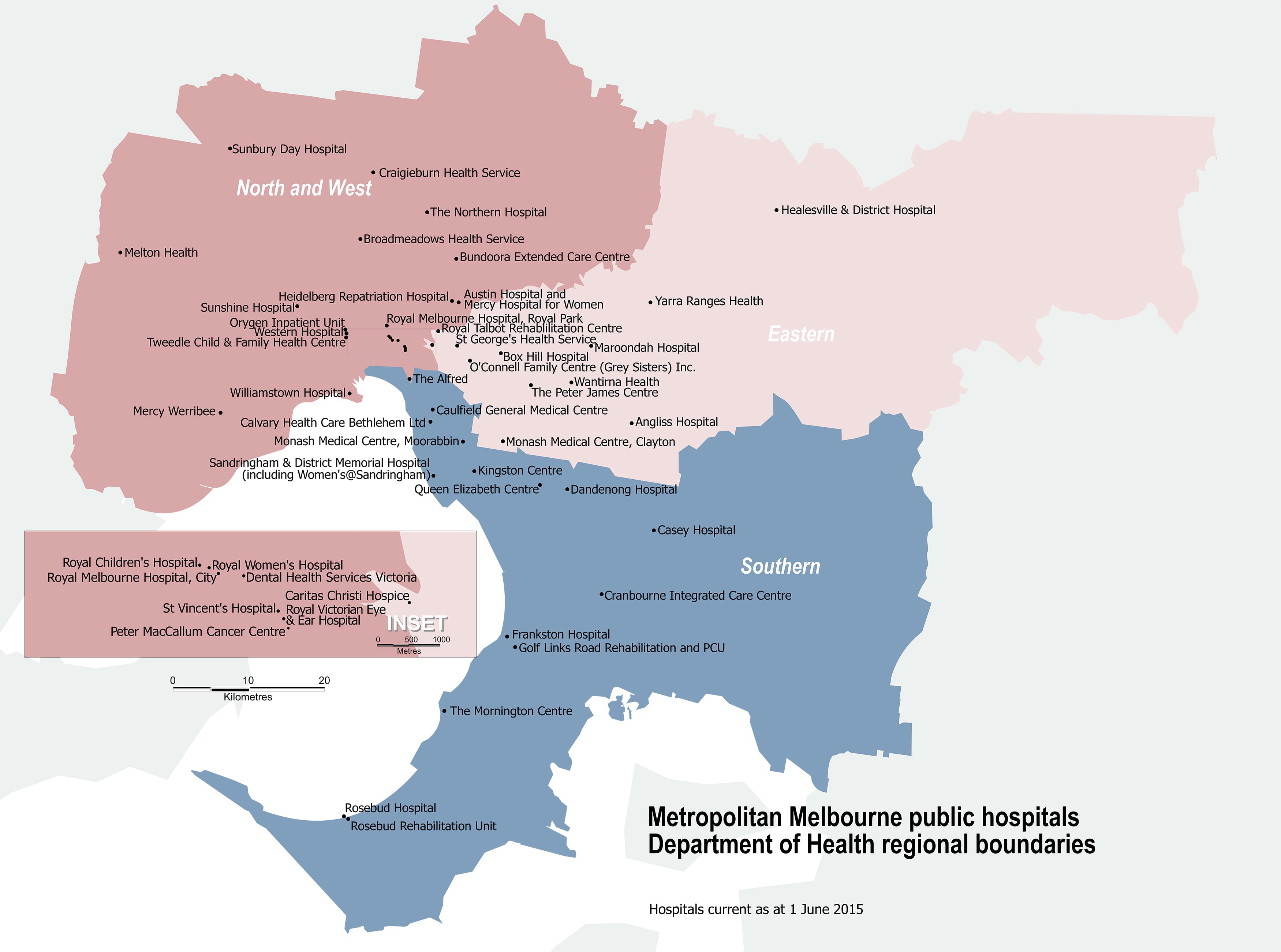
A practical and up-to-date reference map for professionals, planners, and healthcare providers, this Melbourne Public Hospitals Wall Map provides a clear and comprehensive overview of all public hospitals within the Greater Melbourne region, alongside a visual breakdown of regional health boundaries.
Whether you're coordinating logistics, planning patient referrals, or simply looking to understand the layout of Melbourne’s public health infrastructure, this map is an indispensable tool for offices, clinics, emergency services, and healthcare networks.
🗺 Map Features:
-
All Public Hospitals in Greater Melbourne
Clearly marked and labelled for quick identification. -
Regional Health Service Boundaries
Understand jurisdictional and administrative divisions across the healthcare landscape. -
Large Format Design
Sized at 1000mm wide x 743mm high, this wall map offers excellent readability from a distance.
🛡️ Durable Laminate Option
Choose the laminated version for a hard-wearing finish that allows:
-
Easy mark-ups using whiteboard markers
-
Temporary tagging with Map Dots or sticky notes
-
Protection from rips, stains, and general wear and tear
Ideal for high-traffic environments such as hospitals, health planning offices, and training rooms.
📐 Specifications
| Attribute | Details |
|---|---|
| Map Title | Melbourne Public Hospitals Map |
| Coverage | Greater Melbourne Region |
| Additional Data | Regional Health Boundaries |
| Size | 1000 mm (W) x 743 mm (H) |
| Format | Flat |
| Use | Health Planning, Logistics, Admin |
| Publisher | Australian Mapping Specialists |
Perfect For:
-
Hospital and clinic walls
-
Ambulance dispatch and health service coordination rooms
- Government and NGO health offices
-
Teaching environments and healthcare training providers
-
Businesses interacting with Melbourne’s public health
Stay informed. Stay organised. Add the Melbourne Public Hospitals Map to your planning toolkit to
