- Australia ▾
- Topographic
▾
- Australia AUSTopo 250k (2024)
- Australia 50k Geoscience maps
- Australia 100k Geoscience maps
- Australia 250k Geoscience maps
- Australia 1.1m Geoscience maps
- New Zealand 50k maps
- New Zealand 250k maps
- New South Wales 25k maps
- New South Wales 50k maps
- New South Wales 100k maps
- Queensland 10k maps
- Queensland 25k maps
- Queensland 50k maps
- Queensland 100k maps
- Compasses
- Software
- GPS Systems
- Orienteering
- International ▾
- Wall Maps
▾
- World
- Australia & New Zealand
- Countries, Continents & Regions
- Historical
- Vintage National Geographic
- Australian Capital Territory
- New South Wales
- Northern Territory
- Queensland
- South Australia
- Tasmania
- Victoria
- Western Australia
- Celestial
- Children's
- Mining & Resources
- Wine Maps
- Healthcare
- Postcode Maps
- Electoral Maps
- Nautical ▾
- Flags
▾
- Australian Flag Sets & Banners
- Flag Bunting
- Handwavers
- Australian National Flags
- Aboriginal Flags
- Torres Strait Islander Flags
- International Flags
- Flagpoles & Accessories
- Australian Capital Territory Flags
- New South Wales Flags
- Northern Territory Flags
- Queensland Flags
- South Australia Flags
- Tasmania Flags
- Victoria Flags
- Western Australia Flags
- Gifts ▾
- Globes ▾
Dear valued customer. Please note that our checkout is not supported by old browsers. Please use a recent browser to access all checkout capabilities


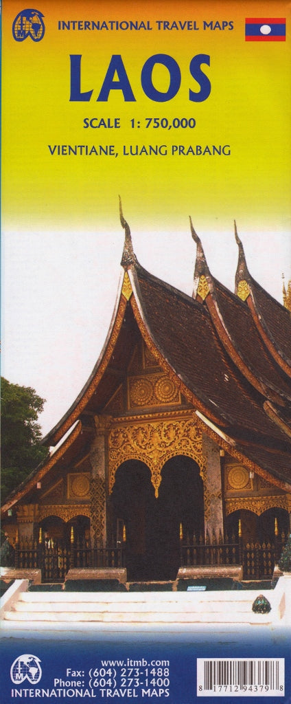
Laos ITMB Map
$24.95
Afterpay is only available for orders between $50.00 and $1000.00 More info
🇱🇦 Laos Travel Map – ITMB
Double-Sided | Waterproof Lamination Option | Scale 1:750,000 | Size: 690 x 1000 mm
Embark on a journey through the untamed beauty of Laos with this detailed double-sided map from ITMB (International Travel Maps). Whether you're planning a backpacking adventure, teaching Southeast Asian geography, or managing field operations, this map delivers accurate, practical, and up-to-date cartographic information.
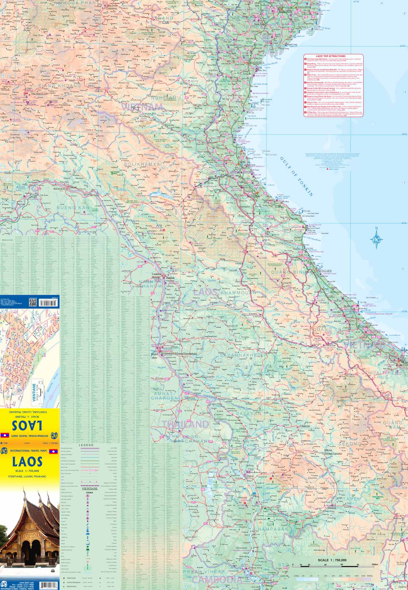
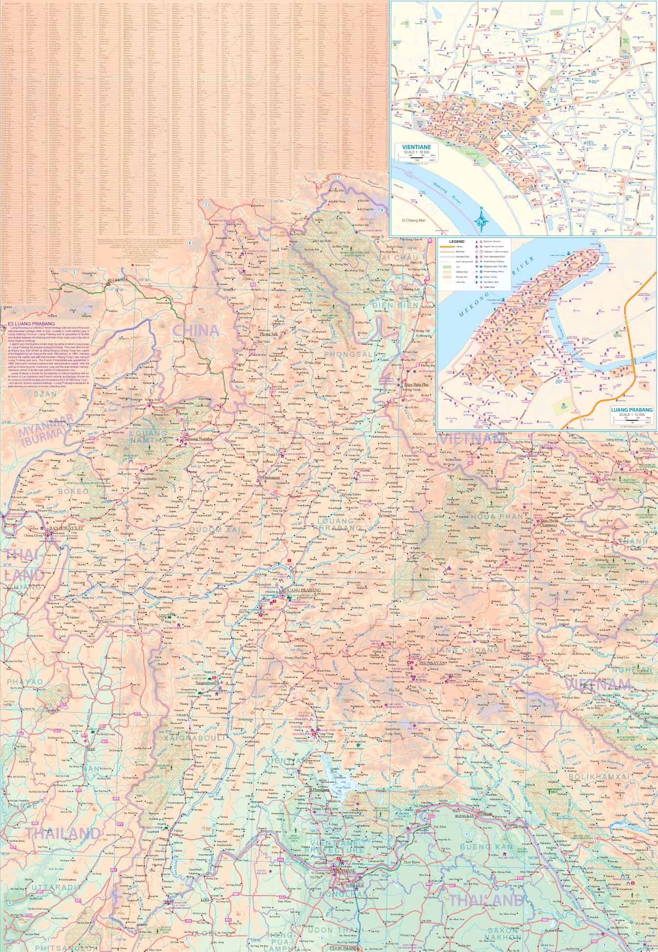
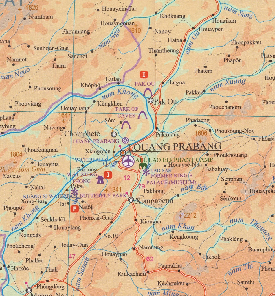
Covering the entire country from the northern highlands of Luang Namtha and Phongsali to the lush southern reaches of Champasak and the Bolaven Plateau, this map is ideal for travellers seeking an authentic and immersive experience in one of Asia’s most captivating nations.
📌 Coverage & Map Features
| Feature | Description |
|---|---|
| Double-Sided Design | North Laos on one side; Southern Laos on the reverse for maximum detail without clutter |
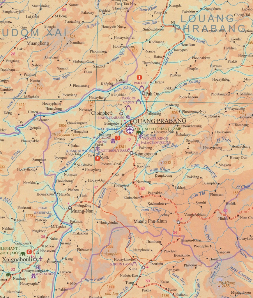
| Inset City Maps | Includes clearly detailed street maps of Luang Prabang and Vientiane, Laos’s cultural and administrative hubs |
| Scale | 1:750,000 – detailed enough for road-tripping, planning, and identifying key terrain |
| Relief Shading | Elevation and topography are illustrated with shaded relief, enhancing understanding of Laos’s mountainous terrain |
| Road Network | Shows major highways, provincial roads, rural routes, and unpaved tracks, as well as ferry crossings and border checkpoints |
| Tourist Sites & Services | Highlights national parks, Buddhist temples, heritage zones, caves, viewpoints, and guesthouses |
| Hydrography | Major rivers such as the Mekong, Nam Ou, and Nam Theun are clearly labelled for orientation and route planning |
| Comprehensive Index | Extensive place name index included for easy reference |
🧭 Why Choose This Map?
Laos is a land of rugged mountains, river valleys, and tranquil rural life — and exploring it without a proper map can be a challenge. This ITMB map helps you:
-
Find your way to hidden waterfalls, historic temples, and off-grid eco-lodges
-
Navigate overland from Thailand or Vietnam
-
Explore trekking areas such as the Nam Ha National Protected Area or the Plain of Jars
It’s a must-have companion for anyone venturing beyond the tourist hotspots.
🖼️ Laminated Wall Map Option
Upgrade to the laminated version and enjoy the benefits of a display-quality wall map:
-
✅ Fully encapsulated in 80-micron gloss laminate
-
✅ Ready to hang on a wall, pinboard, or display stand
-
✅ Ideal for schools, NGOs, aid organisations, and home study
-
✅ Write-on/wipe-off surface: Use whiteboard markers for trip planning or education
-
✅ Highly durable and tear-resistant – perfect for repeated use in the field or office
Note: The map is originally folded but is professionally flattened before lamination. Faint fold lines may remain.
🌍 Who Is This Map For?
-
Adventure Travellers: Trekking, motorbiking, or slow-travelling through Laos? This map helps you venture confidently off the beaten path.
-
Teachers & Students: A great visual aid for geography, Southeast Asian studies, or cultural history lessons.
-
Field Workers & NGOs: Navigate remote areas, track development regions, or display key zones in your field office.
-
Map Enthusiasts: Add a rare, detailed map of Laos to your collection.
📏 Map Specifications
| Specification | Details |
|---|---|
| Publisher | ITMB (International Travel Maps) |
| Format | Folded paper map (optional lamination available) |
| Scale | 1:750,000 |
| Size (unfolded) | 690 mm x 1000 mm |
| Inset Maps | Luang Prabang, Vientiane |
| Lamination | 80-micron gloss (optional) |
| Language | English place names with local variants |
Explore Laos with clarity, confidence, and curiosity.
This map is your key to unlocking one of Asia's most compelling destinations — from the misty mountains of the north to the sleepy river towns of the south.


