- Australia ▾
- Topographic
▾
- Australia AUSTopo 250k (2024)
- Australia 50k Geoscience maps
- Australia 100k Geoscience maps
- Australia 250k Geoscience maps
- Australia 1.1m Geoscience maps
- New Zealand 50k maps
- New Zealand 250k maps
- New South Wales 25k maps
- New South Wales 50k maps
- New South Wales 100k maps
- Queensland 10k maps
- Queensland 25k maps
- Queensland 50k maps
- Queensland 100k maps
- Compasses
- Software
- GPS Systems
- Orienteering
- International ▾
- Wall Maps
▾
- World
- Australia & New Zealand
- Countries, Continents & Regions
- Historical
- Vintage National Geographic
- Australian Capital Territory
- New South Wales
- Northern Territory
- Queensland
- South Australia
- Tasmania
- Victoria
- Western Australia
- Celestial
- Children's
- Mining & Resources
- Wine Maps
- Healthcare
- Postcode Maps
- Electoral Maps
- Nautical ▾
- Flags
▾
- Australian Flag Sets & Banners
- Flag Bunting
- Handwavers
- Australian National Flags
- Aboriginal Flags
- Torres Strait Islander Flags
- International Flags
- Flagpoles & Accessories
- Australian Capital Territory Flags
- New South Wales Flags
- Northern Territory Flags
- Queensland Flags
- South Australia Flags
- Tasmania Flags
- Victoria Flags
- Western Australia Flags
- Gifts ▾
- Globes ▾
Dear valued customer. Please note that our checkout is not supported by old browsers. Please use a recent browser to access all checkout capabilities
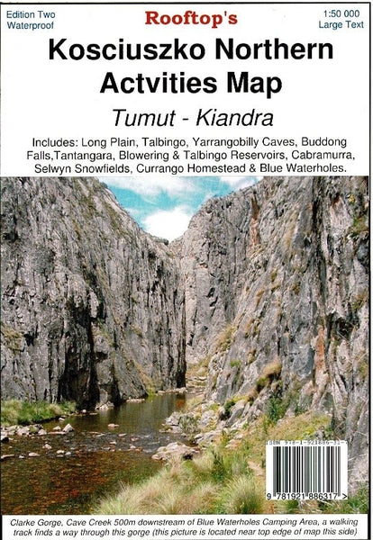
Kosciuszko Northern Activities Map Rooftop
$14.95 $15.95
Afterpay is only available for orders between $50.00 and $1000.00 More info
Explore the high country of northern Kosciuszko National Park with confidence and clarity.
The Kosciuszko Northern Activities Map by Rooftop Maps is a highly detailed, adventure-ready topographic map covering the stunning alpine and subalpine landscapes of northern Kosciuszko National Park. With a scale of 1:50,000, it offers exceptional accuracy for bushwalking, 4WD touring, camping, and backcountry exploration.
Extensively field-checked between 2008 and 2010, this map provides reliable and practical information across one of the most scenic and historically rich regions of the Snowy Mountains.
🗺️ Coverage Area
This map covers the vast and varied terrain from Kiandra to Tumut, including key alpine destinations and outdoor activity hubs:
-
Talbingo & Blowering Reservoirs
-
Tantangara Reservoir
-
Long Plain & Currango Homestead
-
Blue Waterholes & Yarrangobilly Caves
-
Buddong Falls & Selwyn Snowfields
-
Cabramurra & surrounding huts and heritage sites
🧭 Map Features
-
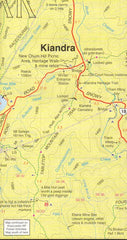
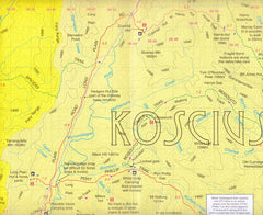
✅ Topographic contours for precise terrain understanding
-
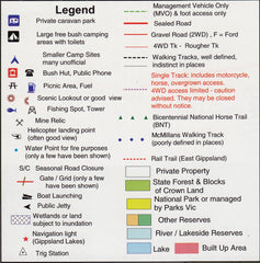
✅ Roads and 4WD tracks with conditions clearly marked
-
✅ Walking tracks including alpine trails and riverside routes
-
✅ Watercourses, rivers, and reservoirs
-
✅ Bush huts, campgrounds, and historic homesteads
-
✅ Fully field-verified mapping, ensuring accuracy in even remote areas
This map is ideal for planning multi-day bushwalks, day hikes, fishing trips, mountain biking, or 4WD journeys in the Snowy Mountains' less-travelled northern reaches.
🧴 Optional Laminated Finish
We offer a professional laminated version of this map, enhancing its durability and usability:
-
✅ Write on/wipe off surface for use with whiteboard markers
-
✅ Apply and remove map dots without damaging the surface
-
✅ Fully encapsulated in 80-micron gloss laminate for protection against moisture, dust, and tears
-
✅ Perfect for use in the field, on dashboards, or in planning areas
Note: This laminated version is produced by flattening a folded map, so minor fold lines may still be visible.
📐 Specifications
| Feature | Detail |
|---|---|
| Map Title | Kosciuszko Northern Activities Map |
| Publisher | Rooftop Maps |
| Scale | 1:50,000 |
| Dimensions | 750 mm × 1050 mm (unfolded) |
| Coverage Area | Kiandra to Tumut & surrounding alpine regions |
| Material | High-quality paper or laminated option |
| Verified | Field-checked from 2008–2010 |
🏕️ Ideal For:
-
Bushwalkers and hikers
-
4WD adventurers and campers
-
Alpine explorers and anglers
-
National parks visitors and outdoor educators
-
Travellers seeking off-the-beaten-track destinations in Kosciuszko National Park
🛒 Ordering & Delivery
-
✅ In stock and ready to ship
-
📦 Ships rolled in a protective mailing tube (flat version)
-
🚚 Fast Australia-wide and international shipping options available
-
🎁 Suitable for outdoor gear shops, park visitor centres, and bushwalking clubs
Navigate Australia’s alpine north with precision and peace of mind.
The Kosciuszko Northern Activities Map by Rooftop Maps is a rugged, reliable, and richly detailed tool—perfect for those who prefer paper maps they can trust when phone signals fade.


