- Australia ▾
- Topographic
▾
- Australia AUSTopo 250k (2024)
- Australia 50k Geoscience maps
- Australia 100k Geoscience maps
- Australia 250k Geoscience maps
- Australia 1.1m Geoscience maps
- New Zealand 50k maps
- New Zealand 250k maps
- New South Wales 25k maps
- New South Wales 50k maps
- New South Wales 100k maps
- Queensland 10k maps
- Queensland 25k maps
- Queensland 50k maps
- Queensland 100k maps
- Compasses
- Software
- GPS Systems
- Orienteering
- International ▾
- Wall Maps
▾
- World
- Australia & New Zealand
- Countries, Continents & Regions
- Historical
- Vintage National Geographic
- Australian Capital Territory
- New South Wales
- Northern Territory
- Queensland
- South Australia
- Tasmania
- Victoria
- Western Australia
- Celestial
- Children's
- Mining & Resources
- Wine Maps
- Healthcare
- Postcode Maps
- Electoral Maps
- Nautical ▾
- Flags
▾
- Australian Flag Sets & Banners
- Flag Bunting
- Handwavers
- Australian National Flags
- Aboriginal Flags
- Torres Strait Islander Flags
- International Flags
- Flagpoles & Accessories
- Australian Capital Territory Flags
- New South Wales Flags
- Northern Territory Flags
- Queensland Flags
- South Australia Flags
- Tasmania Flags
- Victoria Flags
- Western Australia Flags
- Gifts ▾
- Globes ▾
Dear valued customer. Please note that our checkout is not supported by old browsers. Please use a recent browser to access all checkout capabilities


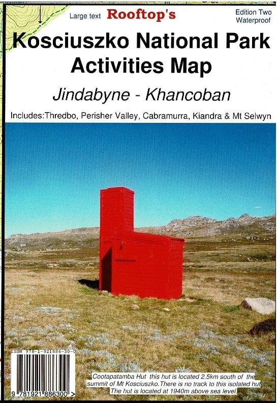
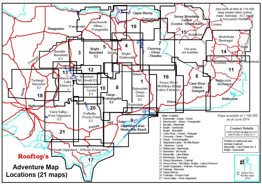
Kosciuszko National Park Forest Activities Map Jindabyne - Khancoban Rooftop
$14.95 $15.95
Afterpay is only available for orders between $50.00 and $1000.00 More info
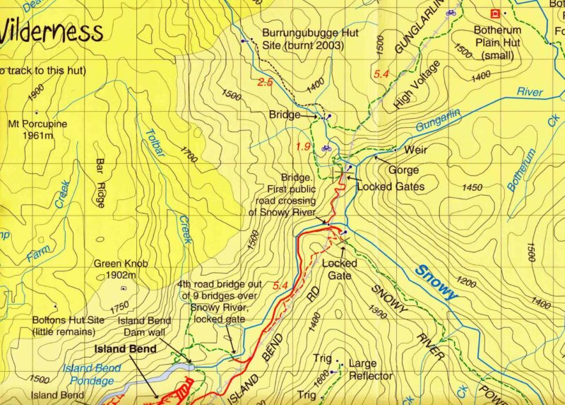
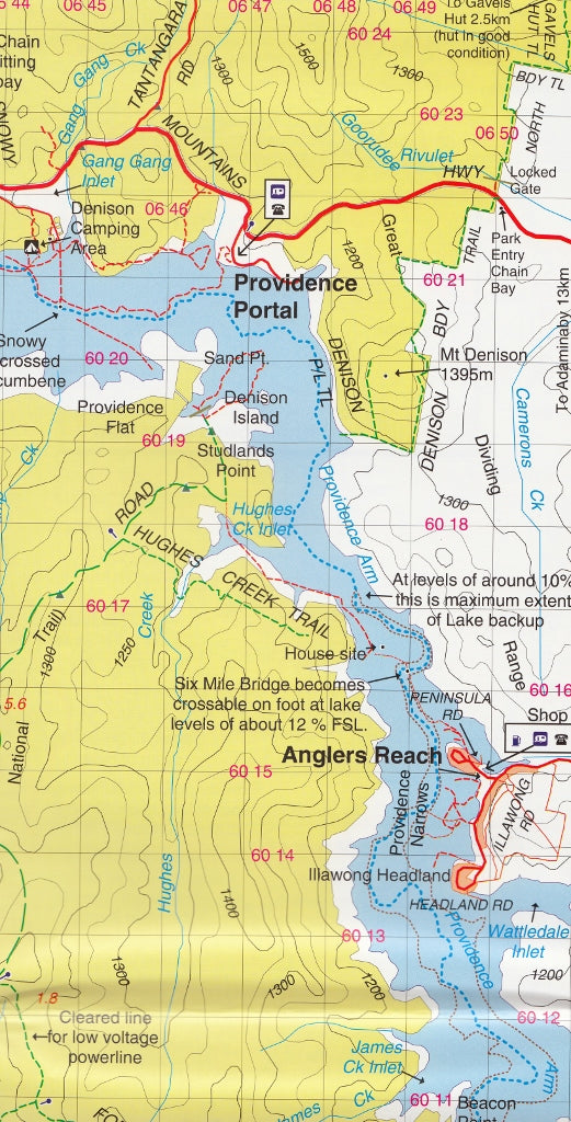
Explore the spectacular alpine wilderness of New South Wales with the Rooftop Kosciuszko National Park Activities Map—your essential guide to one of Australia’s most iconic national parks.
Whether you're planning a day hike, multi-day trek, 4WD adventure, or just want to uncover the hidden huts and historic routes of the Snowy Mountains, this high-detail topographic map offers exceptional coverage, clarity, and rugged performance in all conditions.
🗺️ Coverage Includes:
This map covers a vast area across the Kosciuszko alpine region, featuring popular towns, snowfields, and remote wilderness zones, including:
-
Thredbo
-
Perisher Valley
-
Charlotte Pass
-
Guthega
-
Tom Groggin
-
Geehi
-
Cabramurra
-
Selwyn Snowfields
-
Kiandra
-
Khancoban
-
Jagungal Wilderness
-
Jindabyne and more
Ideal for bushwalkers, skiers, climbers, cyclists, photographers, and anyone seeking to navigate the region with confidence and precision.
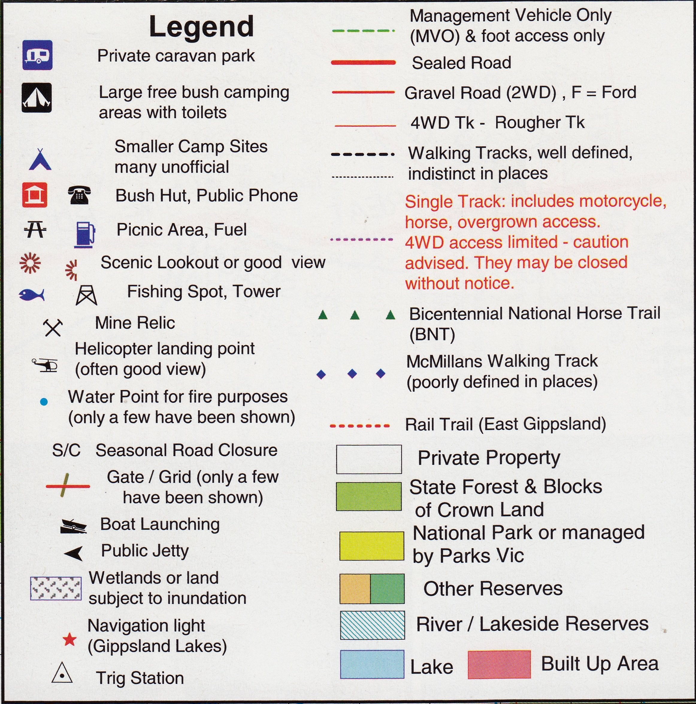
🔍 Map Features:
-
🛣️ Roads & 4WD Tracks – Includes all navigable roads and unsealed vehicle tracks
-
🥾 Walking & Hiking Trails – Clearly marked trails, from short alpine walks to multi-day wilderness routes
-
🌊 Rivers & Watercourses – All major waterways, creeks, and alpine lakes included
-
🛖 Historic Bush Huts – Pinpoint locations of remote alpine huts, perfect for rest stops or heritage visits
-
🗻 Contour Lines – Topographic detail with contours for elevation and gradient awareness
💧 Waterproof & Adventure-Ready
Printed on durable, waterproof material, this map is built to withstand alpine weather, wet conditions, and rough handling—ideal for use in snowfields, riverside trails, or high-country terrain.
It’s tear-resistant, stain-resistant, and folds easily into your backpack, glovebox, or daypack without damage.
🖊️ Optional Lamination Available
We offer this map laminated on request, providing additional benefits for active use:
-
✍️ Use with whiteboard markers – Plan routes, take notes, and wipe clean when done
-
📍 Apply removable map dots to mark campsites, trailheads, or key lookouts
-
🛡️ Added durability – Extra protection from dirt, creases, and spills
Laminated maps are shipped rolled in a tube, ready for use or display.
📐 Map Details:
| Attribute | Description |
|---|---|
| Scale | 1:50,000 – highly detailed |
| Edition | 2nd |
| Published | 2022 |
| Material | Waterproof topographic paper |
| Optional Finish | Laminated (rolled) or standard folded |
| Publisher | Rooftop Maps Australia |
🧭 Ideal For:
-
Hikers & trekkers exploring Kosciuszko’s high country
-
Cross-country skiers & alpine adventurers
-
Bush campers & 4WD tourers
-
Trail runners and cyclists
-
Landscape photographers and wildlife spotters
-
Outdoor educators and national park visitors
🏞️ Navigate the Snowy Mountains Like a Local
Whether you’re tracing the Snowy River, climbing toward Mount Jagungal, or simply escaping into the vast Jagungal Wilderness, this Rooftop map is the most trusted companion you can carry. It combines the accuracy of topographic detail with the practicality of outdoor-ready construction.
Add it to your kit today and get ready to explore the hidden treasures of Kosciuszko National Park with confidence, clarity, and durability.


