- Australia ▾
- Topographic
▾
- Australia AUSTopo 250k (2024)
- Australia 50k Geoscience maps
- Australia 100k Geoscience maps
- Australia 250k Geoscience maps
- Australia 1.1m Geoscience maps
- New Zealand 50k maps
- New Zealand 250k maps
- New South Wales 25k maps
- New South Wales 50k maps
- New South Wales 100k maps
- Queensland 10k maps
- Queensland 25k maps
- Queensland 50k maps
- Queensland 100k maps
- Compasses
- Software
- GPS Systems
- Orienteering
- International ▾
- Wall Maps
▾
- World
- Australia & New Zealand
- Countries, Continents & Regions
- Historical
- Vintage National Geographic
- Australian Capital Territory
- New South Wales
- Northern Territory
- Queensland
- South Australia
- Tasmania
- Victoria
- Western Australia
- Celestial
- Children's
- Mining & Resources
- Wine Maps
- Healthcare
- Postcode Maps
- Electoral Maps
- Nautical ▾
- Flags
▾
- Australian Flag Sets & Banners
- Flag Bunting
- Handwavers
- Australian National Flags
- Aboriginal Flags
- Torres Strait Islander Flags
- International Flags
- Flagpoles & Accessories
- Australian Capital Territory Flags
- New South Wales Flags
- Northern Territory Flags
- Queensland Flags
- South Australia Flags
- Tasmania Flags
- Victoria Flags
- Western Australia Flags
- Gifts ▾
- Globes ▾
Dear valued customer. Please note that our checkout is not supported by old browsers. Please use a recent browser to access all checkout capabilities


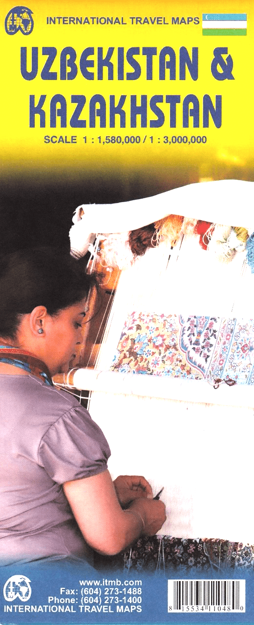
Uzbekistan & Kazakhstan ITMB Map
Sold Out
Afterpay is only available for orders between $50.00 and $1000.00 More info
Double-Sided | Waterproof Paper | Updated Edition
Explore the heart of Central Asia with this comprehensive double-sided map of Uzbekistan and Kazakhstan by ITMB (International Travel Maps). Covering two of the most fascinating and culturally rich countries of the former Soviet Union, this updated edition brings clarity, accuracy, and detailed cartography to a complex and rapidly evolving region.
🗺️ What's Inside:
-
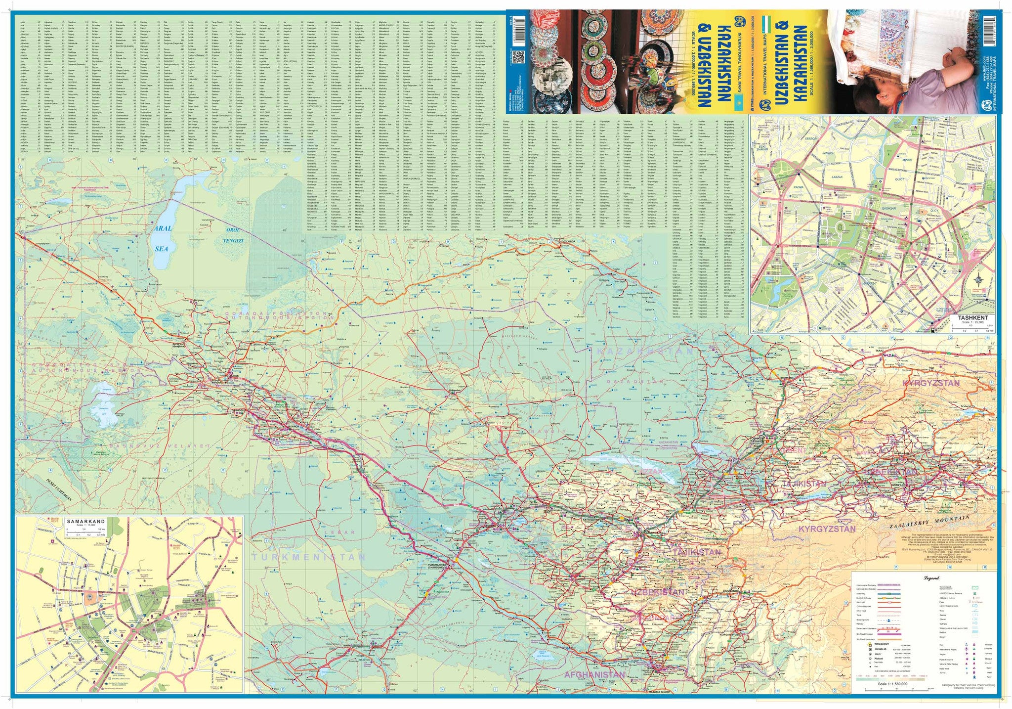
Uzbekistan Map – Side A
Discover the fabled Silk Road cities of Samarkand, Bukhara, Tashkent, and Khiva—along with road networks, topography, and borders. Updated city names reflect modern usage post-independence, correcting decades of Soviet-era Russification. Tourist attractions and key transport corridors are clearly marked. -
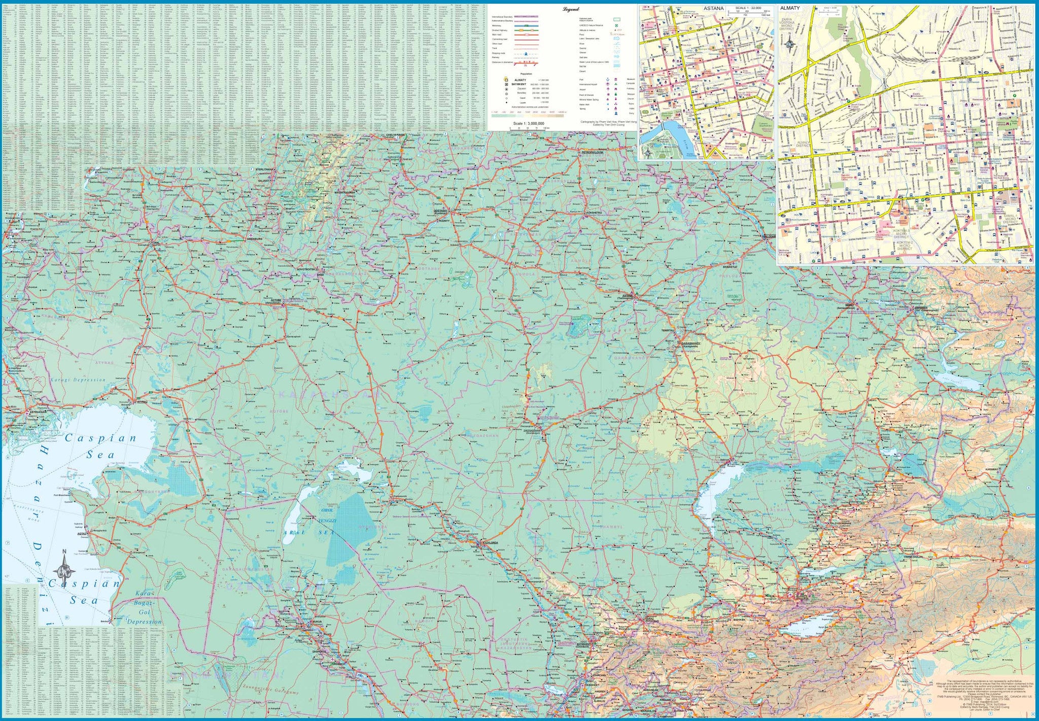
Kazakhstan Map – Side B
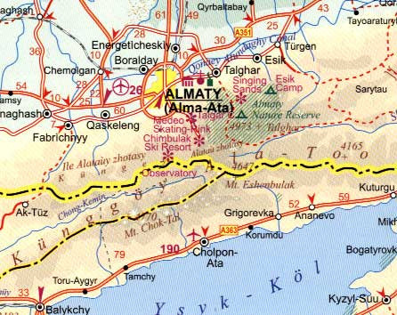
Covering the vast steppes and dynamic urban hubs like Almaty, Astana (Nur-Sultan), and Shymkent, this side features major highways, border crossings, rail lines, national parks, and points of interest from the Caspian Sea to the Tian Shan mountains. -
Place Names & Toponyms
Names have been carefully reviewed to reflect current usage while also respecting regional linguistic differences—essential for travellers navigating signage, local maps, or GPS apps.
✅ Key Features:
| Feature | Description |
|---|---|
| Double-Sided Map | Kazakhstan on one side, Uzbekistan on the reverse |
| Updated Place Names | Reflects modern post-Soviet names and boundaries |
| Road & Rail Networks | Major and minor roads, border crossings, and train lines |
| Topographic Detail | Elevation shading, rivers, lakes, deserts, and national parks |
| Tourist Highlights | Key historical and cultural attractions clearly marked |
| Waterproof & Tear-Resistant | Printed on durable synthetic paper |
| Laminated Option Available | Draw with whiteboard markers or apply map dots without damage |
📐 Specifications:
| Attribute | Detail |
|---|---|
| Publisher | ITMB – International Travel Maps |
| Edition | Latest edition (fully updated) |
| Map Coverage | Kazakhstan (Side A), Uzbekistan (Side B) |
| Scale | 1:1,580,000 (Uzbekistan) / 1:3,000,000 (Kazakhstan) |
| Map Size | 690 mm (W) x 1000 mm (H) |
| Paper | Waterproof, tear-resistant |
| Laminated Version | Available (80-micron gloss laminate) |
🎒 Perfect For:
-
Overland travellers and Silk Road adventurers
-
Cultural historians exploring ancient trade routes
-
Independent travellers navigating between Central Asian capitals
-
Business visitors working in emerging Eurasian economies
-
Academic or library collections needing accurate political boundaries
🖊️ Why Choose the Laminated Option?
For those who want to mark their travels, plot future journeys, or use the map in the field, we offer a laminated version. Encapsulated in crystal-clear 80-micron laminate, it's ideal for:
-
Use with whiteboard markers
-
Highlighting routes with our Map Dots
-
Protection against tears, dust, and stains
-
Long-term wall display or practical reference
(Note: Laminated maps are produced from the flattened version of the folded map, so minor crease lines may still be visible.)
This map is more than a navigational tool—it's a gateway to a region where history, geopolitics, and natural wonder meet. Two countries. One map. Countless discoveries.


