- Australia ▾
- Topographic
▾
- Australia AUSTopo 250k (2024)
- Australia 50k Geoscience maps
- Australia 100k Geoscience maps
- Australia 250k Geoscience maps
- Australia 1.1m Geoscience maps
- New Zealand 50k maps
- New Zealand 250k maps
- New South Wales 25k maps
- New South Wales 50k maps
- New South Wales 100k maps
- Queensland 10k maps
- Queensland 25k maps
- Queensland 50k maps
- Queensland 100k maps
- Compasses
- Software
- GPS Systems
- Orienteering
- International ▾
- Wall Maps
▾
- World
- Australia & New Zealand
- Countries, Continents & Regions
- Historical
- Vintage National Geographic
- Australian Capital Territory
- New South Wales
- Northern Territory
- Queensland
- South Australia
- Tasmania
- Victoria
- Western Australia
- Celestial
- Children's
- Mining & Resources
- Wine Maps
- Healthcare
- Postcode Maps
- Electoral Maps
- Nautical ▾
- Flags
▾
- Australian Flag Sets & Banners
- Flag Bunting
- Handwavers
- Australian National Flags
- Aboriginal Flags
- Torres Strait Islander Flags
- International Flags
- Flagpoles & Accessories
- Australian Capital Territory Flags
- New South Wales Flags
- Northern Territory Flags
- Queensland Flags
- South Australia Flags
- Tasmania Flags
- Victoria Flags
- Western Australia Flags
- Gifts ▾
- Globes ▾
Dear valued customer. Please note that our checkout is not supported by old browsers. Please use a recent browser to access all checkout capabilities


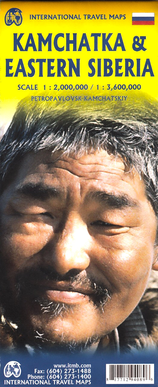
Kamchatka & Eastern Siberia ITMB Map
$24.95
Afterpay is only available for orders between $50.00 and $1000.00 More info
Double-Sided | Folded | Optional Lamination | Scale: 1:3,600,000 / 1:200,000,000 | Size: 690 x 1000 mm
Explore one of the most remote and captivating corners of the globe with this Kamchatka & Eastern Siberia map by International Travel Maps (ITMB). This double-sided map covers the dramatic volcanic wilderness of the Kamchatka Peninsula and the sweeping, seldom-mapped terrain of Eastern Siberia, including portions of the Russian Far East Republic. It's an essential tool for adventurers, scientists, researchers, and explorers looking to venture off the beaten path.
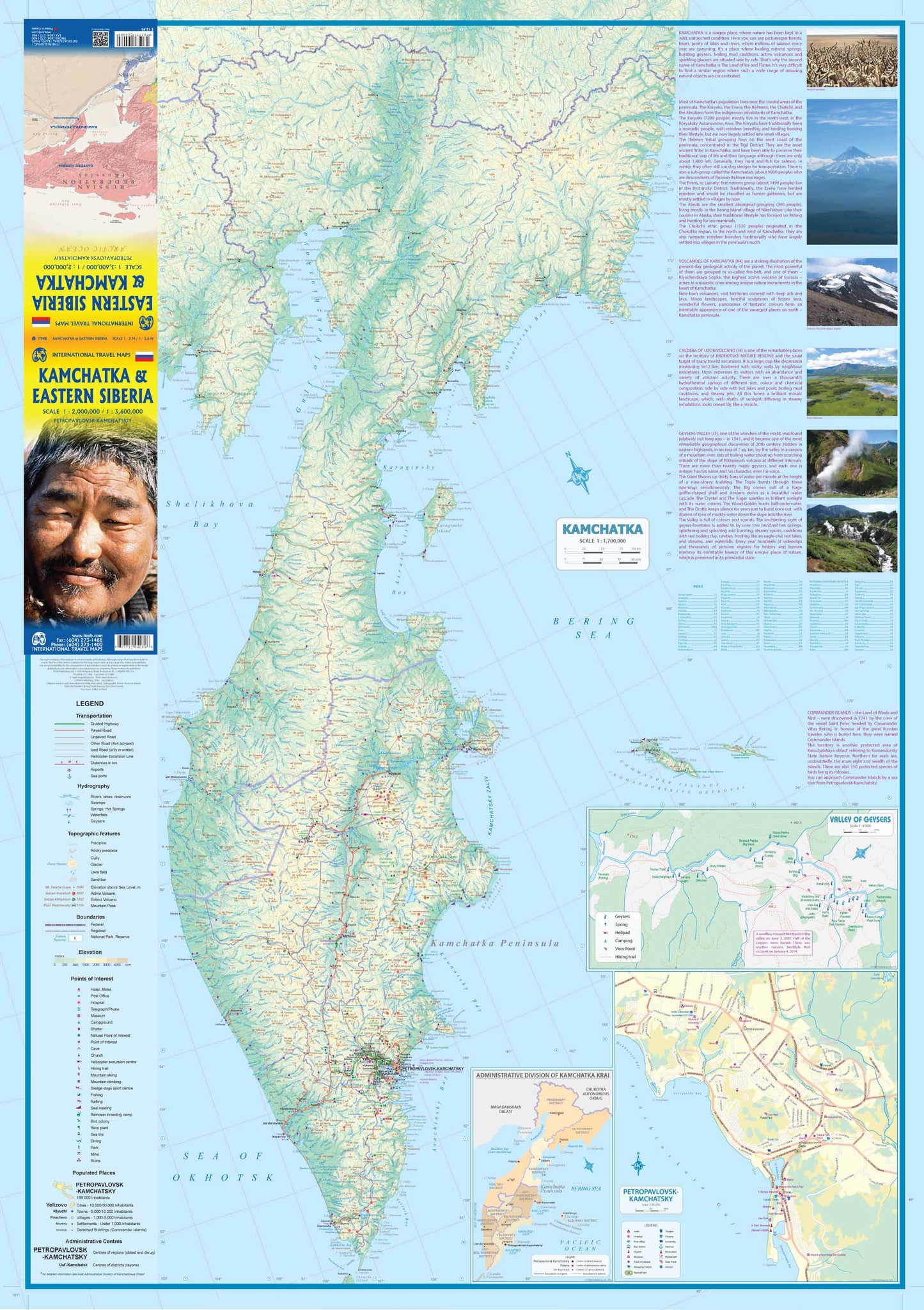
🏔️ Side A: Kamchatka Peninsula – Land of Fire and Ice
Kamchatka is Russia’s wild east—famed for its remote wilderness, geothermal geysers, volcanic peaks, and rugged coastline along the Sea of Okhotsk. This side of the map covers:
-
🌋 Volcanic landscapes and the Valley of Geysers
-
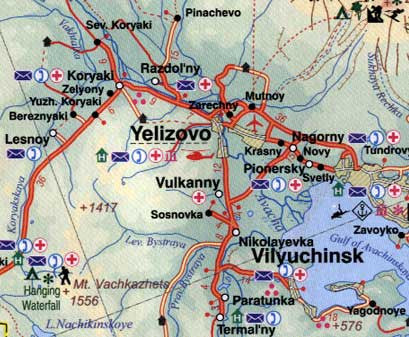
🏙️ Inset map of Petropavlovsk-Kamchatsky, the capital and gateway to the peninsula
-
🧭 Remote towns including Esso, Klyuchi, and others across this largely untouched terrain
-
🏞️ National parks, wildlife reserves, mountain ranges, rivers, and lakes
-
🚗 Road connections and access routes for overland travel
Whether you're planning a wilderness trek, a nature photography expedition, or simply exploring the edges of Russia’s geographic imagination, this section is a rare and valuable cartographic resource.
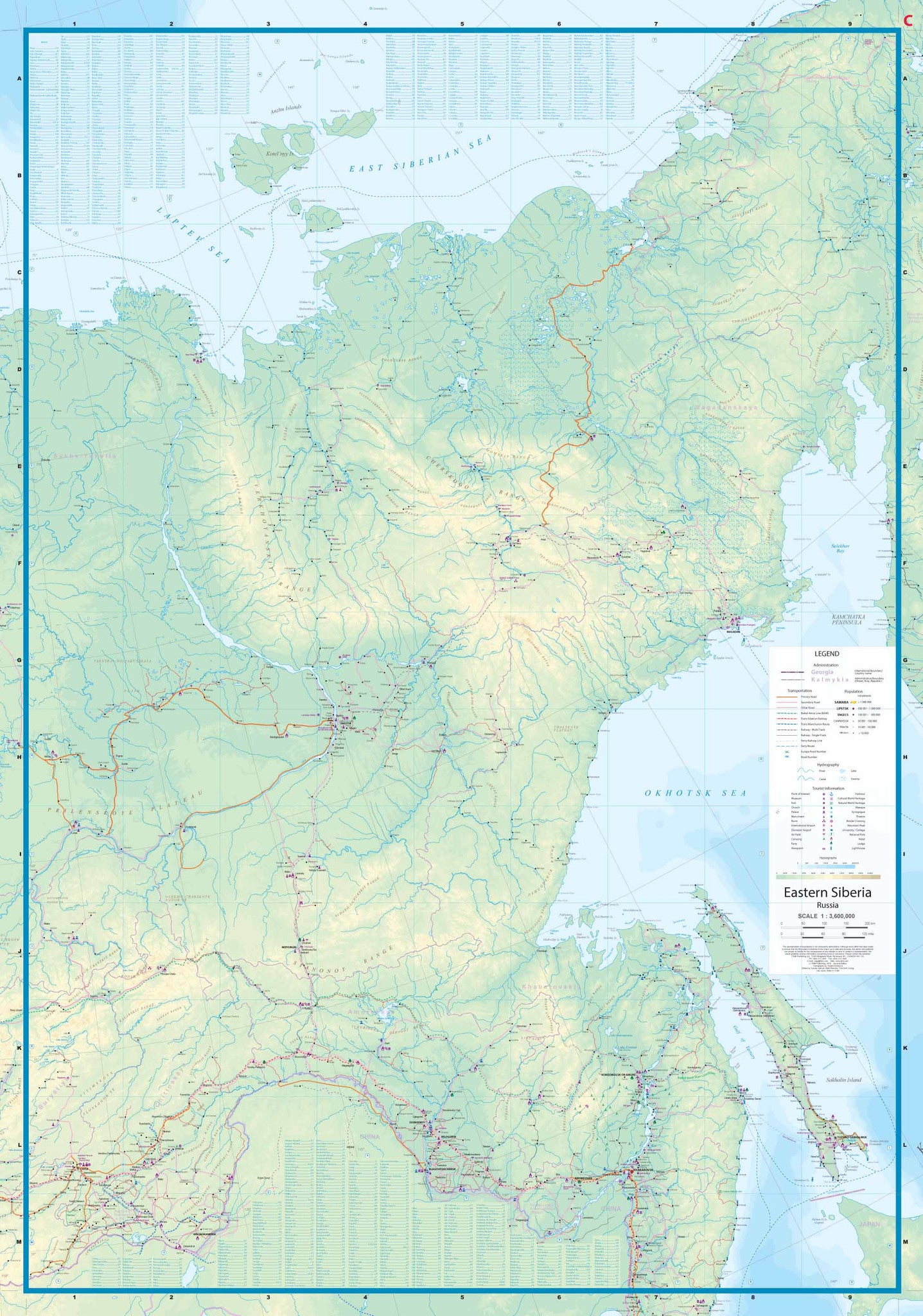
❄️ Side B: Eastern Siberia & The Russian Far East
The reverse side features an expansive regional map stretching from Sakhalin Island in the east across the Sea of Okhotsk to the Arctic reaches of the East Siberian Sea, and westward to the Lena River—one of Siberia’s great waterways.
Key features include:
-
🚂 Trans-Siberian Railway routes west toward Moscow, and branching links to Mongolia and China
-
🚧 Remote infrastructure: airstrips, coastal access roads, and isolated border towns
-
🏕️ Locations of campsites, accommodation hubs, and small settlements
-
🌊 Oceanic geography including bays, straits, and island groups
-
🧭 Extreme northern coordinates offering a glimpse into the Arctic frontier
This vast and rarely visited area is ideal for those interested in polar exploration, ecological research, or extreme adventure tourism. Whether you're mapping an expedition or studying the evolving geography of Siberia’s remote corners, this map offers essential orientation.
📍 Map Features
-
✅ Double-sided full-colour design with region-specific detail
-
✅ Inset maps for Petropavlovsk-Kamchatsky and the Valley of Geysers
-
✅ Shaded relief to indicate topography and elevation
-
✅ Clearly marked roads, railways, and airstrips
-
✅ Border crossings and international connections
-
✅ Place name index and key landmarks
💧 Optional Lamination Available
Upgrade to a laminated version for enhanced durability:
-
✏️ Write-on/wipe-off surface – Use with whiteboard markers for planning
-
💦 Waterproof and tear-resistant – Excellent for fieldwork and rugged use
-
💪 Encapsulated with 80-micron laminate – Long-lasting and travel-ready
Note: Laminated maps are created by flattening the original folded version before encapsulating in gloss laminate. Some original fold lines may still be visible.
📐 Specifications
| Feature | Details |
|---|---|
| Title | Kamchatka & Eastern Siberia Travel Map |
| Publisher | ITMB – International Travel Maps |
| Scales | 1:3,600,000 (Kamchatka) / 1:200,000,000 (Eastern Siberia) |
| Size | 690 mm x 1000 mm |
| Format | Folded paper map (laminated option available) |
| Double-sided, full colour |
🎯 Who’s It For?
-
🧭 Adventure travellers exploring remote Russia
-
🔬 Geologists, researchers, and environmentalists
-
🎒 Expedition planners and off-grid overlanders
-
🗺️ Map collectors and enthusiasts of rare regions
-
📚 Educators and students studying polar and Siberian geography
Whether you're tracing seismic hotspots, searching for reindeer herders, or dreaming of untouched wilderness, the Kamchatka & Eastern Siberia ITMB Map will inspire and guide your next adventure into the farthest frontiers of Russia.


