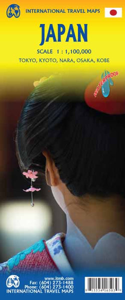
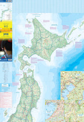
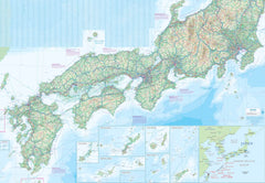
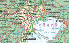
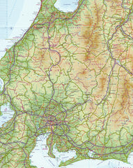
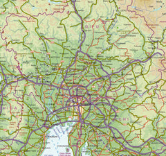
An essential, up-to-date map of Japan featuring extensive road, rail, and ferry networks—now available laminated for extra durability.
Japan is one of the most remarkable travel destinations in the world, and this highly detailed map from ITMB makes navigating the Land of the Rising Sun easy and intuitive. Frequently updated and immensely popular, the Japan Travel Map remains a reliable go-to for travellers, educators, and map collectors alike.
This edition has been completely revised to reflect recent infrastructure developments across the country—including ongoing enhancements to Japan’s Shinkansen (bullet train) network, and major upgrades to the expressway and motorway system. With so much happening in Japan’s transport and tourism sectors, it’s an ideal time to update your reference materials with this clear, practical and beautifully printed map.
🗺️ Coverage & Content
The map offers comprehensive national coverage at a practical touring scale of 1:1,000,000, making it easy to plan travel routes or study the country’s geography in detail.
-
Side A: Covers Honshu (Japan’s main island), as well as Kyushu and Shikoku, including all major cities such as Tokyo, Kyoto, Osaka, Hiroshima, Fukuoka, and Sendai
-
Side B: Covers Hokkaido, Okinawa, and the Ryukyu Islands, along with ferry connections and island airports
-
Detailed inset maps of Tokyo and Osaka for urban navigation
-
Markings for:
-
National highways and regional roads
-
Railways and Shinkansen lines
-
Ferry routes between islands
-
International and domestic airports
-
UNESCO World Heritage Sites
-
National parks and reserves
-
Tourist attractions, temples, onsen, ski resorts, and historic landmarks
-
Ideal for long-term planners or travellers making their way through multiple prefectures, this map provides a clear snapshot of Japan’s geography, making it easier to appreciate the country’s topography, regional divisions, and cultural hotspots.
💧 Waterproof & Tear-Resistant
The map is printed on durable synthetic ITM plastic paper, making it:
-
Waterproof
-
Tear-resistant
-
Lightweight and travel-friendly
It’s well suited to outdoor use or for carrying in a backpack or glovebox during your journey—whether you're island-hopping, train-travelling, or road-tripping across Japan.
🧴 Optional Lamination
We also offer a laminated version, ideal for those who want an extra layer of protection and flexibility. Laminated maps are:
-
Encapsulated between two sheets of 80-micron gloss laminate, front and back
-
Whiteboard-marker compatible, allowing you to draw routes or take notes
-
Map-Dot compatible – use our removable Mark-It-Dots to highlight places visited or planned
-
Wipe-clean surface resists spills, stains, and damage
📌 Note: As this is laminated from a previously folded map, some minor crease lines may still be visible. These do not affect the usability or durability of the map.
📐 Specifications
-
Scale: 1:1,000,000
-
Unfolded Size: 690 mm (W) × 1000 mm (H)
-
Folded Size: Approx. 140 mm × 250 mm
-
Edition: Latest available from ITMB
-
Publisher: International Travel Maps (Canada)
-
Material: Synthetic plastic (non-tear)
-
Laminated by: Mapworld, using archival-quality gloss laminate
-
Printed in: Canada
-
Made for: Global travellers, educators, and cartography enthusiasts
🛒 Purchasing Options
-
Standard Folded Synthetic Map – $24.95
-
Flat Laminated Map – $45.00
-
Rolled for shipping in a protective tube
-
Ideal for pinning, display, or frequent handling
-
🎯 Perfect For
-
Travellers and tour organisers planning regional or national trips across Japan
-
Students and language learners studying Japanese geography or place names
-
Cultural institutions and embassies needing a clear national reference
-
Map collectors looking to expand their collection with a modern, detailed edition
-
Educators teaching geography, cultural studies, or tourism
-
Fans of Japan looking for a beautifully printed and functional piece to hang or use
🌏 Discover Japan Your Way
Whether you're planning a whirlwind rail journey from Sapporo to Kagoshima, mapping out temples and shrines, or exploring the many island chains, this map is designed to support your experience.
Comprehensive, durable, and visually informative, the ITMB Japan Travel Map is the perfect way to bring your trip to life or bring Japan into your classroom or home.
From the bullet trains of Tokyo to the hot springs of Hokkaido, this map helps you follow every step of your journey—with clarity and confidence.


