- Australia ▾
- Topographic
▾
- Australia AUSTopo 250k (2025)
- Australia 50k Geoscience maps
- Australia 100k Geoscience maps
- Australia 250k Geoscience maps
- Australia 1:1m Geoscience maps
- New Zealand 50k maps
- New Zealand 250k maps
- New South Wales 25k maps
- New South Wales 50k maps
- New South Wales 100k maps
- Queensland 10k maps
- Queensland 25k maps
- Queensland 50k maps
- Queensland 100k maps
- Western Australia 25k maps
- Western Australia 50k maps
- Western Australia 100k maps
- Compasses
- Software
- GPS Systems
- International ▾
- Wall Maps
▾
- World
- Australia & New Zealand
- Countries, Continents & Regions
- Historical
- Vintage National Geographic
- Australian Capital Territory
- New South Wales
- Northern Territory
- Queensland
- South Australia
- Tasmania
- Victoria
- Western Australia
- Celestial
- Children's
- Mining & Resources
- Wine Maps
- Healthcare
- Postcode Maps
- Electoral Maps
- Nautical ▾
- Flags
▾
- Australian Flag Sets & Banners
- Flag Bunting
- Handwavers
- Australian National Flags
- Aboriginal Flags
- Torres Strait Islander Flags
- International Flags
- Flagpoles & Accessories
- Australian Capital Territory Flags
- New South Wales Flags
- Northern Territory Flags
- Queensland Flags
- South Australia Flags
- Tasmania Flags
- Victoria Flags
- Western Australia Flags
- Gifts ▾
- Globes ▾
Dear valued customer. Please note that our checkout is not supported by old browsers. Please use a recent browser to access all checkout capabilities


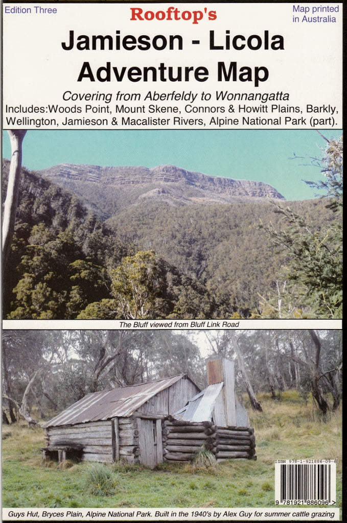
Jamieson - Licola Adventure Map Rooftop
$12.95 $14.95
Afterpay is only available for orders between $50.00 and $1000.00 More info
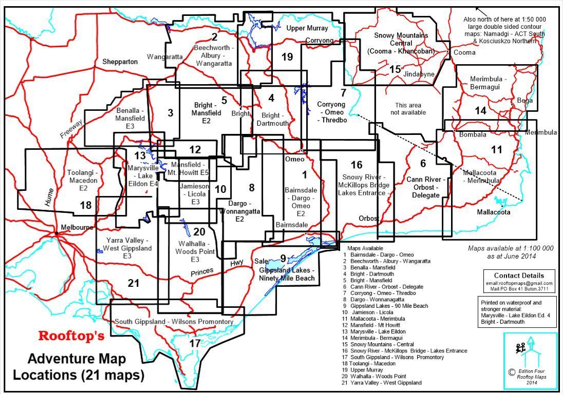
Navigate Victoria’s high country with precision and confidence using the 3rd Edition of the Jamieson–Licola Adventure Map by Rooftop Maps, one of Australia’s most respected producers of high-detail outdoor mapping. This map is an indispensable guide for 4WD adventurers, bushwalkers, anglers, campers, and anyone exploring the wild beauty of the Victorian Alps and alpine river systems.
🗺️ Comprehensive Coverage of Victoria’s Rugged Wilderness
This detailed touring and activities map spans a vast and rugged region from:
-
Goughs Bay, Jamieson and the Howqua River in the north
to -
Licola, Upper Thomson, and Aberfeldy in the south
Also included within the map area:
-
Woods Point & Mount Skene
-
Alpine National Park & Wellington Forest
-
Macalister and Thomson Rivers
-
Connors Plains & Howitt Plains
-
State forests, bush tracks & remote campsites
Whether you're traversing high plains, tackling remote 4WD tracks, or seeking a quiet riverbank to fish from, this map has the detail and accuracy to support your journey.
🔍 Two Scales for Maximum Clarity
-
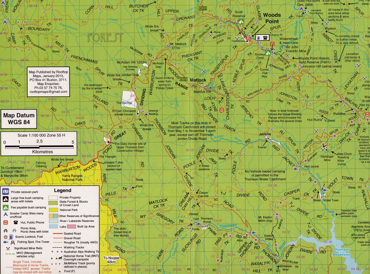
🗺️ Main Map – 1:100,000 scale: Ideal for broad navigation and overland travel
-
🧭 Inset Map (Reverse Side) – 1:50,000 scale: A focused enlargement titled “Sheepyard Flat – Caledonia Valley Forest Activities Map” providing extra detail for popular camping and hiking zones
-
🗻 Contours shown for both navigation and topographic awareness
🛣️ Road & Track Detail Mapped by GPS
Every road and track has been carefully surveyed using high-precision GPS mapping technology, offering unmatched accuracy for:
-
🚙 4WD routes and off-road tracks
-
🥾 Bushwalking and hiking paths
-
🚧 Difficult terrain and access roads
-
🪧 Tips and track-specific warnings throughout the map
-
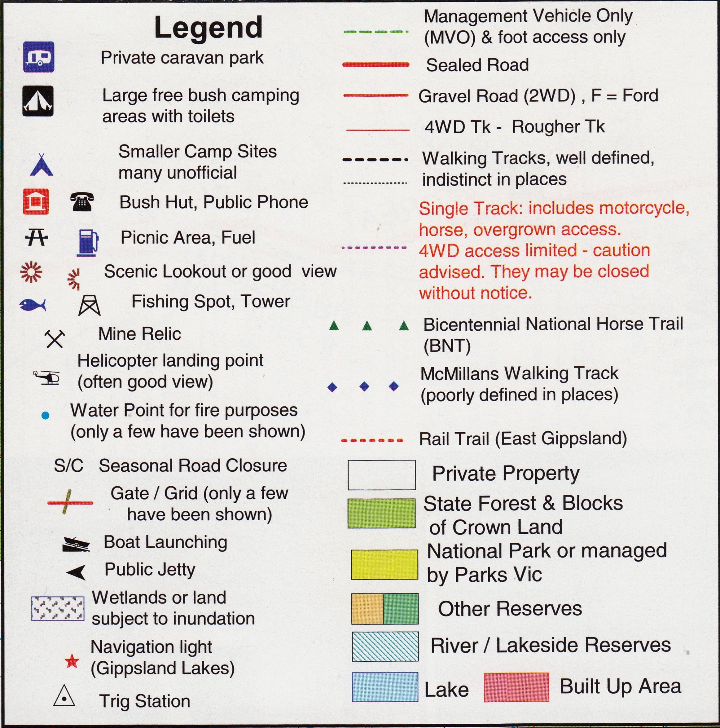
🏞️ Marked campsites, huts, lookouts, and points of interest
Whether you’re seeking fire trails, high-country huts, or secret swimming holes, you’ll find what you need.
🌲 Designed for the Outdoors
This map includes all parks, reserves, and state forests in the region, clearly marked and colour-coded for easy reference. It’s designed to be functional in all conditions—sun, snow, or sudden downpour.
🧭 Perfect for:
-
4WD & off-road enthusiasts
-
Hikers, campers & backcountry explorers
-
Fly fishers & river campers
-
Alpine hut spotters
-
Emergency and SES fieldwork teams
🧼 Optional Lamination Available
Upgrade to a laminated version for even greater durability:
-
✍️ Write on it with whiteboard markers—plan routes, leave notes, and wipe clean
-
📍 Use repositionable map dots to mark track starts, campsites, or meeting points
-
🛡️ Lamination protects against water, mud, UV damage, and tearing
-
📦 Ships rolled in a tube for easy storage or display
📐 Map Specifications:
| Feature | Description |
|---|---|
| Edition | 3rd Edition |
| Scale | 1:100,000 main / 1:50,000 inset |
| Size | 700 mm x 1000 mm |
| Publisher | Rooftop Maps Australia |
| Material | Premium topographic map paper or optional lamination |
| Printed In | Australia |
🏞️ Explore Victoria's Remote Alpine Regions
There are few maps as comprehensive and reliable as this for those tackling the vast alpine territory between Jamieson and Licola. Whether you’re planning a multi-day trek, scouting a new 4WD loop, or setting up camp beside the Howqua River, this map will become your most valuable tool.
Backed by Rooftop’s reputation for accuracy and attention to detail, the Jamieson–Licola Adventure Map is a must-have for anyone serious about exploring the Victorian high country.
Add it to your pack today and get ready to navigate one of Australia’s most rugged and rewarding wilderness areas—with clarity, confidence, and local expertise.
Frequently Asked Questions
Where can I buy the Jamieson - Licola Adventure Map Rooftop?
The Jamieson - Licola Adventure Map Rooftop is available to buy online from Mapworld, Australia's largest map and geographic product retailer, with fast shipping Australia-wide.
Is the Jamieson - Licola Adventure Map Rooftop in stock at Mapworld?
Mapworld maintains extensive stock across its map range and aims for fast dispatch. Orders placed before 2pm AEST on business days are typically dispatched the same day, with standard and express Australia-wide delivery options available.
What is Mapworld's returns policy?
Mapworld accepts returns on undamaged items in original condition. Contact Mapworld within 90 days of purchase to arrange a return or exchange.
Does Mapworld ship the Jamieson - Licola Adventure Map Rooftop across Australia?
Yes, Mapworld ships Australia-wide. Standard shipping is a flat $7 rate, with free standard shipping on orders over $75. Express options are available at checkout. Most orders placed before 2pm AEST on weekdays are dispatched same day.
Related Items


© 2026 Mapworld. Website designed by Genie Media
X