- Australia ▾
- Topographic
▾
- Australia AUSTopo 250k (2024)
- Australia 50k Geoscience maps
- Australia 100k Geoscience maps
- Australia 250k Geoscience maps
- Australia 1.1m Geoscience maps
- New Zealand 50k maps
- New Zealand 250k maps
- New South Wales 25k maps
- New South Wales 50k maps
- New South Wales 100k maps
- Queensland 10k maps
- Queensland 25k maps
- Queensland 50k maps
- Queensland 100k maps
- Compasses
- Software
- GPS Systems
- Orienteering
- International ▾
- Wall Maps
▾
- World
- Australia & New Zealand
- Countries, Continents & Regions
- Historical
- Vintage National Geographic
- Australian Capital Territory
- New South Wales
- Northern Territory
- Queensland
- South Australia
- Tasmania
- Victoria
- Western Australia
- Celestial
- Children's
- Mining & Resources
- Wine Maps
- Healthcare
- Postcode Maps
- Electoral Maps
- Nautical ▾
- Flags
▾
- Australian Flag Sets & Banners
- Flag Bunting
- Handwavers
- Australian National Flags
- Aboriginal Flags
- Torres Strait Islander Flags
- International Flags
- Flagpoles & Accessories
- Australian Capital Territory Flags
- New South Wales Flags
- Northern Territory Flags
- Queensland Flags
- South Australia Flags
- Tasmania Flags
- Victoria Flags
- Western Australia Flags
- Gifts ▾
- Globes ▾
Dear valued customer. Please note that our checkout is not supported by old browsers. Please use a recent browser to access all checkout capabilities


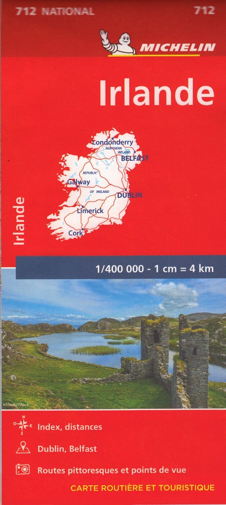
Michelin Ireland Map 712 – 2023 Edition
$21.95
Afterpay is only available for orders between $50.00 and $1000.00 More info
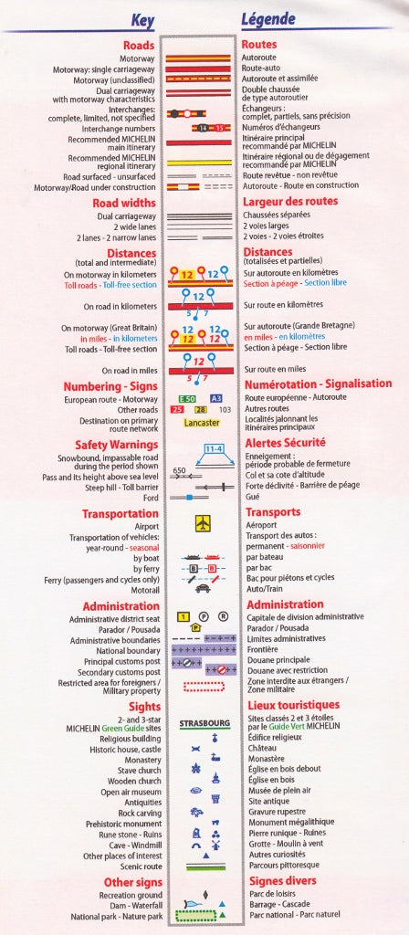
The Michelin Ireland Map 712 is your indispensable guide to navigating both the Republic of Ireland and Northern Ireland. Renowned for their cartographic excellence, Michelin maps combine detailed, easy-to-read road networks with curated tourist information, scenic routes, and helpful travel tools—making this map ideal for road trippers, tourists, cyclists, motorhome users, and even travel educators.
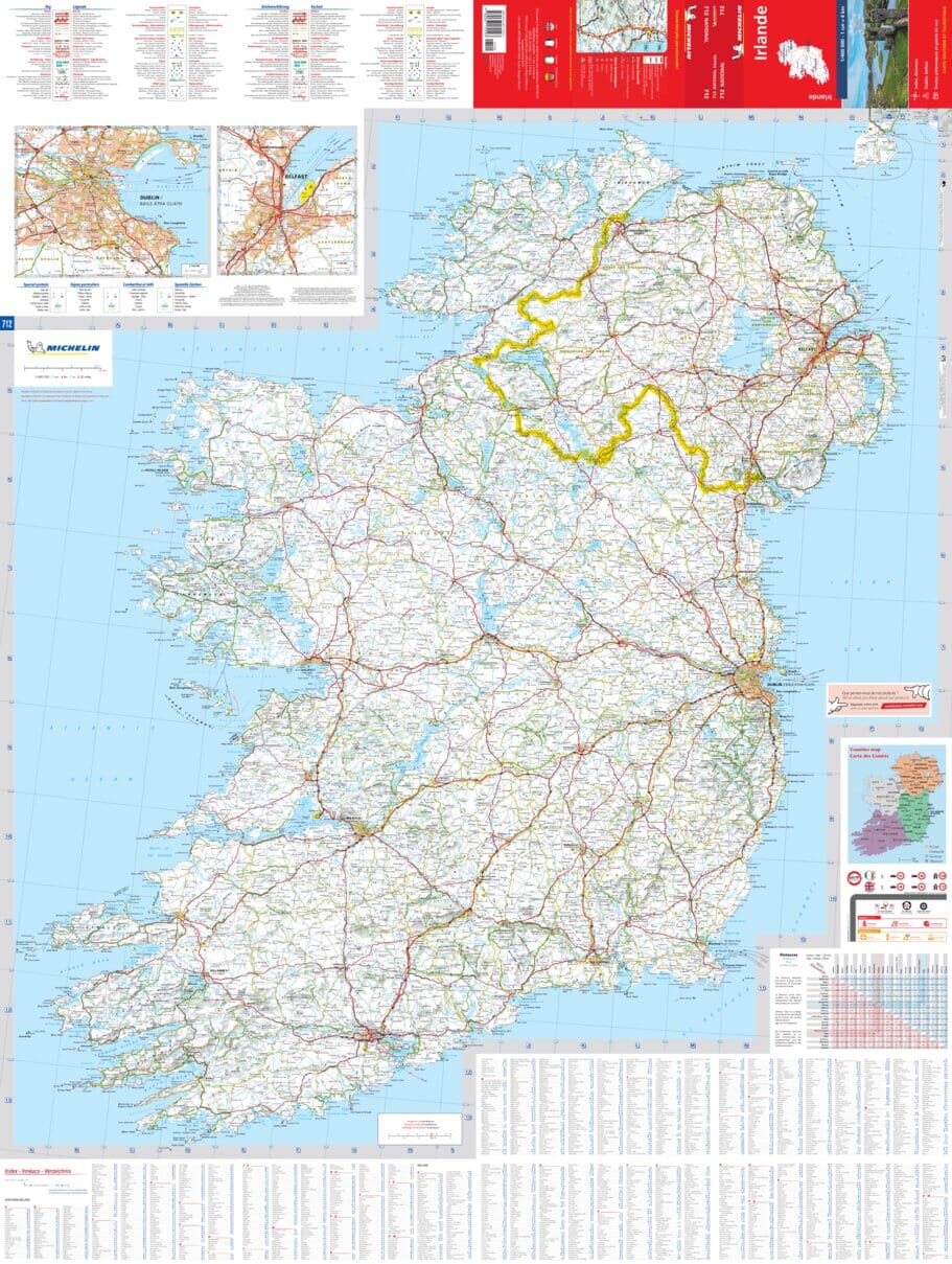
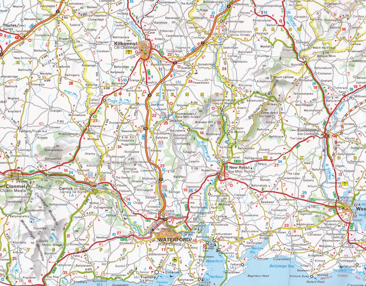
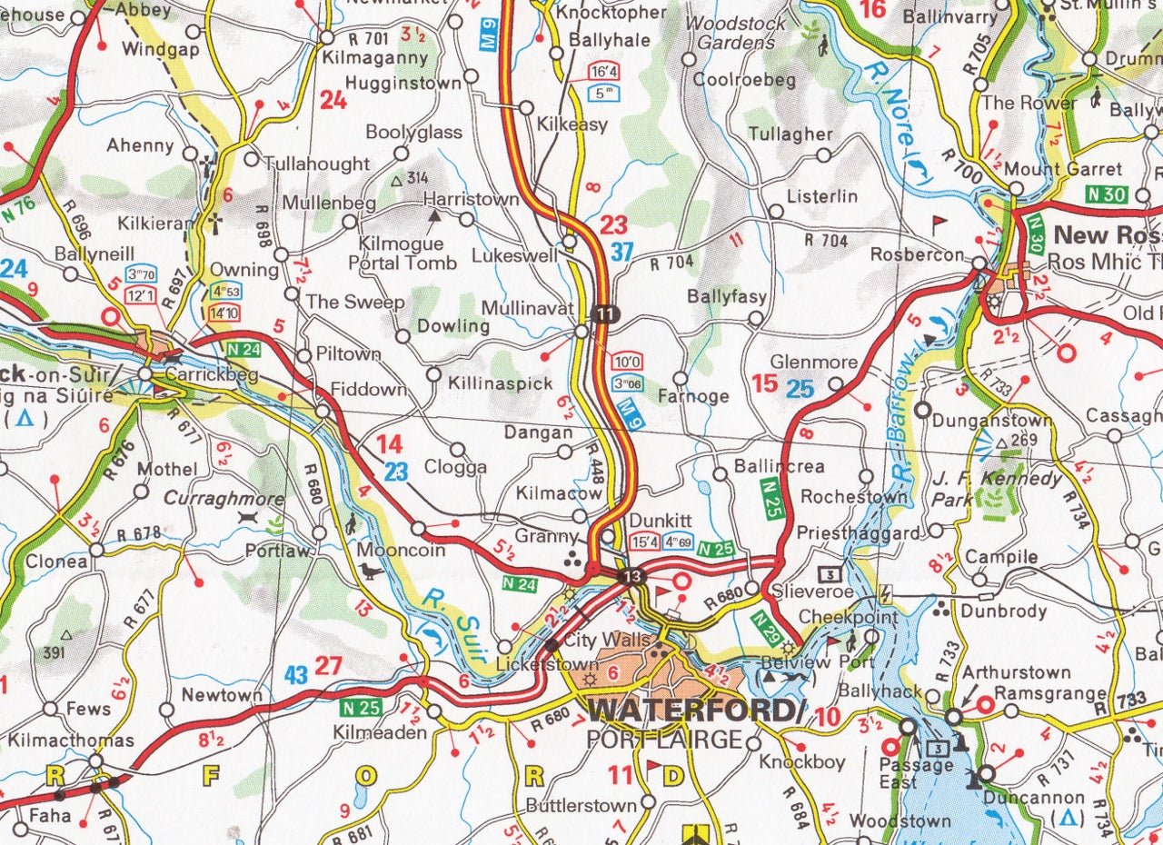
Covering the entire island of Ireland at a practical scale of 1:400,000, this map is designed for planning both long-distance travel and detailed regional exploration—from the Wild Atlantic Way and Ring of Kerry to the Causeway Coastal Route and Glens of Antrim.
🗺️ Coverage
This single-sheet map includes 100% of the island of Ireland, combining both:
-
The Republic of Ireland (including Dublin, Cork, Limerick, Galway, and the south and west coasts)
-
Northern Ireland (including Belfast, Derry/Londonderry, the Antrim Coast, and the Mourne Mountains)
It’s perfect for visitors exploring Ireland by car, campervan, or bicycle—offering a full view of the terrain, infrastructure, and sights of both nations.
🧭 Key Features
-
Scale: 1:400,000 (1 cm = 4 km) – ideal for balancing broad coverage and local road detail
-
Full Island Mapping: Includes all counties and road networks across both the Republic and Northern Ireland
-
City Insets: Detailed street plans of key urban areas such as:
-
Dublin
-
Belfast
-
Cork
-
Limerick
-
Galway
-
Derry
-
-
Scenic Routes Highlighted: Discover Ireland’s most picturesque drives, including the Ring of Beara, Dingle Peninsula, and Donegal’s Atlantic coastal roads
-
Tourist Sites: Castles, gardens, historical ruins, scenic lookouts, and cultural attractions are marked with Michelin’s easy-to-interpret symbols
-
Time & Distance Table: Plan your journeys more accurately with estimated travel times and distances between major towns
-
Comprehensive Index: A full place name index helps you locate towns, villages, and key destinations with ease
-
Multilingual Legend: Includes keys in English, French, German, Spanish, and Italian
📐 Map Specs
-
Map Number: Michelin National Map No. 712
-
Edition: 2023 (latest edition available)
-
Format: Folded, single-sided sheet map
-
Folded Dimensions: 24.5 cm × 11.2 cm × 0.7 cm
-
Unfolded Dimensions: ~100 cm × 132 cm
-
Weight: Approx. 90 grams
-
ISBN: 9782067170209
-
Paper Type: Durable coated stock (not waterproof, but weather-resistant under normal use)
🧳 Who It’s For
-
Independent travellers navigating Ireland by car or camper
-
Cyclists and hikers planning scenic journeys and trail connections
-
Travel agents and educators seeking reliable planning tools
-
Heritage tourists tracing family roots or visiting cultural sites
-
Tourists exploring off-the-beaten-path regions like West Cork, the Lakelands, or the Aran Islands
🌿 Highlights for Irish Travel
-
Perfect for road trips like the Wild Atlantic Way or Ireland’s Ancient East
-
Essential for exploring rural areas where GPS coverage may be spotty
-
Great souvenir or gift for those planning trips or tracing ancestry
-
Designed for usability with Michelin’s classic colour schemes and intuitive layout
In short: the Michelin Ireland Map 712 is a trusted, elegant, and highly practical map for navigating all that Ireland has to offer—north and south, urban and wild, coast and countryside. Whether you’re on a grand road trip or a short escape, this is a map you’ll be glad to have on hand.
Explore Ireland the right way—with Michelin.


