- Australia ▾
- Topographic
▾
- Australia AUSTopo 250k (2024)
- Australia 50k Geoscience maps
- Australia 100k Geoscience maps
- Australia 250k Geoscience maps
- Australia 1.1m Geoscience maps
- New Zealand 50k maps
- New Zealand 250k maps
- New South Wales 25k maps
- New South Wales 50k maps
- New South Wales 100k maps
- Queensland 10k maps
- Queensland 25k maps
- Queensland 50k maps
- Queensland 100k maps
- Compasses
- Software
- GPS Systems
- Orienteering
- International ▾
- Wall Maps
▾
- World
- Australia & New Zealand
- Countries, Continents & Regions
- Historical
- Vintage National Geographic
- Australian Capital Territory
- New South Wales
- Northern Territory
- Queensland
- South Australia
- Tasmania
- Victoria
- Western Australia
- Celestial
- Children's
- Mining & Resources
- Wine Maps
- Healthcare
- Postcode Maps
- Electoral Maps
- Nautical ▾
- Flags
▾
- Australian Flag Sets & Banners
- Flag Bunting
- Handwavers
- Australian National Flags
- Aboriginal Flags
- Torres Strait Islander Flags
- International Flags
- Flagpoles & Accessories
- Australian Capital Territory Flags
- New South Wales Flags
- Northern Territory Flags
- Queensland Flags
- South Australia Flags
- Tasmania Flags
- Victoria Flags
- Western Australia Flags
- Gifts ▾
- Globes ▾
Dear valued customer. Please note that our checkout is not supported by old browsers. Please use a recent browser to access all checkout capabilities


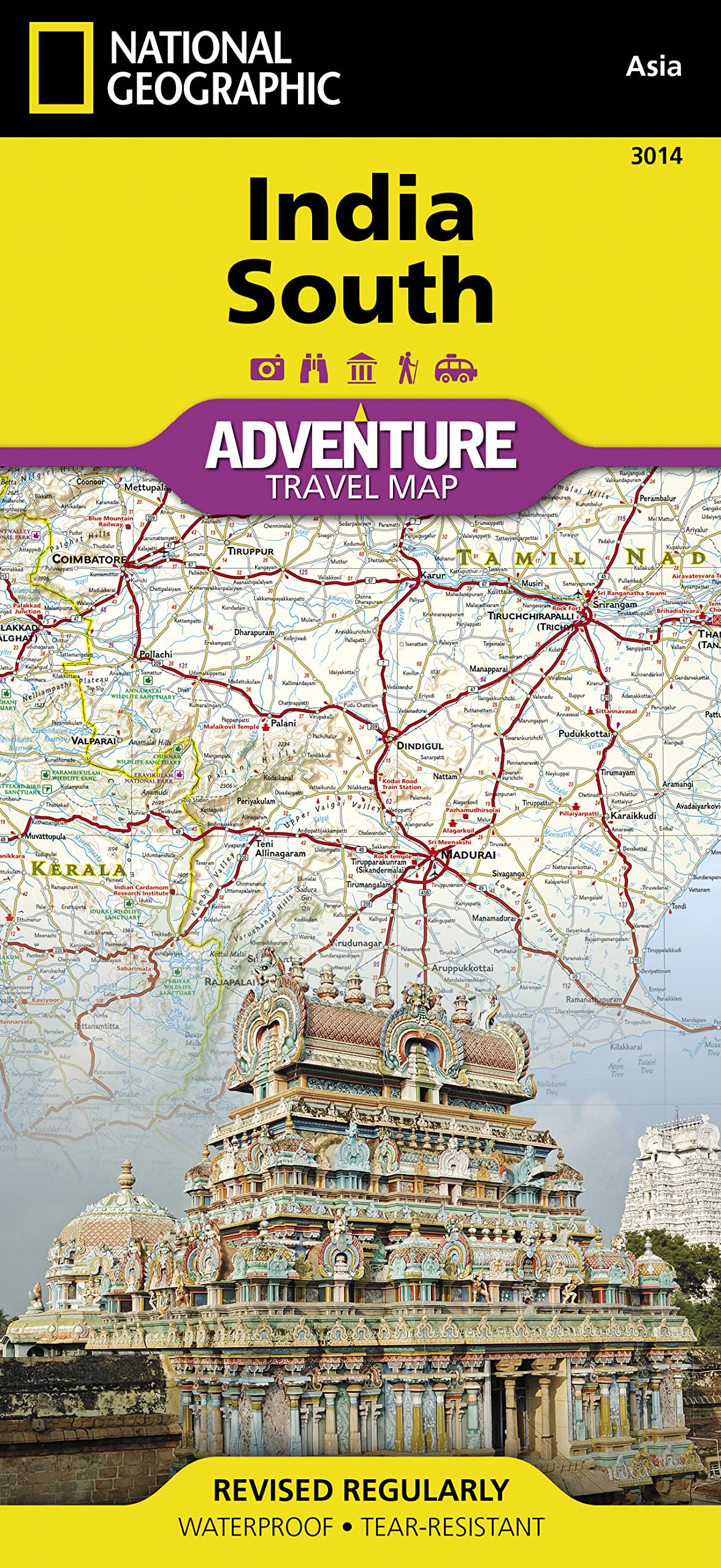
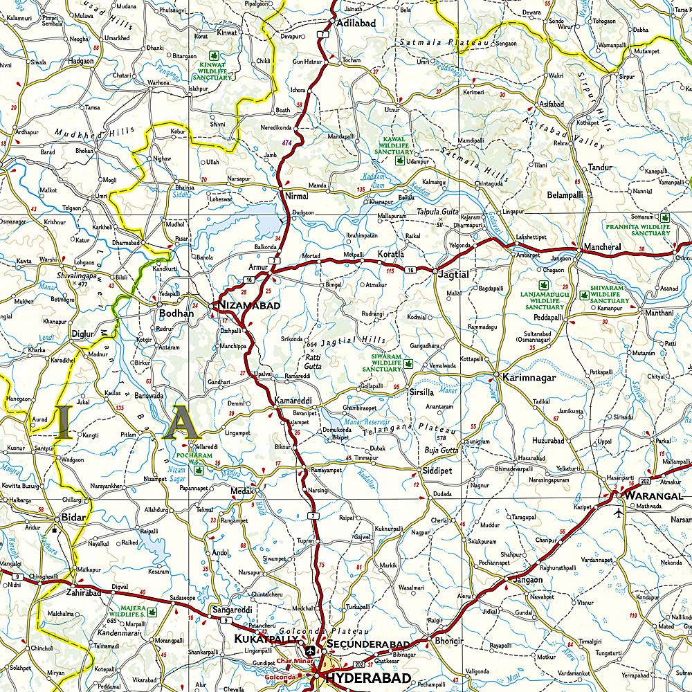
India South National Geographic Folded Map
Sold Out
Afterpay is only available for orders between $50.00 and $1000.00 More info
Folded Travel Map | Waterproof & Tear-Resistant | Double-Sided | Scale 1:1,425,000
📏 Unfolded Size: 965 x 660 mm | 📦 Folded to Pocket Size: 235 x 108 mm
🌴 Discover the Soul of Southern India
From the verdant hills of Kerala to the sun-drenched temples of Tamil Nadu, the India South Adventure Map by National Geographic offers a richly detailed guide to one of Asia’s most culturally layered and naturally diverse regions. Whether you’re tracing ancient pilgrimage routes, exploring spice markets, hiking through tropical jungles, or following the coastline from Goa to Kanyakumari, this map is a trusted companion for immersive and responsible travel.
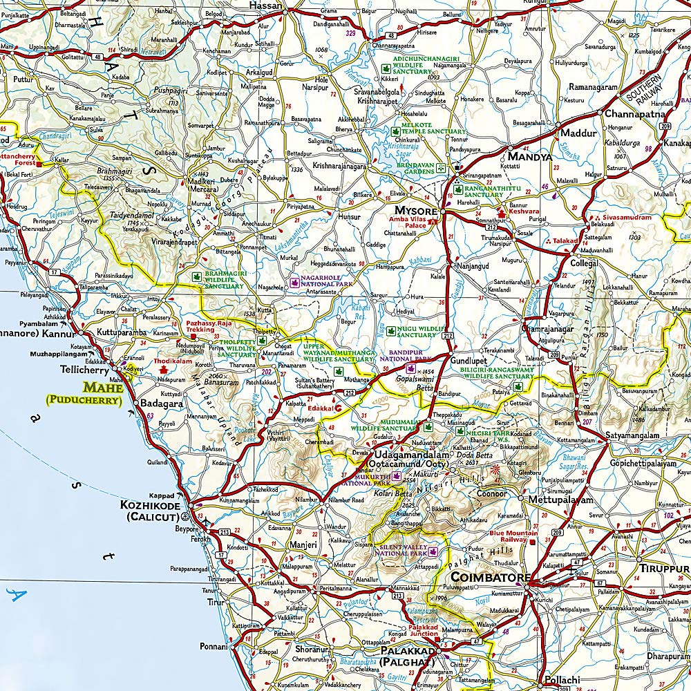
Meticulously crafted for adventure travelers, this two-sided map is printed on durable synthetic paper, making it waterproof, tear-resistant, and adventure-ready. With a clearly marked road network, precise relief shading, and hundreds of ecological, historical, and recreational sites, you’ll have everything you need to navigate and uncover South India’s best-kept secrets.
🧭 What's Covered?
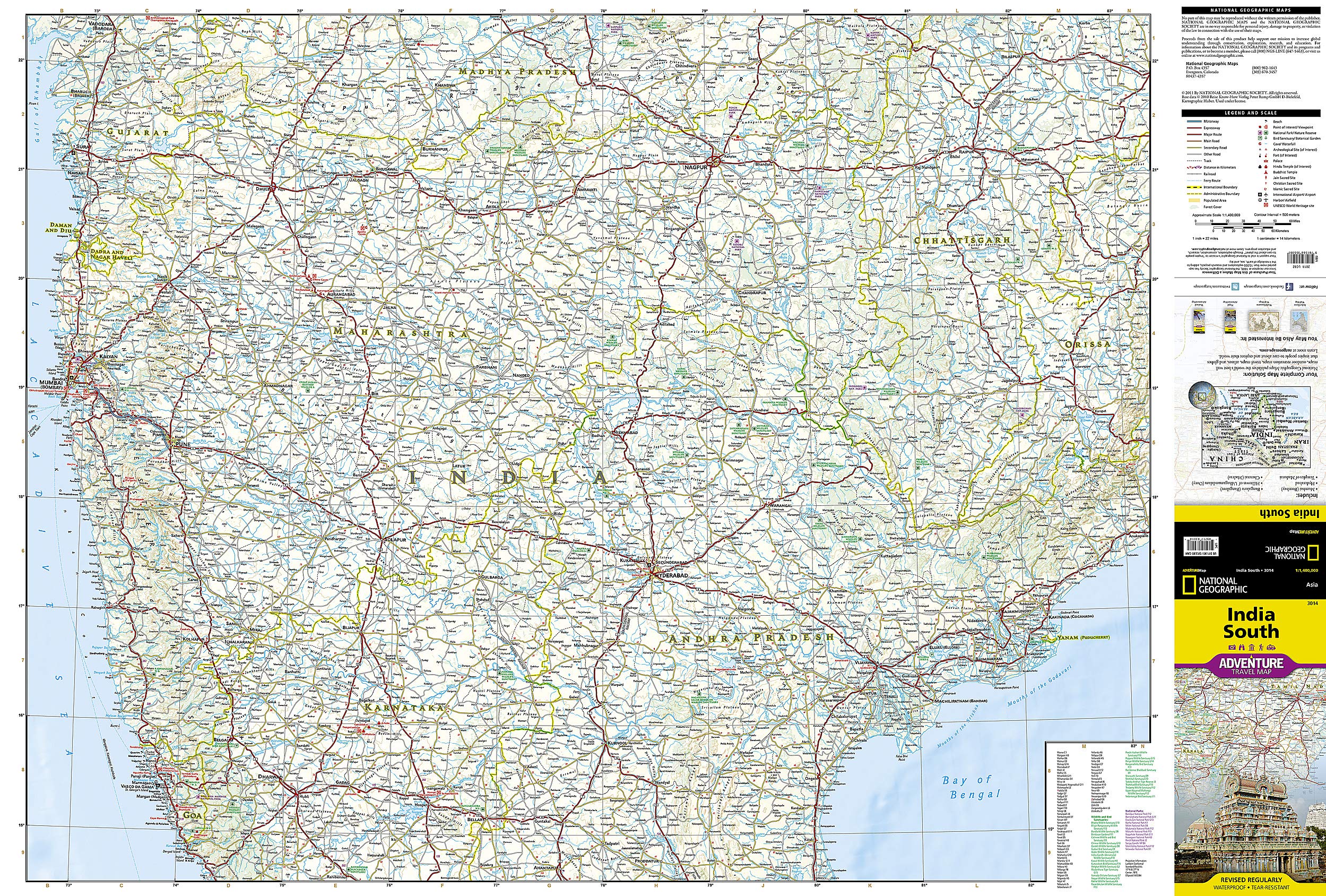
Side One: Central to Mid-South India
-
Southern Madhya Pradesh
-
Chhattisgarh, Odisha, and Gujarat (southern portions)
-
Goa and Maharashtra
-
Andhra Pradesh (northern sections)
-
Major cities: Mumbai, Pune, Nagpur, Raipur, Hyderabad, Vishakhapatnam
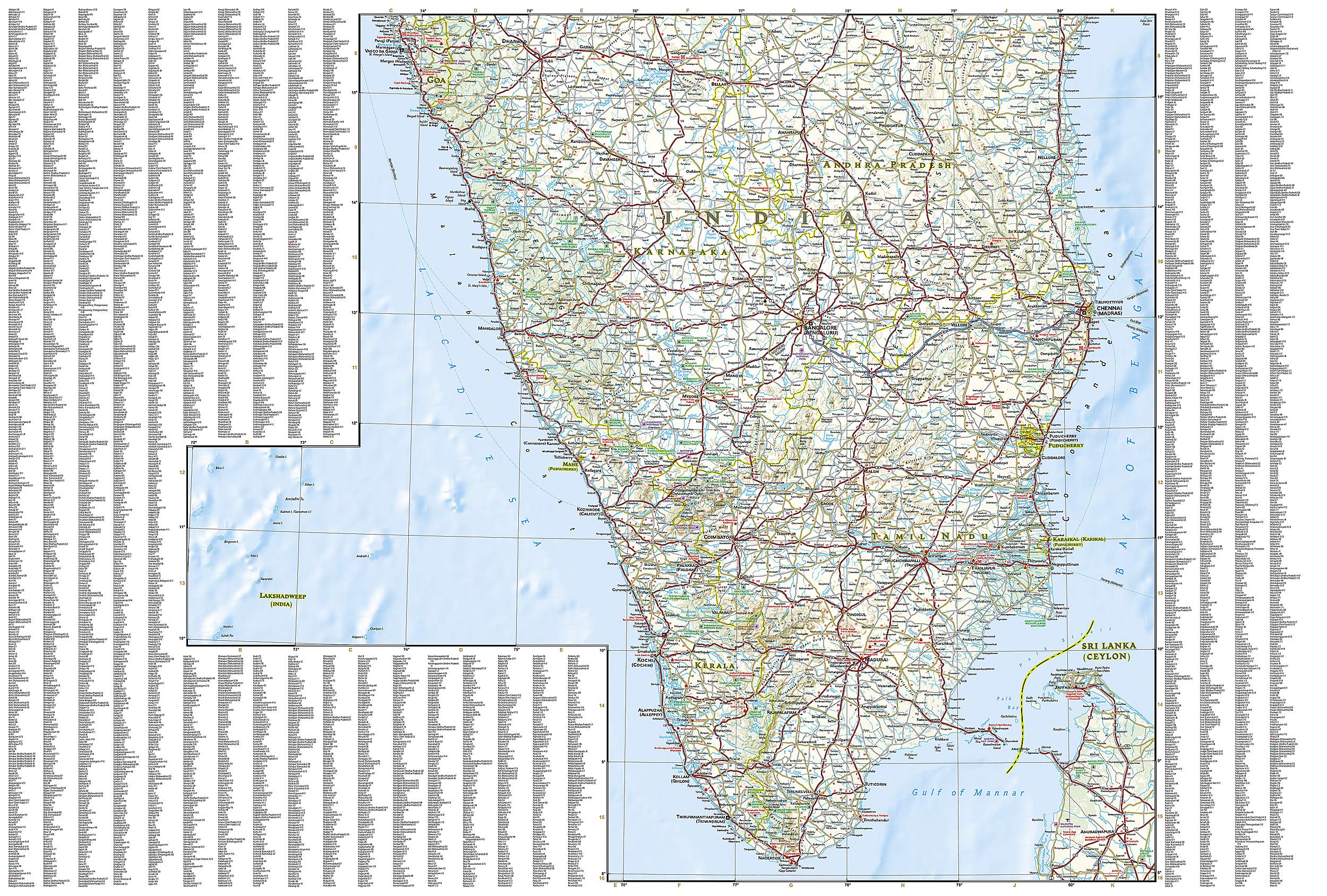
Side Two: Deep South India
-
The peninsula’s tip, from Goa south to Kanyakumari
-
Karnataka, Tamil Nadu, Kerala, and southern Andhra Pradesh
-
Major cities: Bangalore, Chennai, Coimbatore, Madurai, Trivandrum, Mysore
This layout ensures seamless coverage for overland journeys, whether you’re heading west to east or north to south.
🔍 Key Features at a Glance
| 🌟 Feature | 📌 Description |
|---|---|
| Durability | Waterproof, tear-resistant synthetic material |
| Travel Readiness | Compact when folded; unfolds large for full planning visibility |
| Road Network | Marked with distances, classifications, and major junctions |
| City & Town Index | Easy-to-navigate, alphabetized place names |
| Topography | Relief shading, rivers, coastlines, and elevations clearly marked |
| Cultural Highlights | Includes temples, historical landmarks, and UNESCO sites |
| Eco-Tourism | National parks, wildlife reserves, protected wetlands |
| Outdoor Recreation | Beaches, trekking routes, viewpoints, hot springs |
| Transport | Airports, ferry routes, train lines, and bus connections |
| Special Sites | Spiritual centres, scenic backwaters, hill stations, spice plantations |
🧳 Perfect For:
-
Independent travelers seeking authentic experiences
-
Overland explorers driving or motorbiking across states
-
Pilgrims & spiritual seekers visiting temples, ashrams, and holy towns
-
Nature lovers planning visits to wildlife sanctuaries or trekking routes
-
Educational use for geography, culture, or regional studies
🎯 Why Choose a National Geographic Adventure Map?
National Geographic has earned a reputation for cartographic excellence. Each Adventure Map is:
-
✅ Expertly researched and field-verified
-
✅ Printed on recyclable synthetic material
-
✅ Designed with travelers' needs in mind
-
✅ Stylish enough for display, durable enough for the road
📐 Map Specifications
| Attribute | Details |
|---|---|
| Title | India South Adventure Map |
| Publisher | National Geographic Maps |
| Map Type | Folded, double-sided |
| Material | Waterproof, tear-resistant synthetic paper |
| Scale | 1:1,425,000 approx. |
| Unfolded Size | 965 mm x 660 mm |
| Folded Size | 235 mm x 108 mm |
| ISBN | [To be added if known] |
| Edition | Most recent available |
✨ Suggested Use Cases:
-
🧭 Pair with a South India travel guidebook for deeper planning
-
🗺️ Pin to a corkboard to plot multi-city adventures
-
🧘♀️ Use on yoga retreats, eco-tours, or volunteer missions
-
🚴♂️ Ideal for cycling or motorbike route planning
-
🎓 Perfect educational tool for schools or cultural institutions


