- Australia ▾
- Topographic
▾
- Australia AUSTopo 250k (2024)
- Australia 50k Geoscience maps
- Australia 100k Geoscience maps
- Australia 250k Geoscience maps
- Australia 1.1m Geoscience maps
- New Zealand 50k maps
- New Zealand 250k maps
- New South Wales 25k maps
- New South Wales 50k maps
- New South Wales 100k maps
- Queensland 10k maps
- Queensland 25k maps
- Queensland 50k maps
- Queensland 100k maps
- Compasses
- Software
- GPS Systems
- Orienteering
- International ▾
- Wall Maps
▾
- World
- Australia & New Zealand
- Countries, Continents & Regions
- Historical
- Vintage National Geographic
- Australian Capital Territory
- New South Wales
- Northern Territory
- Queensland
- South Australia
- Tasmania
- Victoria
- Western Australia
- Celestial
- Children's
- Mining & Resources
- Wine Maps
- Healthcare
- Postcode Maps
- Electoral Maps
- Nautical ▾
- Flags
▾
- Australian Flag Sets & Banners
- Flag Bunting
- Handwavers
- Australian National Flags
- Aboriginal Flags
- Torres Strait Islander Flags
- International Flags
- Flagpoles & Accessories
- Australian Capital Territory Flags
- New South Wales Flags
- Northern Territory Flags
- Queensland Flags
- South Australia Flags
- Tasmania Flags
- Victoria Flags
- Western Australia Flags
- Gifts ▾
- Globes ▾
Dear valued customer. Please note that our checkout is not supported by old browsers. Please use a recent browser to access all checkout capabilities


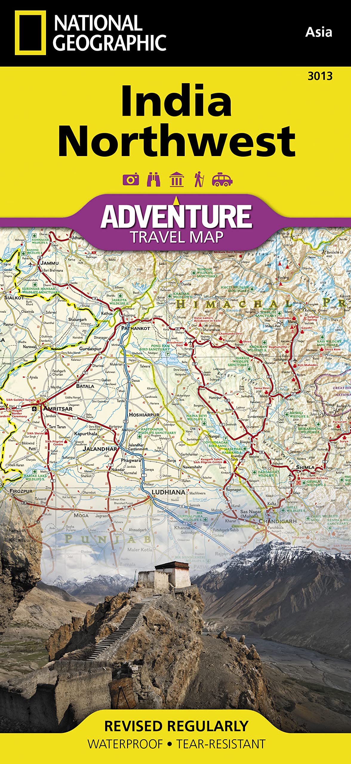
India North West National Geographic Folded Map
$26.95
Afterpay is only available for orders between $50.00 and $1000.00 More info
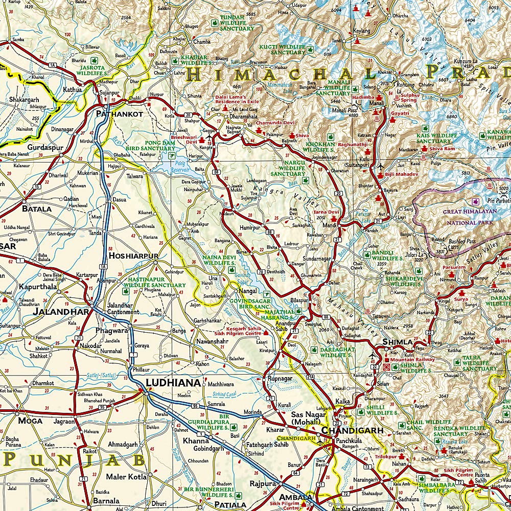
🇮🇳 India, Northwest Adventure Map — National Geographic
Durable Folded Travel Map for the Explorer | Waterproof & Tear-Resistant
Scale: 1:1,375,000 | Double-sided | Synthetic Paper
Discover the sweeping deserts, sacred rivers, Himalayan foothills, and cultural heartlands of northwestern India with this India, Northwest Adventure Map by National Geographic. Designed specifically for the needs of modern adventurers, overlanders, heritage travellers and serious planners, this double-sided map is your gateway to the region’s most spectacular landscapes and historic cities.
🧭 The Explorer’s Map for Northern India
This isn't just a road map—it's a field-ready navigation tool built to withstand rugged travel and frequent use. Printed on durable synthetic paper, this map is waterproof, tear-resistant, and perfectly suited for backpackers, drivers, tour guides, and anyone venturing off the beaten path.
🗺 Regional Coverage Breakdown
| Side | Coverage Description |
|---|---|
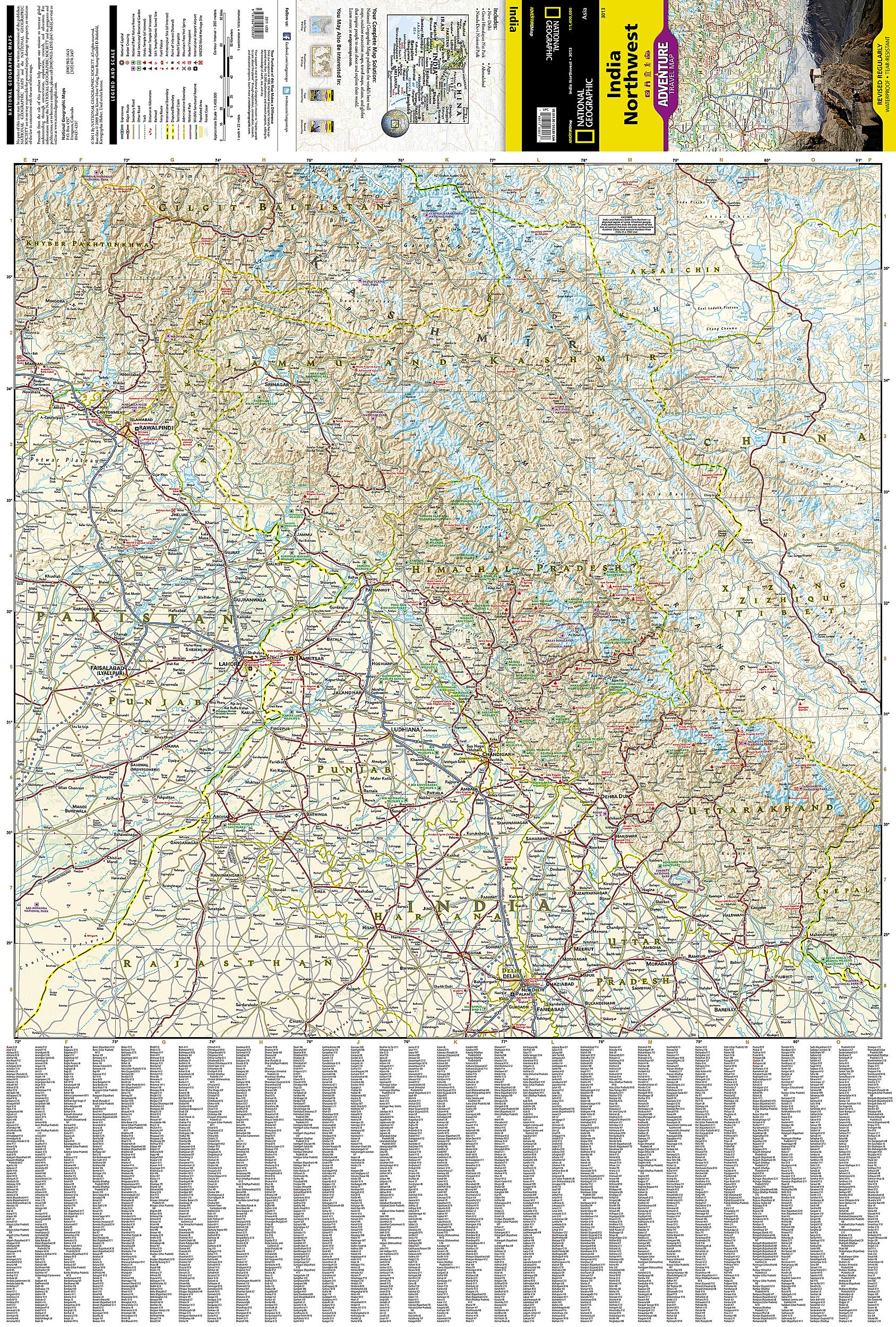
| Front | Northern Himalayas and National Capital Region: Covers Jammu & Kashmir, Himachal Pradesh, Uttarakhand, Punjab, Haryana, Uttar Pradesh, and the National Capital Territory of Delhi. Includes the rugged Himalaya range, pilgrimage towns like Haridwar and Rishikesh, and major destinations such as Chandigarh, Dehradun, and Shimla. |
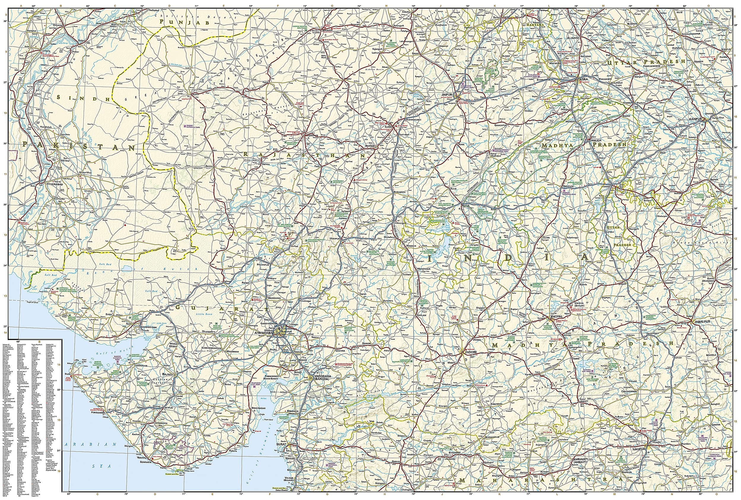
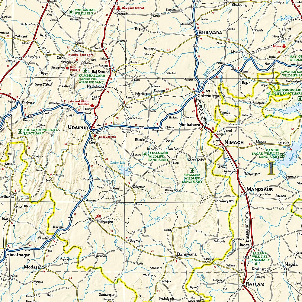
| Reverse | Northwest and Western India: Expands into Rajasthan (including Jaipur, Udaipur, and Jaisalmer), Gujarat (including Ahmedabad and the Kathiawar Peninsula), parts of Uttar Pradesh, and western Madhya Pradesh (including Bhopal). Border regions with Pakistan are also mapped. |
🌟 Features & Highlights
| Category | Details |
|---|---|
| 🛣 Road Network | Clearly marked highways, secondary roads, mountain routes, rural tracks & border crossings |
| 🏙 Urban Index | User-friendly index of cities, towns & villages for fast lookup |
| 🏞 Cultural & Natural Sites | World Heritage sites, temples, forts, palaces, museums, and natural landmarks like deserts and sanctuaries |
| 🚂 Travel Infrastructure | Rail lines, airfields, domestic airports, and ferry routes (where applicable) |
| 🧭 Adventure-Friendly | Trails, scenic viewpoints, national parks, trekking zones and protected reserves |
| 🌍 Topography | Shaded relief, river systems, and key elevations for planning treks or drives |
📐 Map Specifications
| Specification | Value |
|---|---|
| Type | Folded map |
| Material | Waterproof, tear-resistant synthetic paper |
| Scale | 1:1,375,000 |
| Unfolded Size | 965 mm x 660 mm |
| Folded Size | 235 mm x 108 mm |
| Publisher | National Geographic |
| Series | Adventure Map Series |
💼 Who This Map Is For
-
🏞 Adventure travellers planning routes through the Thar Desert, Himalayan foothills or the Aravalli Range
-
🕌 Cultural tourists exploring palaces, ancient cities, and pilgrimage routes
-
🚘 Road trippers and overlanders navigating long-distance drives through Rajasthan or the NCR
-
🧳 Backpackers heading through Himachal, Uttarakhand, or Gujarat
-
🎓 Students and researchers interested in geography, planning, and Indian heritage
-
🗺 Collectors and map lovers seeking high-quality National Geographic cartography
🌐 Why Choose National Geographic Maps?
With a heritage of exploration and excellence, National Geographic Adventure Maps are internationally trusted for their accuracy, design clarity, and rugged usability. More than just maps, they are gateways to understanding the terrain, culture, and history of the places you’ll visit.


