- Australia ▾
- Topographic
▾
- Australia AUSTopo 250k (2024)
- Australia 50k Geoscience maps
- Australia 100k Geoscience maps
- Australia 250k Geoscience maps
- Australia 1.1m Geoscience maps
- New Zealand 50k maps
- New Zealand 250k maps
- New South Wales 25k maps
- New South Wales 50k maps
- New South Wales 100k maps
- Queensland 10k maps
- Queensland 25k maps
- Queensland 50k maps
- Queensland 100k maps
- Compasses
- Software
- GPS Systems
- Orienteering
- International ▾
- Wall Maps
▾
- World
- Australia & New Zealand
- Countries, Continents & Regions
- Historical
- Vintage National Geographic
- Australian Capital Territory
- New South Wales
- Northern Territory
- Queensland
- South Australia
- Tasmania
- Victoria
- Western Australia
- Celestial
- Children's
- Mining & Resources
- Wine Maps
- Healthcare
- Postcode Maps
- Electoral Maps
- Nautical ▾
- Flags
▾
- Australian Flag Sets & Banners
- Flag Bunting
- Handwavers
- Australian National Flags
- Aboriginal Flags
- Torres Strait Islander Flags
- International Flags
- Flagpoles & Accessories
- Australian Capital Territory Flags
- New South Wales Flags
- Northern Territory Flags
- Queensland Flags
- South Australia Flags
- Tasmania Flags
- Victoria Flags
- Western Australia Flags
- Gifts ▾
- Globes ▾
Dear valued customer. Please note that our checkout is not supported by old browsers. Please use a recent browser to access all checkout capabilities


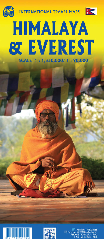
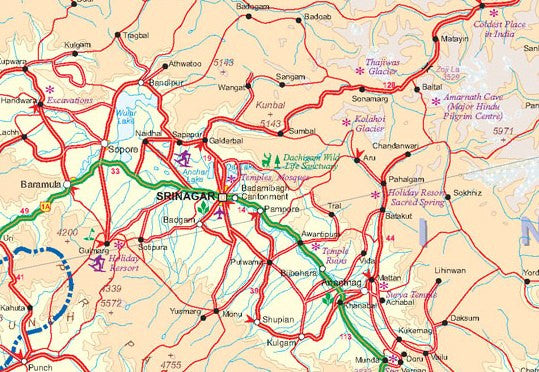
Himalaya & Everest Map by ITMB (International Travel Maps)
$24.95
Afterpay is only available for orders between $50.00 and $1000.00 More info
Double-Sided • Trekking Routes • Cultural Detail
Scale: 1:1,300,000 | Size: 690 x 1000 mm
Embark on a journey through the world's most awe-inspiring mountain range with this double-sided map of the Himalayas and Everest, expertly crafted by ITMB. Featuring rich cartographic detail, this map is ideal for adventurers, trekkers, cultural explorers, and armchair travellers alike.
Whether you're dreaming of standing at the foot of Everest or planning an overland route across the Himalayas, this map delivers clear, accurate, and beautifully presented geographic information on one of the most majestic regions on Earth.
🌄 Map Coverage & Highlights:
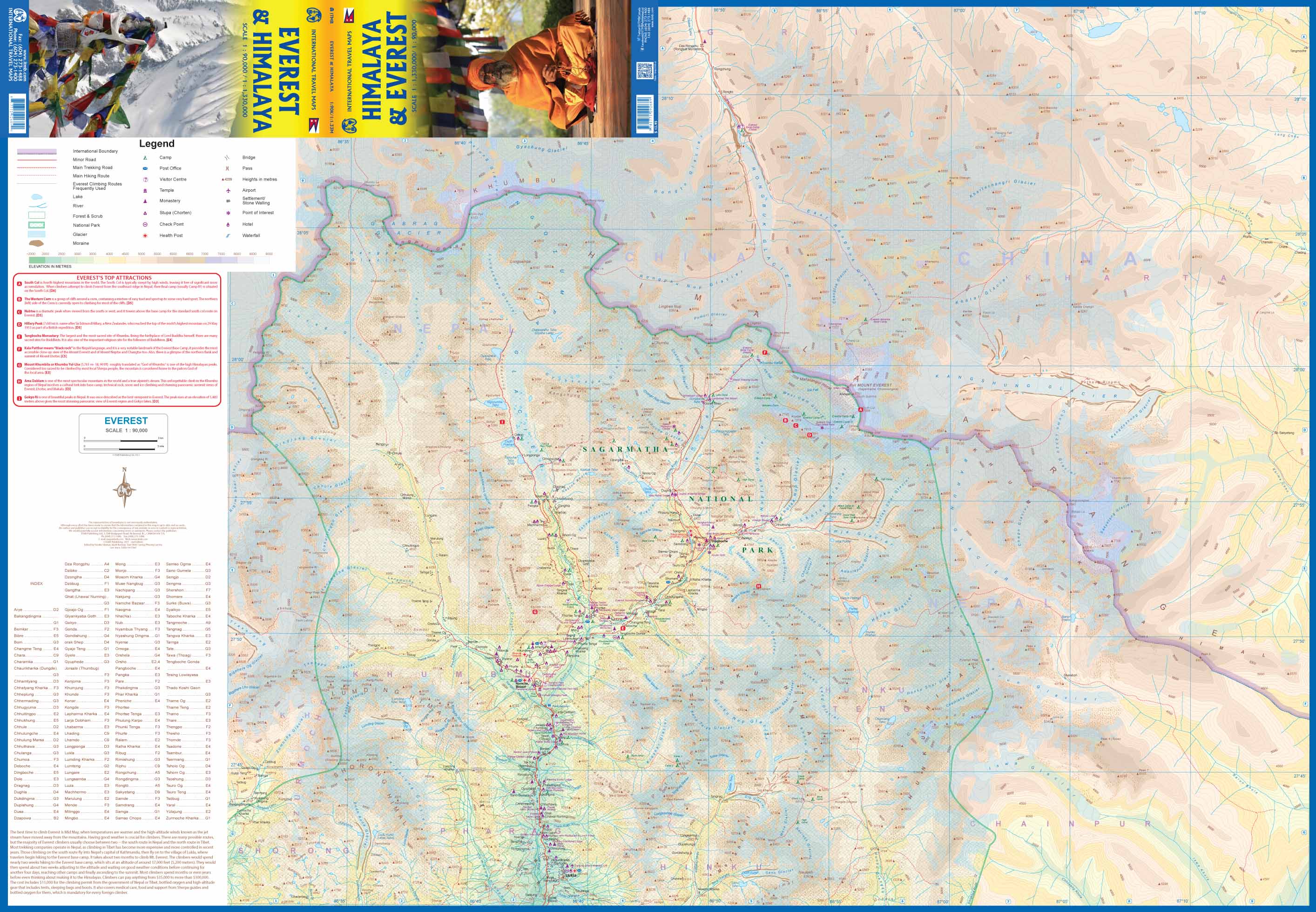
🏔️ Side A: Mount Everest Region (Sagarmatha Zone)
-
Detailed topographic layout of Everest and its surrounding peaks
-
Clearly marked base camps, trekking lodges, tea houses & trails
-
Shows all main trekking routes, including the classic trail to Everest Base Camp (EBC)
-
Includes glaciers, rivers, and elevation contours for serious outdoor planning
-
Excellent for anyone considering treks to Kala Patthar, Gokyo Lakes, or the Three Passes Route
-
Only one route to the summit is marked — a reminder of the mountain’s formidable nature
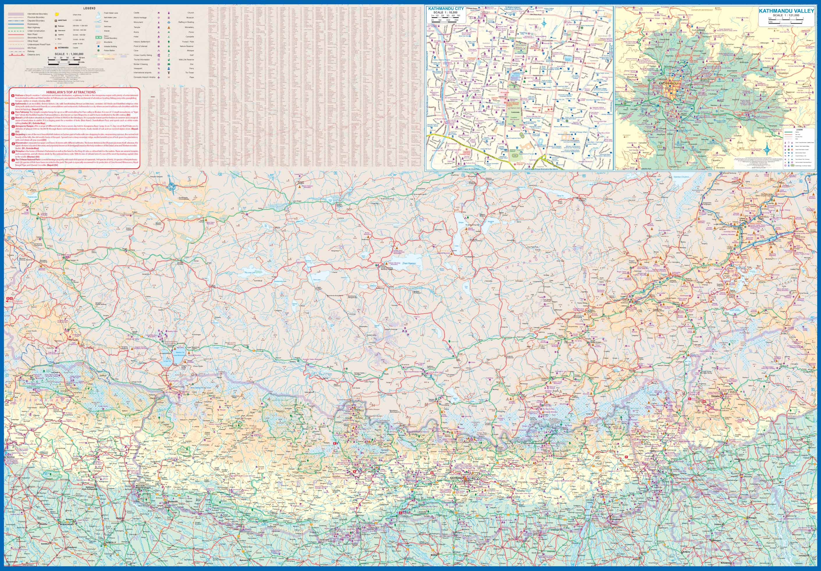
🗻 Side B: The Greater Himalaya Region
-
Covers the entire Himalayan belt, including:
-
Nepal, Sikkim, most of Bhutan
-
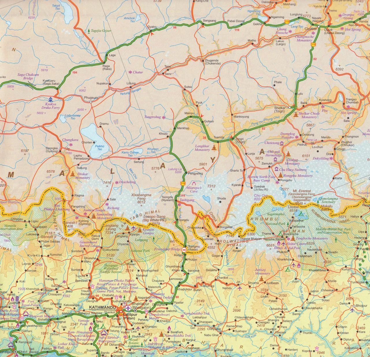
Significant parts of Tibet and northern India
-
-
All highways, border crossings, and newly developed roads are mapped
-
Includes the now-complete East-West Highway (Hwy 1401) through Nepal
-
Detailed inset maps of Kathmandu and the surrounding Kathmandu Valley
📌 Why This Map Stands Out:
| ✅ Feature | 📍 Description |
|---|---|
| 🧭 Double-sided format | Everest Region on one side, full Himalaya on the other |
| 🗺️ Comprehensive coverage | Ideal for both trekking & general travel planning |
| 🏔️ Topographic accuracy | Terrain contours, glaciers, peaks and valleys clearly illustrated |
| 🛣️ Road & trail networks | Shows all known trekking paths, highways & access routes |
| 🏘️ Points of interest | Towns, camps, natural features & major cultural landmarks |
| 🗺️ Inset Maps | Kathmandu city & valley area included |
| 🧼 Optional lamination | Draw on it, wipe it clean, reuse it again and again |
🌏 Ideal For:
-
🎒 Trekking and mountaineering planners
-
🛕 Cultural and religious travellers exploring Nepal, Tibet, and Bhutan
-
🚗 Overland travellers across India and the Himalayan foothills
-
🌍 Collectors of expedition and adventure maps
-
🧭 Guides, students, and educators studying the Himalayas’ geography
🛠️ Product Details:
| Specification | Details |
|---|---|
| Map Scale | 1:1,300,000 |
| Map Dimensions | 690 mm x 1000 mm |
| Format | Double-sided, paper or optional lamination |
| Publisher | International Travel Maps (ITMB) |
Optional Lamination Available:
Upgrade your map with our 80-micron gloss encapsulated lamination, perfect for field use:
-
✔️ Draw routes or notes with whiteboard markers
-
✔️ Apply removable map dots for travel planning
-
✔️ Protects against moisture, stains, and tearing
📌 Note: Laminated versions are created by flattening the original folded map and sealing it. Slight fold lines may remain visible.
🏞️ A Map That Inspires
Whether you're chasing high-altitude adventure or tracing the path of ancient pilgrims, this Himalaya & Everest map is an essential guide and visual companion. It’s both a practical navigation tool and a striking cartographic tribute to one of the most spiritually and geographically significant regions on the planet.


