- Australia ▾
- Topographic
▾
- Australia AUSTopo 250k (2024)
- Australia 50k Geoscience maps
- Australia 100k Geoscience maps
- Australia 250k Geoscience maps
- Australia 1.1m Geoscience maps
- New Zealand 50k maps
- New Zealand 250k maps
- New South Wales 25k maps
- New South Wales 50k maps
- New South Wales 100k maps
- Queensland 10k maps
- Queensland 25k maps
- Queensland 50k maps
- Queensland 100k maps
- Compasses
- Software
- GPS Systems
- Orienteering
- International ▾
- Wall Maps
▾
- World
- Australia & New Zealand
- Countries, Continents & Regions
- Historical
- Vintage National Geographic
- Australian Capital Territory
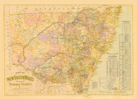
- New South Wales
- Northern Territory
- Queensland
- South Australia
- Tasmania
- Victoria
- Western Australia
- Celestial
- Children's
- Mining & Resources
- Wine Maps
- Healthcare
- Postcode Maps
- Electoral Maps
- Nautical ▾
- Flags
▾
- Australian Flag Sets & Banners
- Flag Bunting
- Handwavers
- Australian National Flags
- Aboriginal Flags
- Torres Strait Islander Flags
- International Flags
- Flagpoles & Accessories
- Australian Capital Territory Flags
- New South Wales Flags
- Northern Territory Flags
- Queensland Flags
- South Australia Flags
- Tasmania Flags
- Victoria Flags
- Western Australia Flags
- Gifts ▾
- Globes ▾
Dear valued customer. Please note that our checkout is not supported by old browsers. Please use a recent browser to access all checkout capabilities


Hawkesbury River Wall Map 1953
$69.95
or make 4 interest-free payments of
$17.49 AUD
fortnightly with
![]() More info
More info
Coverage: Windsor to Broken Bay | Brisbane Water | Pittwater | Ku-Ring-Gai Chase | Terrigal | Tuggerah Lakes Entrance
Published by: Department of Lands, New South Wales
Original Publication Date: 1935
Map Dimensions: 1050 mm (w) x 760 mm (h)
A Tribute to the Waterways of New South Wales
Step back in time and explore one of Australia’s most storied waterways with this beautifully reproduced 1935 map of the Hawkesbury River, originally published by the Department of Lands. Spanning from Windsor in the west to Broken Bay in the east, this map also embraces the many vital tributaries and nearby regions including Brisbane Water, Pittwater, Ku-Ring-Gai Chase, Terrigal, and the Tuggerah Lakes Entrance.
Perfect for maritime history enthusiasts, cartographic collectors, interior designers, or proud locals, this wall map captures a bygone era of Australian coastal and inland geography with a level of detail and charm that modern maps rarely replicate.
Key Features:
-
Historic cartography: An authentic reproduction of the 1935 original
-
Detailed hydrography: Rivers, tributaries, and estuarine networks clearly mapped
-
Cultural and regional interest: Includes now-iconic areas like Ku-Ring-Gai Chase and Pittwater in their early documented forms
-
Ideal for display: A striking centrepiece in offices, libraries, coastal homes, or nautical-themed spaces
Available Finishes:
| Format | Description |
|---|---|
| Paper (160gsm) | Ideal for framing under glass — crisp and true to the original texture |
| Laminated | Fully encapsulated in 80-micron gloss laminate for extra durability. Use with whiteboard markers or map dots for an interactive display. Water and stain-resistant |
| Canvas (395gsm) | Printed on HP Professional Matte Canvas using pigment-based inks. This format is fade-resistant, archival-quality, and adds a timeless elegance to any wall |
Hanging Options (Laminated & Canvas Maps Only)
For a ready-to-hang finish, choose the finsh with wooden hang rails. These are attached top and bottom, lacquered in a warm natural timber tone, and include a cord for simple wall mounting. This option transforms your map into a gallery-quality wall feature.
Please note: Hang-railed canvas maps are custom-fitted by our framer, so allow up to 10 working days for delivery.
📐 Specifications:
| Attribute | Detail |
|---|---|
| Title | Hawkesbury River Wall Map |
| Publisher | NSW Department of Lands |
| Original Publication | 1935 |
| Coverage | Windsor to Broken Bay + Surrounds |
| Size | 1050 mm (w) x 760 mm (h) |
| Material Options | Paper, Laminated, or Canvas |
| Hanging Option | Timber hang rails (canvas only) |
Whether you're mapping the river systems, decorating with coastal nostalgia, or gifting a piece of local history, this classic Hawkesbury River Map is a unique and enduring keepsake—celebrating one of New South Wales' most iconic natural corridors with grace and historical accuracy.