- Australia ▾
- Topographic
▾
- Australia AUSTopo 250k (2024)
- Australia 50k Geoscience maps
- Australia 100k Geoscience maps
- Australia 250k Geoscience maps
- Australia 1.1m Geoscience maps
- New Zealand 50k maps
- New Zealand 250k maps
- New South Wales 25k maps
- New South Wales 50k maps
- New South Wales 100k maps
- Queensland 10k maps
- Queensland 25k maps
- Queensland 50k maps
- Queensland 100k maps
- Compasses
- Software
- GPS Systems
- Orienteering
- International ▾
- Wall Maps
▾
- World
- Australia & New Zealand
- Countries, Continents & Regions
- Historical
- Vintage National Geographic
- Australian Capital Territory
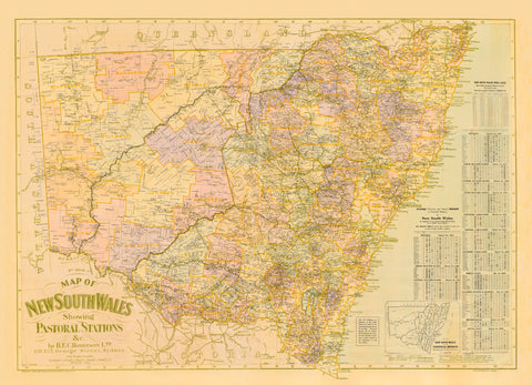
- New South Wales
- Northern Territory
- Queensland
- South Australia
- Tasmania
- Victoria
- Western Australia
- Celestial
- Children's
- Mining & Resources
- Wine Maps
- Healthcare
- Postcode Maps
- Electoral Maps
- Nautical ▾
- Flags
▾
- Australian Flag Sets & Banners
- Flag Bunting
- Handwavers
- Australian National Flags
- Aboriginal Flags
- Torres Strait Islander Flags
- International Flags
- Flagpoles & Accessories
- Australian Capital Territory Flags
- New South Wales Flags
- Northern Territory Flags
- Queensland Flags
- South Australia Flags
- Tasmania Flags
- Victoria Flags
- Western Australia Flags
- Gifts ▾
- Globes ▾
Dear valued customer. Please note that our checkout is not supported by old browsers. Please use a recent browser to access all checkout capabilities


Gleason's New Standard Flat Earth Map of the World
$69.95
or make 4 interest-free payments of
$17.49 AUD
fortnightly with
![]() More info
More info
Gleason’s New Standard — Flat Earth Wall Map (Illustrated Azimuthal Projection)
A conversation-stopping curiosity: the globe stretched and gathered into a single circular plane, meridians radiating like spokes, latitudes nested in perfect rings. This pictorial azimuthal projection—long associated with flat-earth advocacy—compresses distance and direction into a striking diagram of the world-as-disc. Decorative notes, solstice diagrams and a printed longitude/time calculator ring the composition. Part artefact, part provocation, it brings a bold chapter of cartographic culture to your wall—graphic, enigmatic, and impossible to ignore.
Why it captivates
-
Iconic circular world-view — a dramatic azimuthal layout with radial meridians and concentric parallels.
-
Cultural artefact — reflects the visual rhetoric used by flat-earth proponents in the late 19th/early 20th century.
-
Talking point — equal parts design statement and historical curiosity; invites debate and close reading.
-
Scholarly & beautiful — crisp linework, period lettering, and ornamental border features that read clearly across a room.
What you’ll see
-
Circular “world disc” with the North Pole at centre; meridians radiating outward and latitude circles nested concentrically.
-
Printed notes & diagrams including June/December solstices and a longitude/time calculator around the border.
-
Sun-time in minutes marked in the outer frame for quick reference.
-
Reproduction note: some original editions featured two movable arms for time calculation; this edition does not include mechanical arms—all diagrams are printed.
A richer historical frame
This design traces back to late-19th-century pictorial cartography and became emblematic in flat-earth circles, where a polar-centred azimuthal view was presented as an alternative to the spherical model. Today, it stands as a document of ideas—a reminder that maps both describe the world and persuade us to see it a certain way. As a wall piece, it’s compelling evidence of how design, belief and geography can intersect.
Choose your finish
Heavyweight Paper (160 gsm matte)
Best for: framing under glass in studies, libraries and creative spaces
Look & feel: non-glare matte that preserves linework, labels and border detail
Laminated (true encapsulation)
Best for: classrooms, studios, shared spaces
Build: sealed edge-to-edge between two 80-micron gloss sheets
Benefit: wipe-clean, durable, moisture-resistant
Laminated + Timber Hang Rails (Ready to hang)
What you get: encapsulated print plus natural lacquered timber rails top & bottom with a discreet hanging cord
Where it shines: foyers, offices, galleries—polished look with everyday toughness
Install: arrives ready to hang (just add a wall hook)
Lead time: please allow up to 10 working days for professional rail mounting
Archival Canvas (395 gsm HP Professional Matte)
Best for: premium interiors and statement walls
Print system: pigment-based, fade-resistant inks for long display life
Presence: textured surface adds warmth and museum-style depth
Canvas + Timber Hang Rails (Gallery-ready)
What you get: canvas fitted with natural timber rails top & bottom, matching cord
Where it shines: design-forward spaces, curated displays, conversation corners
Install: ready to hang; single-hook friendly
Lead time: please allow up to 10 working days for rail mounting
Sizes (W × H)
655 × 987 mm — tall, portrait presence that showcases the circular field and ornate border
At-a-glance materials
| Option | Best for | Key benefits |
|---|---|---|
| Paper (160 gsm) | Framing under glass | Matte clarity; crisp diagram detail |
| Laminated (encapsulated) | Busy/shared spaces | Wipeable; tough; edge-to-edge protection |
| Laminated + Rails | Ready-to-hang public display | Professional mount; easy install; durable |
| Canvas (395 gsm) | Premium display | Archival inks; textured depth; gallery appeal |
| Canvas + Rails | Gallery-ready feature | Period-true presentation; simple hanging |
Styling ideas
-
Design studio focal point: pair with a small placard discussing projections and persuasion in cartography.
-
Library or classroom wall: choose Laminated + Rails for durable, hands-on discussion sessions.
-
Eclectic living room: canvas with rails above a sideboard; add a globe nearby to spark conversation.
-
Gallery cluster: group with modern world maps to contrast methods, meanings and myths.
Specifications
| Detail | Description |
|---|---|
| Title | Gleason’s New Standard — Flat Earth Map |
| Edition | Contemporary reproduction of a historical design |
| Projection/Type | Azimuthal circular plan (polar-centred) |
| Content Highlights | Printed longitude/time calculator; June/December solstice diagrams; sun-time (minutes) border; period notes |
| Mechanical Features | Movable time-calculator arms not included in this edition |
| Finishes | Paper; Laminated (encapsulated); Laminated + Timber Rails; Canvas; Canvas + Timber Rails |
| Lead Time (Rails) | Up to 10 working days (laminated or canvas with rails) |
| Orientation | Portrait |
| Size | 655 × 987 mm (W × H) |
| Production | Made in Australia |
Who it’s for
-
Designers and educators exploring map projections and visual rhetoric
-
Collectors of unusual or controversial cartography
-
Galleries, libraries & studios curating conversations about science, belief and design
Claim your wall. Choose Paper for crisp, frame-ready clarity. Go Laminated + Timber Rails for tough, ready-to-hang polish. Step up to Archival Canvas + Timber Hang Rails for gallery weight. Printed in Australia with pigment-based, fade-resistant inks. Built to last. Hang it. Discuss it. Let the debate begin.