- Australia ▾
- Topographic
▾
- Australia AUSTopo 250k (2025)
- Australia 50k Geoscience maps
- Australia 100k Geoscience maps
- Australia 250k Geoscience maps
- Australia 1:1m Geoscience maps
- New Zealand 50k maps
- New Zealand 250k maps
- New South Wales 25k maps
- New South Wales 50k maps
- New South Wales 100k maps
- Queensland 10k maps
- Queensland 25k maps
- Queensland 50k maps
- Queensland 100k maps
- Western Australia 25k maps
- Western Australia 50k maps
- Western Australia 100k maps
- Compasses
- Software
- GPS Systems
- International ▾
- Wall Maps
▾
- World
- Australia & New Zealand
- Countries, Continents & Regions
- Historical
- Vintage National Geographic
- Australian Capital Territory
- New South Wales
- Northern Territory
- Queensland
- South Australia
- Tasmania
- Victoria
- Western Australia
- Celestial
- Children's
- Mining & Resources
- Wine Maps
- Healthcare
- Postcode Maps
- Electoral Maps
- Nautical ▾
- Flags
▾
- Australian Flag Sets & Banners
- Flag Bunting
- Handwavers
- Australian National Flags
- Aboriginal Flags
- Torres Strait Islander Flags
- International Flags
- Flagpoles & Accessories
- Australian Capital Territory Flags
- New South Wales Flags
- Northern Territory Flags
- Queensland Flags
- South Australia Flags
- Tasmania Flags
- Victoria Flags
- Western Australia Flags
- Gifts ▾
- Globes ▾
Dear valued customer. Please note that our checkout is not supported by old browsers. Please use a recent browser to access all checkout capabilities


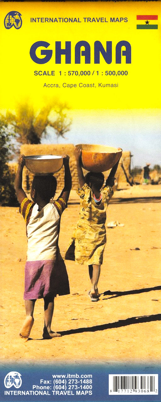
Ghana ITMB Map
$24.95
Afterpay is only available for orders between $50.00 and $1000.00 More info
🇬🇭 Ghana Travel Map by ITMB
A Trusted Map for Exploring Ghana’s Diverse Regions – Updated and Adventure-Ready
Whether you're tracing the cultural riches of Kumasi, navigating the bustle of Accra, or planning a journey around the banks of Lake Volta, this ITMB map of Ghana delivers comprehensive detail, trusted cartography, and useful insets to support travellers, researchers, and planners alike.
A consistent bestseller, this map continues to evolve with every edition. New updates to the Accra and Kumasi city maps ensure this latest version remains a reliable companion for anyone venturing across Ghana — from the coastal towns of Cape Coast to the remote savannah in the north.
🗺️ Key Features
| Feature | Description |
|---|---|
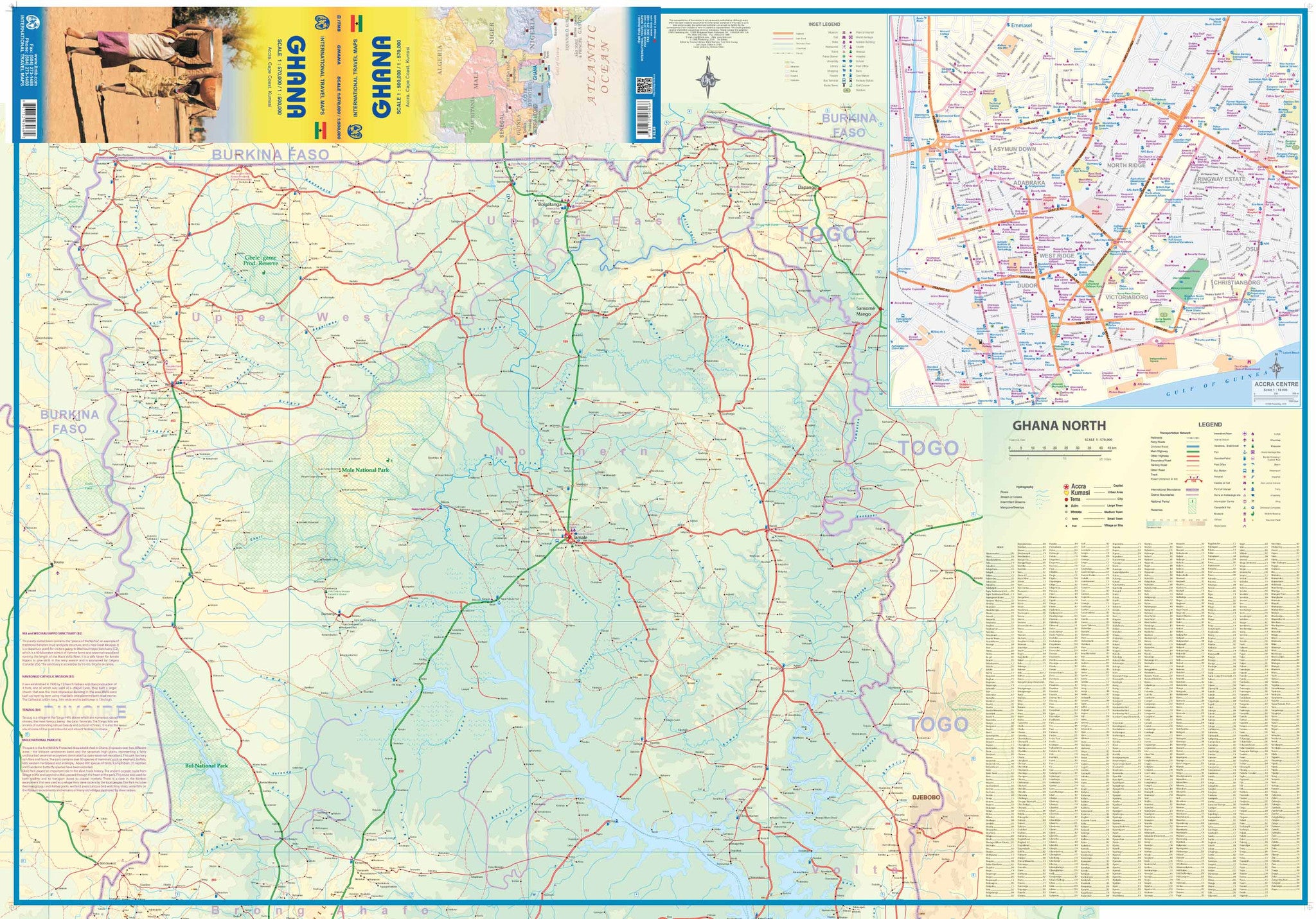
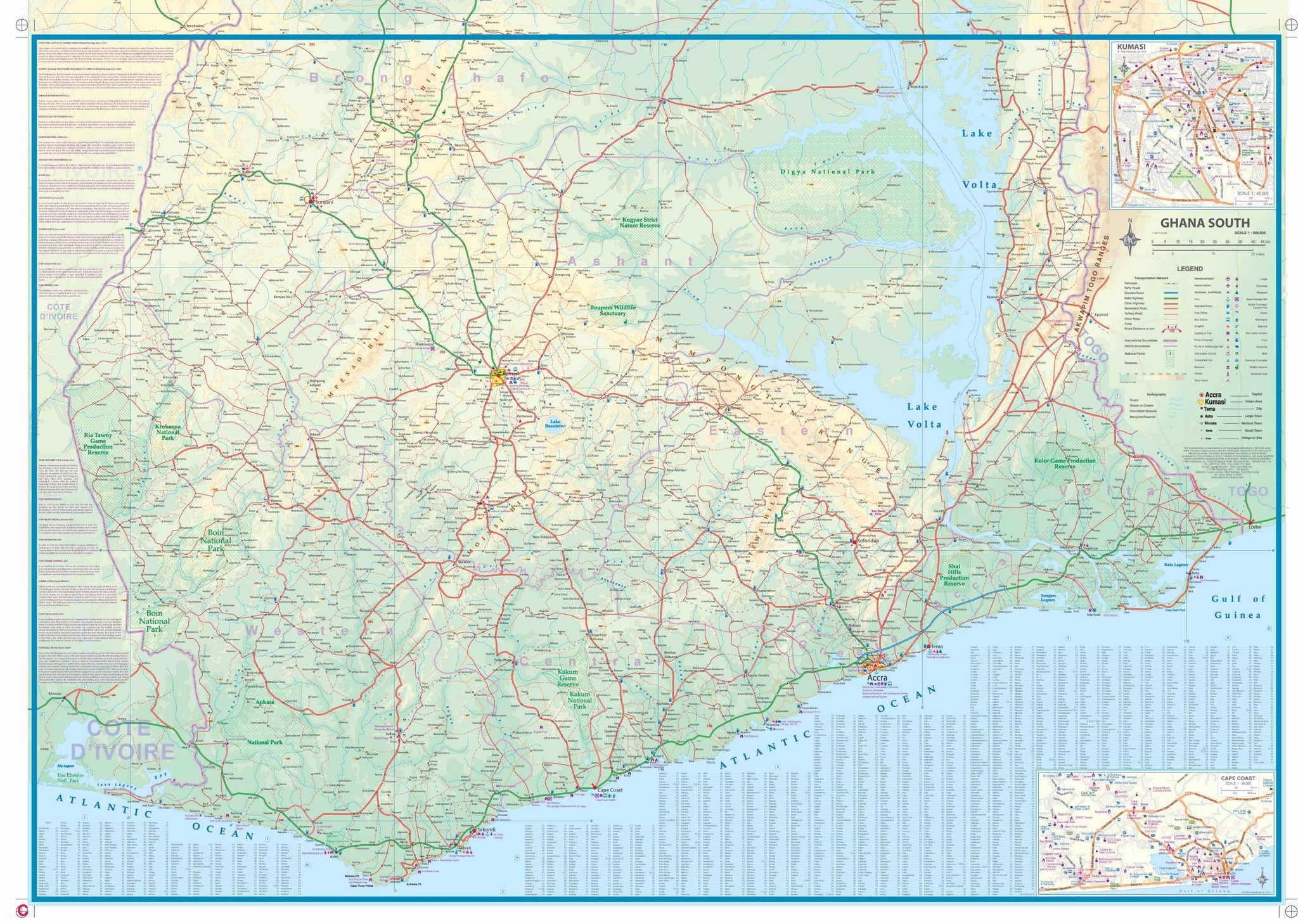
| Main Map Coverage | Full country of Ghana, plus border detail of Burkina Faso, Côte d'Ivoire, and Togo |
| Map Scale | 1:500,000 / 1:570,000 – ideal for regional and long-distance travel planning |
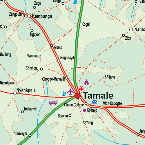
| Inset Maps | Includes city maps of Accra (1:15,000), Kumasi (1:40,000), and Cape Coast (1:40,000) |
| Road & Rail Networks | Detailed major and secondary roads, railways, and ferry routes (including Lake Volta) |
| Tourism Highlights | Capsule comments on popular destinations and cultural sites |
| Parks & Nature Reserves | Clearly marked boundaries of national parks and conservation areas |
| Index | Full index of towns and cities for quick lookup |
| Updated Information | Enhanced place names, updated urban layouts, and new travel infrastructure |
📐 Specifications
| Specification | Detail |
|---|---|
| Title | Ghana Travel Map (ITMB) |
| Publisher | ITMB – International Travel Maps |
| Edition | Most recent available |
| Format | Folded Map (single-sided) |
| Map Scale | 1:500,000 |
| Size (Unfolded) | 680 mm x 990 mm |
| ISBN | Varies by edition |
🌍 Ideal For
-
Travellers and backpackers visiting West Africa
-
Aid workers, NGOs, and researchers operating in the region
-
Educators and students studying Ghana’s geography, culture, or colonial history
-
Travel agents and tour operators designing custom itineraries
-
Business professionals and consultants needing reliable geographical references
🧾 Optional Lamination Available
We offer this map in laminated format for enhanced durability. Laminated maps are:
-
Water-resistant and tear-proof
-
Writable with whiteboard markers (perfect for planning)
-
Great for field use, classrooms, or offices
Note: Fold lines may remain visible under lamination, as the map is flattened and encapsulated using high-quality 80-micron gloss laminate.
✈️ Travel Tip
Pair this map with a Ghana travel guide or West Africa regional map if you plan to cross borders into Togo, Côte d'Ivoire, or Burkina Faso. The inset maps of Accra, Kumasi, and Cape Coast also make it perfect for day trip planning and historical sightseeing.
Frequently Asked Questions
Where can I buy the Ghana ITMB Map?
The Ghana ITMB Map is available to buy online from Mapworld, Australia's largest map and geographic product retailer, with fast shipping Australia-wide.
Is the Ghana ITMB Map in stock at Mapworld?
Mapworld maintains extensive stock across its map range and aims for fast dispatch. Orders placed before 2pm AEST on business days are typically dispatched the same day, with standard and express Australia-wide delivery options available.
What is Mapworld's returns policy?
Mapworld accepts returns on undamaged items in original condition. Contact Mapworld within 90 days of purchase to arrange a return or exchange.
Does Mapworld ship the Ghana ITMB Map across Australia?
Yes, Mapworld ships Australia-wide. Standard shipping is a flat $7 rate, with free standard shipping on orders over $75. Express options are available at checkout. Most orders placed before 2pm AEST on weekdays are dispatched same day.
Related Items


© 2026 Mapworld. Website designed by Genie Media
X