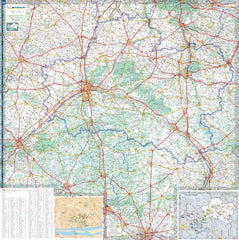
A Map Designed for Dreamers, Explorers, and Connoisseurs of the Loire Valley
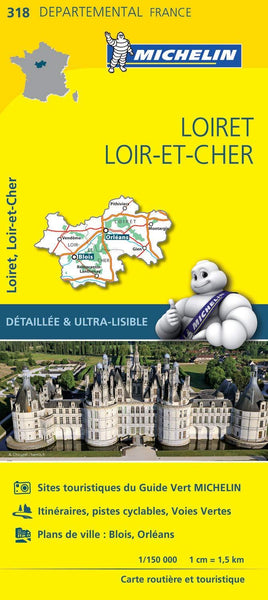
Embark on a journey through the poetic landscapes of central France with the Michelin Map 318: Loiret / Loir-et-Cher. This beautifully detailed local map unlocks the very soul of the region—where the grandeur of Renaissance châteaux meets the quiet charm of riverside villages, and every winding backroad invites a detour worth taking.
Crafted by Michelin’s legendary cartographers, this is more than a map. It’s your gateway to a land where history lingers in the air, where vineyards roll across sun-drenched hillsides, and where every bend in the road reveals something unexpected.
Navigate Like a Local – Explore Like an Insider
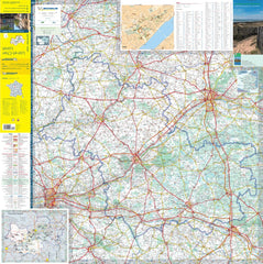
At a detailed scale of 1:150,000, the Michelin Map 318 offers exceptional clarity—showing every minor road, lane, hamlet, and river crossing. Whether you’re heading deep into the Sologne forest, tracing the banks of the Loire, or discovering the birthplace of Joan of Arc, this map helps you travel with purpose and presence.
✅ Meticulously Detailed Cartography – From major highways to unpaved rural tracks, every route is precisely marked and colour-coded for easy reading.
✅ Extensive Index – Every place name is listed in a clear alphabetical index, ensuring you never waste time searching.
✅ Distance Chart Included – Effortlessly plan travel times and organise your days with the included driving distances grid.
✅ Tourist Highlights Identified – Michelin’s iconic star-rating system points you toward the region’s most rewarding sites, including architectural treasures, natural wonders, and cultural gems.
Who This Map Is For
✔ History Lovers & Château Seekers: Trace your path from the soaring towers of Château de Chambord to the delicate arches of Chenonceau. Discover lesser-known gems like Château de Talcy or the medieval fortress of Sully-sur-Loire.
✔ Wine & Food Enthusiasts: Travel between cellars, vineyards, and local producers in the Coteaux du Giennois and Cheverny AOCs. Use the map to locate village markets and rustic auberges serving dishes rooted in regional tradition.
✔ Walkers, Cyclists & Nature Seekers: Identify walking paths, cycling routes, forested reserves, and picnic-perfect riversides. The map’s relief shading and terrain detail make it especially helpful for outdoor planning.
✔ Independent Explorers & Road Trippers: Avoid tourist traps and find the soul of central France by following quiet backroads, seasonal detours, and peaceful hamlets that only a Michelin map reveals.
Product Specifications
| Feature | Details |
|---|---|
| Map Scale | 1:150,000 (1 cm = 1.5 km) |
| Sheet Dimensions | 1200 mm x 1000 mm |
| Index | Full alphabetical place-name index |
| Distance Chart | Included |
| Tourist Recommendations | Michelin-starred sites & scenic drives |
| Relief & Terrain | 3D-style shading for landscape awareness |
| Edition | Latest available |
| Delivery Time | Ordered on demand – allow 7–10 working days |
Michelin: A Legacy of Trust for Over 100 Years
Michelin’s cartographic heritage dates back to 1910, when their first maps were created to support motorists and inspire travel. Today, their local series maps—like Map 318—continue that legacy by offering the most practical, beautiful, and accurate way to explore France. Whether you’re navigating winding château roads or planning your trip from home, Michelin remains the trusted name in travel.
Built for Real Travel – Not Just Decoration
Printed on high-quality stock, this map folds down compactly for use on the road, yet opens up large enough to lay flat for daily planning. It’s perfect for the glove compartment, the pannier of your bicycle, or the coffee table in your gîte.
Durable, dependable, and designed for travellers who want more than just A-to-B—it’s a map you’ll return to again and again.
Ready to Rediscover the Romance of the Road?
Order your Michelin France Loiret / Loir-et-Cher Map 318 today and prepare to slow down, look closer, and uncover the beauty that lies beyond the guidebooks. Whether you’re planning your next great adventure or simply dreaming of river valleys and château rooftops, this map brings France’s enchanting centre to life—one route, one village, and one memory at a time.


