- Australia ▾
- Topographic
▾
- Australia AUSTopo 250k (2025)
- Australia 50k Geoscience maps
- Australia 100k Geoscience maps
- Australia 250k Geoscience maps
- Australia 1:1m Geoscience maps
- New Zealand 50k maps
- New Zealand 250k maps
- New South Wales 25k maps
- New South Wales 50k maps
- New South Wales 100k maps
- Queensland 10k maps
- Queensland 25k maps
- Queensland 50k maps
- Queensland 100k maps
- Western Australia 25k maps
- Western Australia 50k maps
- Western Australia 100k maps
- Compasses
- Software
- GPS Systems
- International ▾
- Wall Maps
▾
- World
- Australia & New Zealand
- Countries, Continents & Regions
- Historical
- Vintage National Geographic
- Australian Capital Territory
- New South Wales
- Northern Territory
- Queensland
- South Australia
- Tasmania
- Victoria
- Western Australia
- Celestial
- Children's
- Mining & Resources
- Wine Maps
- Healthcare
- Postcode Maps
- Electoral Maps
- Nautical ▾
- Flags
▾
- Australian Flag Sets & Banners
- Flag Bunting
- Handwavers
- Australian National Flags
- Aboriginal Flags
- Torres Strait Islander Flags
- International Flags
- Flagpoles & Accessories
- Australian Capital Territory Flags
- New South Wales Flags
- Northern Territory Flags
- Queensland Flags
- South Australia Flags
- Tasmania Flags
- Victoria Flags
- Western Australia Flags
- Gifts ▾
- Globes ▾
Dear valued customer. Please note that our checkout is not supported by old browsers. Please use a recent browser to access all checkout capabilities


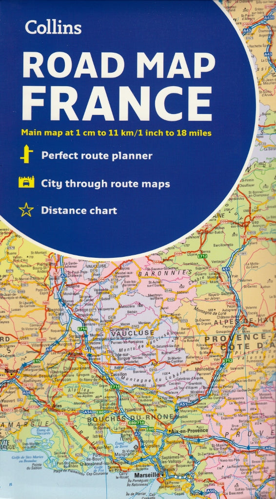

France Collins Folded Map
$22.95 $24.95
Afterpay is only available for orders between $50.00 and $1000.00 More info
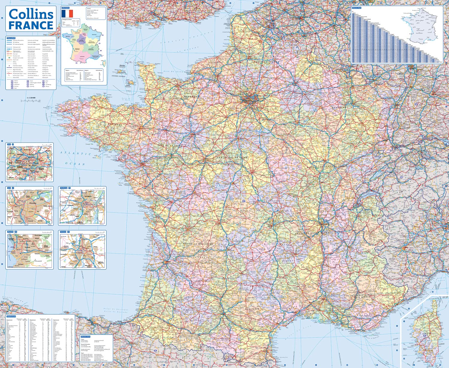
A fully updated, easy-to-read road map of France — ideal for touring, travel planning, and cross-country exploration
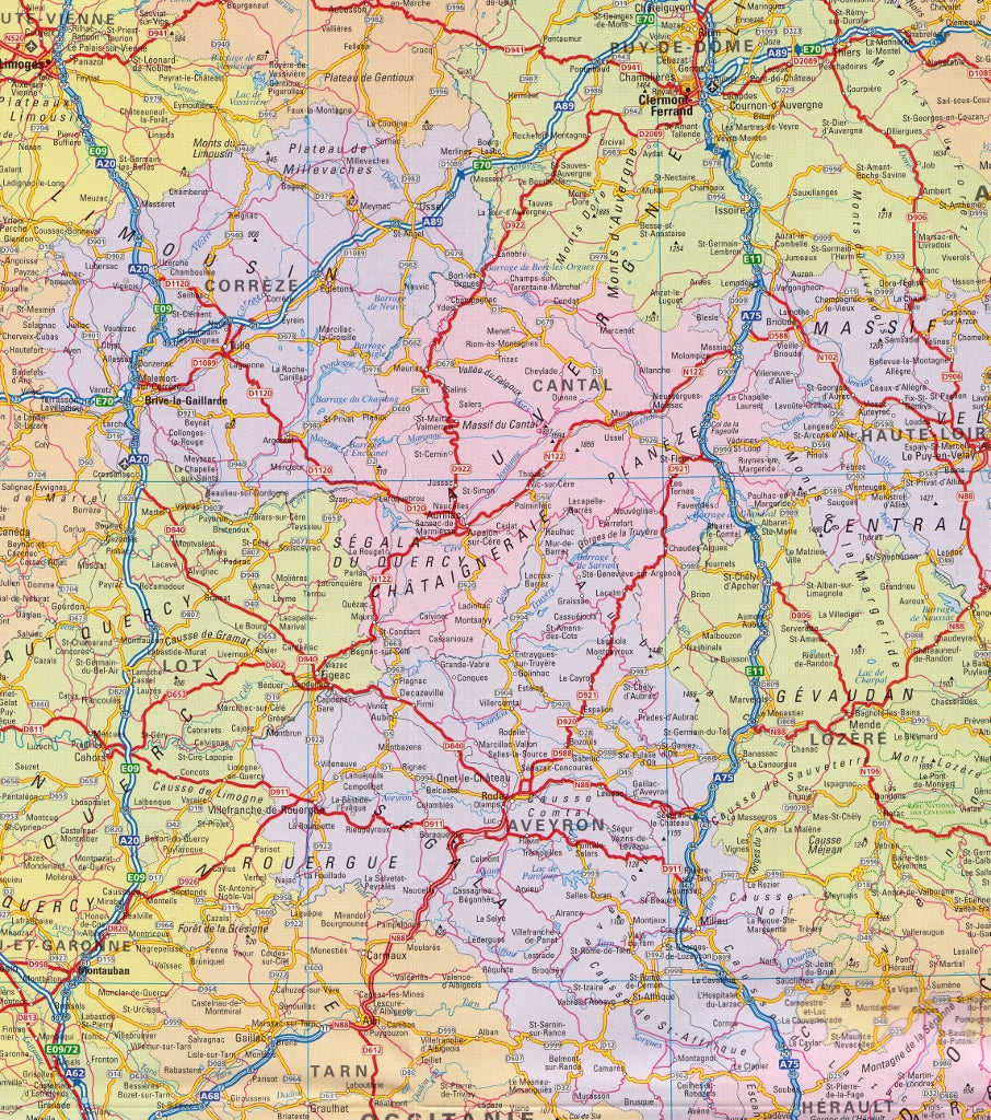
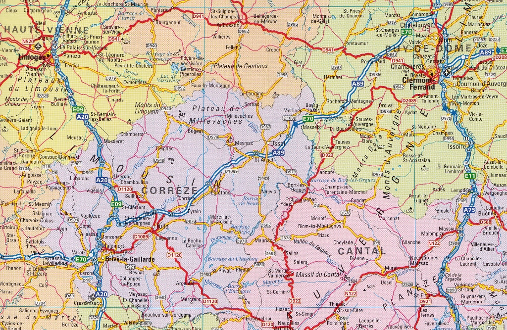
The Collins France Folded Map 2026 Edition is your reliable companion for navigating the roads of mainland France, including Corsica. Designed with clarity and practicality in mind, this map is perfect for road trippers, holidaymakers, cyclists, and travel planners who want a big-picture overview of France with all the essential detail to get from region to region confidently.
Whether you're cruising through Provence, driving the Loire Valley, or heading across the Pyrenees, this map offers clear cartography, updated routes, and convenient features in a compact, foldable format.
🗺️ Key Features:
-
Full national coverage of France, including Corsica
-
Clearly marked motorways (autoroutes), national roads, and regional roads
-
Toll roads, service areas, and distance markers for route planning
-
Highlights tourist attractions, scenic routes, and World Heritage sites
-
Mountain ranges, rivers, forests, and national parks included for topographic reference
-
Ferry routes, key ports, and major border crossings shown
-
Distance chart and travel time references between major cities
-
Index of towns, cities, and regions for quick lookup
-
Updated for 2026, including the latest infrastructure and transport developments
📏 Scale & Size:
-
Scale: 1:1,000,000 – approximately 1 cm = 10 km / 1 inch = 15.8 miles
A perfect scale for national travel, giving a broad overview while still capturing key travel detail -
Unfolded size: approx. 992 mm x 890 mm
-
Folded size: approx. 240 mm x 135 mm
Large enough for clear planning, compact enough to store in your car or travel bag
📄 Format & Quality:
-
Classic folded paper map – easy to use, carry, and refold
-
Printed on high-quality durable paper, built for regular use and handling
-
Clean design, colour-coded roads, and easy-to-read place names
-
Lightweight and portable — ideal for use on the go, or spread out for planning at home or on holiday
🚗 Perfect For:
-
Touring France by car or campervan
-
Cyclists and motorcyclists navigating rural or coastal roads
-
Travellers and families exploring regions such as Normandy, Burgundy, Alsace, or the Riviera
-
Educators, students, and map enthusiasts
-
A dependable backup when travelling through remote or GPS-unreliable areas
From the vineyards of Bordeaux to the lavender fields of Provence, the beaches of Brittany to the snow-capped Alps, the Collins France Folded Map 2026 Edition helps you see the whole journey clearly.
Fold it out. Mark your route. Discover France.
SHIPS FROM AUSTRALIA, NEXT DAY SHIPPING
Frequently Asked Questions
What area does the France Collins Folded Map cover?
The France Collins Folded Map provides road coverage of the region named in the product title. The map covers major cities, highways, towns, and regional roads, with inset city maps for key urban centres where applicable.
Is the France Collins Folded Map up to date?
Yes, this is the current edition. Mapworld stocks the most current editions from all major publishers, updated to reflect new roads and infrastructure.
What size is this map when unfolded?
Folded maps from Mapworld's range are compact and portable. Most standard folded road or travel maps open to between A1 (594 × 841mm) and A0 (841 × 1189mm) when fully unfolded, and fold down to approximately A4 or smaller for easy storage in a glove box, bag, or backpack.
Is the France Collins Folded Map in stock at Mapworld?
Mapworld maintains extensive stock across its map range and aims for fast dispatch. Orders placed before 2pm AEST on business days are typically dispatched the same day, with standard and express Australia-wide delivery options available.
Does Mapworld ship the France Collins Folded Map across Australia?
Yes, Mapworld ships Australia-wide. Standard shipping is a flat $7 rate, with free standard shipping on orders over $75. Express options are available at checkout. Most orders placed before 2pm AEST on weekdays are dispatched same day.
Related Items


© 2026 Mapworld. Website designed by Genie Media
X